SRRTA22
-
Posts
1,828 -
Joined
-
Last visited
Content Type
Profiles
Blogs
Forums
American Weather
Media Demo
Store
Gallery
Everything posted by SRRTA22
-
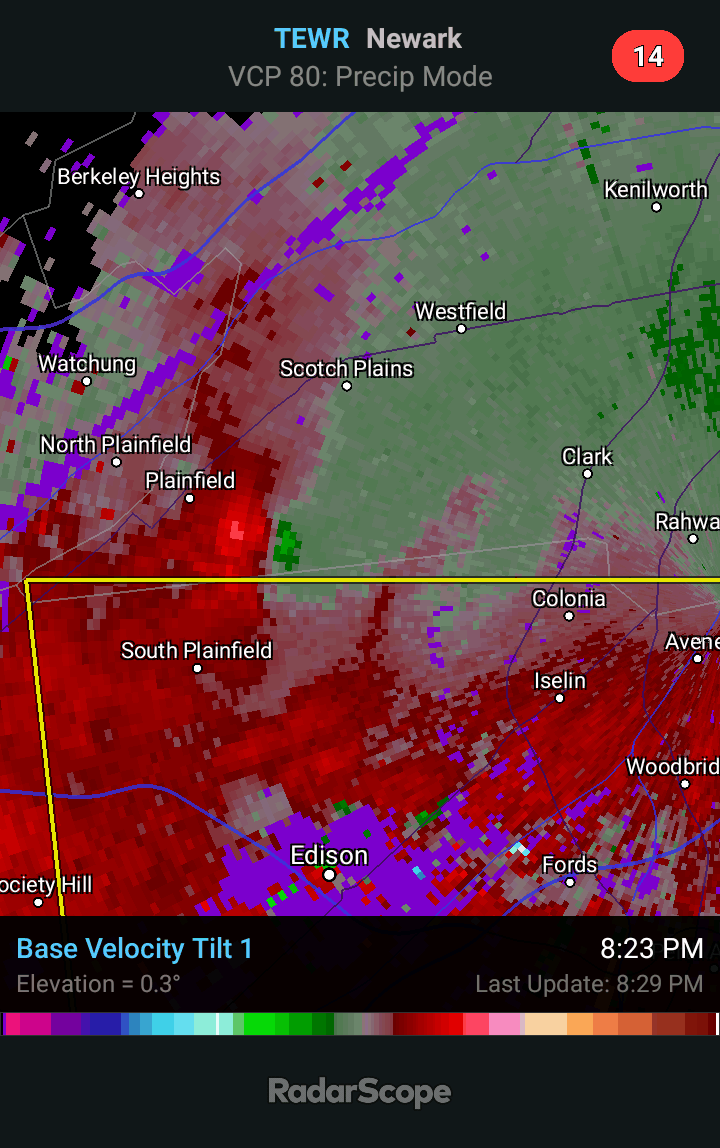
 Some of the soundings Im seeing has me legitimately concerned for tomorrow
 -
"Marginal" SVR/FF risk 3P Today-3P FRI July 30-31
SRRTA22 replied to wdrag's topic in New York City Metro
Heres a close up of the mesoscale convective vortex earlier.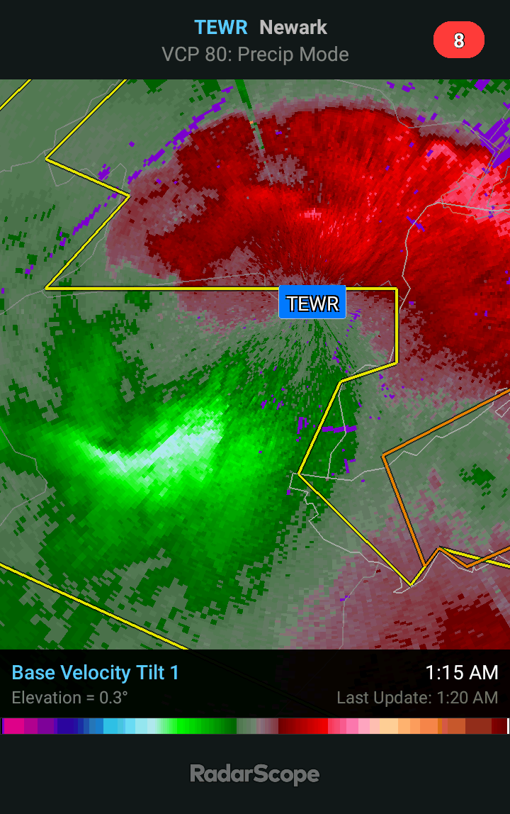
-
"Marginal" SVR/FF risk 3P Today-3P FRI July 30-31
SRRTA22 replied to wdrag's topic in New York City Metro
Nice MCV
-
"Marginal" SVR/FF risk 3P Today-3P FRI July 30-31
SRRTA22 replied to wdrag's topic in New York City Metro
Theres a tornado possible on the warning for the MCV like feature -
"Marginal" SVR/FF risk 3P Today-3P FRI July 30-31
SRRTA22 replied to wdrag's topic in New York City Metro
Mini bow feature with what looks like to me...a MCV? df? lol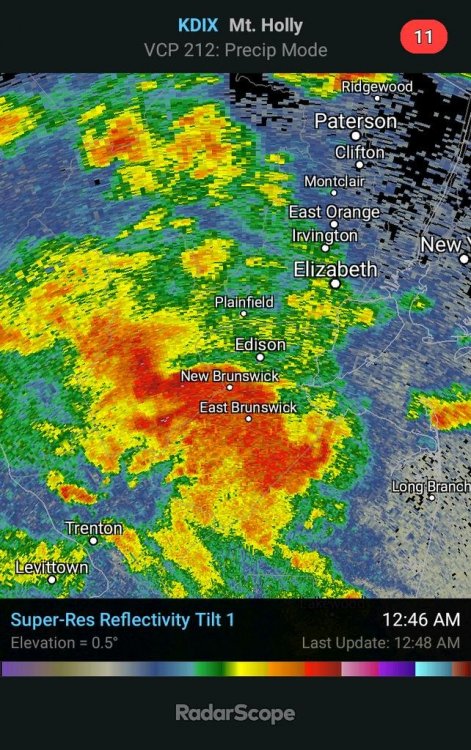
-
Potential few SVR/FF events parts of NYC forum Wed-Thu 7/22-23/20
SRRTA22 replied to wdrag's topic in New York City Metro
Getting hit with a training cell. @wdrag Another great call sir *raises glass* -
Potential few SVR/FF events parts of NYC forum Wed-Thu 7/22-23/20
SRRTA22 replied to wdrag's topic in New York City Metro
This light show is AMAZING. Nearly constant lightning. -
Potential few SVR/FF events parts of NYC forum Wed-Thu 7/22-23/20
SRRTA22 replied to wdrag's topic in New York City Metro
These cells look very meh on radar but Ill tell you, they're packing some nice CGs off in the distance. Usually a precursor to intensification. Some erratic sky crawlers as well -
Potential few SVR/FF events parts of NYC forum Wed-Thu 7/22-23/20
SRRTA22 replied to wdrag's topic in New York City Metro
Figured it was a downburst. Winds got crazy out of no where yesterday here in Jersey City -
0.12 in Jersey City
-
Insanely localized. There must be serious flooding no more than 20 minutes north of me. Cant say Im not a little mad, but it is what it is when it comes to these events. Radar estimates close to 3"
-
Whos been complaining about getting missed? Lol

-
Isolated SVR FF potential for our NYC metro 130P Fri 7/3-3A Sat 7/4
SRRTA22 replied to wdrag's topic in New York City Metro
Yup, the scan is a frame or two later but you can see the velocities spread out. Must've been something to see! Congrats and dont forget to post the video -
Isolated SVR FF potential for our NYC metro 130P Fri 7/3-3A Sat 7/4
SRRTA22 replied to wdrag's topic in New York City Metro
You got yourself a downburst my friend
-
Isolated SVR FF potential for our NYC metro 130P Fri 7/3-3A Sat 7/4
SRRTA22 replied to wdrag's topic in New York City Metro
Frequent lightning. Haven't seen this much lightning in a while -
Isolated SVR FF potential for our NYC metro 130P Fri 7/3-3A Sat 7/4
SRRTA22 replied to wdrag's topic in New York City Metro
The National Weather Service in Upton NY has issued a * Severe Thunderstorm Warning for... Hudson County in northeastern New Jersey... Union County in northeastern New Jersey... South central Bergen County in northeastern New Jersey... Southern Essex County in northeastern New Jersey... Queens County in southeastern New York... Richmond County in southeastern New York... Kings County in southeastern New York... New York (Manhattan) County in southeastern New York... * Until 830 PM EDT. * At 751 PM EDT, a severe thunderstorm was located over Kearny, or over Harrison, moving southeast at 50 mph. HAZARD...Quarter size hail. So much for slow moving storms -
Isolated SVR FF potential for our NYC metro 130P Fri 7/3-3A Sat 7/4
SRRTA22 replied to wdrag's topic in New York City Metro
..A SEVERE THUNDERSTORM WARNING REMAINS IN EFFECT UNTIL 800 PM EDT FOR EAST CENTRAL MORRIS COUNTY... At 746 PM EDT, a severe thunderstorm was located over East Hanover, or near Caldwell, moving southeast at 25 mph. HAZARD...70 mph wind gusts and penny size hail. -
Isolated SVR FF potential for our NYC metro 130P Fri 7/3-3A Sat 7/4
SRRTA22 replied to wdrag's topic in New York City Metro
NAMNST looks to be handling it well. Has it hammering us in a couple of hours.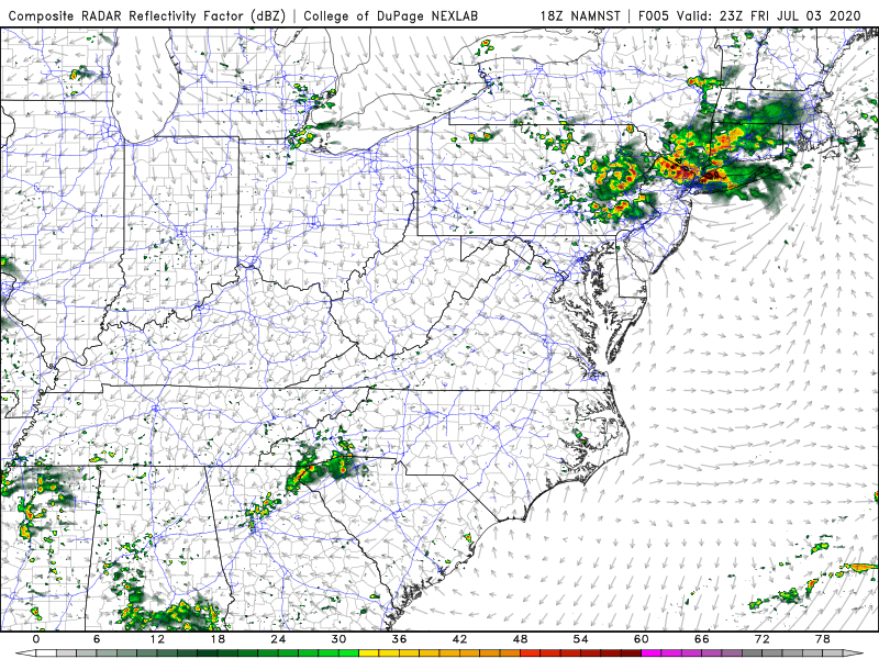
-
Hopefully you and allsnow can cash in on that cell near Summit
-
Tree down on a car via scanner Jersey City
-
Well, certainly making up for lost time. Sheesh FFW in effect now
-
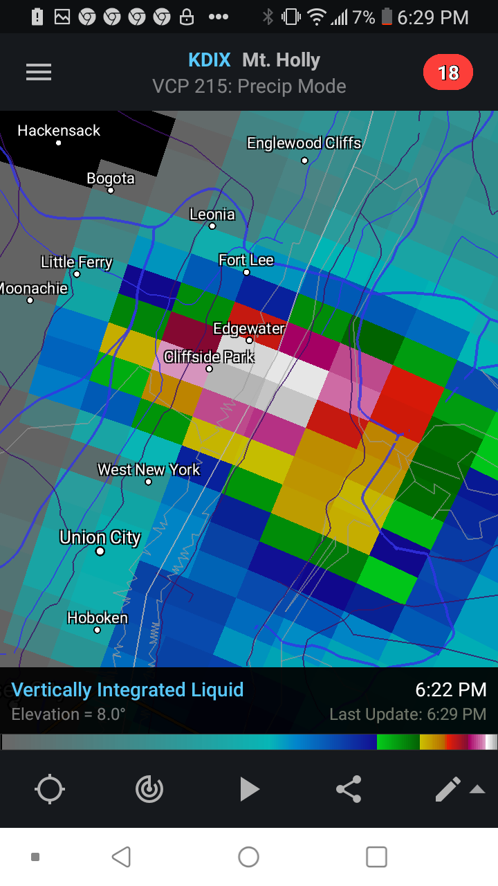
Just had a downburst here with small hail.
.thumb.png.0d4f40c2ee5bea55b2213af6857a29c1.png)
.thumb.png.a85f523eae6d4b9ec46ba300d5da0f8a.png)
-
June 2020 General Discussions & Observations Thread
SRRTA22 replied to Rtd208's topic in New York City Metro
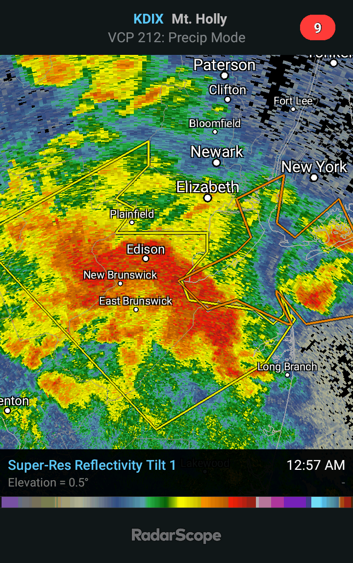
So many boundary interactions. One of the coolest radar grabs Ive seen in our area.png.a3b58813d18874022a7904e2e079a27d.png)
-
June 2020 General Discussions & Observations Thread
SRRTA22 replied to Rtd208's topic in New York City Metro
When the sun meets the hail core Midtown via EarthCam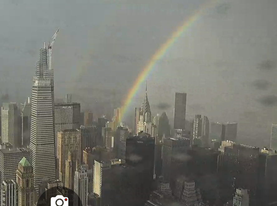
-
June 2020 General Discussions & Observations Thread
SRRTA22 replied to Rtd208's topic in New York City Metro
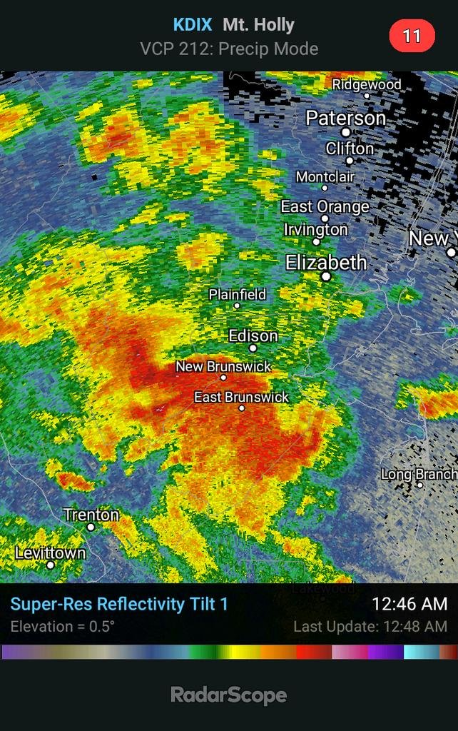
WOW


.png.05f440e187bd1163df7dd8be3a7dc489.png)
.png.17a3d3412516da70daeb6323cef4f73b.png)