George BM
Members-
Posts
2,827 -
Joined
-
Last visited
Content Type
Profiles
Blogs
Forums
American Weather
Media Demo
Store
Gallery
Everything posted by George BM
-
Why do you keep on living my nightmares?
-
75/56 at IAD right now. The drier air has moved in.
-
@BristowWx Claim away my friend!
-
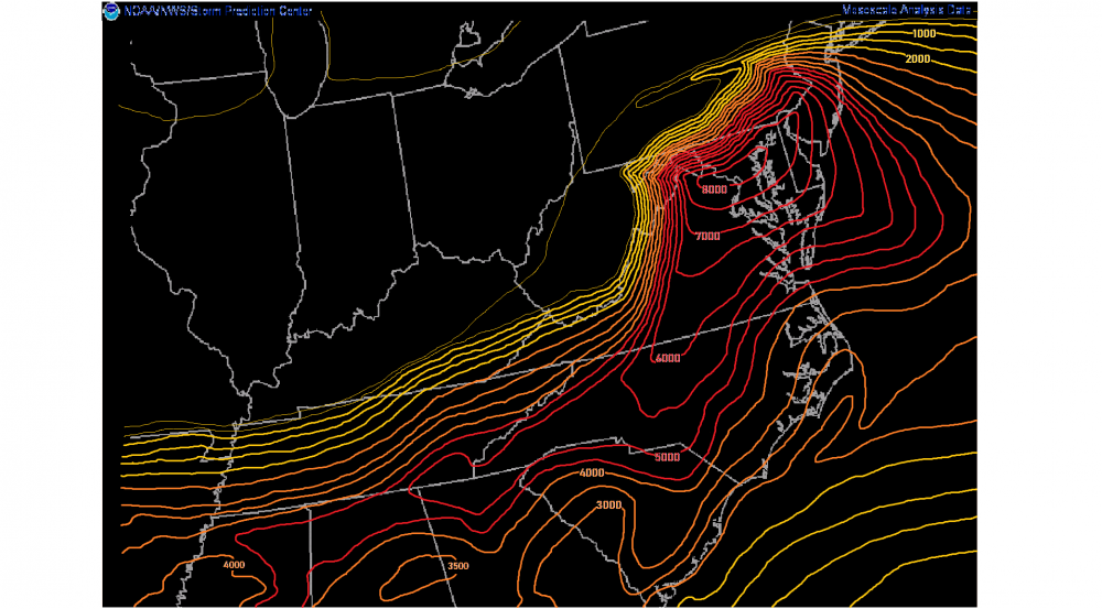
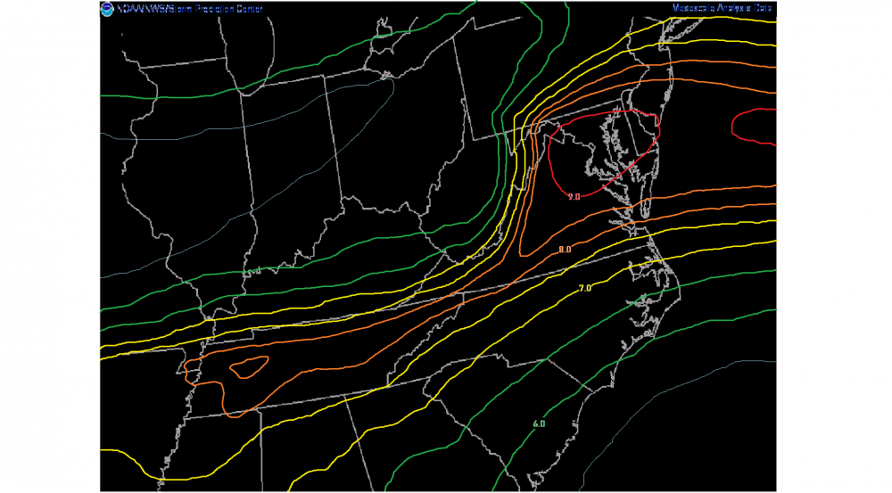
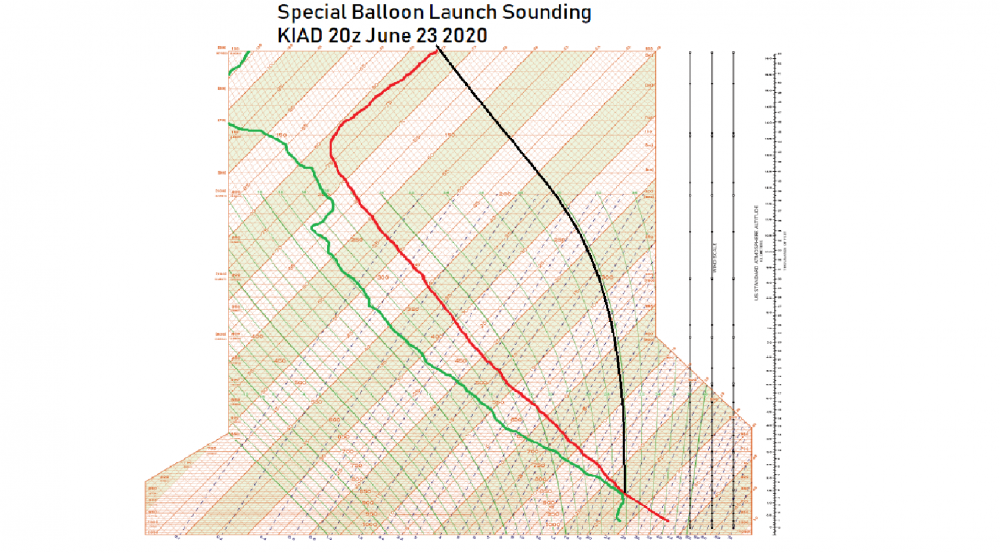
PDS Tornado Watch 333 in effect until 9PM EDT June 23 2020 Hazards: Numerous long-track strong to violent tornadoes expected Numerous significant wind gusts to 115 mph likely Widespread large hail with scattered giant hail events to 5" in diameter likely Discussion: A well-developed and intense MCS/derecho continues to move through much of West Virginia AOA 65kts. The environment within the watch area is characterized by extreme instability (MLCAPE 7000-8000+ J/kg), impressive shear (EBWD 70-90 kts), high moisture content (Pwats of 2-2.25"+) and strong DCAPE (1200-1600+ J/kg). As the MCS moves into the mountains additional supercells are expected to rapidly develop by 19-20z along the foothills/Blue ridge ahead of the main line and move east through the DC and Baltimore metropolitan areas. With the extreme low-level shear also in place (effective SRH of 500-900 m2/s2) these cells will have a high risk of producing long-track and potenially violent tornadoes as well as giant, life-threatening hail. The greatest wind threat over this region will come with the main line of storms between 20-23z with high-end severe winds (possibly in excess of 115 mph). Storms will move out of the watch area by 00z. Forecaster: George BM Look at the 20z Mesoscale Analysis! Unreal. And just look at that sounding from the 20z special balloon launch!
-
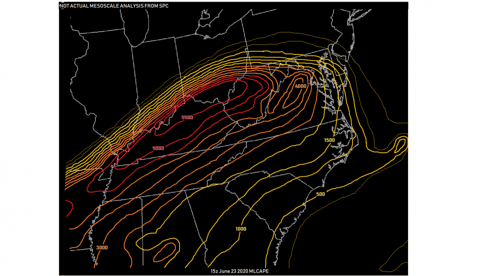
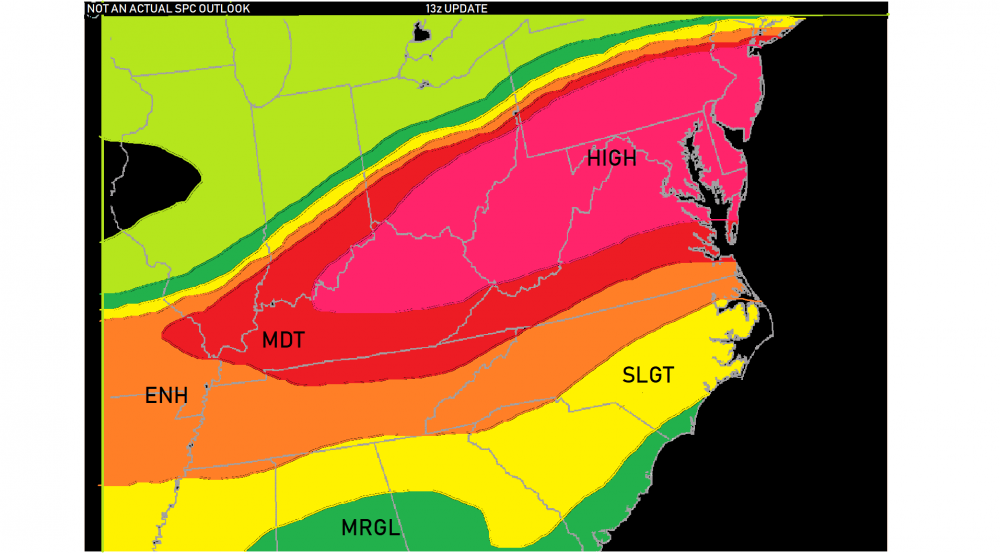
Wow! I'm feeling extremely good about our storm prospects for later in the day! CAPE is already looking great as of 15z and shear will become extreme by the mid-late afternoon hours. All mesoscale guidance agrees on a very intense MCS screaming east through our region late this afternoon and into the early evening hours with supercells (likely tornadic) forming ahead of the main line by the mid afternoon hours. SPC already has us and a large portion of the Mid-Atlantic/Ohio Valley in a high risk for wind and tornadoes as of the 13z update!
-
A more north-stream dominant look. Verbatim I wonder if we could score some arctic fronts and snow squalls?... ... Currently 74/66 at IAD with mostly cloudy skies (low clouds w/ a ceiling of ~1500ft).
-
Yeap. Nasty weather indeed.
-
Same pattern... but 4 months back: "What an epic cold, snowy, blizzardy period! I am literally buried inside my house with 30'+ snow drifts everywhere! Boy oh boy oh boy oh BOY!! "Jebman! You're missing out on dopamine overloads! You GOT to get up here with your Jeb-shovel and help me dig up an EPIC snow-maze! Think about it! We can make boatloads of the green stuff for the tourists in the region going through our maze! You can help me put various household items that we no longer need at various locations in the maze and there's my jump-start to spring cleaning right there! WOOHOO! HOOWOOWOO!!" ... IAD: Currently the temperature is 68F with low clouds and light drizzle. Dewpt: 66F Wind: E 10 mph
-
Actually, in the past week I've noticed a rapid uptick in firefly activity... in my neighborhood at least.
-
Aaaaaaaaaaaaaaaaaaaaand I can't read it because it's on the Washington Post and somehow I've already used up my free readings although I haven't read a Washington Post article yet this month.
-
Shoot. Didn't realize the deadline had past. I'm about to read your story.
-
Reaper call or Watch list?
-
2020 Mid-Atlantic Severe Weather - General Thread
George BM replied to Kmlwx's topic in Mid Atlantic
Did you lose power and/or notice any damage to your house after it took a direct hit from lightning during the June 4th storm? -
2020 Mid-Atlantic Severe Weather - General Thread
George BM replied to Kmlwx's topic in Mid Atlantic
Indeed. Now parts of the upper Ohio Valley into the Great Lakes region are under a moderate risk of severe weather (45% hatched wind)... only the second moderate risk or greater anywhere in the US since April. -
2020 Mid-Atlantic Severe Weather - General Thread
George BM replied to Kmlwx's topic in Mid Atlantic
Lots of models have been hinting at a strong shortwave trough interacting with Cristobal's remnant circulation and becoming negatively-tilted through the Ohio Valley. The GFS has been most aggressive and fastest model when it comes to swinging the cold front associated with the shortwave through the region (late Wednesday). Most other models are slower with the cold front and have weaker shear/dynamics as a result of the shortwave being farther away from us by the time the front passes through (Wednesday night/ early Thursday) as well as poor timing heating-wise anyway. Should the shortwave and front be a bit faster, like the GFS shows, there could be a severe threat come later Wednesday given the warm/moist airmass that should be in place from Cristobal. Just me thinking out loud. It's a bit of a long shot atm given how different the GFS is from other models timing-wise. Well have to see how the interaction takes place between the two main features. #Notanexpertopinion -
2020 Mid-Atlantic Severe Weather - General Thread
George BM replied to Kmlwx's topic in Mid Atlantic
Being in a spot that normally misses out on storms this evenings storm was a decent one my MBY standards. Sheets of rain w/ 40+ mph wind gusts at times. Better than normal for MBY. -
2020 Mid-Atlantic Severe Weather - General Thread
George BM replied to Kmlwx's topic in Mid Atlantic
https://www.earthcam.com/usa/newjersey/seasideheights/?cam=seasideheights Next in line. -
2020 Mid-Atlantic Severe Weather - General Thread
George BM replied to Kmlwx's topic in Mid Atlantic
Yeap. I haven't noticed any lightning though. -
2020 Mid-Atlantic Severe Weather - General Thread
George BM replied to Kmlwx's topic in Mid Atlantic
https://www.earthcam.com/usa/pennsylvania/philadelphia/?cam=philly Enjoy. -
2020 Mid-Atlantic Severe Weather - General Thread
George BM replied to Kmlwx's topic in Mid Atlantic
Verbatim, it would be a nice fast-moving line with good wind potential if CAPE ended up better than modeled... not that I'm implying that it will be. -
2020 Mid-Atlantic Severe Weather - General Thread
George BM replied to Kmlwx's topic in Mid Atlantic
-
Meteorological summer is upon us.
-
PDS Tornado Watch 333 in effect until 9PM EDT June 23 2020 Hazards: Numerous long-track intense tornadoes likely Numerous significant wind gusts to 105 mph likely Widespread large hail with scattered giant hail events to 4" in diameter likely Discussion: A well-developed and intense MCS/derecho continues to move through much of West Virginia AOA 65kts. The environment within the watch area is characterized by extreme instability (MLCAPE 6000+ J/kg), impressive shear (EBWD 60-80 kts), high moisture content (Pwats of 2-2.25"+) and strong DCAPE (1200-1500+ J/kg). As the MCS moves into the mountains additional supercells are expected to rapidly develop by 19-20z along the foothills/Blue ridge ahead of the main line and move east through the DC and Baltimore metropolitan areas. With the very strong low-level shear also in place (effective SRH of 300-600 m2/s2) these cells will have the greatest risk of producing long-track strong to violent tornadoes as well as very large to giant hail. The greatest wind threat over this region will come with the main line of storms between 20-23z with high-end severe winds (possibly in excess of 100 mph). Storms will move out of the watch area by 00z. Forecaster: George BM
-
Many thanks to you all for the birthday wishes, Weather family!
-
2020 Mid-Atlantic Severe Weather - General Thread
George BM replied to Kmlwx's topic in Mid Atlantic


