George BM
-
Posts
3,071 -
Joined
-
Last visited
Content Type
Profiles
Blogs
Forums
American Weather
Media Demo
Store
Gallery
Everything posted by George BM
-
Real jazz right there. I listen to jazz music heard on the LOT8s forecasts frequently. Big nostalgia.
-
Tomorrow has now gone Code Red for the DC region w/ Friday being an Orange.
-
Aych Bee Dee @mappy. Have you had the best cake yet?
-
Got brief torrential rain w/ few lightning strikes here with the complex in Herndon as it developed to your east.
-
2023 Mid-Atlantic Severe Wx Thread (General Discussion)
George BM replied to Kmlwx's topic in Mid Atlantic
- 2,785 replies
-
- 3
-

-

-
- severe
- thunderstorms
- (and 3 more)
-
2023 Mid-Atlantic Severe Wx Thread (General Discussion)
George BM replied to Kmlwx's topic in Mid Atlantic
IAD at 82/69 currently. -
Please procrastinate and don't prep the snow plow this year. That combined w/ El Nino will bring some fun times. TIA for your service.
-
Deeper blue.
-
2023 Mid-Atlantic Severe Wx Thread (General Discussion)
George BM replied to Kmlwx's topic in Mid Atlantic
I'm actually mildly surprised that they put us in a MRGL for Day 3 as I personally don't see any glaringly obvious signs of models decisively backing off on Mondays potential yet (still better than usual MLLRs leading to sufficient CAPE w/ at least modest deep-layer shear). We'll see what transpires with CAMs and future SPC outlooks. -
I know my extreme naivety is showing here but what's this from?
-
Summer! At 10:57am edt the sun hit its furthest point north of the equator (23.4 degrees N of equ.) directly above the earth's surface. It's on it's way back south now.
-
2023 Mid-Atlantic Severe Wx Thread (General Discussion)
George BM replied to Kmlwx's topic in Mid Atlantic
Yeah that Monday/Tuesday timeframe has one of my eyes.- 2,785 replies
-
- 2
-
-
- severe
- thunderstorms
- (and 3 more)
-
-
Boeing 737-700?
-
Junust 16th.
-
2023 Mid-Atlantic Severe Wx Thread (General Discussion)
George BM replied to Kmlwx's topic in Mid Atlantic
Yeah. I'm not sure. My NOAA weather radio went off saying there was a watch for local counties (Arlington, Fairfax, etc... *shrugs*) -
2023 Mid-Atlantic Severe Wx Thread (General Discussion)
George BM replied to Kmlwx's topic in Mid Atlantic
Severe Thunderstorm Watch coming out for parts of our area? -
2023 Mid-Atlantic Severe Wx Thread (General Discussion)
George BM replied to Kmlwx's topic in Mid Atlantic
- 2,785 replies
-
- 2
-
-
-
- severe
- thunderstorms
- (and 3 more)
-
Guess what four letter word that starts with an 'H' (or 5 letter word that starts w/ an 'S') is coming back to play with us from late today through the next few days? Were you all starting to miss it?
-
2023 Mid-Atlantic Severe Wx Thread (General Discussion)
George BM replied to Kmlwx's topic in Mid Atlantic
Off the top of my head I believe there was one last year on May 12th in the Plains.- 2,785 replies
-
- 1
-

-
- severe
- thunderstorms
- (and 3 more)
-
2023 Mid-Atlantic Severe Wx Thread (General Discussion)
George BM replied to Kmlwx's topic in Mid Atlantic
Classic intense WNW flow mid-June severe potential today. Moderate risk for wind issued by SPC. "A series of mid/upper shortwave impulses are expected to shift east across the Lower MS Valley and Southeast today in strong west/southwesterly mid/upper flow. Consistency among various forecast guidance shows at least 40-50 kt west/southwest flow between 850-700 mb with 60+ kt at 500 mb. A plume of very steep lapse rates will overspread the region, and 500 mb temperatures around -10 to -11 C will be common. Forecast soundings indicate midlevel lapse rates around 8-8.5 C/km over the region..." "...strong destabilization with MLCAPE values exceeding 3000 J/kg..." "...Locations may see a mix of supercells and intense bowing segments during the day, with potential for a derecho developing..." The upper Midwest can sure be interesting this time of year wi- one sec... Wait this is for the deep-south?!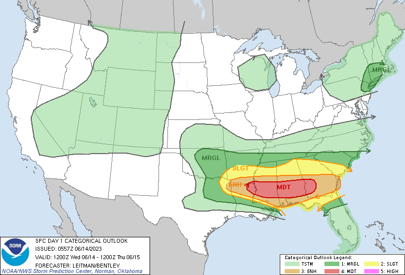
- 2,785 replies
-
- 3
-
-
- severe
- thunderstorms
- (and 3 more)
-
2023 Mid-Atlantic Severe Wx Thread (General Discussion)
George BM replied to Kmlwx's topic in Mid Atlantic
Happy Ten Year Anniversary, weenies!- 2,785 replies
-
- 1
-
-
- severe
- thunderstorms
- (and 3 more)
-
First sunset in a long time that's had no discernable haze in the sky. Nice deeper blue skies as well.
-
73/70 at IAD. IADs first 70F+ dewpoint of the year.
-
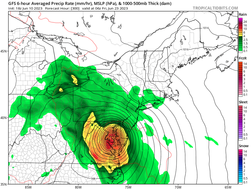
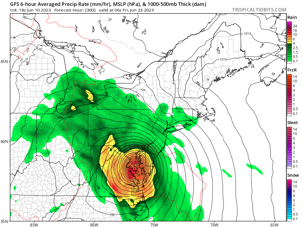
Oh GFS. If only you didn't occasionally suffer from severe CFb (convective feedback).