Cobalt
-
Posts
4,908 -
Joined
-
Last visited
Content Type
Profiles
Blogs
Forums
American Weather
Media Demo
Store
Gallery
Everything posted by Cobalt
-
I believe they're referring to the US record. Now, if the GFS had been right about setting a new global record, it would've been with the 1101mb high over Greenland that was forecast about a week back by that model. Needless to say, I don't think that verified.
-
I'm not sure if this was the case in 2003 or 1996, but the first Feb 2010 storm stands out to me because of how wet the snow was initially. I'd imagine it was less than 10:1 until things really got going during the overnight hours, and that set down the perfect base for snow to cling onto trees and poles. I recall several massive trees falling overnight, and we didn't have power until after the second storm. Never had either of those things happen in the 2016 storm as that was very powdery in nature.
-
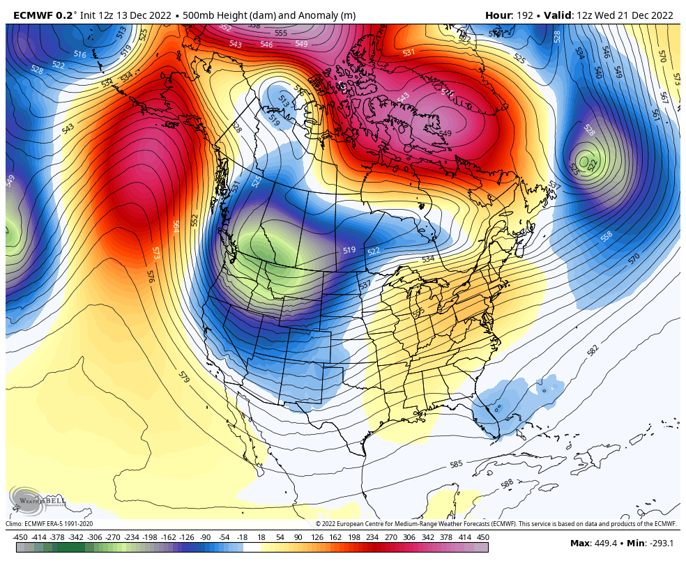
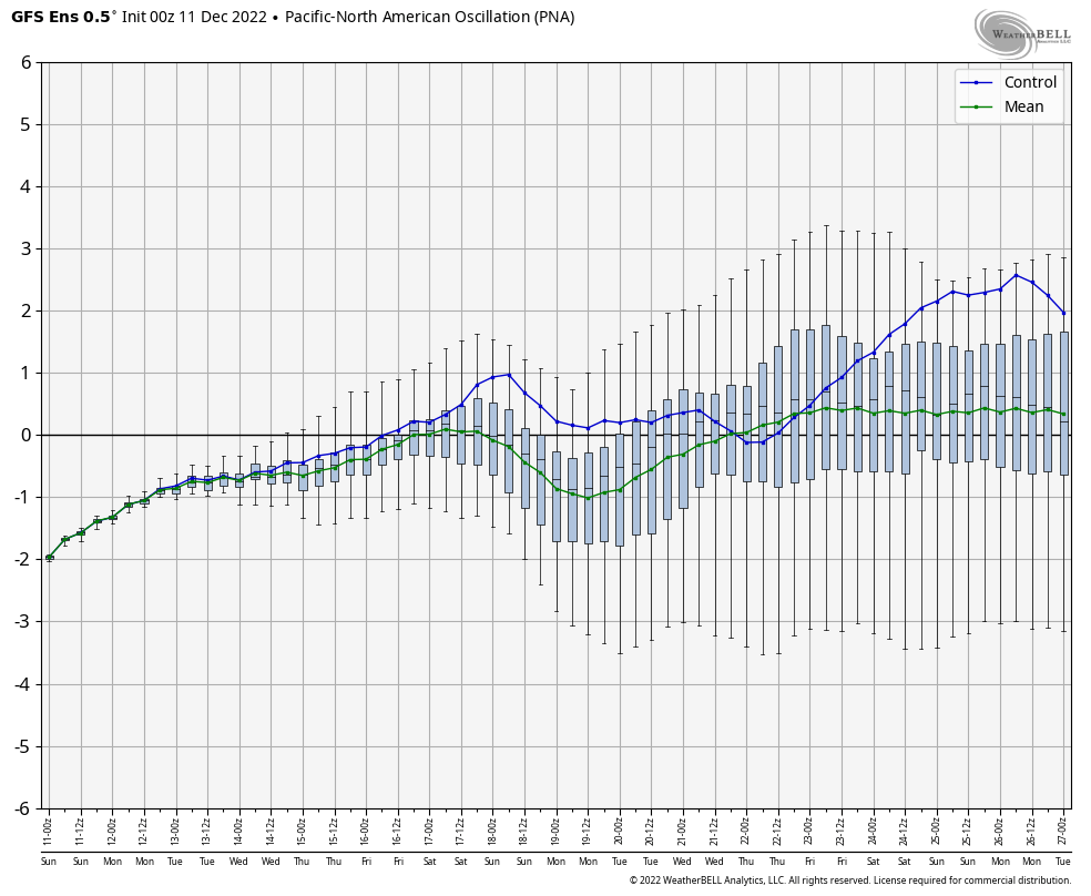
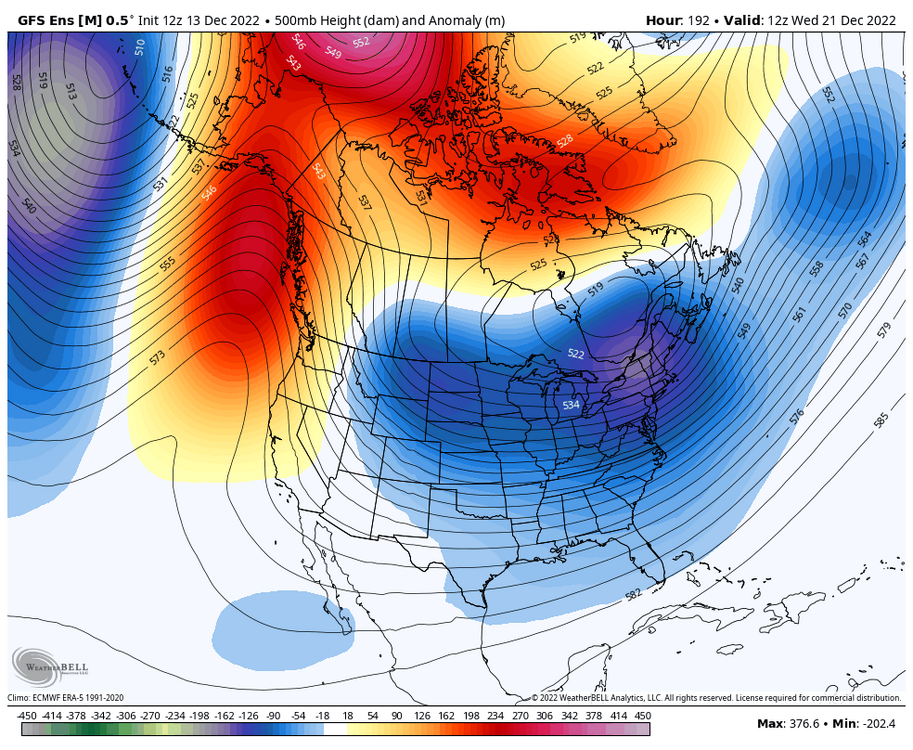
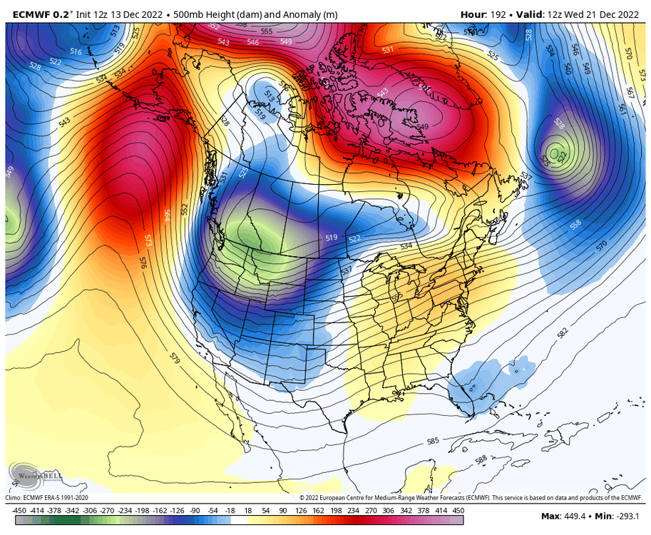
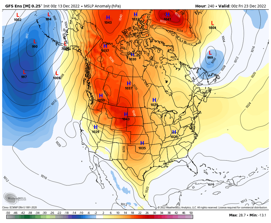
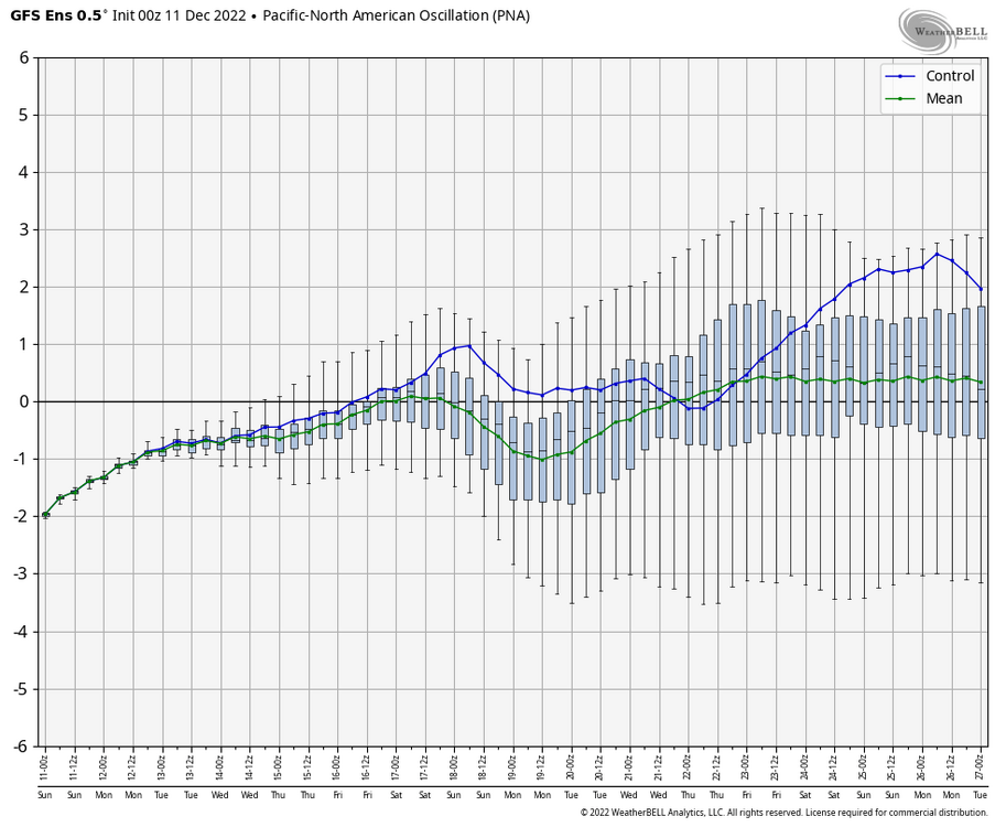
Improvements in both the PNA region and in blocking over Baffin Island as per the last 2 GEFS runs. If we are to believe that the GEFS has been handling the pacific domain better than the EPS during this blocking regime, this would be an ample test for that.
.thumb.gif.10c1c83b237463d333eab70c63a3c719.gif)
-
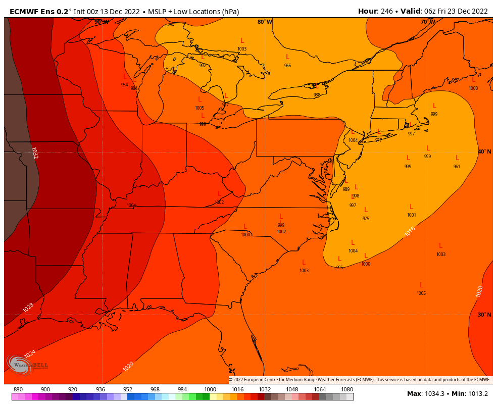
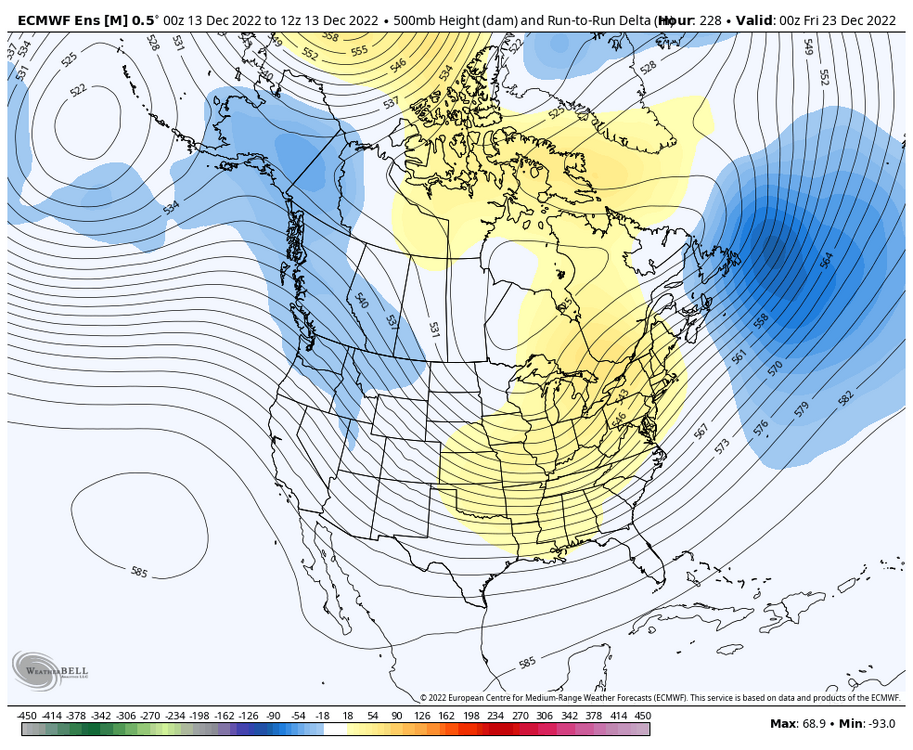
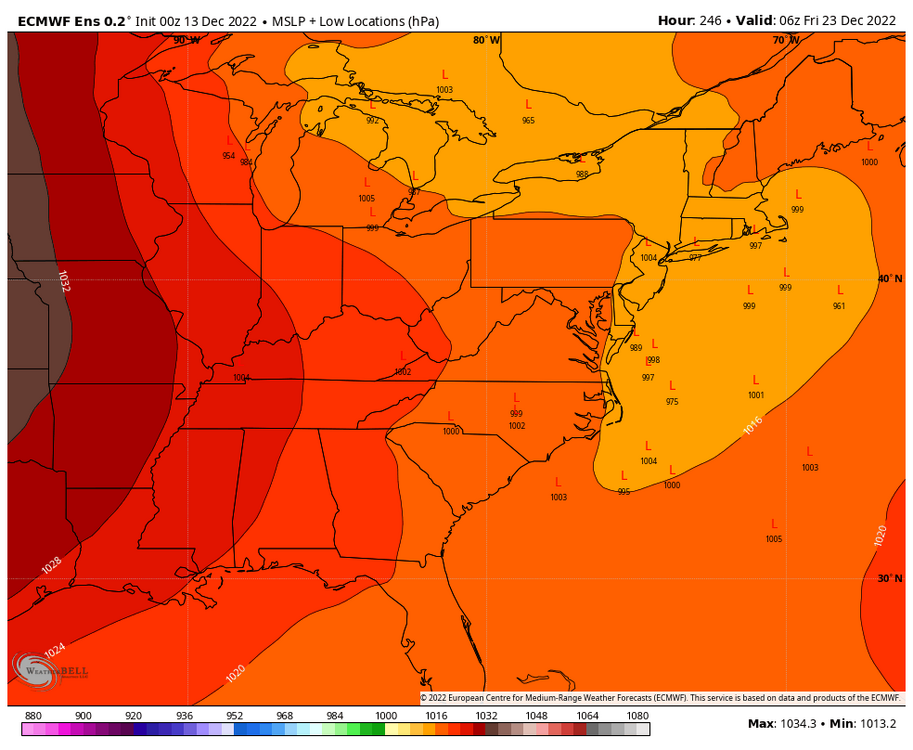
I see two distinct camps. Euro OP looks to be part of that cluster of LPs over the great lakes. Despite a slight trend in heights to favor the Euro OP over the CONUS (not enough to resemble or cave to the OP however), check out the run to run change of lower heights near the 50/50 region. I would like to see that be picked up in future ensemble runs.
.thumb.png.3e39c840e5793f257c3e7bc5c4472383.png)
-
Just a small difference..
-
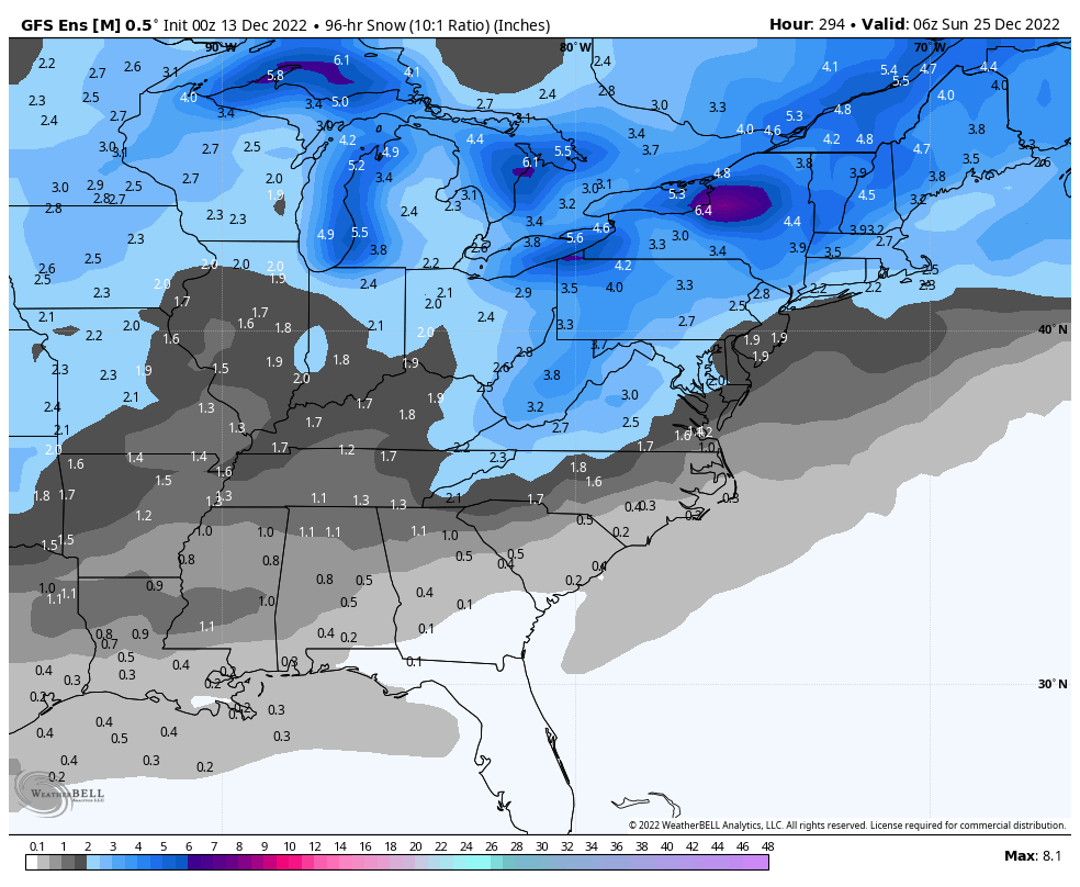
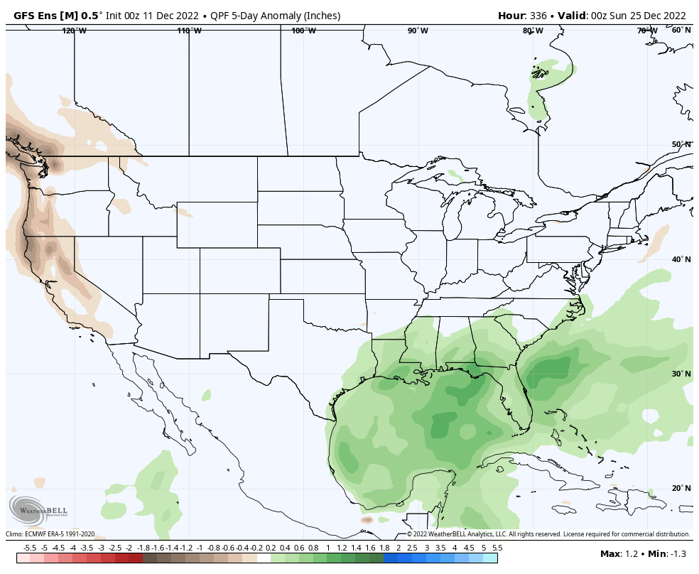
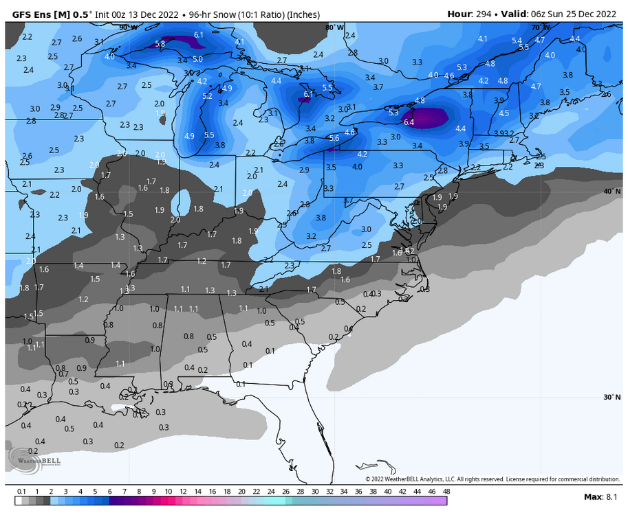
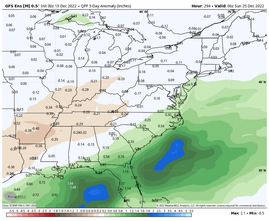
0z GEFS depicts a pretty favorable window for snowfall from the 20th-24th. Seems to be a few members that followed the OP which would explain some of the greater westward totals, so definitely not as much of a sign of suppression on these panels. What I like to see is the appearance of a low pressure system in the 50/50 region as per the GEFS mean, it looks like that's been picked up on the recent ensemble runs. PNA begins to spike during this timeframe as well, so the teleconnections definitely bode well for a train of systems during the week leading up to and after Christmas. EPS quite likes an idea of a 22nd-24th event as well. +PNA popping and -AO nearing -5 would make me somewhat hopeful for this window.
-
Seeing all of the discussion of some crazy cold makes me desperately want a PDII type cold smoke event, low teens or even single digits with heavy snow falling. I can't really remember the last time we had a WSW+ type event with temperatures in the teens for most of the event, maybe Jan 2019?
-
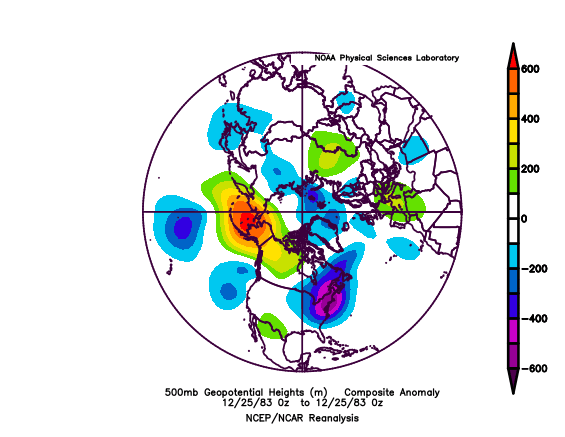
https://psl.noaa.gov/data/composites/hour/ This site gives you a lot of parameters to mess around with, so you can change the timeframe and metrics depicted on the map. Definitely a recipe for an icebox as shown in that panel.
-
Feb 2021 is one that stands out to me in recent memory. I had to look back at the h500 maps and it looks like we actually had a +PNA during the first half of that blocking period in January. The issue was that there had been a raging +EPO that helped in scouring out any sustained cold in Canada, so storms became shredded messes as they made their way eastwards. It took more than 3 weeks to sustain cold enough airmasses for adequate threats in the East, misses or otherwise. That was when someone (I can't remember who) brought up the data on how DC tends to reliably sustain at least one stretch during each met winter where snow doesn't fall for at least 3-4 weeks (if not more), almost regardless of the underlying patterns. That's been a way for me to mitigate expectations when favorable patterns develop and wane, and as you brought up, it typically takes some time for the stage to get set, even in our most dynamic and favorable setups.
-
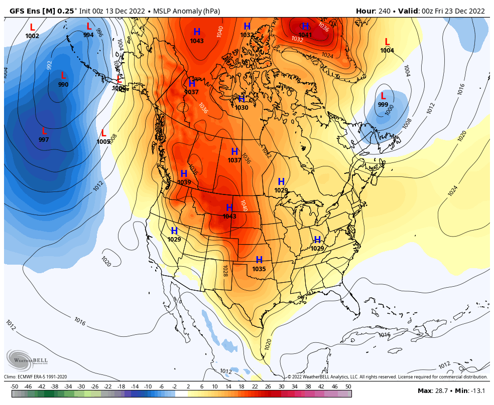
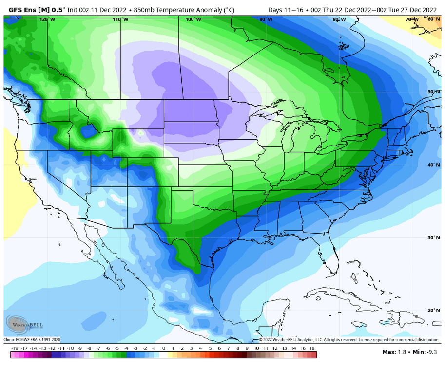
Very interesting precip and temperature depiction on the GEFS for the few days leading up to Christmas. Would imagine that a threat window emerges from this timeframe. GEFS has PNA nearing neutral or even slightly positive during this timeframe to. Coupled with an -EPO and a -AO/-NAO that are slightly rising, that definitely can't hurt.

-
Yeah, that primary lp rotting away near the border of North Dakota does not bode well for us. The Euro has swapped places with the GFS and has some more favorable cold to the point where it's ~5F+ colder at the surface and 3-4C colder up at 850mb for a good bit of the general subforum at 6z Thursday, and it tracks the primary lp a good bit farther south. Still not too serviceable of an airmass, but still enough for frozen at onset.
-
I am a firm believer in the inverse Idub23 index (note the date)
-
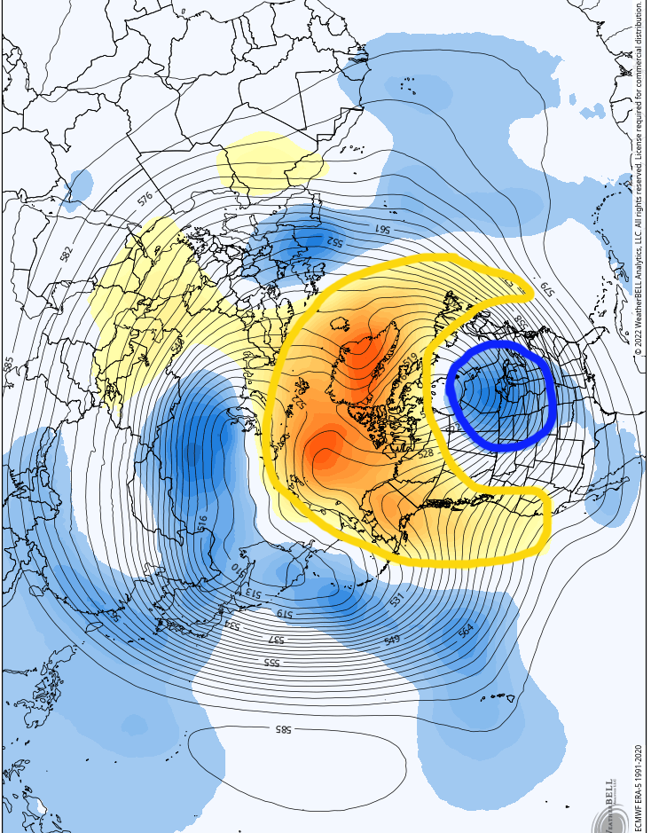
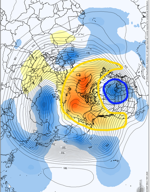
The fabled Pac-Man pattern? No wonder people are bringing up analogs from the 80s.
-
The setup leading into it is nowhere near identical (in the sense that we're dealing with a major Midwest storm as depicted on the models) but the lack of major costal development and angle of precipitation as shown on the GFS heavily reminds me of 12/16/10, another event where an episode of blocking was becoming established. To my memory that was a clean 1-3" during the daytime, and a nice early sendoff into the winter break. I have yet to look at the h500 comparisons though, but the PNA was not all that favorable for that month either.
.gif.6876e9349d8b67e33dd085284a8a1819.gif)
-
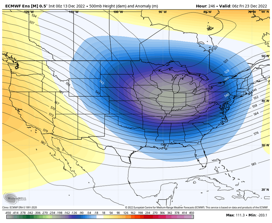
GFS is definitely feeling the block
-
Seeing the advertised pattern around the holiday season heavily reminds me of that late December 2017 pattern that had shown glimpses on nearly all the guidance for a few days. I was a young impressionable weather enthusiast, so all of the monumental operation runs (and ensemble runs with high snow means) gave me the complex of a gambler winning jackpot after jackpot, and sure enough, the rug was pulled just a few days later. Pretty good introduction to keeping snow expectations in check at least!
-
Funnily enough, the EPS keeps the central area of our subforum near normal temperature-wise for the next 10 days.. Culprit is probably the consistent storminess being caught under the block, so after our brief warmup (+3-4F for the next 5 days), things look to cool down a bit from D5-D10. EPS +0-1F, GEFS +2-3F. All eyes are on the pattern after this timeframe, but definitely not a "torch" look as we head towards mid-month, despite poor airmass quality.
-

-
Not sure why people are all that excited about Artificial Intelligence.. this thing is clearly digesting false information (OpenAI Chat Playground)

-
I think this is an extra layer to the worry for some people as well. A good pattern will necessitate that the nail biting over long range pattern trends turns into nail biting over medium/short range threats and their respective modeled outputs. We don't do uncomplicated setups that often, especially in Ninas, so it can be difficult not to sweat over threats until you're watching snow falling out of the sky (and even then people will worry about the back edge, dry slot, etc). That's why last January was pretty special for me, we had 3 relatively uncomplicated setups that all gave sizeable snows before the pattern was supposed to "get good". Even then, there were still substantial winners and losers in each threat.
-
I think it's the worry of delayed becoming denied. As you've mentioned, we are in a much better position to can kick this early in the season, but it's hard for some to view it that way when whatever is on the other side of this pattern isn't in the medium range yet. Once those trackable threats begin to show up, people will loosen up a bit.
-
I think our lack of experience with modelled -NAO events is also hurting our sense of time with this upcoming pattern. The one I can remember somewhat vividly is the late Jan 2021 blocking event, where both the GEFS and EPS were spitting out super cold and snowy 10-15 day looks starting around the 5th of January. It still took until very late into the month to get any meaningful cold, and basically on the cusp of February for meaningful snow. That was at the heart of snow and cold climo, so us being in December definitely can't help in those departments.
-
While the trends in pattern progression look to mimic the 18z GFS through the medium range (not good), the 18z GEFS also looks to be picking up on the potential 9th/10th event. A few scattered hits and misses on the individual members, but the idea is there.
-
Weeklies try to keep the party going through Christmas.
-
BWI: 17.4" DCA: 12.3" IAD: 17.2" RIC: 11.1" Tiebreaker (SBY): 10.8"

.gif.9d8edeea965b777d68cb473c5e37ef8a.gif)

.png.898cbbcebdae6f065260eb366c9e49a1.png)