

Cobalt
-
Posts
4,908 -
Joined
-
Last visited
Content Type
Profiles
Blogs
Forums
American Weather
Media Demo
Store
Gallery
Everything posted by Cobalt
-
The April 18th snow event. I had never seen snow fall that late into the season before, so watching 2-3" of snow pile up during the daytime in mid-April was just incredible.. definitely not used to seeing that late of an event back home.
-
Verbatim the GFS has ~.2-.3" QPF falling over the course of 12 hours (mostly overnight) with temps in the mid 30s. As shown that could provide the first flakes/coating for most of the central subforum area, but as you said it seems to be trending weaker as that second wave comes in stronger and much too late.
-
Only because of what happened the following year.. Gotta play the long game
-
Attempting to "reshuffle" patterns nowadays just feels like rearranging the deck chairs on the Titanic.
-
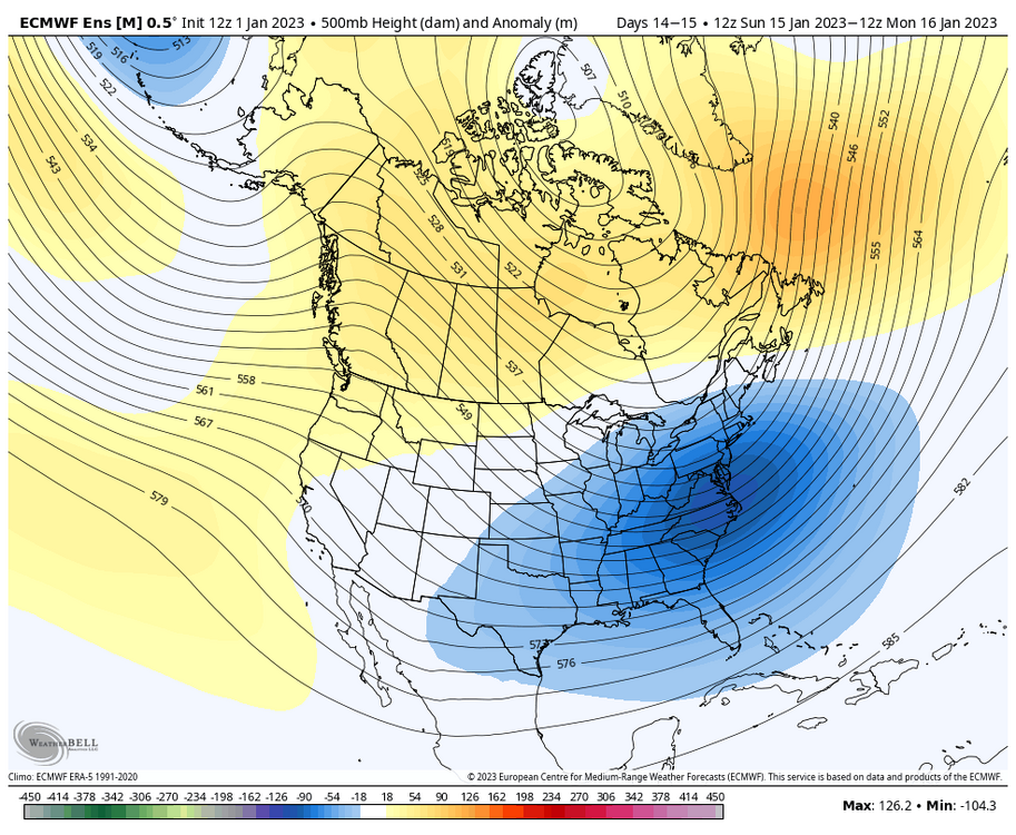
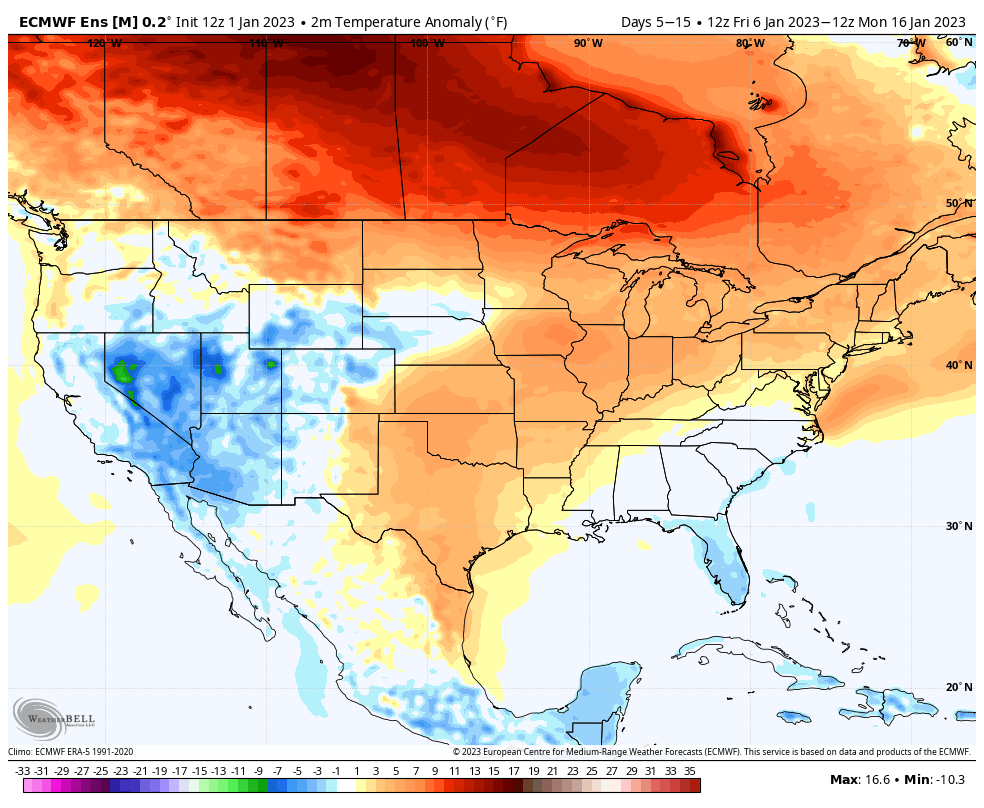
EPS also has an intriguing look out at Day 14. Takeaway is that all 3 of the major ensembles look to mix things up as we enter the D10-15 period. EPS also moderates temperatures quite well, so after an anomalously warm start to the month, the ensemble mean has the following 10 days closer to +1-3F which isn't all too warm during peak cold climo. The temp distribution with +10-15F across much of Canada definitely reminds me of Jan 2021.

-
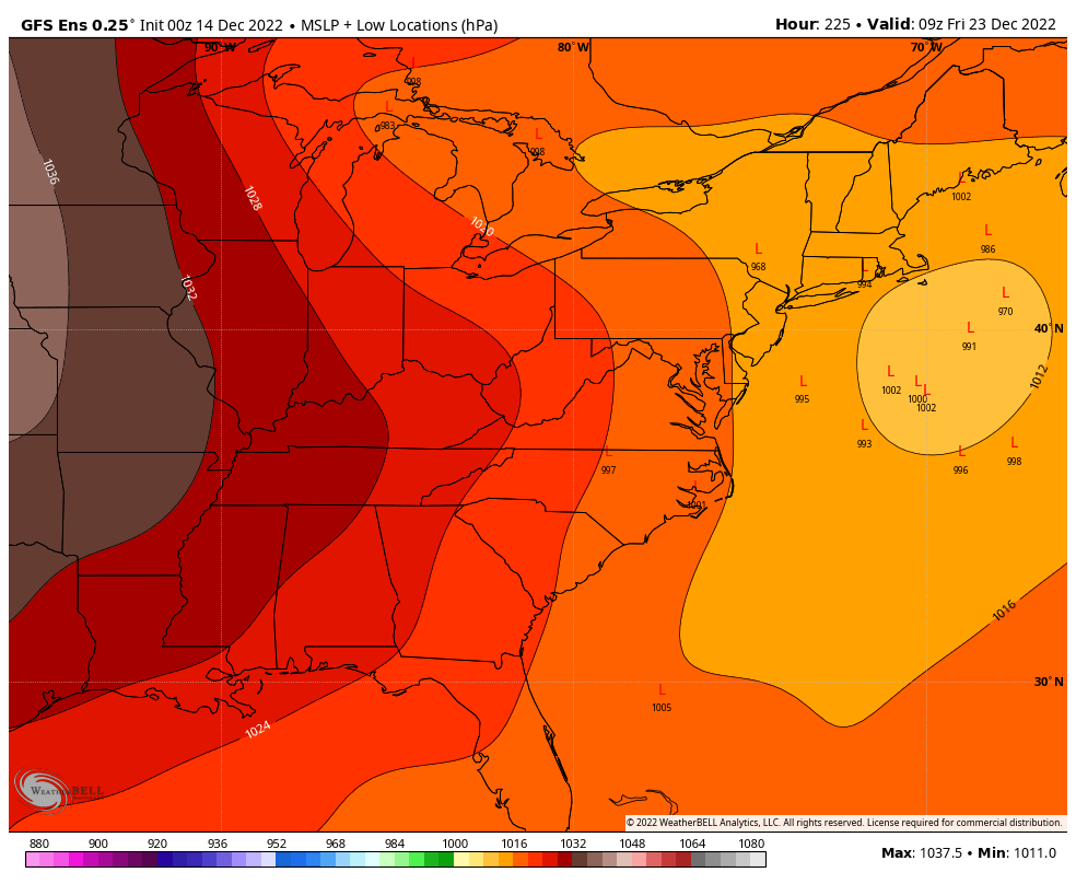
Pretty surprising to have this substantial of a signal out at D14 for a coastal, as depicted by the GEFS. In the short term, I think our issue with the 6-10th threats simply hinges on how long it will take to flush out the PAC puke, and I can remember a similar thing happening 2 years ago (Jan 1-15th 2021), where it took weeks for things to become less marginal in the East after a longstanding Alaskan low. Hopefully the further we distance ourselves from the recent influx of Pacific air, the more favorable things will become (before the inevitable Feb -PNA fest)

-
How did you fare early last winter? IIRC DCA had no snowfall whatsoever until January 3rd, with 13.2" falling through the west of the winter. I don't recall there being any events for the Northern parts of the subforum during November or December.
-
Looks like DCA topped out at 22F which would be the coldest maximum temperature for December 24th since records began, narrowly beating out 1989 (23F). The daily average of 15.5F (22/9) also beats 12/24/89's average of 16.5F (23/10), making this the coldest December 24th on record for Washington D.C.
-
If North Atlantic/Gulf of Mexico SSTs are to blame for our blocking periods not working out then that would make perfect sense. Our 2 arguably most productive blocking periods during this stretch were Feb 2021 and March 2018, late enough in the season that the Atlantic and the Gulf at least had some chance to cool down. These blocking episodes in December or into January don't work the same as they used to, and that definitely fragments the winter season.
-
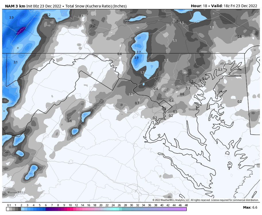
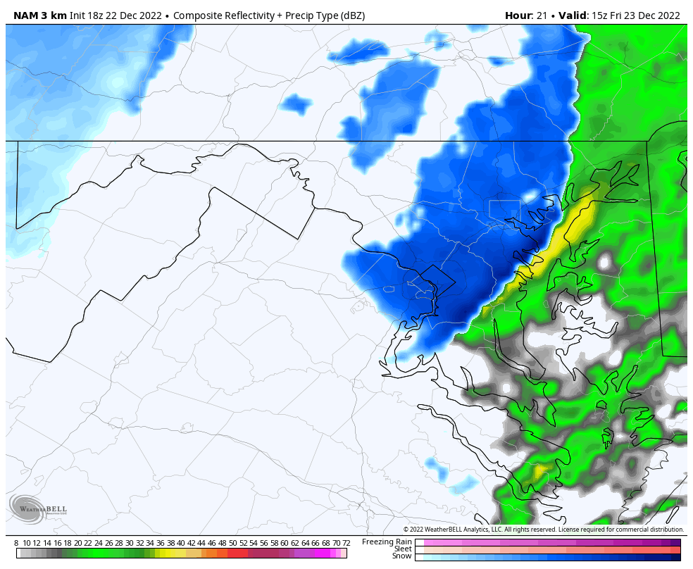
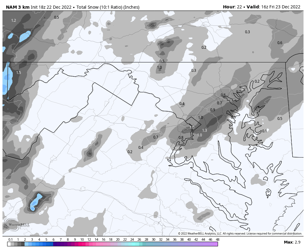
The 0z 3k NAM has its best depiction of the snow associated with the front. Shifted a bit North, but definitely a swath of 1"+ that wasn't as prominent in previous runs.
-
Our epic pattern might be condensed into 5 minutes of +SN tomorrow, but that's all we could ask for given this past week of trends. An old fashioned snow squall would definitely help brighten the mood, the 18/19 and 14/15 winters had some great ones from what I can remember.
-
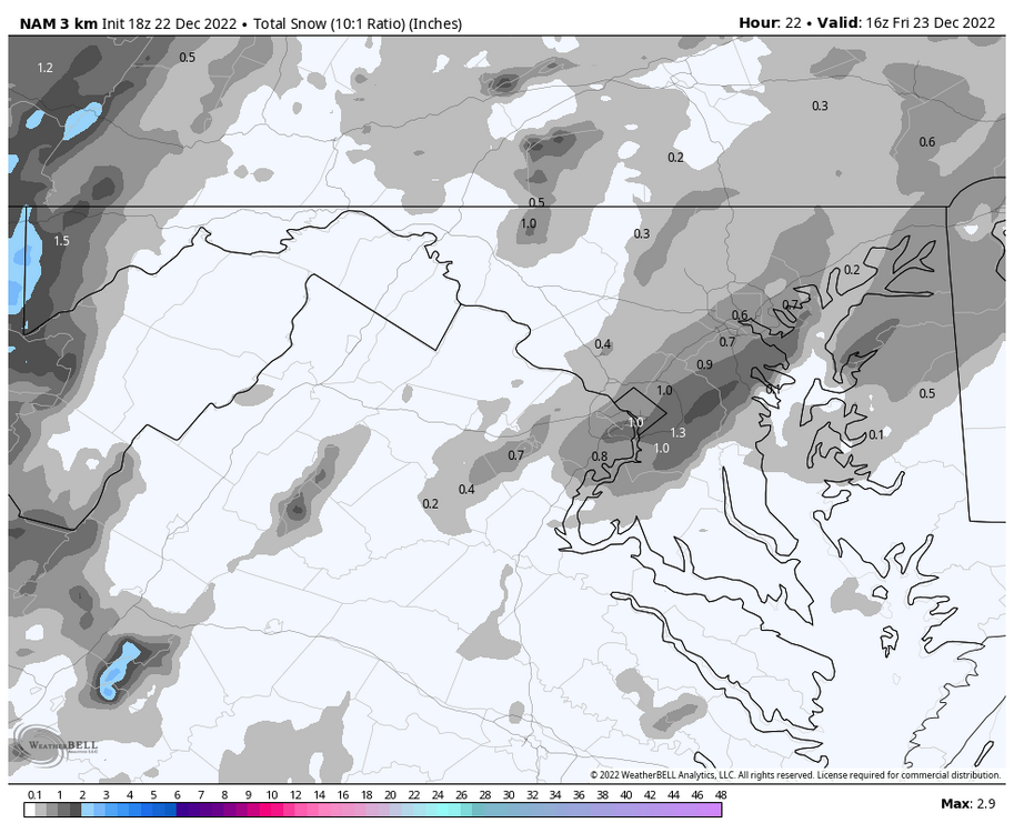
3k NAM does suggest that there might be a brief period of snowfall associated with the front.

-
Yeah the HRRR is definitely running a bit too cold, but I'm personally interested in DCA's high temp on the 24th. The 3k NAM has the site topping out at just 19F, which would be an extremely cold day for December standards. That would be just the 4th time at the DCA that the high temp failed to get out of the teens during month of December. 12/22/89 (17F), 12/25/83 (14F), and 12/31/62 (18F) are the only other times that's happened at the airport site. If we can't do snow, then at least the cold snap will be something of interest. That said, I greatly appreciate all of the snow reports and pics coming from the western part of the subforum
-
DCA's lowest temperature during the 18/19 season was 10F on 1/31. The latest single digit reading at the airport was 8F on 1/7/18. 5F as a low temperature would be the lowest that location has been since 2/20/15 (Also 5F).
-
It seems to me that our winter troubles are amplified whenever the Pacific isn't close to perfect. In recent memory 2013-2014/2014-15 were our last big +PNA/-EPO winters and those absolutely worked in the East, but out West they were near wall to wall record warm. +EPO/-PNAs do the same to us in the East. Anything in between and the firehose is muted somewhat but you can definitely tell where margins are lost. In the past 10 years or so it seems like the Pacific has entered the driver's seat and overpowers any other influence, positive or negative. That especially hurts us in La Ninas that still need some blocking help for the larger type storms, so now on top of needing a perfect pacific look you require at least some blocking in the AO or NAO domains. The 18-19 Nino did underperform but it was DCA's only AN snowfall winter since 15/16 and that was the last winter that had respectable cold readings at DCA as well. In my mind the change in base state has us faltering in La Ninas more but I guess there hasn't been enough El Ninos to accumulate sufficient data.
-
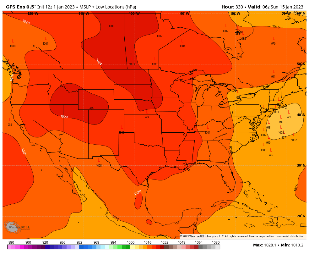
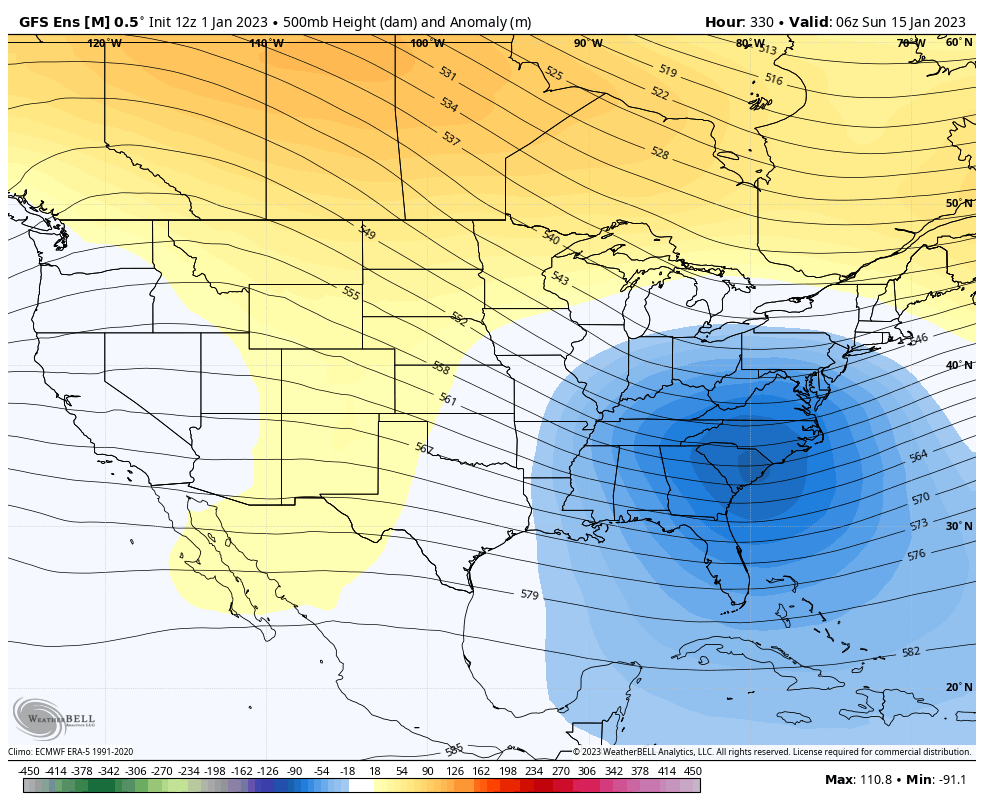
Still a crazy amount of cold behind that system.. 30F departures below normal from the Gulf of Mexico to the Montana/Canadian border. As per Euro, DCA challenges the record cold max for the 24th set in 1989 of 23F (25F on Euro), and the 4th coldest Christmas high w/ 26F as depicted. If it can't be snowy, at least some anomalous cold will make Christmas feel "wintry".
-
Pretty substantial shift..
.thumb.gif.6fd4f22be4451623494d4673d5595c4f.gif)
-
This would also explain why it appears as if December is becoming a non-winter month faster than any month after, right? From what I've seen, we can get those domains to "play nice" once we're farther into the season when those anomalously warm regions of water have had ample chance to cool down, but they're mostly hostile the earlier we are into the season. That especially doesn't sit well with La Nina regimes as they're much more likely to be frontloaded. It also seems to have knock-on effects when we're dealt an excessively unfavorable pattern very early on, something like the +EPO in late Dec 2020-Jan 2021 and of course Dec 2015 where it took 3-4 weeks for cold air to reach our side of the hemisphere once again. Quite the frustrating game we have to play.
-
The ICON is still well.. the ICON, but a sizeable positive shift w/ regards to how it handles the TPV. Doesn't get anywhere near resembling a GFS scenario, but maybe we could at least avoid the dreaded pre-Christmas 60s torch?

-
At my location back home 3.6" during the entire month would make it the snowiest December since.. 2009 lol. Gotta stay humbled by climo after seeing those 2 GFS runs back to back, and of course it's good to know that we're just now at the start of our tracking season.. anything this early is gravy
-
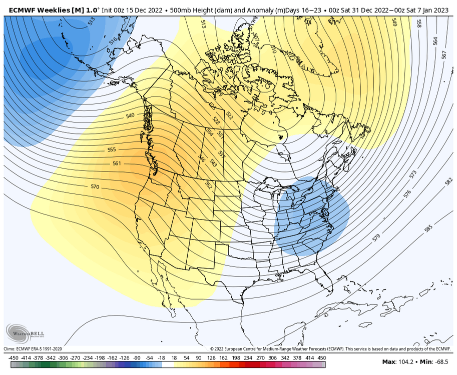
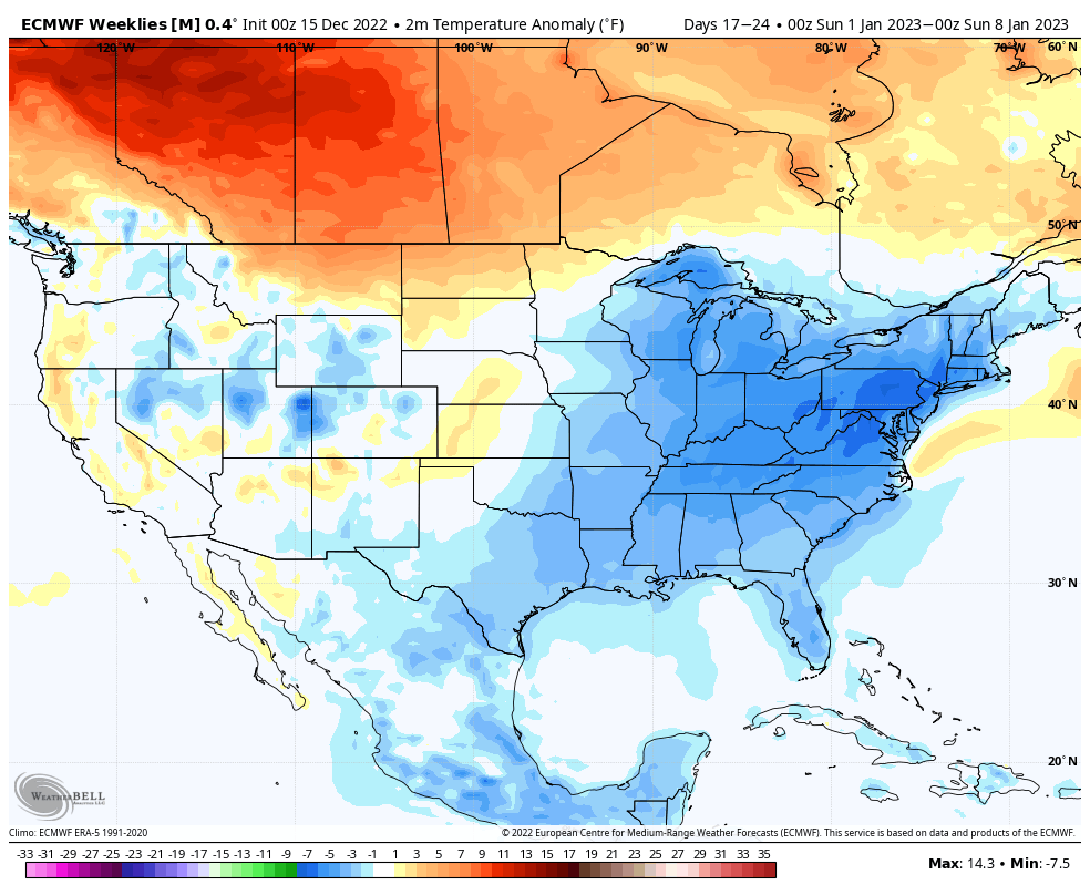
While we wait for the GFS, Euro Weeklies continue w/ the cold into early January. Of course a lot of this is weighted towards next week's cold snap, but the weeklies depict negative departures through much of January. This would be for the first week of January, showing cold anomalies continue with a pretty decent look up at h500. Verbatim we play with that Aleutian low attempting to encroach mainland Alaska, but not enough to conduct a fully-fledged onslaught of Pacific air. The 12z EPS looked like it would go on and do that, but that look plays out near the Day 12-15 range so there's still a lot of uncertainty w/ regards to the Pacific. Also correct me if I'm wrong, but isn't that Aleutian low more characteristic of an El Niño? I recall most of the seasonal models parking an Aleutian ridge over that domain.
.thumb.png.9741e84824ee2c7e214089c1899b8622.png)

-
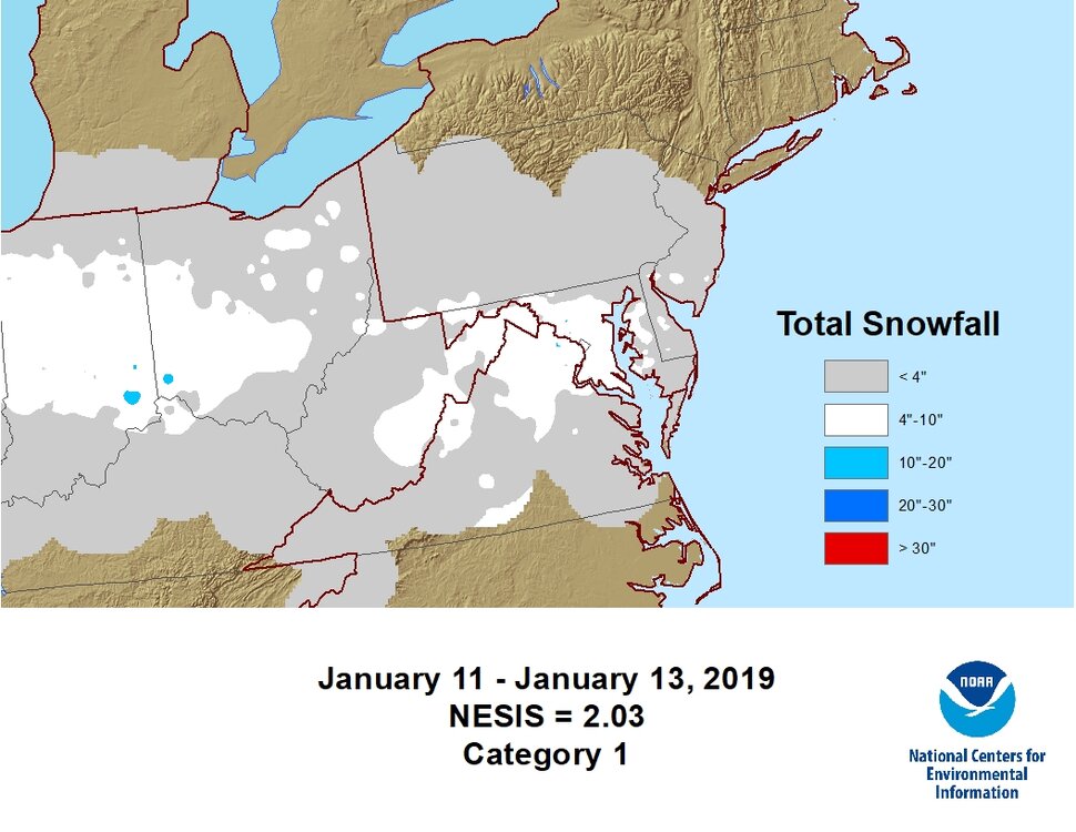
For the data-obsessed weather geeks like myself out there, it looks like the team that creates the NESIS snowfall map graphics went back and filled in the gaps for some of the storms from the 2000s-today. The graphics don't look as polished as some of the earlier ones, but it's nice to see some love for the storms that were somewhat prolific, but might've just not been considered at the end of their respective seasons. You can find that data here: https://www.ncei.noaa.gov/access/monitoring/rsi/nesis This was a personal favorite of mine.
-
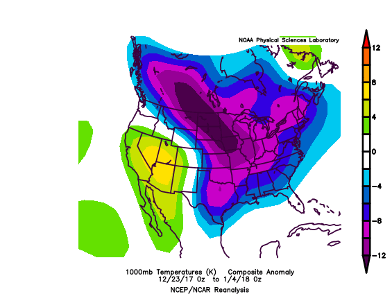
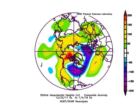
While the month wasn't 1:1 at h500, November 2017 did have an extreme -EPO event, much like what we had during the middle of last month. That year also featured a prolific Arctic outbreak during the last week of December into early January. The main difference between these two timeframes is that December 2017 was more positive in the AO and NAO domains than what we're dealing with now. Not hostile, but it was definitely a pacific driven pattern. That timeframe had some impressive cold. According to @RodneyS, December 26th through January 8th 2018 averaged 22.5 degrees at DCA, which was the coldest such 2 week stretch since January 10-23, 1994. That arctic outbreak concluded with a major storm for our subforum's Eastern region on January 4th, but wintry threats continued through mid January. We will see if additional Greenland/Arctic blocking allows for this stretch to be snowier than that was for our general subforum, although I'm unsure if this timeframe will rival that one in terms of temperature departures.
-
Euro doesn't have the single digits all the way down to San Diego anymore so that's a start at least
-
This is workable.

.thumb.png.e4f6002ca6b4901e5331f146587f83a4.png)


.gif.85e6bc5c673e3000c1c2dddeae7c32ff.gif)

.png.1481824ae0bd1ca8d3dbcaa875256824.png)


.png.6e1732bee3ad3639f9c5ae8269636204.png)