

Cobalt
-
Posts
4,908 -
Joined
-
Last visited
Content Type
Profiles
Blogs
Forums
American Weather
Media Demo
Store
Gallery
Everything posted by Cobalt
-
bleh
-
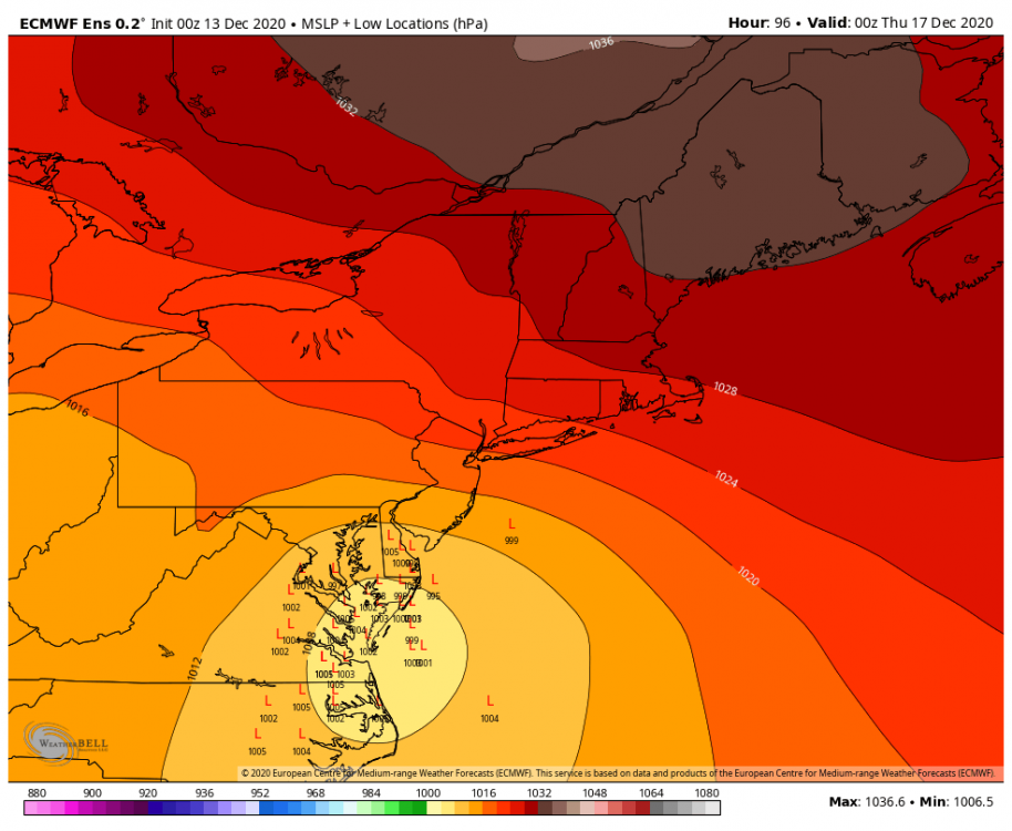
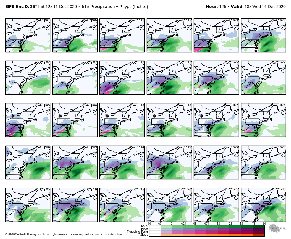
Kuchera, for reference.
.thumb.png.fb652ac51b7834b6fcd4b44604e96c35.png)
-
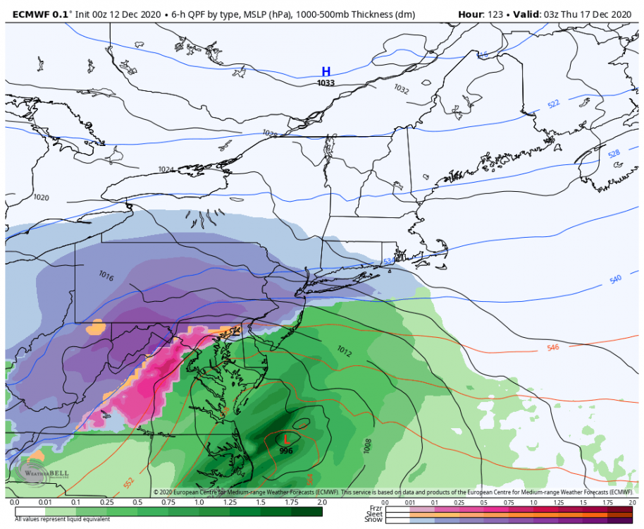
Here's a trend of the lps too, nice.
-
Was gonna say this before the 0z suite came out but forgot to, but thanks PSU and others for the incredible analysis about the storm itself, as well as analysis on med/long range patterns. You guys are what make this worthwhile, and it's amazing to learn from some of the best. Cheers!
-
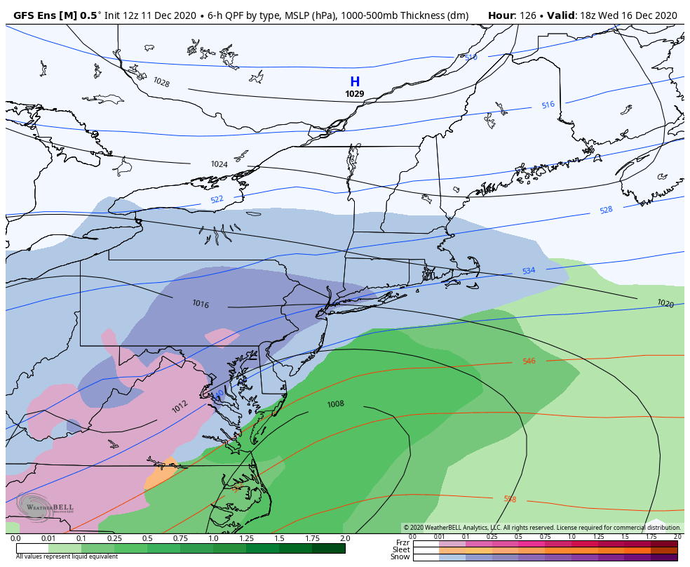
Cutting with a 1033 high directly over top of us would be very 2020
-
I was the ripe old age of 0.5 at the time but 03-04 was frontloaded, no? Pretty sure there was a few good snows in December but not much else for the Mid Atlantic, from what I've seen.
-
True, but we entered NAM range thinking it would be a 2-4/3-5" event. All of the big trends were short range. What I meant was a storm that we could track all the way from med range knowing we have a good shot at WSW criteria for a decent chunk of the subforum. Kind of a niche way to describe it, but just thought it was interesting
-
fyp Speaking of which, is this the last time we've actually been tracking a potential WSW event in the medium range since March 20-21 2018? The Jan storm wouldn't count since all positive trends were basically short range. Even March 20-21 didn't verify, so maybe the last one since Jan 2016??
-
The individual members don't really even show much ice, maybe it's just seeing the snow panels + rain panels and splitting the difference?

-
Yup, seems like a good bit of ice solutions, but we're still in a somewhat decent spot
-
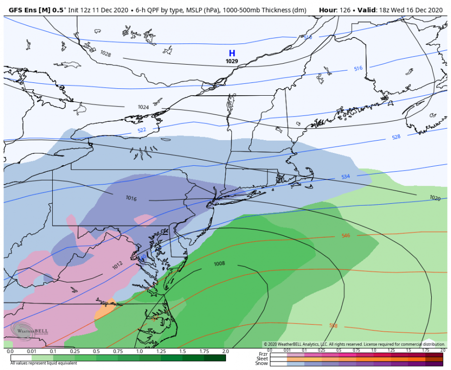
Taken with obvious med/long range grain of salt, but the trends on both the GEFS and the GFS have been really nice to say the least.
.thumb.png.3e70161e72d6bc300a9d36373b043b1c.png)
-
Kuchera, for reference.
-
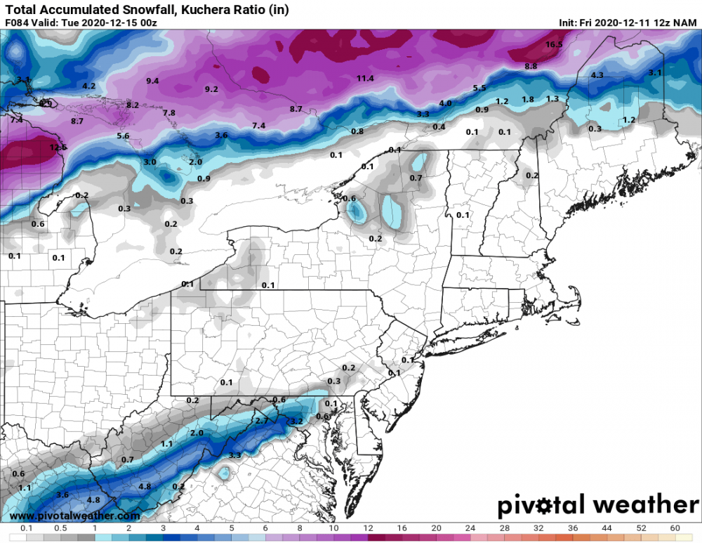
Here they are. A couple that jackpot SE of DC, surprisingly, which inspires some confidence
-
in CAD we trust?
-
Interesting to see that CAD signature show up on multiple models
-
I mean, 57 runs until we see this verify, but yeah not the best scenario to be heading into. Hope DT's ideas of nina's lessening impact come to fruition in late Jan/Feb to circumvent this.
-
-

GOOD CHANCE OF 1ST LIGHT SNOW EVENT VA / nw NC/ MD DEL MONDAY DEC 7
Cobalt replied to DTWXRISK's topic in Mid Atlantic
Ukie didn't seem to hold back all too much, interesting to see if the Euro is similar -
GOOD CHANCE OF 1ST LIGHT SNOW EVENT VA / nw NC/ MD DEL MONDAY DEC 7
Cobalt replied to DTWXRISK's topic in Mid Atlantic
Apologies, only if the models would support a storm for them that is. Not trying to backseat forecast in a subforum that doesn't belong to us ¯\_(ツ)_/¯ Anywho, getting off topic, but the ICON seems to be getting Saturday's storm out of the way a bit earlier. Wonder how that'll translate to Tuesday's event given the extra spacing. -
GOOD CHANCE OF 1ST LIGHT SNOW EVENT VA / nw NC/ MD DEL MONDAY DEC 7
Cobalt replied to DTWXRISK's topic in Mid Atlantic
We gotta get the Southeastern forum to make threads about southern sliders so we can swoop in and will them our way I guess -
GOOD CHANCE OF 1ST LIGHT SNOW EVENT VA / nw NC/ MD DEL MONDAY DEC 7
Cobalt replied to DTWXRISK's topic in Mid Atlantic
Yup, today/Saturday's storm lingering longer thru 57hrs was a good indicator that the storm would miss any type of phase. But then again, NAM. Not enthralled with the chances but snow showers in December don't sound like the end of the world. -
-
It's really trying to continue that Dec 5 magic. Maybe December 5th needed to take a gap decade and is back for the 2020s?
-
Mid-Atlantic winter 2020-21 snowfall contest
Cobalt replied to PrinceFrederickWx's topic in Mid Atlantic
I admire your optimism. BWI: 10.4" DCA: 6.8" IAD: 13.6" RIC: 5.4" Tiebreaker (SBY): 4.2" -
Yeah not sure that's a large enough sample size. 16-17 and 17-18 were both ninas, 18-19 at least brought most in the area to climo with the Dec and Jan storms, and of course 19-20 was a torchfest. That just seems like a random mixed bag, we've certainly had multiple instances of that within even the 21st century, a good bit in the 80s/90s too. Considering how much of a distinct lack of sustained blocking we've had since 10-11 I'd say that maybe that was when the flip was switched, but what do I know I guess.

.png.5ac57de2b3d6678c1e633efaabf6e0a7.png)


.png.573044b2a439ace0e76523b9a260ffea.png)
