Cobalt
-
Posts
4,908 -
Joined
-
Last visited
Content Type
Profiles
Blogs
Forums
American Weather
Media Demo
Store
Gallery
Everything posted by Cobalt
-
3F below normal compared to 1991-2020 averages, the warmest 30 year set. In 2024, 2023, and 2020, the nation blew past 3F above normal during the exact same stretch like nothing. Where were you posting the national temp anomaly maps then?
-
Light snow, 15F
-
We're sick and twisted individuals
-
It torched in December. Pretty sure if not for 2015, Dec 2021 would be the warmest at the 3 airports. That made a BN DJF average impossible, but January-April were pretty chilly as far as La Ninas go.
-
damn this thing must be a powerhouse if it's snowing all the way from 50mb
-
Feb 26-27 2004 says hi
-
My personal favorite - can you guess which winter this post followed? let me give a hint, it starts with an 09 and ends with a -10

-
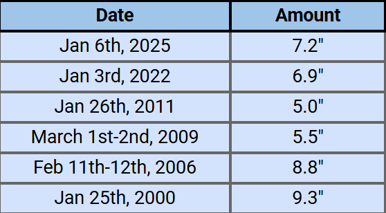
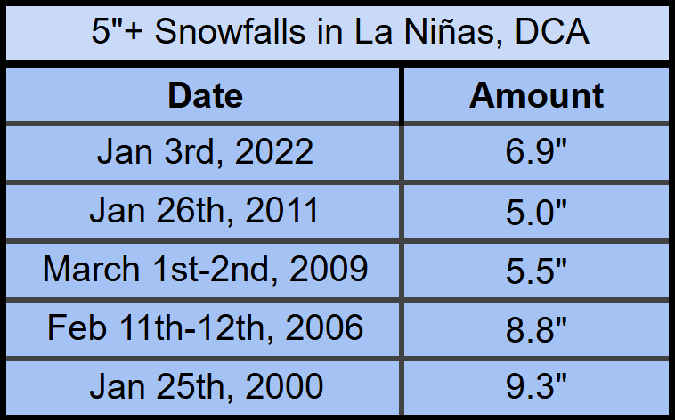
Worth bringing up because this isn't all too far fetched at this point. Listed are all the 5"+ snowfalls at DCA during 21st century La Niñas. The last La Niña to feature 2+ snows above 5 inches was 95-96 (3 instances), so the slight chance of DCA not DCAing today would have this winter be the first in nearly 30 years to join that club.
-
Your file size is limited by other files you've uploaded. On desktop click on your name in the top right, then click "my attachments" (should work on mobile too). Delete the files taking up the most space but definitely save them to your device beforehand. A bunch of lost media over the years all because of an understandable file limit.
-
checks out.
-
La Ninas of years past have produced eerily similar fails. Folks might remember that one mid Feb 2021 threat (also February 12th I think?) that had two waves to it. Guidance converged on both waves producing a flush hit from 100+hrs out and I think even the Euro within hour 70 had a widespread 6-12". However, the same 1st wave weak second wave too strong thing happened. It is excessively difficult to put stock in these multi-wave solutions when there is so much give and take to how the guidance places emphasis on either phase of the thing.
-
Just gotta wait a few weeks my friend. Mid February onwards looks cold and snowy!
-
Should bring pause to whenever a qg_omega or snowman type person comes out of the gate predicting warmth. Are they making a knowledge-based call in accordance to guidance, analogs, etc, or are they betting on persistence giving them an easy win? It's not rocket science to bet on AN each year, they'll be right 8/10 times nowadays. It's the 2/10 where their true character and intentions come to light.
-
Wonder whatever happened to this guy
-
Seems like censorship to me.
-
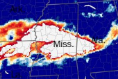
always cool when the abbreviated name of a state can also explain what happened with the snowstorm
-
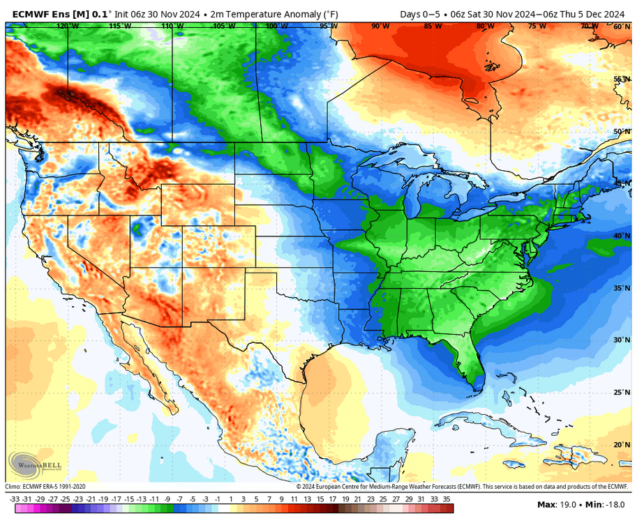
Wxbell uses 91-2020 norms, so it makes sense that it's displayed as colder there.
-
Quick table that illustrates how rare warning level niña snows are in DC. Below is every instance in the 21st century. Anything 7"+ would be the biggest such snow in nearly two decades, and a total exceeding 9.3" would be the biggest since Jan '96.
-
that cutter pattern you predicted for the next 2 weeks could help with that
-
Quite a change in your tune from just a few days ago.. what happened?
-
lol it casually sped up the pattern progression by 100 hours or so
-

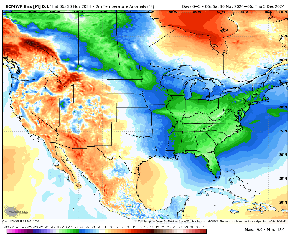
December 2024 - Best look to an early December pattern in many a year!
Cobalt replied to FXWX's topic in New England
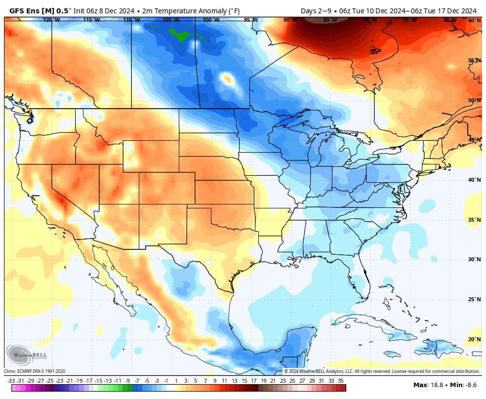
Here comes the record warmth you've been talking about for the past month!! Brace for impact!!
-
So close!! it's actually the coldest start in the East since at least 2010 ❤️❤️
-
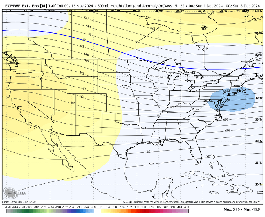
Notable 5 poster thinks this h5 pattern will produce a record warm start to December for the CONUS
-
Blowvember - and not named for wind potential
Cobalt replied to Go Kart Mozart's topic in New England
We've flipped a coin and hit tails 5+ consecutive times so we must be due for a stretch of heads soon.. sounds like a case of gambler's fallacy