

DownpourDave
-
Posts
1,341 -
Joined
-
Last visited
Content Type
Profiles
Blogs
Forums
American Weather
Media Demo
Store
Gallery
Posts posted by DownpourDave
-
-
2 hours ago, Scraff said:
Imagine that QPF at the right temps. OMG.

No need to imagine, the way thermodynamics work, it wouldn’t be that QPF if it were snow.
It is why you can get 3 inches of rain per hour but not 30 inches of snow per hour. It doesn’t work like that.
-
 4
4
-
 1
1
-
 1
1
-
-
2 minutes ago, SnowLover22 said:
I checked the raw data file, it seems the data simply stopped transmitting and is missing. I wonder if maybe they ran into some instrumentation issues/communication issues?
It just filled in now.... strange the data is now all there.
-
1
-
-
3 minutes ago, WxWatcher007 said:
lol nothing from the NE eyewall.
I checked the raw data file, it seems the data simply stopped transmitting and is missing. I wonder if maybe they ran into some instrumentation issues/communication issues?
-
1
-
-
30 minutes ago, NJwx85 said:
This is probably already a hurricane. Just don't have recon to confirm so still going off satellite estimates.
Quote000 NOUS42 KNHC 052054 REPRPD WEATHER RECONNAISSANCE FLIGHTS CARCAH, NATIONAL HURRICANE CENTER, MIAMI, FL. 0455 PM EDT TUE 05 SEPTEMBER 2023 SUBJECT: TROPICAL CYCLONE PLAN OF THE DAY (TCPOD) VALID 06/1100Z TO 07/1100Z SEPTEMBER 2023 TCPOD NUMBER.....23-098 AMENDMENT I. ATLANTIC REQUIREMENTS 1. NEGATIVE RECONNAISSANCE REQUIREMENTS. 2. OUTLOOK FOR SUCCEEDING DAY: A. BEGIN 6-HRLY FIXES ON TROPICAL STORM LEE AT 07/2330Z. B. NOAA 43 P-3 TAIL DOPPLER RADAR MISSION INTO LEE FOR 08/1200Z, DEPARTING TISX AT 08/0800Z. C. (ADDED) POSSIBLE USAF RESERVE WC-130J SYNOPTIC SURVEILLANCE MISSION AROUND TROPICAL STORM LEE FOR 08/0000Z. II. PACIFIC REQUIREMENTS 1. NEGATIVE RECONNAISSANCE REQUIREMENTS. 2. OUTLOOK FOR SUCCEEDING DAY.....NEGATIVE. $$ SEF NNNNLooks like reconnaissance on Lee will begin tomorrow 07/2330z.
-
1
-
-
31 minutes ago, dendrite said:
Long, cold, and dark. CAD reigns supreme. Don't expect any blockbuster events unless a deformation band somehow makes it up there and rots.
I was hoping it would be a little bit snowier than Geneva in the Finger Lakes region of NY. I am a skier so I am hoping for enough snow for that!
I did hear there are many great ski resorts near where I am.
-
Just moved to Plymouth NH to start my masters degree. Anyone around there that can give me a sense of the winters up here?
-
6
-
-
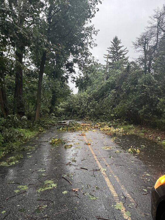
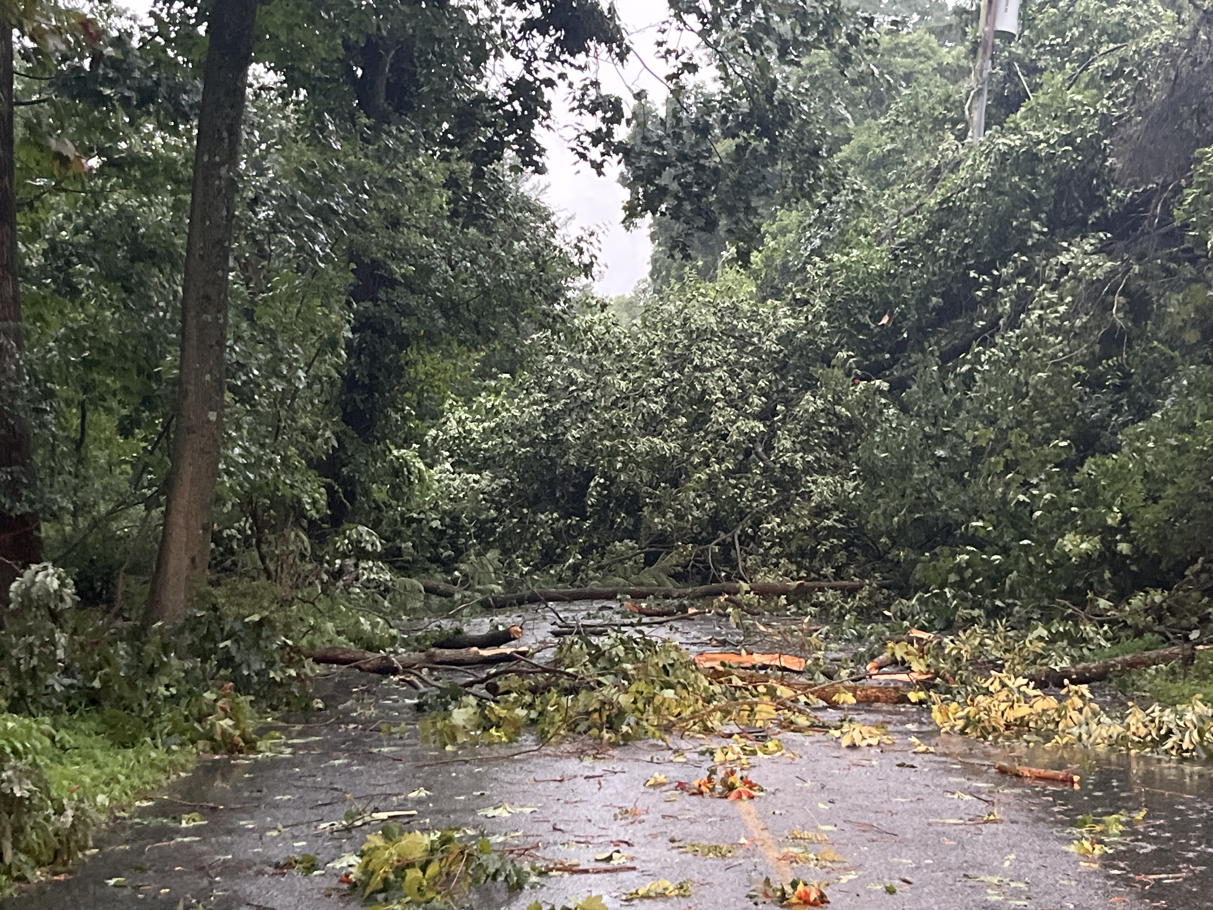
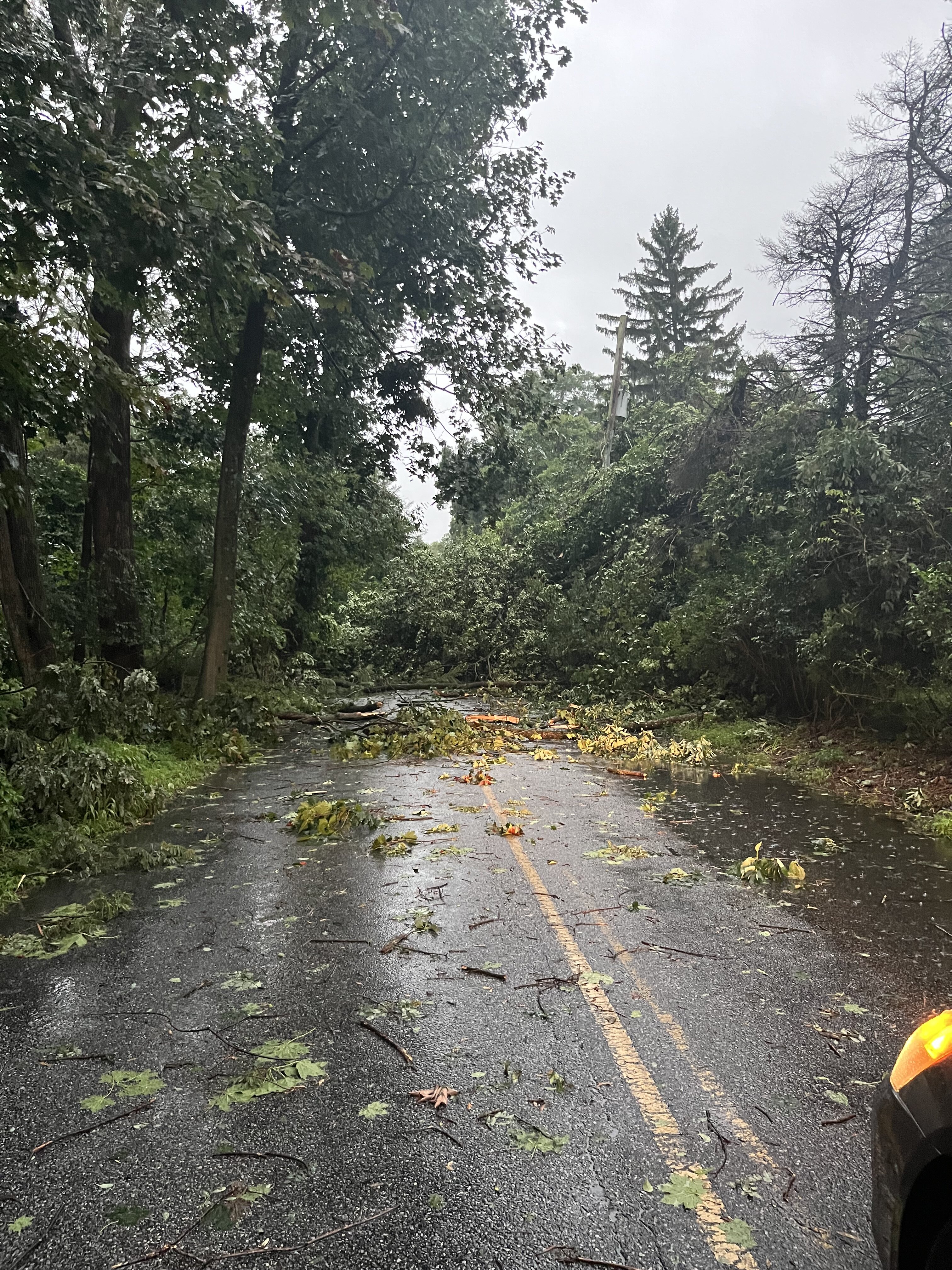
2 hours ago, blackhound said:
In Glen Mills not far from Cheyney Road. All that happened on our property was the patio table was picked up and tossed onto the vegetable garden fence. Fence survived as did the tomatoes.
But it's a mess around here. One of our neighbors had a tree come down on their house. No surprise the power is still out. Roads closed all over the place. PECO estimate is 11PM tonight. That would be lucky.
Near S concord road and Brinton lake road

-
3
-
-
Not that it matters that much but Icon just made a step toward the gfs camp.
-
4
-
-
Just now, H2O said:
can we let the damn run finish?
The critical features to observe that have a domino effect to the rest of the run are only 3-4 days out but your point is valid.
-
Just now, Maestrobjwa said:
Which also means we ain't gotta wait too long on the Euro before we have an idea where this run is gonna go, lol
Spoiler: It won't be as a good as the gfs.
-
1
-
-
The good news is the differences between the favorable solutions and unfavorable solutions GFS and CMC respectively can be traced back to the shortwave over Alaska at 54 hours. Meaning this model "war" should end relatively soon. One should cave "soon"
-
1
-
-
1 minute ago, Ralph Wiggum said:
You can see why the GFS made the change at the surface from 6z. Just look at how much sharper the PNA ridge becomes at 12z vs 6z:

It really does seem like the PNA getting that right is one of the most important ingredients.
-
Geneva actually getting lake effect snow? What is this!!!
-
1
-
-
15 hours ago, BuffaloWeather said:
Check your pms
I would also like an invite
-
would you rather have 40 inches of rain in Tampa or a 8-12 foot storm surge into Tampa Bay?
-
Just now, Sandstorm94 said:
Best track has it EX, TT has it as Remants
Sent from my SM-S102DL using Tapatalk
Does best track have the current strength and pressure m?
-
17 minutes ago, Sandstorm94 said:
Fiona Post Tropical
Sent from my SM-S102DL using Tapatalk
Don’t think it is. A post tropical cat 3 equivalent is unheard of. Definitely still a warm core present.
-
On 4/30/2022 at 3:40 PM, yoda said:
Monday's highs 60-65... and then someone ordered the wedge sandwich for next Tuesday on the 12z GFS too


kinda looks like cold air damming.
-
5 hours ago, DeltaT13 said:
Alright, I'm pushing off for Vermont at 4am tomorrow morning/tonight. Still riding the hairy edge of that rain snow line, but that's typically where you want to be. I'm hoping some elevation also helps out. Good luck to everyone with what will likely be the last "big one" of this winter.
You going to the storm conference in Burlington?
-
24 minutes ago, DeltaT13 said:
Wow. You’d rather ski hard pack ice than powder, and miss an awesome storm solely because you don’t want to drive in a little snow. What in the world is going on here. Move to florida. Haha
My car is shit in the snow. The smallest amount on the roads and I am sliding like crazy. As long at the storm ends before I plan on hitting the road to drive(around 4PM on Saturday), I should be fine. Obviously I would love to ski in powder, just wish the timing of the storm was better.
-
7 minutes ago, TugHillMatt said:
Snowed out?!? In Geneva? This winter? You don't belong here...

reverse psy....**** is it working?
-
 1
1
-
-
3 minutes ago, rochesterdave said:
Wrong board
Let's smoke cirrus that would be nice. Seriously I do love snow but i am all but snowed out.
-
6 minutes ago, BGM Blizzard said:
Nam made a sizeable move east

Hopefully the east trend continues. I am going to be going skiing on Saturday. While fresh snow at Bristol would be nice, do not want to drive in the snow.
-
8 minutes ago, tim123 said:
75 mph in Milwaukee with snow squall
really surprised no Severe Thunderstorm warning. Would meet criteria for wind.


12/17/18 Disco/Obs - Rain/Wind Event
in Mid Atlantic
Posted
You’re right that you can, my point is it is harder. The answer is a bit complicated.
Part of the answer is in the physical process of rain and snow formation and how fast they fall.
Rain forms through liquid droplets coalescing in the atmosphere creating larger and heavier droplets that can fall quicker under the force of gravity
Snowflakes form when water vapor turns directly into ice crystals.
Snowflakes form at a slower rate than rain droplets and obviously the structure is different with air pockets within the snow flake causing them to be lighter than rain drops.
Thus,
Rain can physically fall at a faster rate than snow and rain forms at a faster rate.
This explains it better.
https://geo.libretexts.org/Bookshelves/Geography_(Physical)/The_Physical_Environment_(Ritter)/07%3A_Atmospheric_Moisture/7.04%3A_Clouds_and_Precipitation/7.4.03%3A_Precipitation_Process
Bergeron Process vs Warm-Rain Process
Now assuming that one is dealing with the Bergeron Process for areas that get rain and areas that get snow, rain will still fall at a faster rate due to structure differences between a snow flake vs rain drop.