DownpourDave
-
Posts
1,336 -
Joined
-
Last visited
Content Type
Profiles
Blogs
Forums
American Weather
Media Demo
Store
Gallery
Everything posted by DownpourDave
-
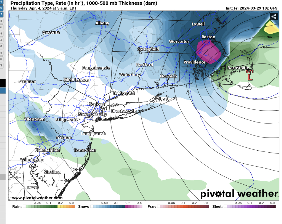
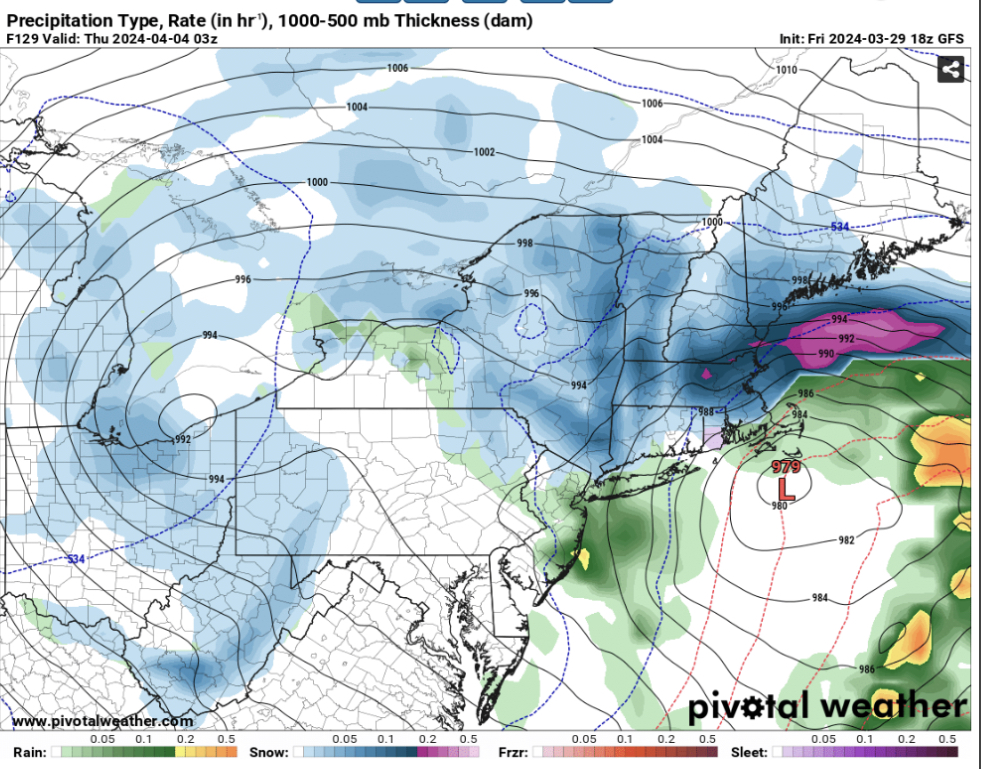
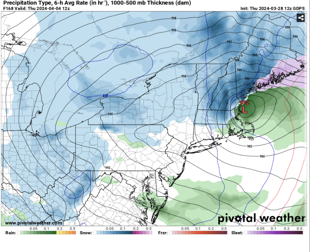
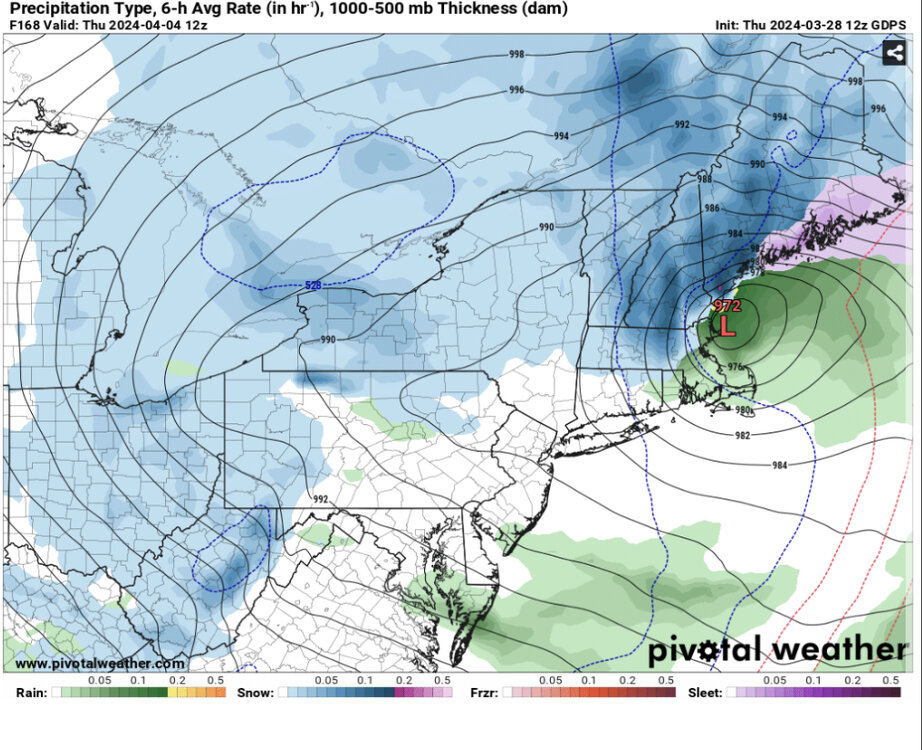
Significant Miller B Nor'easter watch, Apr 3rd-4th
DownpourDave replied to Typhoon Tip's topic in New England
It’s over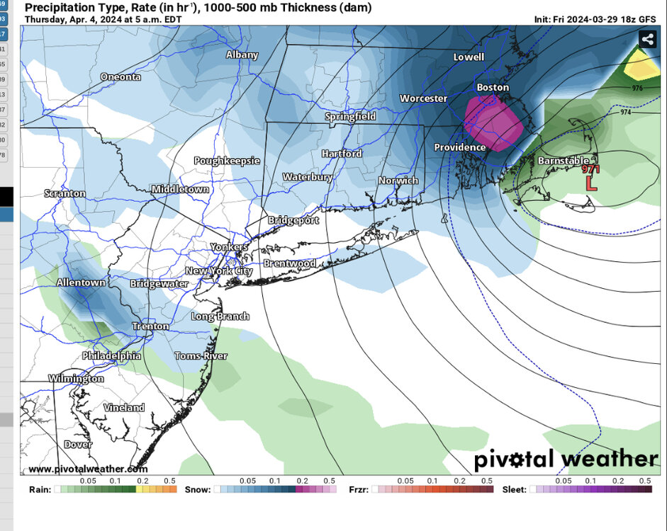
-
Significant Miller B Nor'easter watch, Apr 3rd-4th
DownpourDave replied to Typhoon Tip's topic in New England
Such a step back guys, storm cancel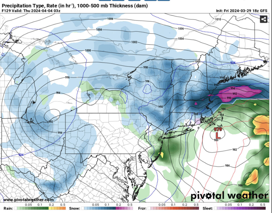
-
I mean, this storm is probably the last hurrah so patience….
-
Hopefully, still far out enough to say we have no idea what will happen other then there will be a storm system somewhere along the east coast, location tbd.
-
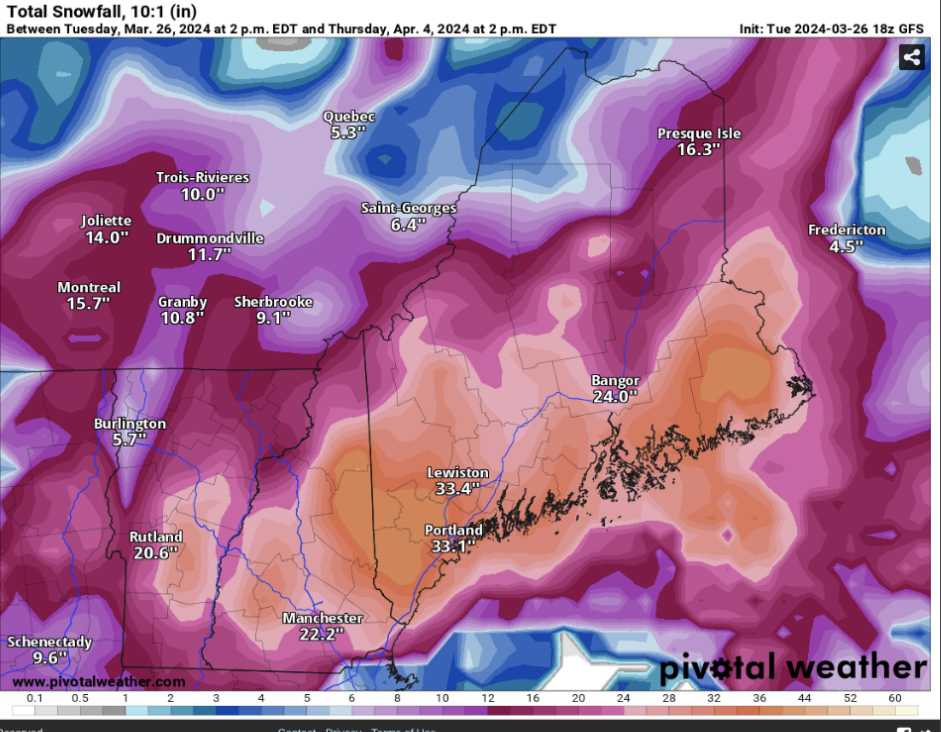
This time next week you and me will be wishing away our 20 inch snow pack.
-
Snow will stick at 28-32 even in April and verbatim height of storm is at night.
-
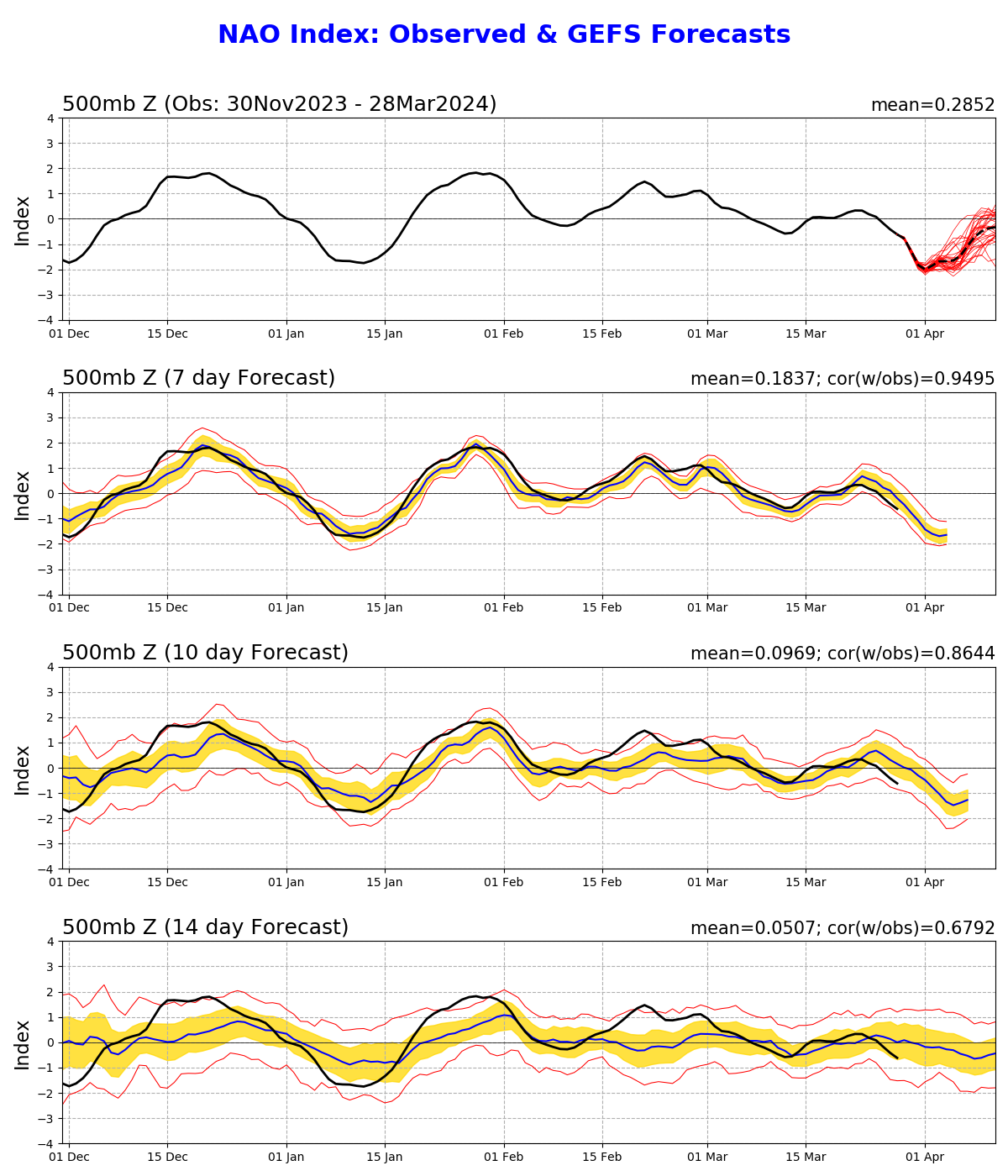
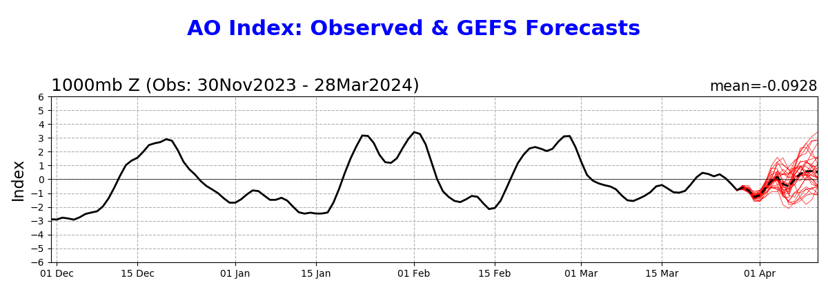
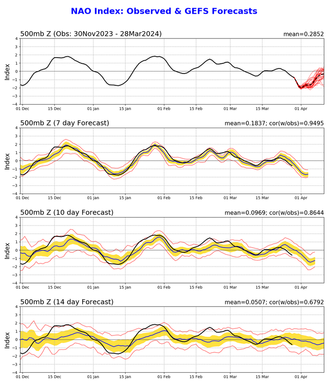
There definitely is tele support for something to happen Rising NAO from negative to more neutral along with rising AO with the EPO being negative.

-
How much I pray this does not happen. I already moved on to spring.
-
The Congrats Dendrite Deck Destroyer 3/23-3/25 obs discussion
DownpourDave replied to Ginx snewx's topic in New England
Snow has just come to an end. Final total is 19.75”. -
The Congrats Dendrite Deck Destroyer 3/23-3/25 obs discussion
DownpourDave replied to Ginx snewx's topic in New England
The door probably wouldn’t open unless the roof has been shoveled. -
The Congrats Dendrite Deck Destroyer 3/23-3/25 obs discussion
DownpourDave replied to Ginx snewx's topic in New England

-
The Congrats Dendrite Deck Destroyer 3/23-3/25 obs discussion
DownpourDave replied to Ginx snewx's topic in New England
I can go to the roof right now and get back to you lol -
The Congrats Dendrite Deck Destroyer 3/23-3/25 obs discussion
DownpourDave replied to Ginx snewx's topic in New England
Gauge at Plymouth Campus Up to 1.72 inches.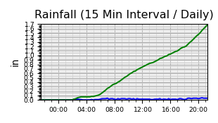
-
The Congrats Dendrite Deck Destroyer 3/23-3/25 obs discussion
DownpourDave replied to Ginx snewx's topic in New England
May make a run at 20”. Let’s see what the final 2 hours of this has in store. 17” right now.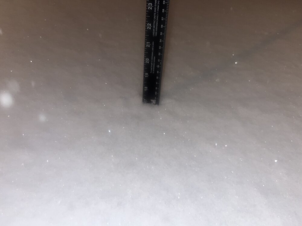
-
The Congrats Dendrite Deck Destroyer 3/23-3/25 obs discussion
DownpourDave replied to Ginx snewx's topic in New England
Just measured, up to 15.5” inches of snow. Liquid up to around 1.4 inches so roughly 10:1 ratios. -
The Congrats Dendrite Deck Destroyer 3/23-3/25 obs discussion
DownpourDave replied to Ginx snewx's topic in New England
Just measured, roughly 13 inches here. Rough estimate, snowboard not used. -
The Congrats Dendrite Deck Destroyer 3/23-3/25 obs discussion
DownpourDave replied to Ginx snewx's topic in New England
Sleet briefly mixed in, back to all snow. -
The Congrats Dendrite Deck Destroyer 3/23-3/25 obs discussion
DownpourDave replied to Ginx snewx's topic in New England
The signs were there…. Still wait and see but looks like the NAM was wrong.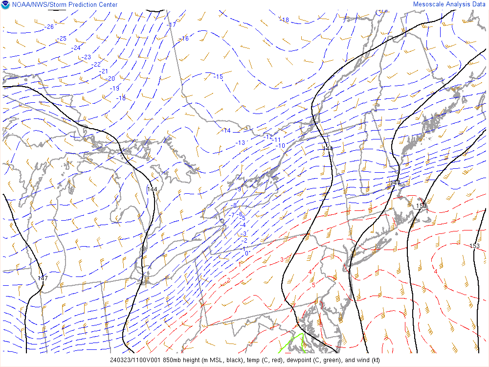

-
The Congrats Dendrite Deck Destroyer 3/23-3/25 obs discussion
DownpourDave replied to Ginx snewx's topic in New England
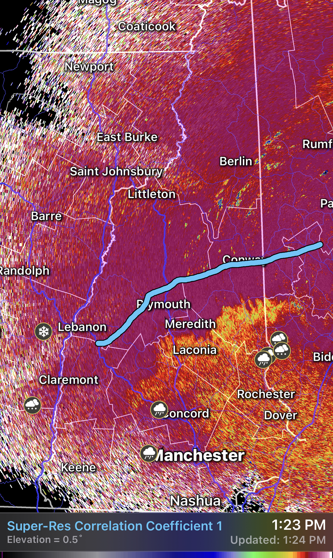
This is the farthest north I believe the mix line will get.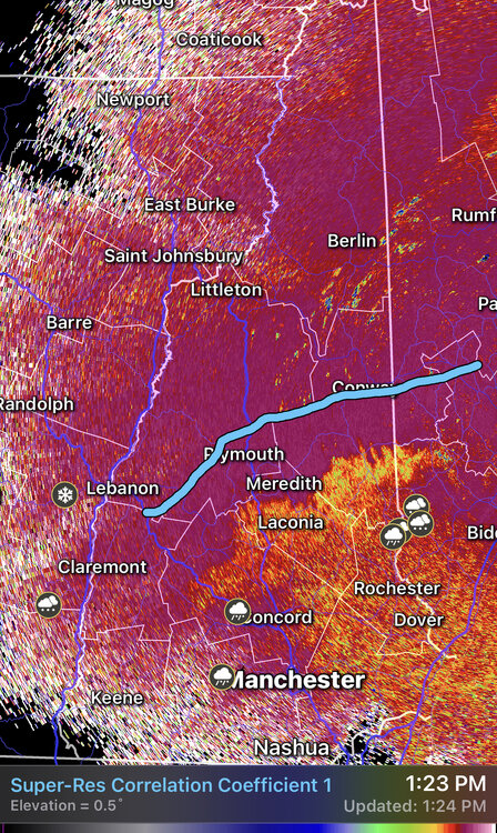
-
The Congrats Dendrite Deck Destroyer 3/23-3/25 obs discussion
DownpourDave replied to Ginx snewx's topic in New England
Thanks for the observations. I am estimating I have another 1 hour or 2. -
The Congrats Dendrite Deck Destroyer 3/23-3/25 obs discussion
DownpourDave replied to Ginx snewx's topic in New England
I could care less if the mix line gets up to me, I am just hoping Cannon stays all snow. -
The Congrats Dendrite Deck Destroyer 3/23-3/25 obs discussion
DownpourDave replied to Ginx snewx's topic in New England
Latest metar for MHT METAR KMHT 231153Z COR 05004KT 1SM R35/P6000FT -SN BR FEW008 OVC021 M01/M03 A3018 RMK AO2 SFC VIS 1 1/4 SLP237 P0009 60038 70038 T10111033 11006 21011 58004 -
The Congrats Dendrite Deck Destroyer 3/23-3/25 obs discussion
DownpourDave replied to Ginx snewx's topic in New England
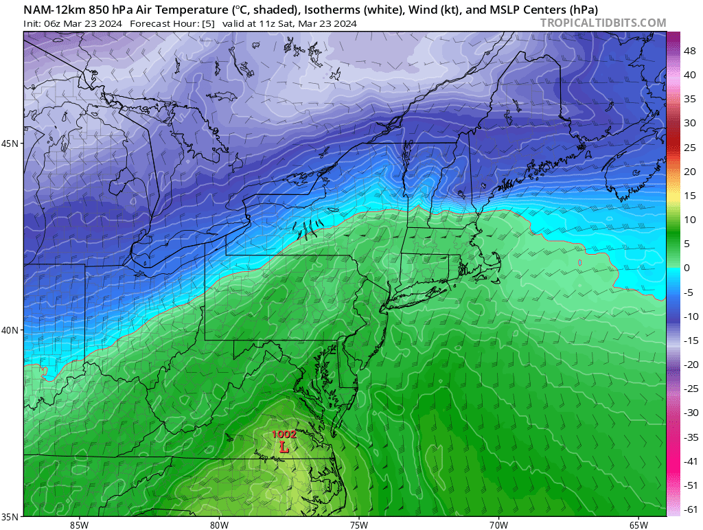
I honestly couldn’t find the warm layer. 850s and 925 below freezing from where radar says the sleet line is. Using cc as the sleet line, NAM is a touch too far north and HRRR is a touch too far south. -
The Congrats Dendrite Deck Destroyer 3/23-3/25 obs discussion
DownpourDave replied to Ginx snewx's topic in New England
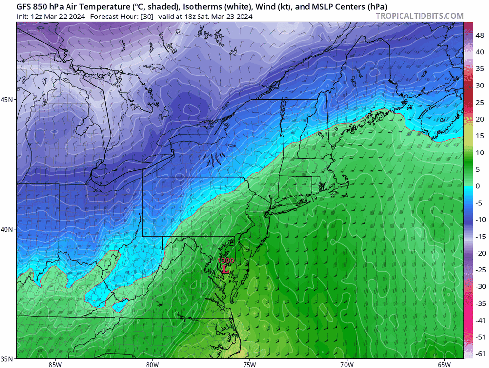
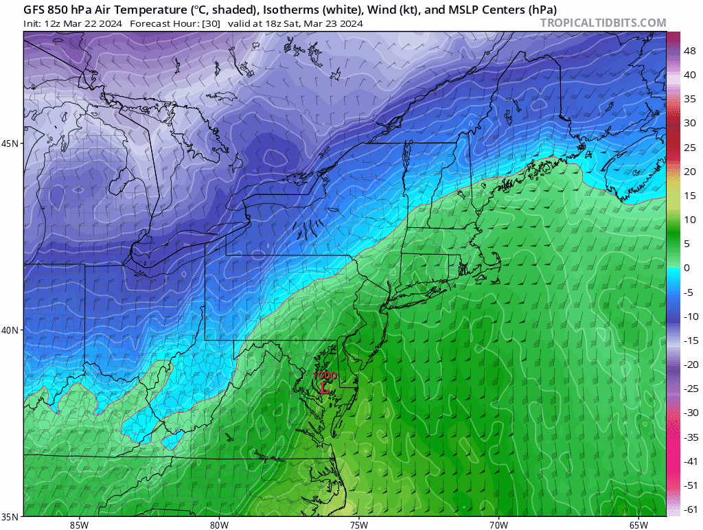
Do you think the NAM is right with the mid level warm surge. Now casting says the depiction is full of shit. Current 850s NAM 850s
-
The Congrats Dendrite Deck Destroyer 3/23-3/25 obs discussion
DownpourDave replied to Ginx snewx's topic in New England
No it is not. At least 850 temperatures.