DownpourDave
-
Posts
1,353 -
Joined
-
Last visited
Content Type
Profiles
Blogs
Forums
American Weather
Media Demo
Store
Gallery
Everything posted by DownpourDave
-
January 24-26: Miracle or Mirage JV/Banter Thread!
DownpourDave replied to SnowenOutThere's topic in Mid Atlantic
Hey you can put me as tentative for now. Will try my best to make it, will depend on my workload. -
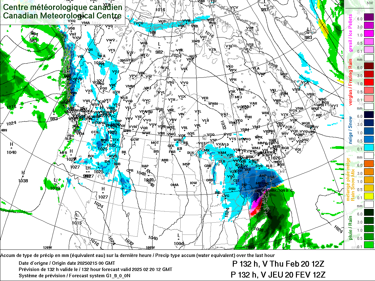
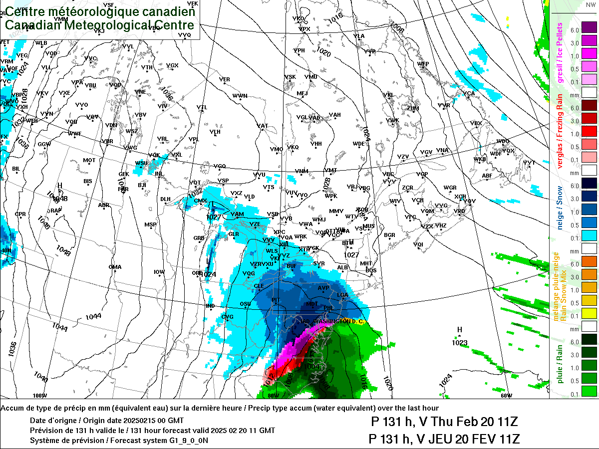
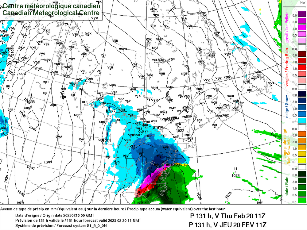
FYI not my image 6z euro

-
I would just have to like step-out if I got a work related call but should be able to make it work. I’ll call the place ahead of time and see if they have wifi I can connect to.
-
Damn, I would love to come if I could make it work…. You think I could bring my work laptop lol… nah that would be weird. I could try and come problem is I am technically on-call until 9 pm.
-
Hmm…..
-
On shift nights all week but have fun y’all!
-
Maybe you should ask them in slack? Sort of kidding….
-
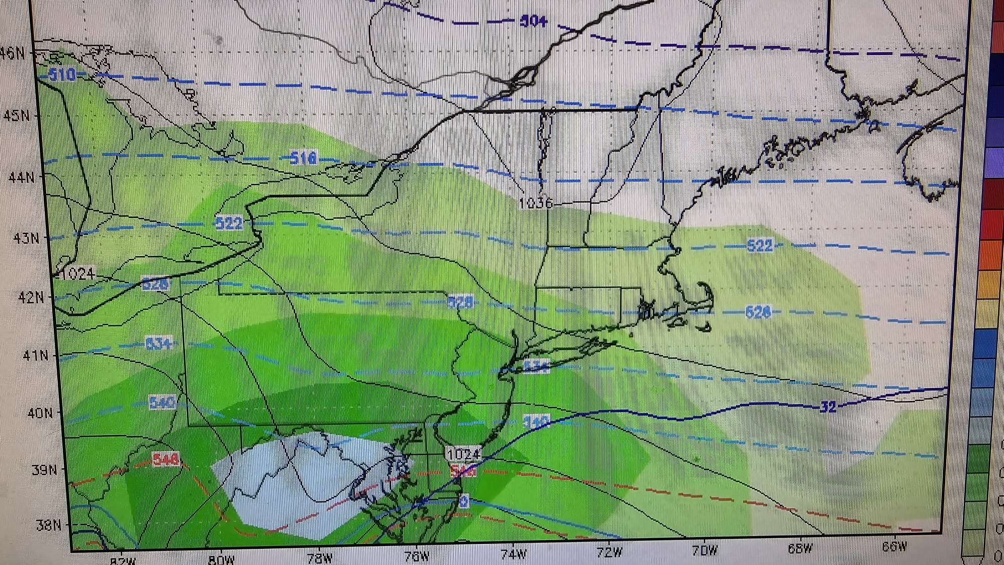
BWI: 24.1" DCA: 17.1" IAD: 27.5" RIC: 9.2" _______ Tiebreaker: (SBY) 8.5"
-
It will be my first winter here, hopefully I can bring the snow from NH down to here.
- 484 replies
-
- 27
-

-

-

-
Near Shirlington… my job is a Physical Scientist Federal Contractor supporting NWS Upper-Air.
-
Just recently moved here for a new job fresh out of graduate school. Anyone got recommendations of things to do for someone that is new to the area. Thanks!
- 267 replies
-
- 12
-
-

-
TSPL, wow
-
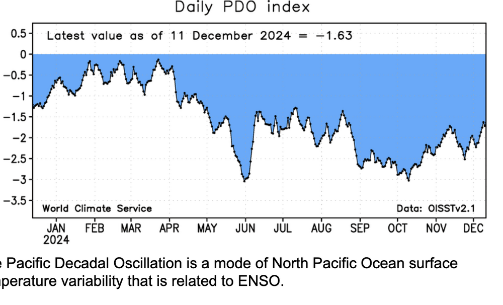
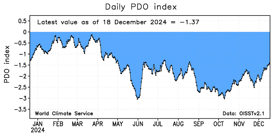
Not that it matters at all at this point but the PDO is now positive albeit barely
-

-
-
New England Winter 2024-25 Bantering, Whining, and Sobbing Thread
DownpourDave replied to klw's topic in New England
I am back. Touch and go for a hot minute, Fever peaked at 103 but avoided the hospital(mostly because ambulance prices are insane). -
New England Winter 2024-25 Bantering, Whining, and Sobbing Thread
DownpourDave replied to klw's topic in New England
Be careful out there. Tested positive for FLU A. Hit me like a ton of bricks. According to CdC high prevalence in New England. -
January: Medium/ Long Range: May the Force be with Us....
DownpourDave replied to Weather Will's topic in Mid Atlantic
I was gonna say, can’t be normal to have the PDO flip like this in a Nina is it? Anyways that Nino like flow in the NPac looks to continue according to the models. Also regardless of the cause, the PDO flipping like this can’t be a bad thing. -
January: Medium/ Long Range: May the Force be with Us....
DownpourDave replied to Weather Will's topic in Mid Atlantic
Looking at the models and what is forecast in the Pacific, I would not be shocked to see this rise continue and for the PDO to outright flip to positive. -
January: Medium/ Long Range: May the Force be with Us....
DownpourDave replied to Weather Will's topic in Mid Atlantic
The word was “mint” -
January: Medium/ Long Range: May the Force be with Us....
DownpourDave replied to Weather Will's topic in Mid Atlantic
I was hoping we get there by Jan 1st so this is better than I expected. I know PSU said getting above that number puts the better analogs in play. -
Lets get this at -1.00 by January 1st
-
You know what is strange, the PDO was near neutral at times last winter(according to chart) yet it didn’t seem to help much. Probably other factors at play (most likely would find an answer by researching the analogs applicable to last year).
-
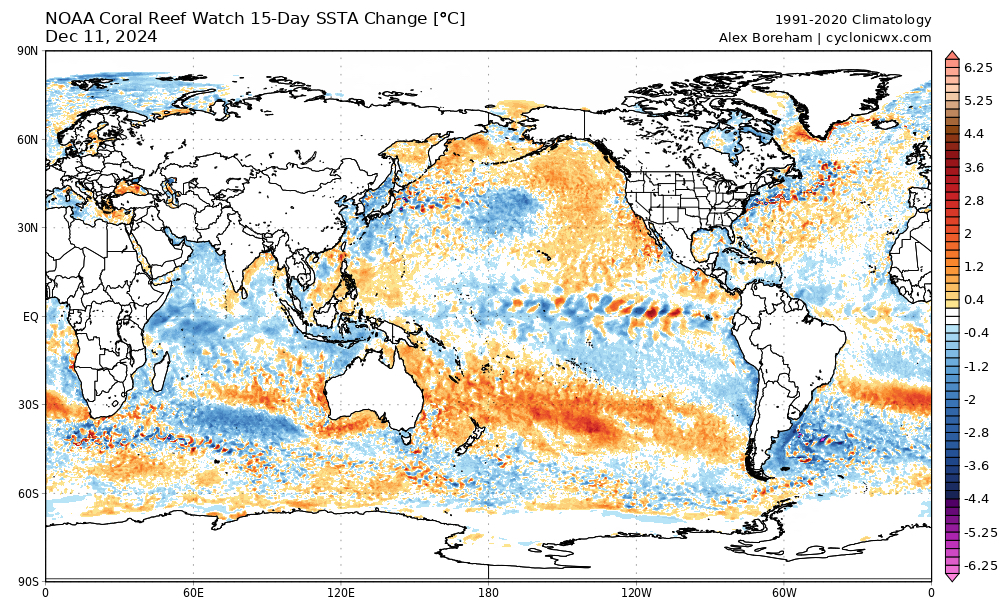
Credit to @brooklynwx99 A visual representing the change in that chart. SSTA Change
-
PDO trending upwards the first half of December. @psuhoffman what is your target value out of curosity. If I am understanding the PDO correctly, the general "trough pattern" over the North Western Pacific Ocean that has been ongoing and forecast on the models should act to continue to help cause the PDO Index to rise.