RDRY
-
Posts
795 -
Joined
-
Last visited
Content Type
Profiles
Blogs
Forums
American Weather
Media Demo
Store
Gallery
Everything posted by RDRY
-
TWC all in on a torch. https://weather.com/news/weather/video/our-new-temperature-outlook-is-here?pl=pl-the-latest
-
Seems like it hung back a little the last day or so, and was more robust and north. But then another vortex dropped in from Maine to squash and starve it.
-
So now storms track DOWN the coast instead of up. That's a fun twist.
-
Nice storm in Cali on Monday. They need it a helluva lot more than us.
-
Persistence for the win ... or the loss in this case.
-
The energy in Canada lifts north, but voila, another piece of energy backs into Maine to squash the storm.

-
Can't recall such a long stretch of winter when there's no strong systems really anywhere outside the northwest. Even the long-range globals have given up inventing bombs. It's like the atmosphere is starved or something.
-
Western Mass is a solid upslope location following departing lows or from upper-air impulses. With the weekend system long gone, are this week's very persistent snows because of the juicier Pac air carried on west winds?
-
Interesting. The OP looked north.
-
Nice weenie band in WMA. Resorts here are desperate for some of the natural stuff.
-
Looks like a western and northern New England storm at best. The Berks will have to rely on upslope as the system heads north.
-
e6 -- Error on the shortstop.
-
Mid-December? Ugh, it's even worse than I thought!!
-
Pushed east by another vort.
-
Insane western ridge.
-
That 12th storm is driving north from the central Gulf!
-
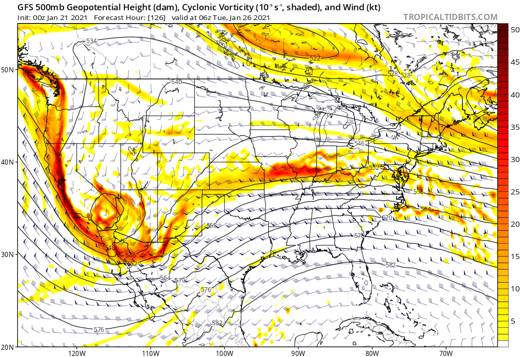
Meteorological turd in the punchbowl -- though that thing is moving all about on the models. It's unlikely, but maybe shove it far enough west and/or south, and it has a positive effect on the southern system. CMC 12z vs. 0z.


-
Interesting discussion. Thanks to everyone for their input.
-
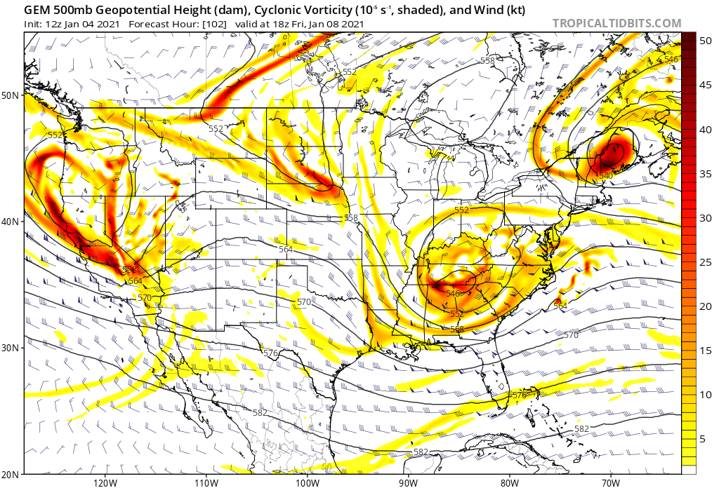
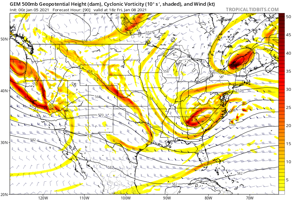
500 MB graphic question: What does the blue-shaded region in southern New England represent? An upper-air low?

-
Significant upper middle Atlantic S/CNE mix/snow potential Jan 3+
RDRY replied to Typhoon Tip's topic in New England
The follow-up system looking mighty suspect as well. -
Significant upper middle Atlantic S/CNE mix/snow potential Jan 3+
RDRY replied to Typhoon Tip's topic in New England
It's essentially a non-event outside of eastern Maine. -
Significant upper middle Atlantic S/CNE mix/snow potential Jan 3+
RDRY replied to Typhoon Tip's topic in New England
Freudian slip for the cape folks. -
Significant upper middle Atlantic S/CNE mix/snow potential Jan 3+
RDRY replied to Typhoon Tip's topic in New England
Hunter Mountain approved.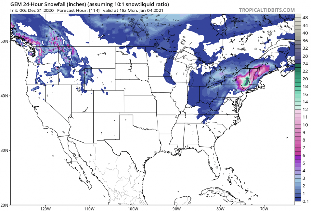
-
We say that with almost every storm.
-
Dec (Edit: Jan1/..2 ) multi-faceted ptype mess potential...
RDRY replied to Typhoon Tip's topic in New England
Freezing rain. The holy grail. Both are serious business.