

Paleocene
-
Posts
1,396 -
Joined
-
Last visited
Content Type
Profiles
Blogs
Forums
American Weather
Media Demo
Store
Gallery
Everything posted by Paleocene
-

January Storm Term Threat Discussions (Day 3 - Day 7)
Paleocene replied to WxUSAF's topic in Mid Atlantic
boomin out over the great dismal swamp -
NAM Is running now, I am ready to cling to its definitely inaccurate surface precip projections in the 72-84 hour range to hallucinate snow IMBY!!! But seriously that cold difference shown above for 6z would be huge to say the least for the front end thump. We need something to hold on to hope with y'all.
-
Erm
-
Ha ha ... I get the NAM IS BAD MEME but I'm serious about it getting the gradient right in December. And met-taggers discussion that it did well versus the globals
-
Does anyone else remember the NAM doing pretty well with the big december storm, especially in regard to the R/S gradient line? Gonna be on that NAM this weekend for this setup.
-
Feb Long Range Discussion (Day 3 and beyond) - MERGED
Paleocene replied to WinterWxLuvr's topic in Mid Atlantic
Temps are not an issue with this one. Hopefully it gets some support... I'm not confident with the crazy variation on solutions we've seen for mon/tues next week, even inside 200 hours. 12 op GFS had a faster/flatter wave exit SE of hatteras around the same time. op CMC also has a wave moving east but it looks way less organized. -
January Storm Term Threat Discussions (Day 3 - Day 7)
Paleocene replied to WxUSAF's topic in Mid Atlantic
verbatim we hold the 850s well south during the thump period but those SW winds are uh, cranking in some 850 juice shortly thereafter -
January Storm Term Threat Discussions (Day 3 - Day 7)
Paleocene replied to WxUSAF's topic in Mid Atlantic
-
January Storm Term Threat Discussions (Day 3 - Day 7)
Paleocene replied to WxUSAF's topic in Mid Atlantic
Pray for thump--->dry slot verbatim on this one. -
January Storm Term Threat Discussions (Day 3 - Day 7)
Paleocene replied to WxUSAF's topic in Mid Atlantic
thumpage? before rain... -
January Storm Term Threat Discussions (Day 3 - Day 7)
Paleocene replied to WxUSAF's topic in Mid Atlantic
-
it's runnin! i'm ready to post some inaccurate analysis
-
January Storm Term Threat Discussions (Day 3 - Day 7)
Paleocene replied to WxUSAF's topic in Mid Atlantic
Thanks for asking this, was wondering the same. -
Thought it was a rain shower that moistened the streets here in the UHI last evening but a quick morning walk revealed some graupel in the colder areas, especially on grass and mulch. That brings this thrilling season up to flurries twice in december, 1.5 inches of snow before heavy rain in the December storm, and graupel today. Better luck next week
-
Feb Long Range Discussion (Day 3 and beyond) - MERGED
Paleocene replied to WinterWxLuvr's topic in Mid Atlantic
minor changes from 00z to 12z at d10 lol -
Feb Long Range Discussion (Day 3 and beyond) - MERGED
Paleocene replied to WinterWxLuvr's topic in Mid Atlantic
Yeah i think this is the right take, that wave coming out of the rockies weaker/less organized than it was on 00z. still much to learn! -
Feb Long Range Discussion (Day 3 and beyond) - MERGED
Paleocene replied to WinterWxLuvr's topic in Mid Atlantic
I have called things wrong before as a n00b but it looks like the euro is about to crank up a weenie run post d8 on 12z... will add maps shortly edit: lesson: do not comment on model runs until they over :-D -
January Storm Term Threat Discussions (Day 3 - Day 7)
Paleocene replied to WxUSAF's topic in Mid Atlantic
A lot of this happens after D7 (post 168 hour mark). We flirt with above freezing in the afternoon next wednesday, but verbatim surface maps show most/all of this as snow NW of 95 -
January Storm Term Threat Discussions (Day 3 - Day 7)
Paleocene replied to WxUSAF's topic in Mid Atlantic
Panel 174 also shows snow over DC -
January Storm Term Threat Discussions (Day 3 - Day 7)
Paleocene replied to WxUSAF's topic in Mid Atlantic
-
Feb Long Range Discussion (Day 3 and beyond) - MERGED
Paleocene replied to WinterWxLuvr's topic in Mid Atlantic
yeah *bit* of a difference with the interaction with the NS 500mb low...they stay separate on 18z 12z... gobbles up the NS shortly thereafter. -
Feb Long Range Discussion (Day 3 and beyond) - MERGED
Paleocene replied to WinterWxLuvr's topic in Mid Atlantic
will it turn the corner? that weak LP north of hte lakes was not there on 12z GFS. primary is much further south this run too -
Feb Long Range Discussion (Day 3 and beyond) - MERGED
Paleocene replied to WinterWxLuvr's topic in Mid Atlantic
It's about time to crack open a crispy boy and watch the GFS flip completely to rain for the D9 threat dump feet of snow over the metro corridor . Happy happy hour everyone. On a serious note, there is a sliiightly stronger high over the north central plains at D7 on the 18z GFS run. Compared to 12z. Fingers crossed for some digital ice. -
Feb Long Range Discussion (Day 3 and beyond) - MERGED
Paleocene replied to WinterWxLuvr's topic in Mid Atlantic
-
Feb Long Range Discussion (Day 3 and beyond) - MERGED
Paleocene replied to WinterWxLuvr's topic in Mid Atlantic
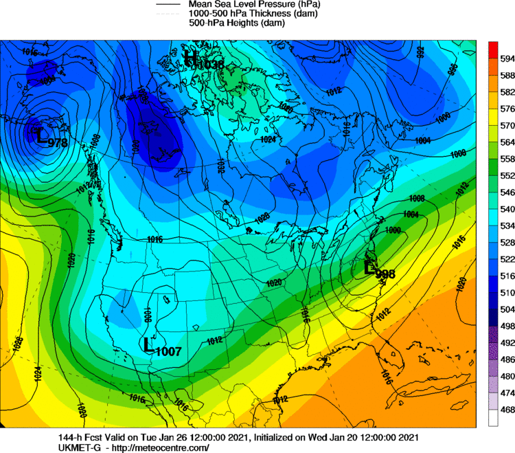
Euro (top) versus GFS (next post)


