Paleocene
-
Posts
1,396 -
Joined
-
Last visited
Content Type
Profiles
Blogs
Forums
American Weather
Media Demo
Store
Gallery
Everything posted by Paleocene
-
12z GFS 10:1 weenie Kuchoochoo
-
kuchera 12k thru 15z
-
850s look great, but surface temps aren't cold during heaviest precip:
-

Feb Long Range Discussion (Day 3 and beyond) - MERGED
Paleocene replied to WinterWxLuvr's topic in Mid Atlantic
Sorry if this is a repost but I rarely see HM writing so literal on twitter. Usually his posts are uh... complex. https://mobile.twitter.com/antmasiello/status/1356599737097605120 -
Thanks for saying this! It's particularly unnecessary to insult people's intelligence and call them children, when I'm sure a lot of kids are on this board and trying to learn.
-
Ji measurement rules apply here.
-
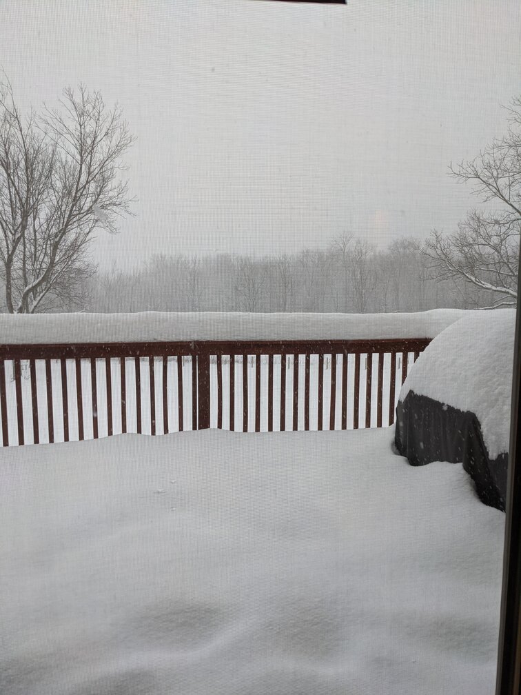
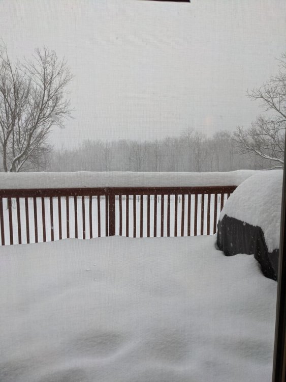
Deck pic from my brother's house in Ithaca NY where i have been hunkered down since Friday. 6" was already OTG; then we got a few of lake effect fri-sat; then about 3" yesterday, now in the outer bands of the coastal low getting more stacked on top. Good times. Hoping the metro area looks like this by the end of the next two weeks
-
I was shocked by this too, didn't think it was possible. My brother has been here a few years and said it has happened. Radar yesterday was uncanny, we were in a bubble east of Cayuga that never died. Didn't stop until 11am today. NWS tweeted about it. 3" overnight https://mobile.twitter.com/NWSBinghamton/status/1355180976792502280
-
Sitting pretty on 10" of snow at my brother's north of ithaca NY tonight, gonna ride the storm out here. 24 straight hours of lake effect yesterday into today, off the finger lakes believe it or not. NWS binghamton (jackpotville) thinks we'll get 5" plus by Tuesday. I'll take those odds up here. Hoping you all down by the cities jackpot and I drive past bare mountains in central pa. I hope when we try to get back to silver spring our driveway is covered in 12"+. Get that CCB! Also it's cold as hell here, not above 22 since we arrived yesterday lunch time, lows in the singles. Pointed my brother's fans south for you all
-
It's NAM time ladies and gents! 18z shows WAA precip creeping up into central VA/ the southwest reaches of metro DC by 12z sunday.
-
Yeah, very true, especially if it's cold. Learned that lesson in 2016 before the big storm when an inch caused armaggedon in moco.
-
Indeed, that's the fear. Going to see family that we haven't been able to see for a while so I don't want to cancel the trip. Worst case, we just stay there, which would be no big deal. But some of the modeling today led me to believe that the WAA snow wouldn't be terrible in PA, and could be dealt with by Sunday evening on the roads. Famous last words of course. I'll probably err on the safe side at the end.
-
So uh, good idea to drive from Ithaca NY to MoCo late sunday afternoon / evening during the 'lull' or bad idea? Maybe it would be a fun drive :weenie:
-
GFS, like NAM (and ICON), has WAA hitting the SW side of the broader metro DC area by 12z sunday.
-
12Z 12k NAM has the first stretch of WAA getting to our area by 12z Sunday.
-
Lol driving to Ithaca Friday, supposed to come back Monday. I'll be sure to schedule numerous trips out of the area so you all get more snow.
-
January Storm Term Threat Discussions (Day 3 - Day 7)
Paleocene replied to WxUSAF's topic in Mid Atlantic
FYI, this is the hottest 850mb temp panel on the Euro. The surface maps look warm. As in above 32 warm. I don't know what to make of that but won't post because it's anti- -
January Storm Term Threat Discussions (Day 3 - Day 7)
Paleocene replied to WxUSAF's topic in Mid Atlantic
YEET -
January Storm Term Threat Discussions (Day 3 - Day 7)
Paleocene replied to WxUSAF's topic in Mid Atlantic
kuchera for 24 hour accums at 00z monday --- CMC --- transfer about to pop on this panel, 108 -
January Storm Term Threat Discussions (Day 3 - Day 7)
Paleocene replied to WxUSAF's topic in Mid Atlantic
-
January Storm Term Threat Discussions (Day 3 - Day 7)
Paleocene replied to WxUSAF's topic in Mid Atlantic
-
January Storm Term Threat Discussions (Day 3 - Day 7)
Paleocene replied to WxUSAF's topic in Mid Atlantic
if you aren't paywalled, this CWG article has some model outputs from 90+ hours out. there was agreement. https://www.washingtonpost.com/news/capital-weather-gang/wp/2016/01/20/how-much-snow-are-local-forecasters-and-computer-models-predicting/ -
I'm taking the way out and going to visit my brother and sister in law in Tompkins County NY (Ithaca) this weekend for 4 days. Might not get snow but high temps are forecasted in the teens, and they have snow cover. Hopefully I get hit with a HECS on i-81 headed home!
-
Anyone else getting more now? Pixie dust sn- flying in silver spring. Yeet