-
Posts
392 -
Joined
-
Last visited
About Hank Scorpio

Profile Information
-
Four Letter Airport Code For Weather Obs (Such as KDCA)
KJYO
-
Gender
Not Telling
-
Location:
Leesburg, VA
Recent Profile Visitors
The recent visitors block is disabled and is not being shown to other users.
-
Loudoun didn't send kids home early, but then my kids school ended up within one of the tornado warnings. No tornado of course, but kids were sitting in the hallway in the 'duck and cover' pose for 30 minutes. Ultimately not a huge deal, and since I was watching radar and know what to look for, I wasn't stressing about it at all. I also know most people not only don't watch the radar, but wouldn't know what to look for even if they did. Probably a pretty anxious time for a lot of parents today.
- 1,093 replies
-
- 2
-

-
- severe
- thunderstorms
-
(and 1 more)
Tagged with:
-
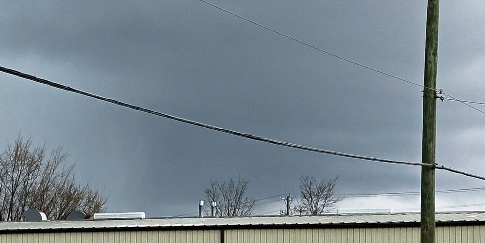
I was so close to having a great view of that couplet just before it crossed the Potomac. I was a few miles south, in sterling, but was waiting on an oil change to be done so didn't have access to my car. This was as good as my view got
- 1,093 replies
-
- 2
-

-
- severe
- thunderstorms
-
(and 1 more)
Tagged with:
-

80 Degrees to Ripping Snow: March 12th
Hank Scorpio replied to SnowenOutThere's topic in Mid Atlantic
Just dropped to 33.9° where I am in Leesburg and snow is starting to stick in the grass. Fun event! -

Outta gas and Outta Time: Early March Winter Storm finale
Hank Scorpio replied to Ji's topic in Mid Atlantic
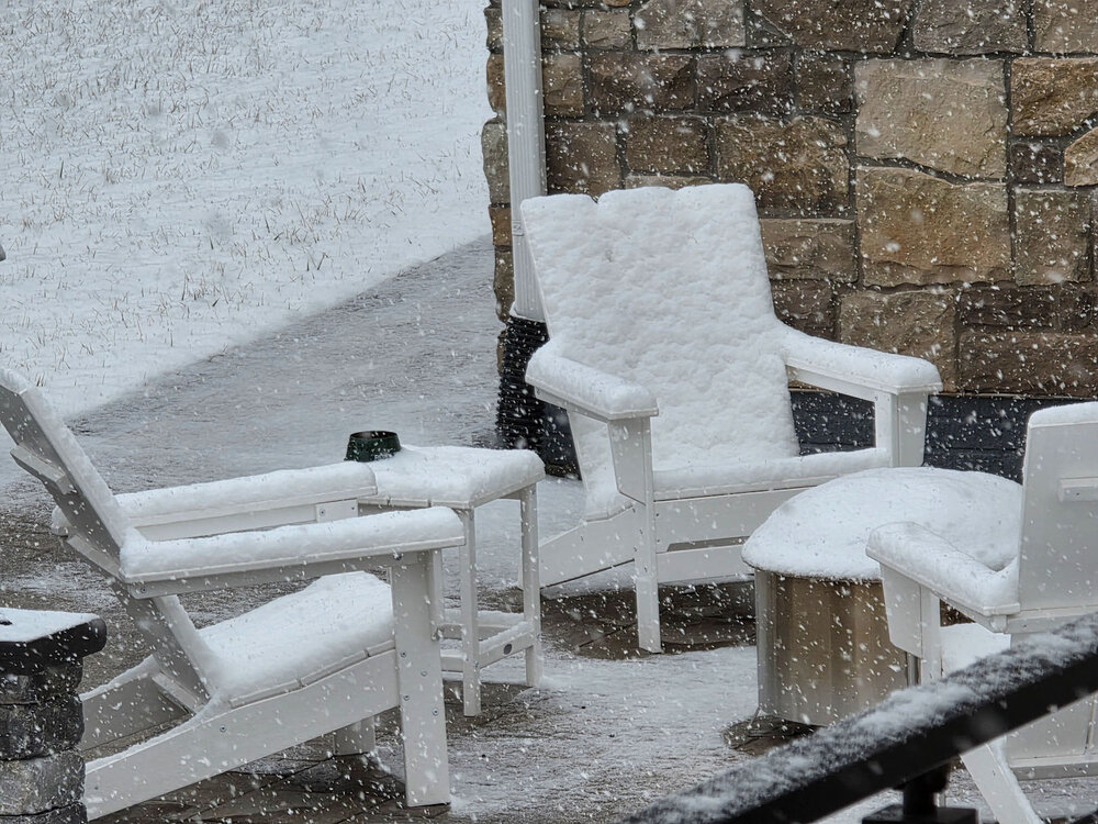
Starting to stick to paved surfaces in my neighborhood here in Leesburg. And based on my very scientific "take a look at my neighbors patio furniture" measurement method, looks like we're over 2". -

Feb 22nd/23rd "There's no way..." Obs Thread
Hank Scorpio replied to Maestrobjwa's topic in Mid Atlantic
Lots of flakes suddenly mixing in now, but the temperature is still hovering around 37. Lines up well with the radar presentation, since oranges just stared popping up over Leesburg -

Feb 22nd/23rd "There's no way..." Obs Thread
Hank Scorpio replied to Maestrobjwa's topic in Mid Atlantic
Temp on my PWS is sloooooooowly creeping down, just now showing 35.8 As soon as the yellows got overhead here in Leesburg again we went right back to a rain / snow mix. -
Anyone have a good siding repair contractor recommendations in NOVA? The glacier on my roof moved a bit this week and took some trim+siding with it.
-
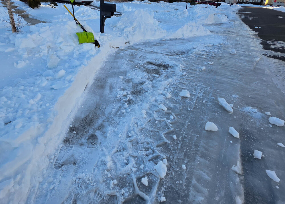
The USPS keeps leaving me notes telling me to clear the snow from in front of my mailbox. But I'm one of the only ones in my neighborhood who shoveled enough that the mail truck can actually pull up to my mailbox. And I know he is, because I can see remnants of tire tracks in the slush every day. Maybe I'll shovel snow back in front of the mailbox to see if that makes them happy.
-
This is exactly what I'm doing today. I was able to get up and down my driveway yesterday without shoveling, so now I'm working on clearing a one car width path in case I need to get back out again. What's working best so far is to use a regular shovel to punch through and break up the glacier. Then I'm using a snow shovel to move bunches of it out of the way. Slow going, but it works.
-
-

January 24-26: Miracle or Mirage JV/Banter Thread!
Hank Scorpio replied to SnowenOutThere's topic in Mid Atlantic
Really interesting thing to me about driving in this stuff is how much of a difference ground clearance seemed to make. My vehicle has AWD but only has 6 inches of ground clearance. On the plowed but still snow/sleet covered and compacted surfaces I had zero issues. But on my unplowed street, I just could not get any traction with the snow and sleet keeping the vehicle from settling down to street level. Sitting on top of the sleet, my wheels basically just spun. Just to get off my unplowed street I had to drive in reverse, which probably only worked because the rear has a bit more clearance than the front and that allowed for a little momentum. Felt a lot like driving on sand though. -

January 24-26: Miracle or Mirage JV/Banter Thread!
Hank Scorpio replied to SnowenOutThere's topic in Mid Atlantic
Made it home from the hospital! I was hoping we'd get out of there while it was still snowing, but by the time we got all the paperwork done and the baby in the car, it'd been sleeting for quite a while. Thankfully roads were fine, just snow and sleet packed. Hardest part of the drive was getting up our unshoveled driveway. Speaking of, I'm not too excited about going out to shovel that. Might just wait until tomorrow to get working on it and just relax the rest of today. -
We've got first flakes where I am in Loudoun right now, just a few miles SE of Leesburg. It's light, but fun to know that every single flake is sticking
-

January 24-26: Miracle or Mirage JV/Banter Thread!
Hank Scorpio replied to SnowenOutThere's topic in Mid Atlantic
Whoa nice! I have the same oven but never use it in the cold. Does it hold heat pretty well at lower temperatures? -

January 24-26: Miracle or Mirage JV/Banter Thread!
Hank Scorpio replied to SnowenOutThere's topic in Mid Atlantic
Doctor DiGiornio in the house! Are you even a pizza connoisseur if you don't doctor up your frozen pizzas?


