snowmagnet
-
Posts
962 -
Joined
-
Last visited
Content Type
Profiles
Blogs
Forums
American Weather
Media Demo
Store
Gallery
Posts posted by snowmagnet
-
-
1 hour ago, WVclimo said:
@wxdude64 jackpot

Groundhog Day -a 30" storm on the maps every Sunday for the next 6 weeks!
-
 2
2
-
-
1 hour ago, osfan24 said:
Some places going to make a run at a foot, even maybe slightly more, if those snowfall rates are accurate and you end up being the lucky one that sees that ridiculous high rates for a few hours.
I like the mid Fairfax Co bullseye right over my house, but from what I’ve been reading here, we shouldn’t get those numbers based on the warmth on Saturday. I would love to get close to a foot.
-
2 hours ago, MillvilleWx said:
Eh. Who needs power anyway?
Ice storms will be the new snow days in a virtual world. Can't do work/school virtually without power.
-
3
-
-
Just now, losetoa6 said:
That pixies dust spreader dumped 14-20" in parts of md.

Better than the rest of us with our 3-6. Still not much for 3 days of snow, but it was probably record-breaking pages of Storm Obs!
-
32 minutes ago, mappy said:
wouldn't toot your own horn too soon friend.
The 12K gave me 15.5" last night.
-
3 minutes ago, psuhoffman said:
Definitely true for the majority of the area. One of my "secrets" up here actually is ratios. With my elevation (about 1,050 ft) I typically do get higher ratios. 15-1 is pretty common and I have even gone 20-1 in some storms (feb 10 2010). Yea the orographics help get a little more precip but its actually more so the ratios that account for my "jack zone" more often then not.
I can believe that. I had about 2" of snow (plus sleet/rain) from our December storm and then was up in your area the following weekend. Your neck of the woods was beautiful with at least 6-8" of snow still on the ground!
-
2 minutes ago, IronTy said:
That 3k tho....

I grew up in Charles County- it happens. We got hit hard during the Veterans Day storm. My parents often had more snow than me (FFX Co), but this sounds like temps are too marginal for SoMD to get this.
-
1 hour ago, CAPE said:
Given temps, and esp if the best lift ends up along/east of I-95, I hope folks aren't taking any of these snow maps literally. Looking like a 2-4" deal to me, which would be just fine.

Thank you for that - good to temper expectations. Since temps are an issue, do you see this having a big impact on roads Sunday? It sounds like it will be coming down pretty fast, but I’m wondering about accumulation on surfaces.
-
21 minutes ago, NorthArlington101 said:

I would like my 15.5” back!
What is the difference between the 12k and the 3k, other than the 12k always seems to have more snow?
-
11 minutes ago, MillvilleWx said:
I know everyone here is very interested in mainly the snow chances for the extended, but I cannot understate how insane this cold signature is for the entire CONUS on guidance right now. This would rival some of the top cold outbreaks of all time. Even the ensembles are hinting at some historic level cold over the country. There will be lots of squall potential in this setup too with that Valentines Day period that @Eskimo Joe brought up above my post as the most aggressive time frame for it. Globals will not see that squall potential until it's within short range either. Bundle up
The coldest temperatures I ever experienced was in the winter of 1994. I know that people up north and the Midwest have been through much worse, but being from the East coast, I was not used to it. I was living in Louisville in ‘94 and we had air temps around between 0 to - 10 for about a week. That was after we had a surprise 13” snow storm that ended up shutting down the city for close to a week. No one was prepared for it because it was only supposed to be 1 inch! The highways were closed around Louisville and they literally sent in the National Guard to plow out the city. It was like lake effect snow along the Ohio River. It was so cold in Louisville that we couldn’t even enjoy the snow. I don’t look forward to that kind of cold again. My parents were in MD, so I know that the DC area was hit with a terrible ice storm a that same week.
-
1
-
-
25 minutes ago, losetoa6 said:
Keep it there till 12 hours before for one final 30 mile bump nw

I’m actually in the 15” range here. It can’t stay exactly as shown.
-
 2
2
-
-
4 minutes ago, Ji said:
If Dr no is yes...the doctor might need to get fixed....never seen the euro go from no to snow that close to a storm for us(60 hours,etc)?
Dr No originally was the 1st to say yes, but then maybe just took a couple of sick days. Seeing the others come around, I bet it will come back. And if my memory serves me, I am pretty sure it has happened several times.
-
1
-
-
1 hour ago, CAPE said:
lol I was just having a bit of fun at your expense.
I know my climo here, and what is ideal for my yard is not necessarily what you want to see, but it is not all that rare either. Long term avg snowfall here is higher than DC, at 18.5".
There are many times I have gotten moderate or even significant snow that have left places NW of I-95 high and dry. Happened in Jan of 2017 and 18 most recently. Both of those events had legit cold air in place. That tends to even things out a bit, because clearly being further inland is better much of the time.
I was just thinking that the Eastern and southeastern areas did well in a couple of storms a few years back while most of us had nothing.
-
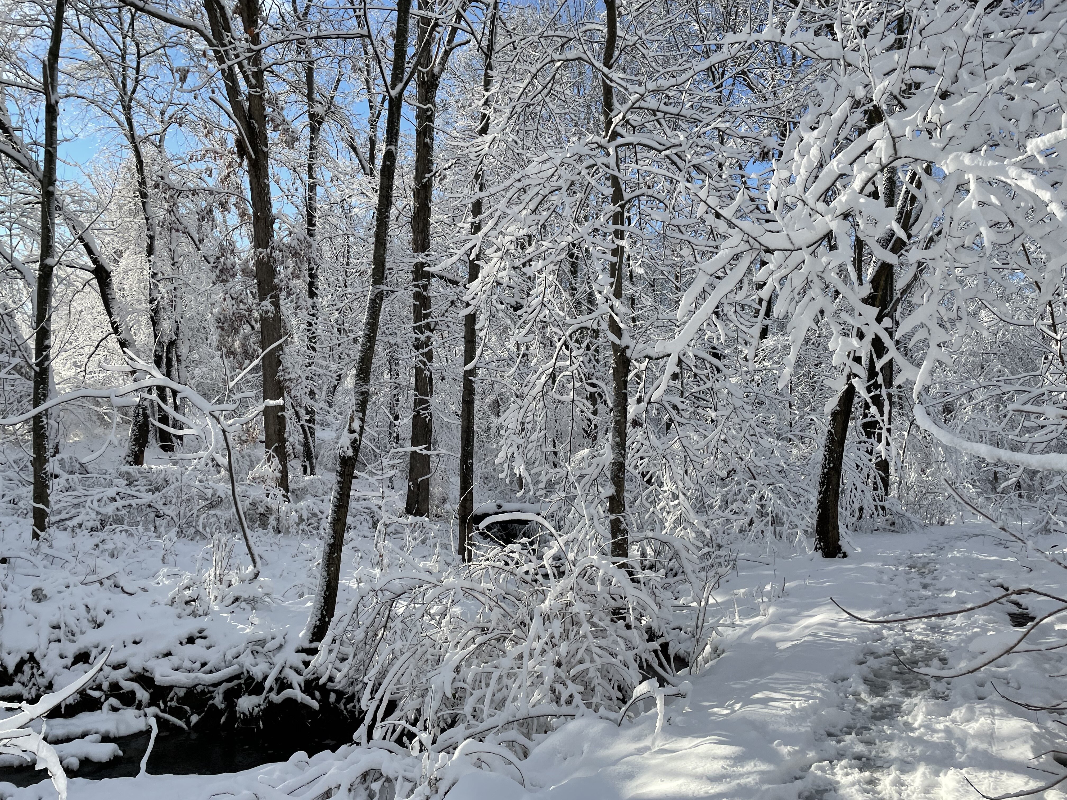
Still coming down fairly steady in Fairfax. Coating the ground again!
-
1
-
-
Had some sleet earlier, but Fairfax County seems to have a forcefield around it on radar, keeping snow away until around 5 pm.
-
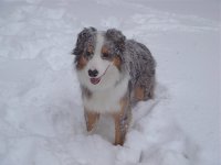
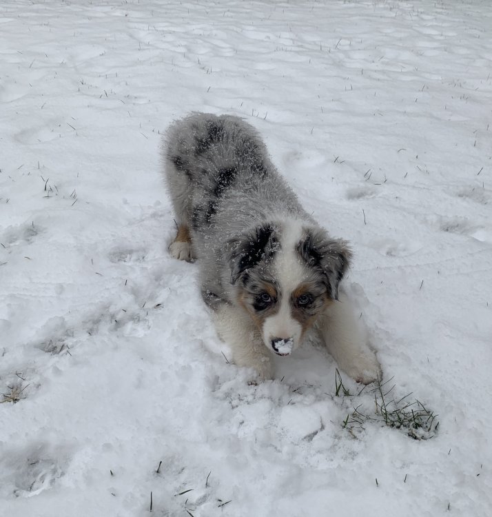
I'm enjoying the snow day, but don't like hearing rain/sleet outside my window while it's showing blue on radar. I did take the new Australian Shepherd pup out for a Jebwalk in the snow and he is loving it. It seems like we have been stuck at around 2" for the past several hours. The roads are cleared pretty well in my neighborhood, so it is definitely less than expected. I agree with Bob Chill about the Miller B PTSD. I really hoped models were onto something, but I 'm not holding my breath for part 2 of the storm in my neck of the woods (Fairfax). But I am optimistic for the rest of February.
-
13
-
-
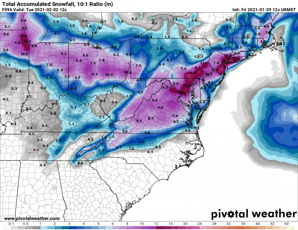
Just now, MillvilleWx said:
Here's my Only Forecast Map
Could be a little high on the southern piece, but from looking at guidance, this is my estimate for the storm. This also doesn't include up to a 0.1" of ice accretion tonight into Monday morning for Central MD and southern PA

That’s a great map. I love the details! Thank you!
-
 1
1
-
-
2 minutes ago, BristowWx said:
Ok. Guess that looks good if you like BECS level storms.
Looks a little like the Euro 5 days ago.
-
1
-
-
3 minutes ago, Bob Chill said:
Usually not until its already happening and we dont need models anymore
This must be the most stressful part for meteorologists. People will always complain when they get it wrong. Everyone wants an accurate forecast, but with these kinds of storms, you really can't know until it sets up off the coast. I've always liked these kinds of storms for this reason...the storm will do what it wants. Then we just sit and watch the NWS continue to increase totals throughout the storm!
-
1
-
-
22 minutes ago, JakkelWx said:
Oh no, the 18z EPS shaved about a half inch of snow off the mean here. I think this storm is over and done with. Miller B screwjob!
I think it added that .5" to my totals! Northern VA here!
-
2 minutes ago, WinterWxLuvr said:
Wondering if we see this really amp up going forward.
The Euro set the bar a few days ago...
-
12 minutes ago, Bob Chill said:
It's a grey area and we all have our own rating system. To me, true miller A's run the southern stream and turn the corner. They often run into the TN valley and transfer but imo they are still pure miller As. Any northern stream storm is a hybrid or miller B. This one is more of a hybrid than a miller B but we all think our own way
I’m happy to hear you say that because I don’t remember many Miller B’s that have worked out well IMBY. And so glad to hear from you! The last good storm we had was the Bob Chill storm - 2 long years ago.
-
1
-
-
2 minutes ago, IUsedToHateCold said:
I wouldn’t count on it. Deformation bands tend to set up to our north west in most coastal storms. That said, it can happen. I’d lock up the 12z CMC in a heartbeat, but it’s probably wrong.
Fairfax Co and Loudoun Co tend to do well with the deform bands, but I guess it just depends on the placement of the Low. I remember several storms in the past decade where we we got pounded with much higher numbers than forecasted.
-
1
-
-
1 minute ago, Hypothetical 240 hour snow said:
UKMET coming in hot
Same as yesterday afternoon - 13" for DC metro area.
-
1
-
 1
1
-
1
-


Feb Long Range Discussion (Day 3 and beyond) - MERGED
in Mid Atlantic
Posted
This is incredible. If this ends up accurate, the King will keep his crown.