Hurricaneguy
-
Posts
129 -
Joined
-
Last visited
About Hurricaneguy

-
Jan 30th-February 1st 2026 Arctic Blast/ULL Snow OBS Thread.
Hurricaneguy replied to John1122's topic in Tennessee Valley
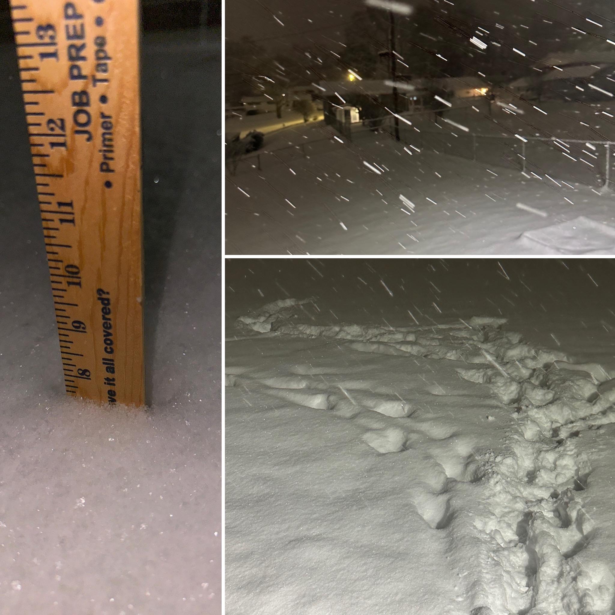
10.125” final Greeneville! I’m so unbelievably happy. Grateful to have cashed in big on this one. Good enough for our best snowstorm in nearly 30 years!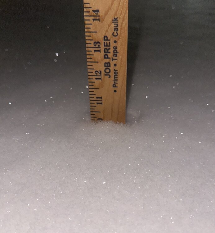
-
Jan 30th-February 1st 2026 Arctic Blast/ULL Snow OBS Thread.
Hurricaneguy replied to John1122's topic in Tennessee Valley
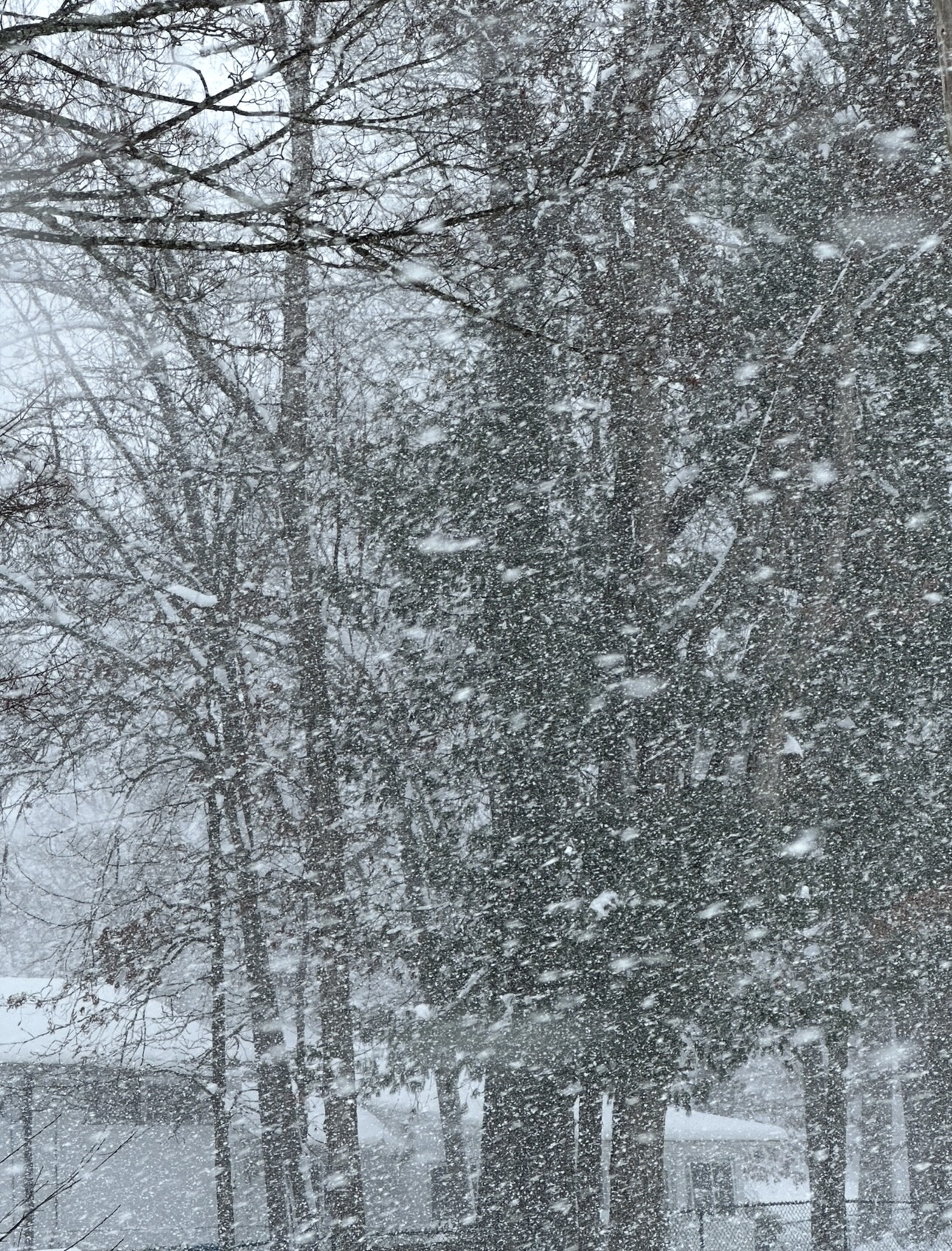
Still waiting to take a final measurement. It’s still snowing in Greeneville. 30 hrs straight now and counting -
Jan 30th-February 1st 2026 Arctic Blast/ULL Snow OBS Thread.
Hurricaneguy replied to John1122's topic in Tennessee Valley
Btw it has been snowing in Greeneville now non-stop for 27 hrs and still going. This has been steady to heavy snow with zero down times. That has to rival some of the longer duration snowstorms in our history. -
Jan 30th-February 1st 2026 Arctic Blast/ULL Snow OBS Thread.
Hurricaneguy replied to John1122's topic in Tennessee Valley
Final push of snow trying to go out with a bang in Greene Co. Heavy rates again with these final bands trying to squeeze out the last of moisture. Pouring snow! -
Jan 30th-February 1st 2026 Arctic Blast/ULL Snow OBS Thread.
Hurricaneguy replied to John1122's topic in Tennessee Valley
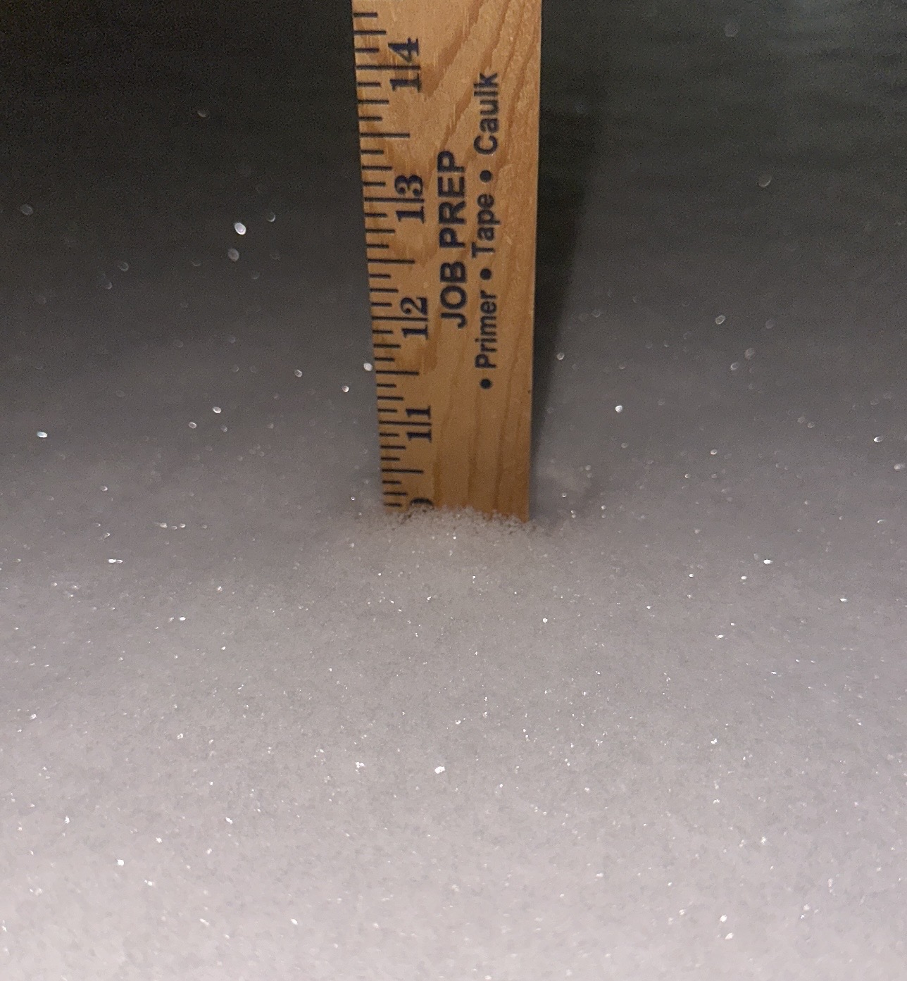
Now at 9.5” Greeneville. Was ripping fatties!! Heaviest snow of the event for about 15 mins.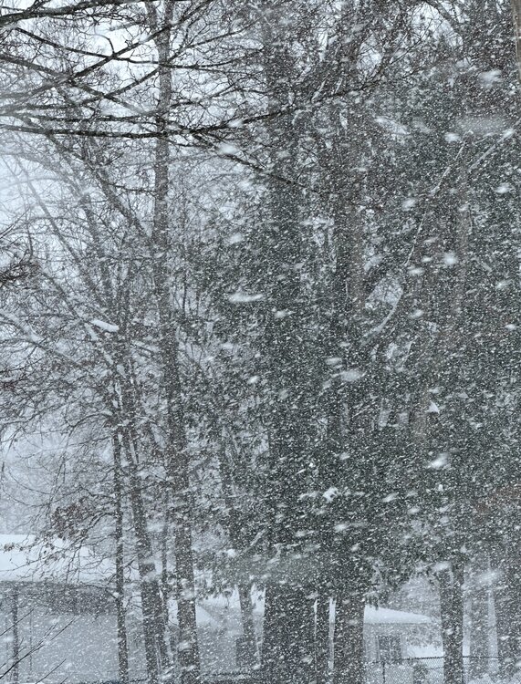
-
Jan 30th-February 1st 2026 Arctic Blast/ULL Snow OBS Thread.
Hurricaneguy replied to John1122's topic in Tennessee Valley
Incredible! What town/area are you in? -
Jan 30th-February 1st 2026 Arctic Blast/ULL Snow OBS Thread.
Hurricaneguy replied to John1122's topic in Tennessee Valley
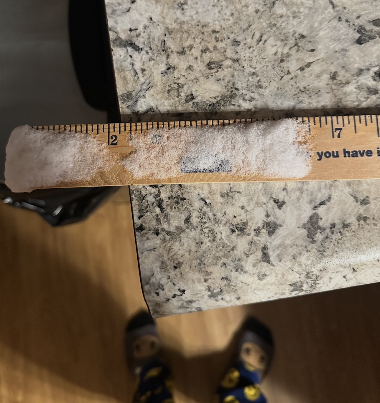
8.625” Greeneville TN. Beyond thrilled!!! Still snowing too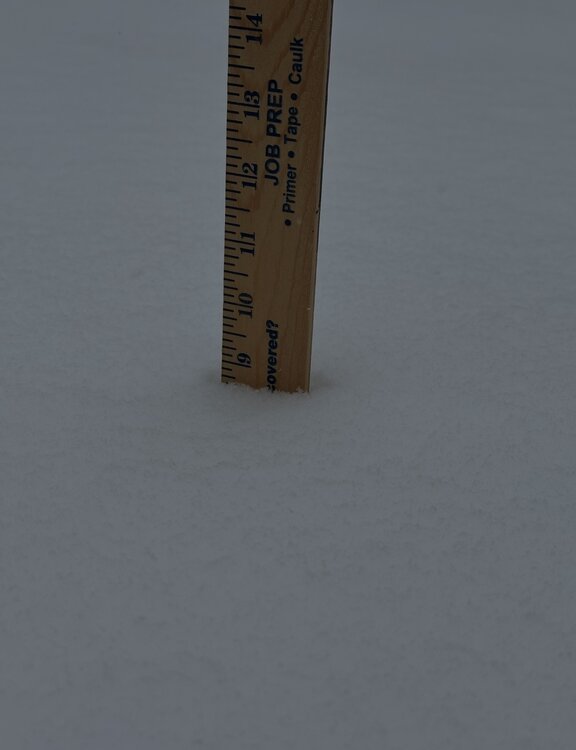
-
Jan 30th-February 1st 2026 Arctic Blast/ULL Snow OBS Thread.
Hurricaneguy replied to John1122's topic in Tennessee Valley
Almost 7.5” Greeneville!! Biggest snowstorm in 22 years. We may have a shot at double digits now.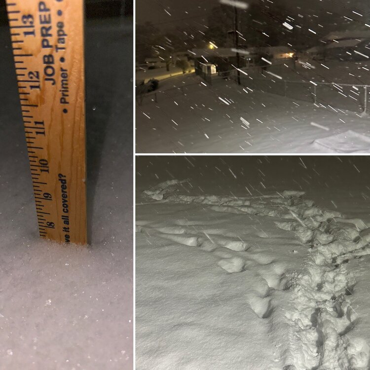
-
Jan 30th-February 1st 2026 Arctic Blast/ULL Snow OBS Thread.
Hurricaneguy replied to John1122's topic in Tennessee Valley
I also I cannot recall a time I've witnessed 12 straight hours of steady to heavy snowfall. -
Jan 30th-February 1st 2026 Arctic Blast/ULL Snow OBS Thread.
Hurricaneguy replied to John1122's topic in Tennessee Valley
If you believe the avg of the short res models there is a chance 6-8'' of snow will still fall over Greene Co before things wrap. I'm speechless -
Jan 30th-February 1st 2026 Arctic Blast/ULL Snow OBS Thread.
Hurricaneguy replied to John1122's topic in Tennessee Valley
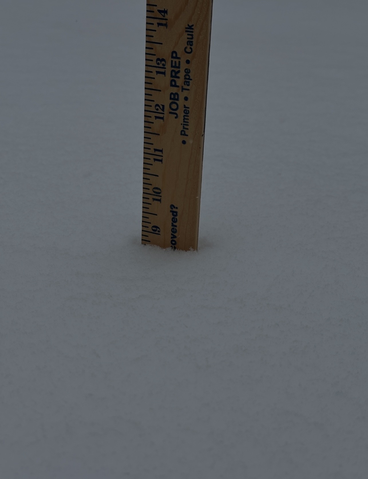
6.5” in Greeneville!! It’s been snowing non stop since 4pm. And it’s pouring still right now. Officially our biggest snow in 12 years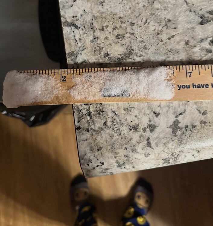
-
Jan 30th-February 1st 2026 Arctic Blast/ULL Snow OBS Thread.
Hurricaneguy replied to John1122's topic in Tennessee Valley
John based on what has fallen and what could still yet to fall taking into count hi res models duration left, what do you think areas around Greeneville through Johnson City end up with? -
Jan 30th-February 1st 2026 Arctic Blast/ULL Snow OBS Thread.
Hurricaneguy replied to John1122's topic in Tennessee Valley
I'm going to be up for a while for this one. Coming down like crazy right now. I'm going to measure at 3am. I suspect we'll be pushing 6'' by then -
Jan 30th-February 1st 2026 Arctic Blast/ULL Snow OBS Thread.
Hurricaneguy replied to John1122's topic in Tennessee Valley
Decent band moving over Greeneville. Rates have increased in the last 15 mins. -
Jan 30th-February 1st 2026 Arctic Blast/ULL Snow OBS Thread.
Hurricaneguy replied to John1122's topic in Tennessee Valley
4.5'' in Greeneville at midnight. Just unreal!! My forecast was 5-8''. MRX had us down for 9''. AT this point not sure how high it will go.