
mattb65
-
Posts
4,722 -
Joined
-
Last visited
Content Type
Profiles
Blogs
Forums
American Weather
Media Demo
Store
Gallery
Everything posted by mattb65
-
NAM3k shows a thin warm layer centered around 800 just NW of DC to Baltimore that will make or break the storm for those riding the boundary. Looks good for the favored spots further to the north and west.
-
Still 31.6 on the pws this morning. Impressive CAD almost always holds longer than predicted.
-
Mix of snow, pingers and rimed flaked for the last 30 mins. 3.75" and 28 degrees in Wheaton/Kemp Mill. There looks to be some heavies heading this way which will hopefully flip us back to more snow than ip.
-
A hair over 3" OTG in Kemp Mill/wheaton park region of silver spring, time to head out with the little guy and enjoy
-
Baltimore weenies can step off the ledge.
-
27 degrees, 2" OTG and moderate snow picking up in intensity. I was expecting 2-4" and think I may exceed the top end of expectations. Every storm has busted positive here this year, why not this one too.
-
These SWFE tend to come in hot with the thump, looks like this one is no exception. Herpaderp ftw.
-
Ferrier snow maps about to bust already, think it gave 1" for the event.
-
Moco deathband is amazing, up to 9.5" on the ground and still piling up fast!
-
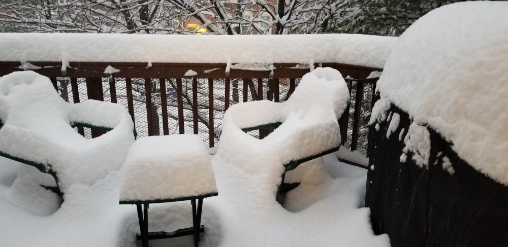
Deck pics!
-
Round 2 has delivered big time imby. Measured 8" on the ground, haven't been cleaning and there was some compaction during the lull. Awesome storm!
-
This lull is forecasted (not a lull imby, still snowing good). Radar should light up starting between 9 and 10 and move north. Looks like it may be snow showery.
-
A little over 5" here and it's coming down very nicely, if the NAM is to be believed there is another 7" expected today assuming 10:1 ratios. Storm has already exceeded expectations. Can't wait for daylight.
-
2.5" measured on the back deck, 27.5/27.3 beautiful out! Also in the crew about a mile from wheaton regional near the university towers.
-
NAM is actually north and more tucked in than 18z but the snow isn't quite as heavy, still showing a lot of snow, long duration storm. A bit closer to consensus.
-
Guidance looks like 4-8" for the metro with a jack to 10" where the best banding sets up. Some upside potential given what the NAM showed but that output is a clear outlier compared with all the other guidance thus far.
-
Don't want to sound like a broken record but out to 72 hrs on the 00z GFS, mix of good/bad. More amplified ridge out west and slightly stronger SW but the confluence in the way is pushing down even more than at 18z and the trailing NS SW in the Dakota's still looks a touch too slow to be able to dive in and save the day.
-
March 12/13/14 Blizzard/Winter Storm/WWA etc
mattb65 replied to Bostonseminole's topic in New England
I got an updated map, all of Cape Cod, MA, USA, Earth is without power so we don't have any updated totals. -
March 12/13/14 Blizzard/Winter Storm/WWA etc
mattb65 replied to Bostonseminole's topic in New England
Just observing from afar - wish I was still in Boston for this one. Lots of PWS on the cape reporting sustained winds >30 mph, gotta assume it's all snow down there with low vis. Should verify blizz warning easily. Looks to be a classic E MA/SE MA crushing incoming. -
Love the site, great job! Any plans on making it available on mobile either as a mobile friendly mode or app? Android in particular is severely lacking a app for viewing the models. I know i would pay to get a decent app. Great work so far, bookmarked.
-
Forecast/storm discussions and part II Manitoba Mauler
mattb65 replied to Damage In Tolland's topic in New England
W CT, Berks down to NYC get some deform pivot action, lolli to 30"+ in that area verbatim. -
Forecast/storm discussions and part II Manitoba Mauler
mattb65 replied to Damage In Tolland's topic in New England
Goodness, nam is an absolute shellacking... All of sne and back to NYC, just a complete snowgasm all over.. -
Forecast/storm discussions and part II Manitoba Mauler
mattb65 replied to Damage In Tolland's topic in New England
The noose was tied 48 hours ago down here lol. Wish I was still in Boston for this one, looks amazing.


