Newman
-
Posts
2,096 -
Joined
-
Last visited
Content Type
Profiles
Blogs
Forums
American Weather
Media Demo
Store
Gallery
Everything posted by Newman
-
The big heat out west will make it's way east over the rocky mountain area later this week and weekend. Both Laramie and Cheyenne WY will approach their all time record highs of 94° and 100° respectively, we'll see if afternoon clouds inhibit any attempt at breaking these records
-
https://x.com/mcfrsPIO/status/1798524345481904229
- 1,696 replies
-
- 1
-

-
- severe
- thunderstorms
- (and 5 more)
-

E PA/NJ/DE Spring 2024 OBS/Discussion
Newman replied to Hurricane Agnes's topic in Philadelphia Region
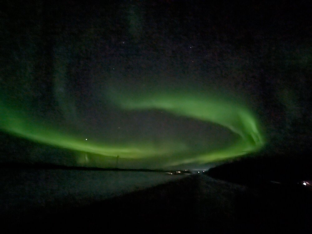
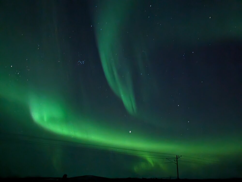
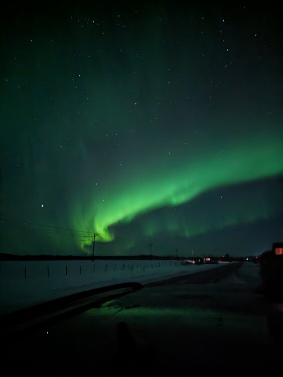
Absolutely, double win here. Snow and cold, and the northern lights -
E PA/NJ/DE Spring 2024 OBS/Discussion
Newman replied to Hurricane Agnes's topic in Philadelphia Region
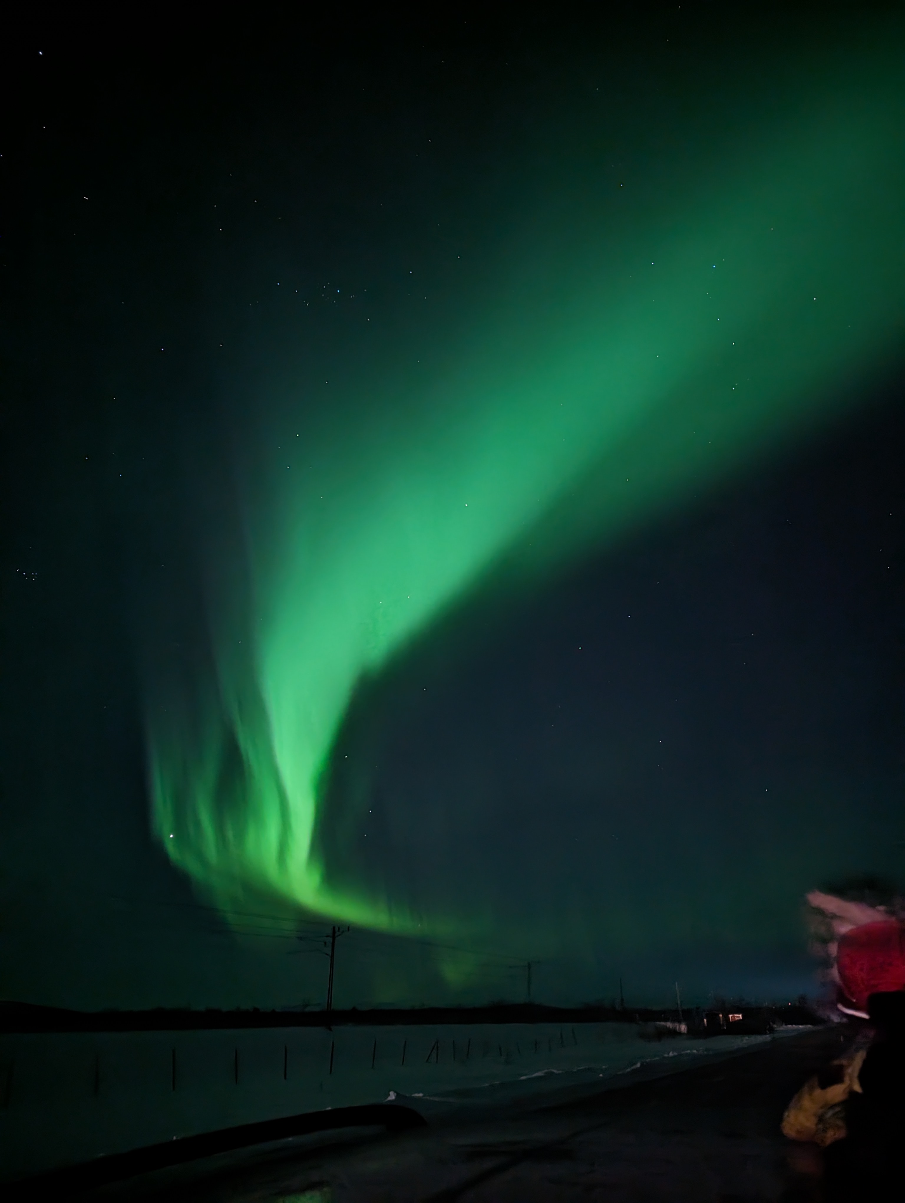
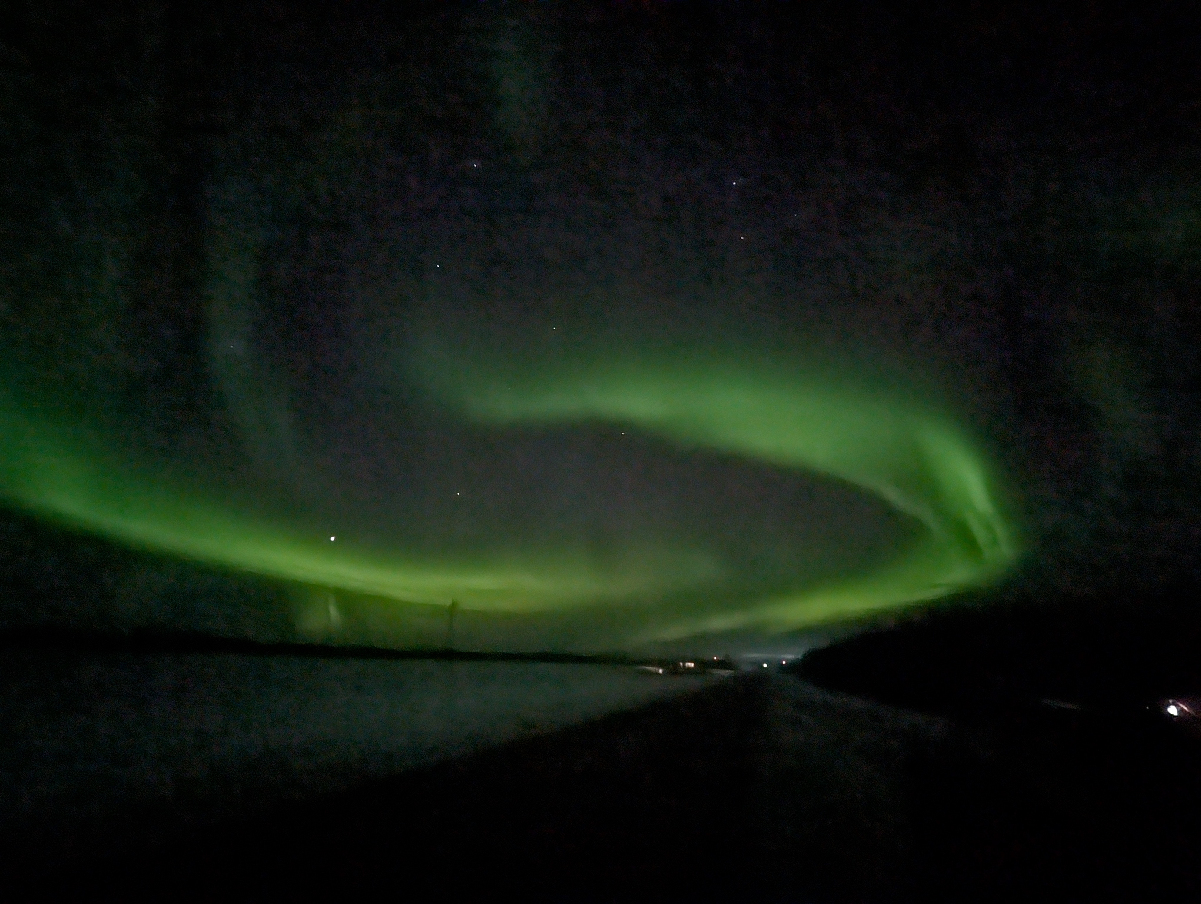
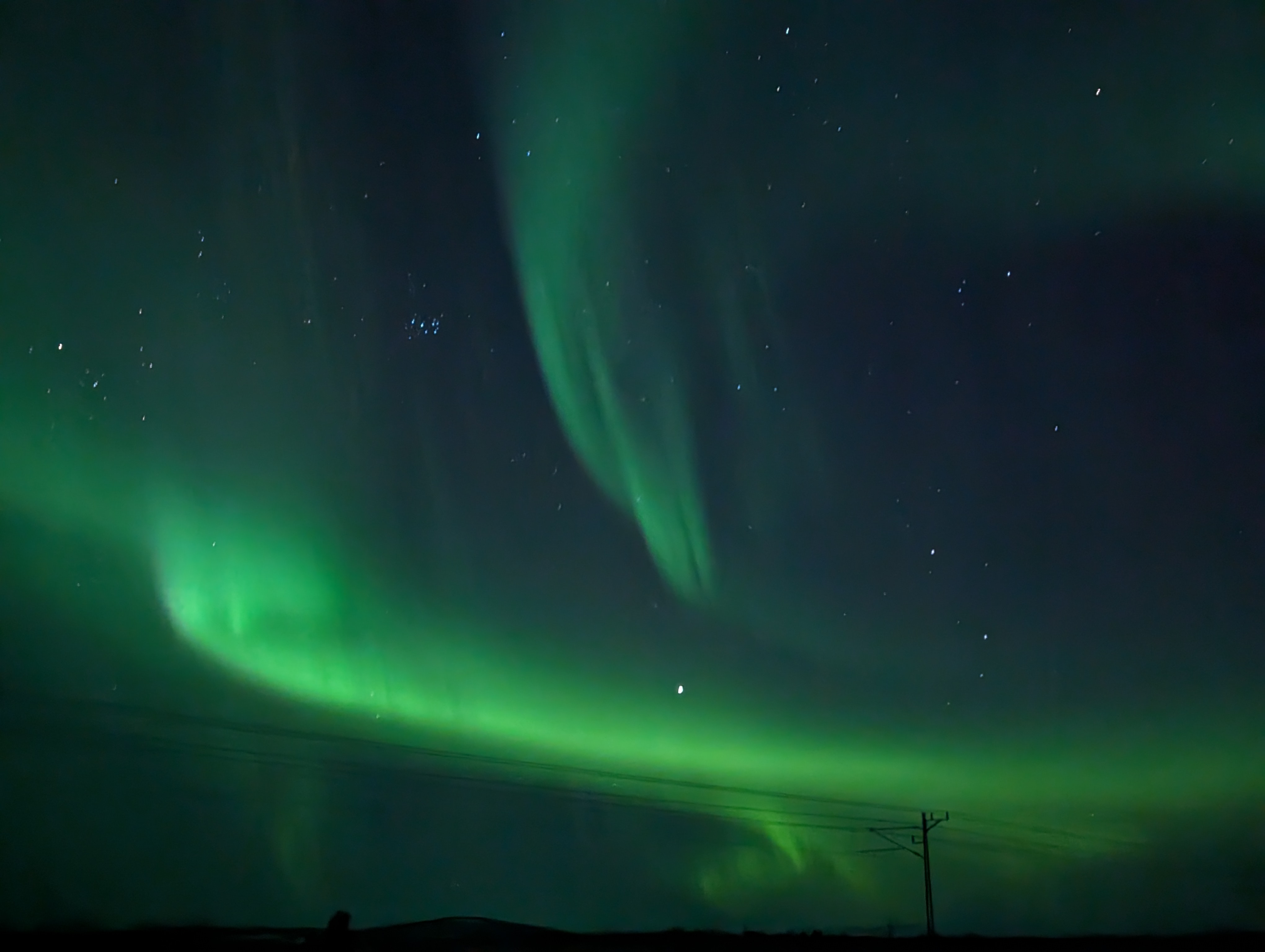
I'm in northern Sweden for the month of March, took these yesterday!
-
Mountain West Discussion- cool season '23-24
Newman replied to mayjawintastawm's topic in Central/Western States
Anyone know how much snow might be on the ground NW of Fort Collins around Greyrock Summit (Poudre Park)? Looking at hiking that Monday, but want to be sure trail conditions are decent enough and not like 2 feet of snow -
10" on the measuring board in Fleetwood from my dad
-
Any Berks reports? Looks like that band meant business and affected much of eastern Berks as well. Might just have to wait for the folks to wake up and hear how much they got
-
Dad said we got about 9" in Fleetwood, biggest storm in quite some time. 2021 was the last double digit snow I even remember
-
Berks and Lehigh counties look to be in the best spot for this as of now. Probably start as some brief rain, unlike those in Carbon/Monroe counties. But the strongest banding and snowfall rates will slide through south of the Poconos for the longest duration. 6-10" thump in that area
-
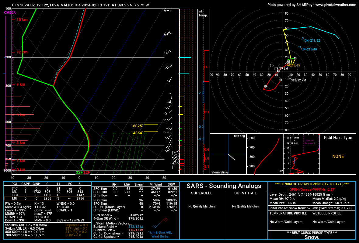
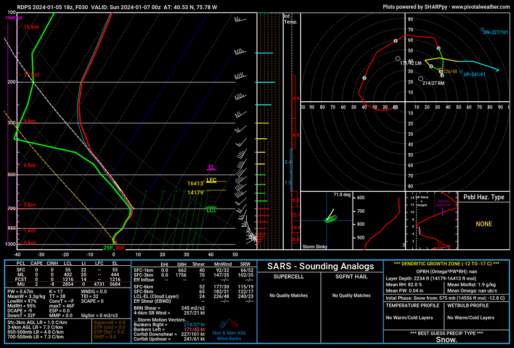
Latest 12z GFS with yet another shift south. Sounding provided is for SE PA valid at 12z tomorrow morning. Fully saturated through the DGZ with maximum omega as well. It's going to thump around the morning commute, easily 1-2"+ rates for a time. Even though it's a quick moving storm, some places will see over 6" with rates that heavy for a time
-
E PA/NJ/DE Winter 2023-2024 OBS/Discussion
Newman replied to The Iceman's topic in Philadelphia Region
Euro is quite a paint job for the Lehigh Valley -
Dad said we got about 3.2" in Fleetwood. Happy for y'all further south towards Philly, its been a long time coming! Made me smile seeing Philly come in with 5"
-
E PA/NJ/DE Winter 2023-2024 OBS/Discussion
Newman replied to The Iceman's topic in Philadelphia Region
NWS WWA for 2-4" seems right. Most will probably see 1.5-2.5". Max around 4 or perhaps 5+ -
Mountain West Discussion- cool season '23-24
Newman replied to mayjawintastawm's topic in Central/Western States
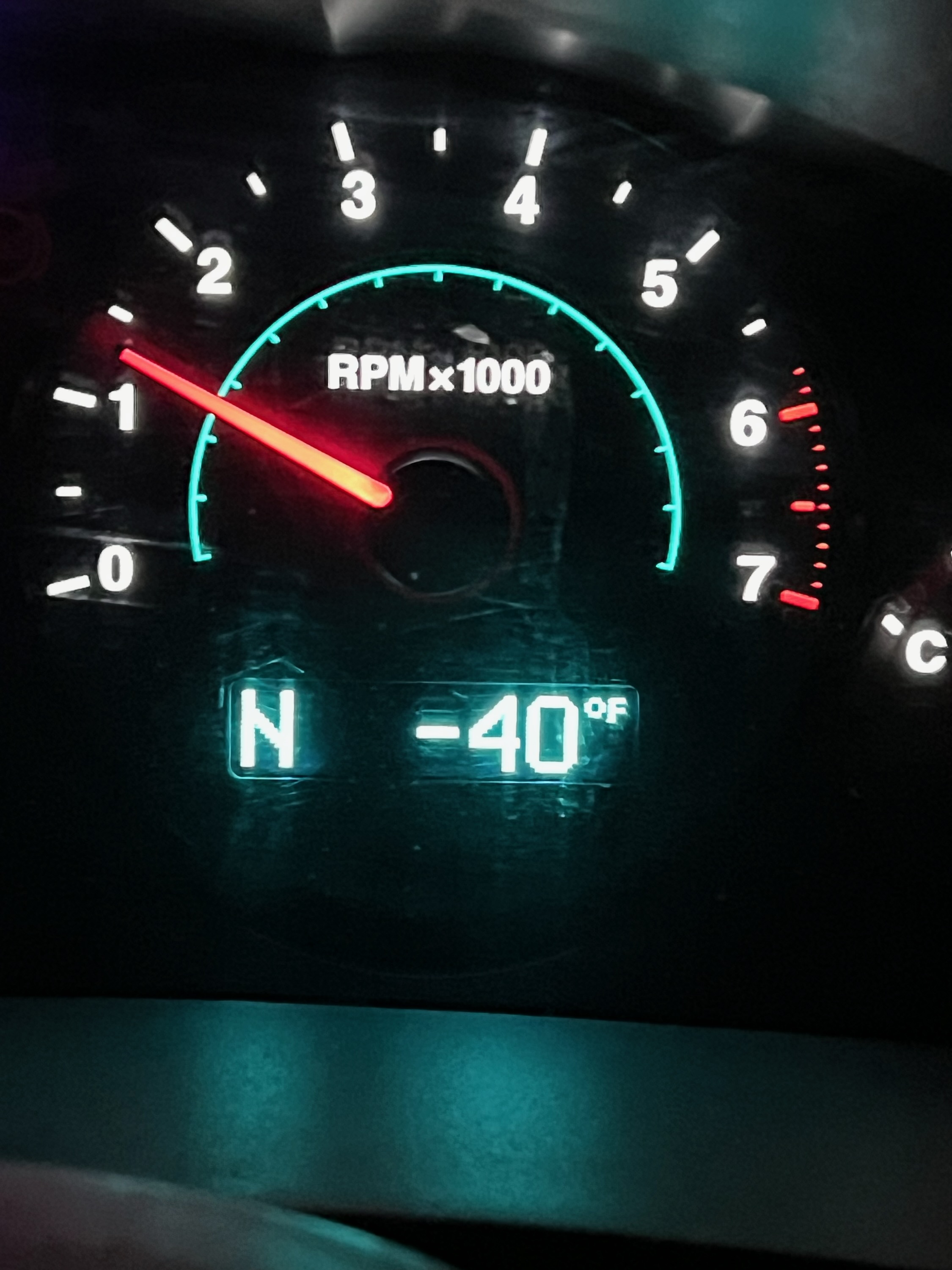
We got down to -30° at the Laramie airport last night, the coldest temperature since January 2017 here when it got to -40. Driving around outside town in the Laramie Valley the car thermometer read -40° -
E PA/NJ/DE Winter 2023-2024 OBS/Discussion
Newman replied to The Iceman's topic in Philadelphia Region
Meanwhile out here in Siberia, I mean Laramie WY, the airport got down to -30° last night and driving around outside town my car read -40°. That's not wind chill, but actual air temperature! Certainly have never felt such cold air before in my life living in Pennsylvania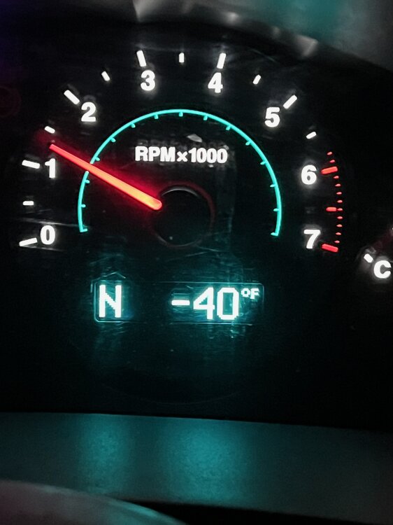
-
My folk said we got about 3.5" back in Fleetwood
-
NWS upgraded the NW burbs WWA to 3-5" on the latest forecast package. If the NAM is to be believed, there could be an iso 6"+ in there across Berks or the Lehigh Valley. Depends if we get some good banding to set up across that area, otherwise i don't think rates or snow growth will be spectacular. Snow comes in around 7-9pm, gone by 10-11am on the NAM. That's a solid 14-16 hours of snow. But, we won't be seeing consistent 1" hour rates or something.
-
E PA/NJ/DE Winter 2023-2024 OBS/Discussion
Newman replied to The Iceman's topic in Philadelphia Region
0z ICON (yeah Icon i know) is really solid for NW burbs. 4-6" for all of Berks and the Lehigh Valley -
E PA/NJ/DE Winter 2023-2024 OBS/Discussion
Newman replied to The Iceman's topic in Philadelphia Region
GFS brings 1-3" back to the general Mount Holly CWA, those NW of 95. It's been clear looking at upper levels that were trending back towards a light advisory event. The 250mb jet continues to improve in orientation -
Mountain West Discussion- cool season '23-24
Newman replied to mayjawintastawm's topic in Central/Western States
We made it down to -15 in Laramie this morning, wind chill of -37. Expecting another 2-5" in town with the next few waves/impulses in the flow tonight and tomorrow night -
Heard rumors that they might be moving the game to Cleveland? Would be a bummer, though I also can't imagine the logistical nightmare of trying to get a sell out playoff crowd out of a stadium with roads impassable
-
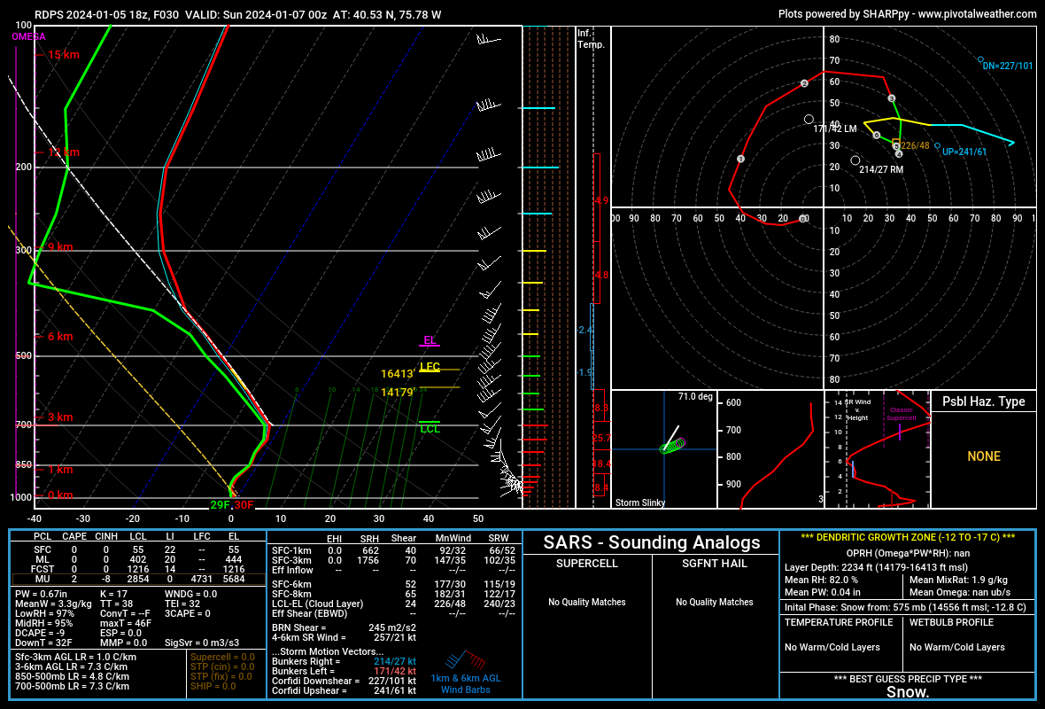
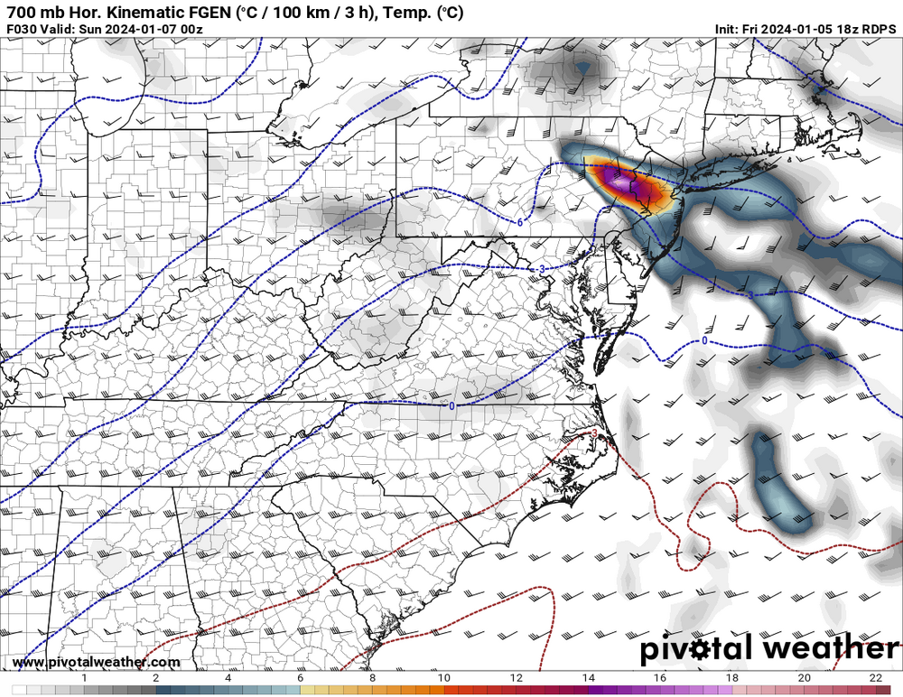
The RGEM comes in cooler as well, following the NAMs. Again, there was a very slight shift south with the 850mb low, but each mile matters as the rain-snow line battle will be a real one. Below is a sounding from the RGEM for tomorrow evening in eastern Berks county 0z UTC. Between 21z and 3z (so like 4pm-10pm) is when much of the NW burbs will see their best snow growth. After that, rates will drop off. Certainly not extremely "unstable", but the mid-levels do have pretty steep lapse rates and that will aid in dynamics. Between 4pm-7pm the RGEM has a solid 700mb fronto band push through. This is that initial "thump" that many will be relying on.
-
I do, hence why I'm even in this forum posting about a snowstorm I won't be experiencing lol.
-
Storms like this make me glad I didn't choose to go the forecasting route
-
The 850s are held more at bay on the NAM, aided by the mid-level circulation passage coming in a bit further south this go around. Yes just pointing it out.