

Newman
-
Posts
2,104 -
Joined
-
Last visited
About Newman

Recent Profile Visitors
8,055 profile views


-
Things look stormy and active from Wednesday through the weekend across the front range and plains. A pretty potent shortwave trough and -PNA will result in quite a few disturbances rotating through the region. The orientation and strength of the PNA will determine where the bulk of the precip goes and whether the front range gets in on a favorable moisture advection regime. Currently a marginal risk from the SPC for Wednesday
-
I'm not sure we even picked up 1 inch here in Laramie, under a WWA for 3-6"
-

E PA/NJ/DE Spring 2025 Obs/Discussion
Newman replied to PhiEaglesfan712's topic in Philadelphia Region
Gotcha, was just going off the MesoWest site https://mesowest.utah.edu/cgi-bin/droman/meso_base_dyn.cgi?stn=KRDG&unit=0&timetype=GMT -
E PA/NJ/DE Spring 2025 Obs/Discussion
Newman replied to PhiEaglesfan712's topic in Philadelphia Region
My folk in Fleetwood had a big tree go down in the backyard this afternoon. Looks like peak gust at KRDG was 57 mph this afternoon. More shallow convection moving through right now -
E PA/NJ/DE Spring 2025 Obs/Discussion
Newman replied to PhiEaglesfan712's topic in Philadelphia Region
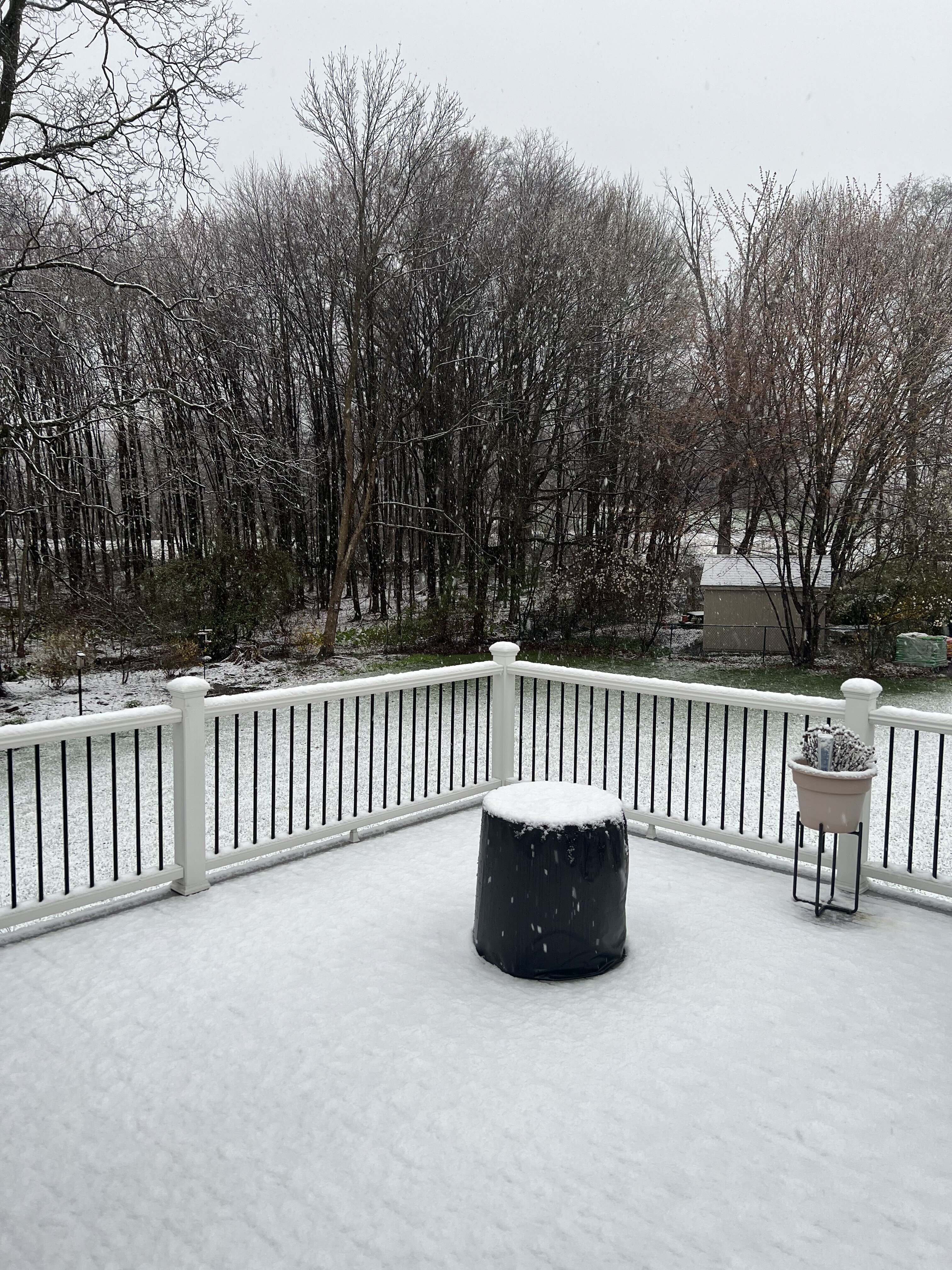
From my folk just in Fleetwood... Over an inch of snow on cold surfaces this morning before things started to melt. Certainly didn't expect accumulating snow to get as far south as Berks, let alone over an inch
.thumb.jpg.4465063cf05810ed7d3a7b5571ae3bfb.jpg)
-
12z Euro is pretty much bone dry for the next 10 days across the Lehigh Valley. GFS keeps temps in lower 50s while Euro gets into mid-upper 50s. Quite possible this final stretch of February gets some climate stations back closer to normal for the month after a cold start
-
To be honest, the coastal storm itself is probably long gone at this point for much of the SE PA region. The ULL snows though are very much a plausible possibility with a C-1"
-
Did the 12k NAM just give Philly like 8 inches? Lol. Even the 3k NAM, which skunks Philly, shifted quite a bit NW and gives ACY like 4-6. Don't believe it
-
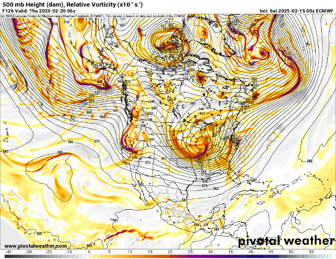
Quite the h5 look, so close to something big but it'll probably be too little too late. If at this point the ULL/trough was neutral and not slightly positive, you'd be able to scoop up enough PVA to swing it into at least the Philly area. Some very intense curvature vorticity being advected towards the downstream flank of the trough, but that pesky confluence streak in northern Maine is helping to slow how quickly this turns neutral (as well as the fast flow in general). If a long range smoothed ensemble picked up on this exact h5 look, I'd be screaming KU too. But when it came down to it, we were about 12-18 hours off in timing.
.thumb.png.fdaf7730b224f31bd6145fe17433c281.png)
-
Quick glance seems like H5 is improved on almost all models, if the trend continues I'd expect some ticks back NW. However even with improvement still dealing with a lack of PVA getting into the region with the ULL turning neutral just too late
-
Currently the tally in Fleetwood for the season is ~19.5-20 inches or so. There's been a whopping 12 "events" this winter with measurable snowfall... 11 of those events were 2 inches or less. Only 1 storm, the one on January 19th, dropped appreciable snow with 7.9 inches. Talk about a nickel and dime winter, or maybe more appropriately penny and nickel
-
Genuinely can't remember the last time a storm shifted so bad on guidance, usually it stops bleeding at some point. The Ukie barely even has a surface reflection. It's comical actually
-
Sister in Reading just lost power, KRDG just gusted to 56mph
-
Yes the trends have been quite unfavorable, but I don't think we're done seeing changes with the evolution of the upper level low that tugs and phases with the southern vort. The past 4 runs of the Euro have been all over the place with that, it won't be resolved until we're closer in. The phase is just off too. Not saying the changes with the ULL will result in a better outcome, in fact we could see it continue to get worse with the phase. But the Euro still shows 6-8" SE if Philly in south Jersey. There's no reason to believe we can't squeak that NW a bit in 96-102 hours
-
Euro vs everyone

.jpg.d3475adad5c4da6905556bb5a64f1bef.jpg)

.png.8e08e6d3f5fd65916bedf3d91a7201c3.png)


