Scarlet Pimpernel
-
Posts
7,335 -
Joined
-
Last visited
Content Type
Profiles
Blogs
Forums
American Weather
Media Demo
Store
Gallery
Everything posted by Scarlet Pimpernel
-
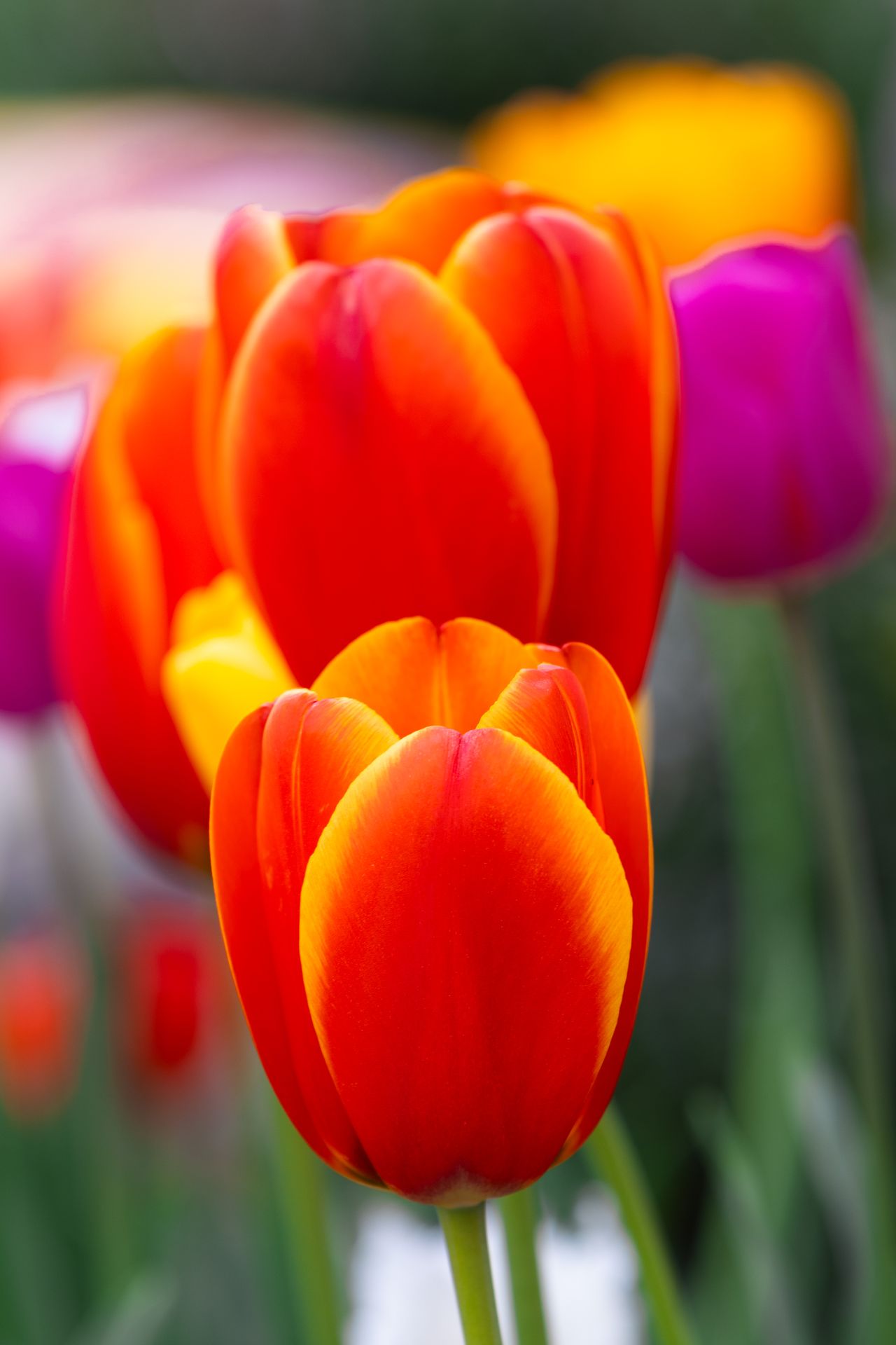
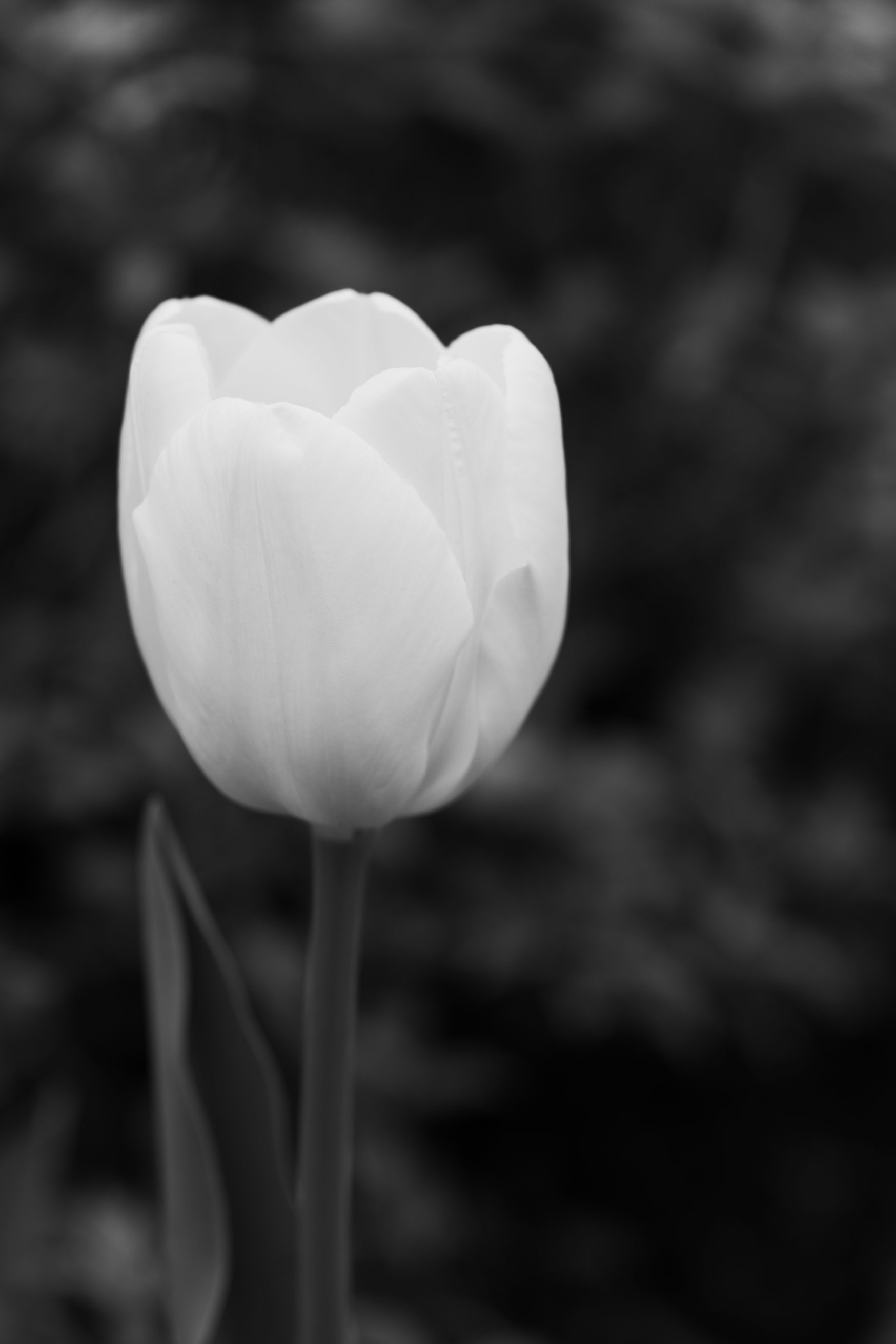
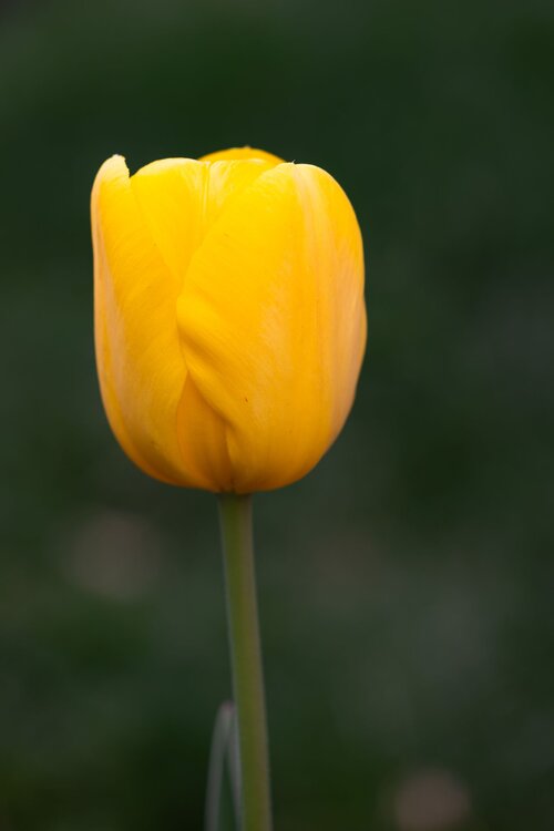
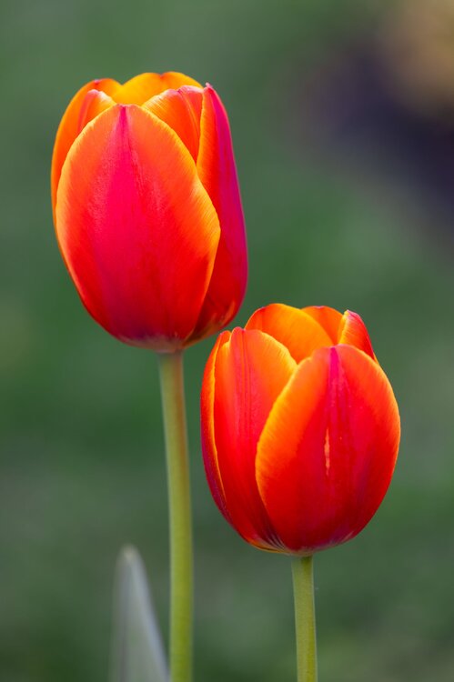
Thank you! A lot of people in my neighborhood have them in their yards, and there are a lot of those planters along several roads that have them as well each year. Very stunning flowers for sure! My favorite perhaps are the ones that have the reddish and yellow color streaks on them. Hope you're able to see lots of nice ones at that garden when you go in a couple of weeks! Seems like they're a little earlier than usual (?) perhaps, even around here in metro DC. I saw them just starting to come up the other week, and they're now really out and going.
-
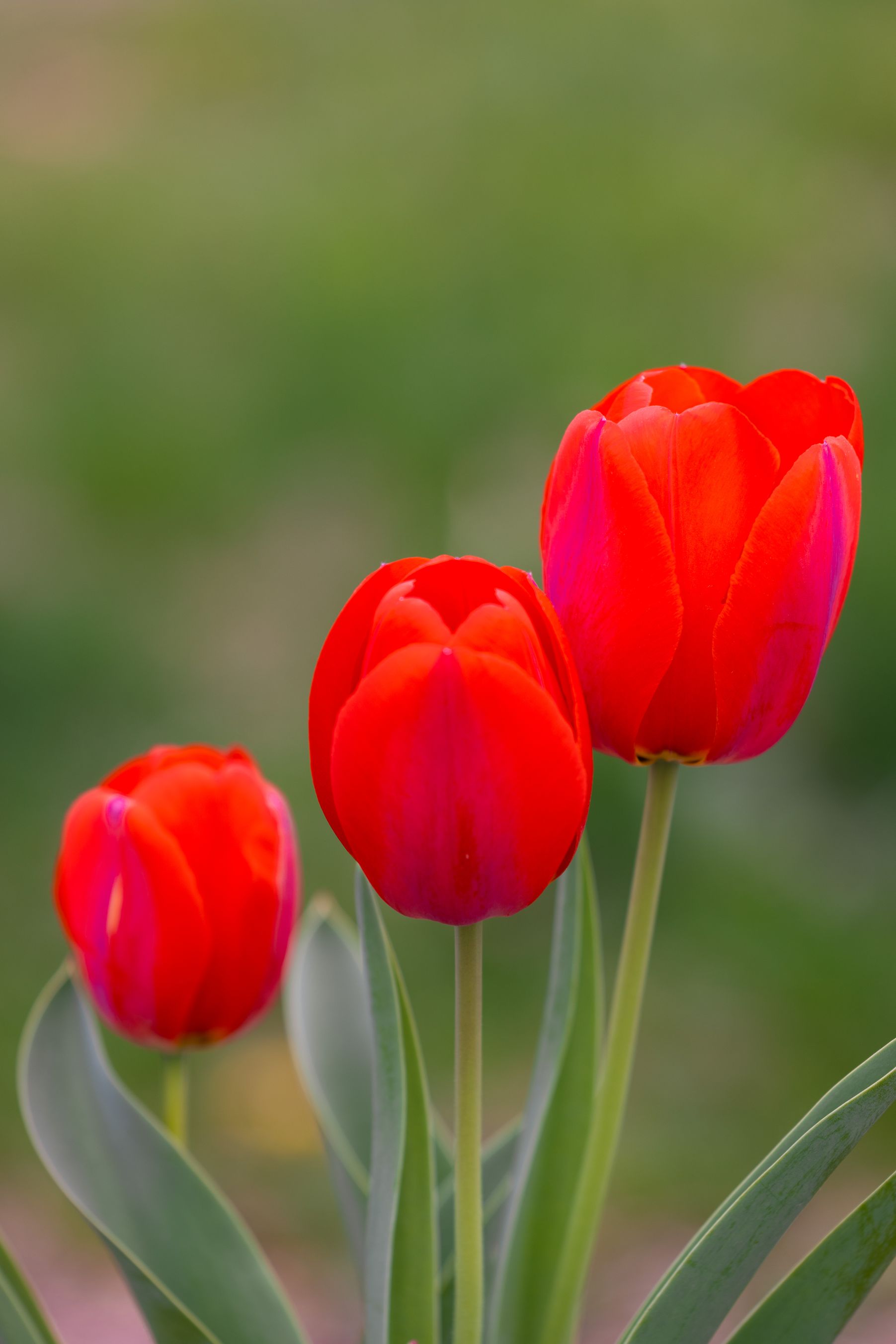
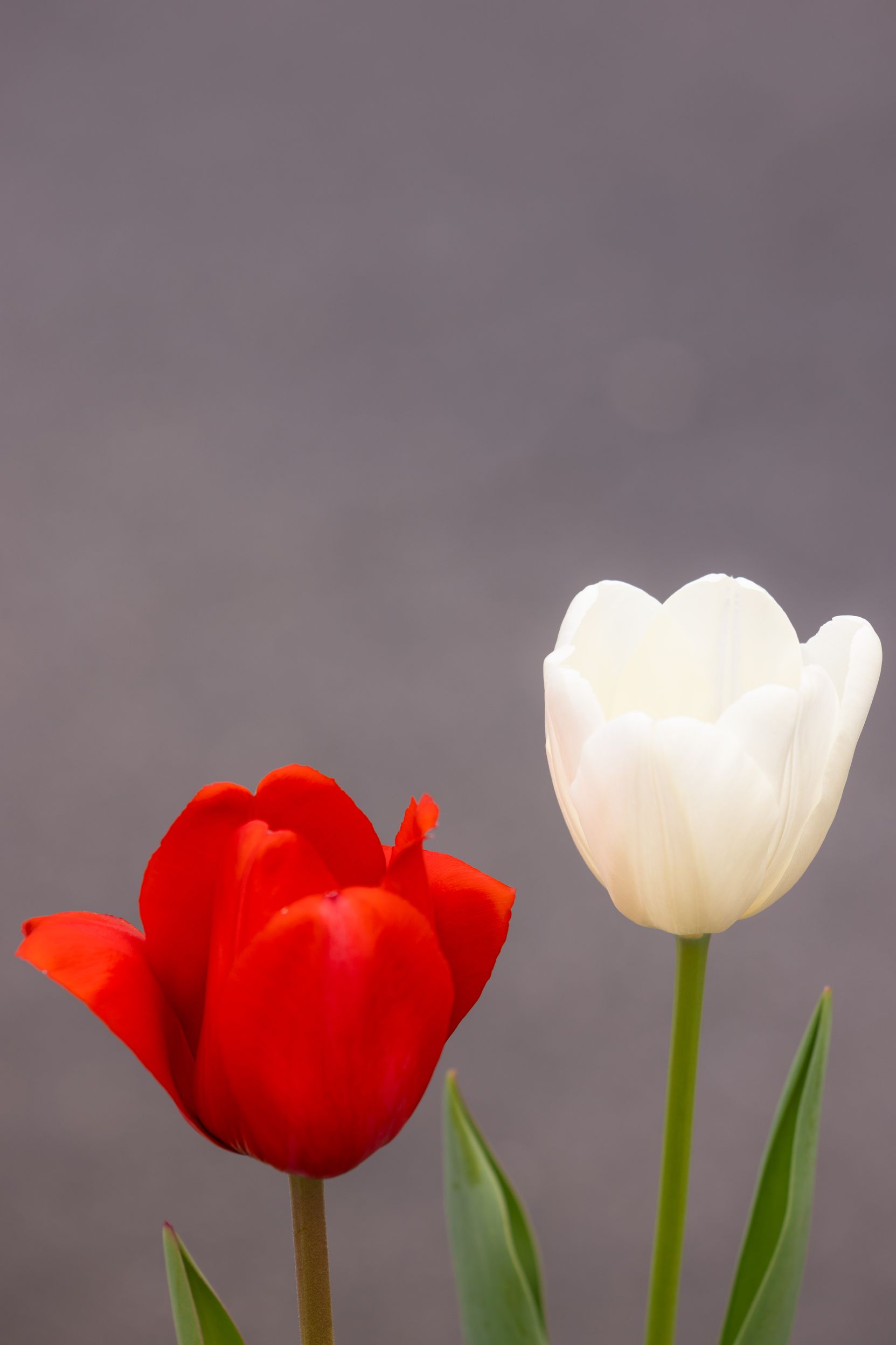
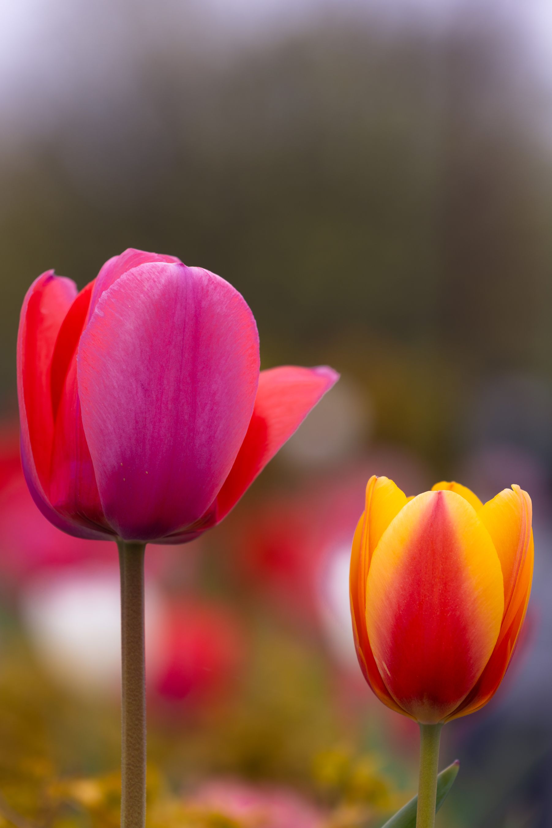
And a few more!...


-
@mappy...TULIPS for you! Several images to follow...
-
Agree. Unlike perhaps some in here, I really like good March snows when we get them! Who cares if generally they get melted away within a couple of days. And we've had some solid ones over the years. I'm not a big fan of 40s-50s and cloudy/drizzle, but you cannot escape that around here in March or April (sometimes even May!). So you deal with it and enjoy either the snow events we do get in March, or the 60s-70s pleasant spring weather as things come alive again. And I also agree, we'll see God-awful heat and humidity soon enough, and for far too long of a time! That much is guaranteed every single year. Actually, outside winter when there are snow chances (such as they are!) my favorite season is fall...the changing leaves, crisper evenings and nights after the heat of summer, it generally tends to be pleasant out, plus looking forward to all the upcoming Holidays the latter part of the year.
-
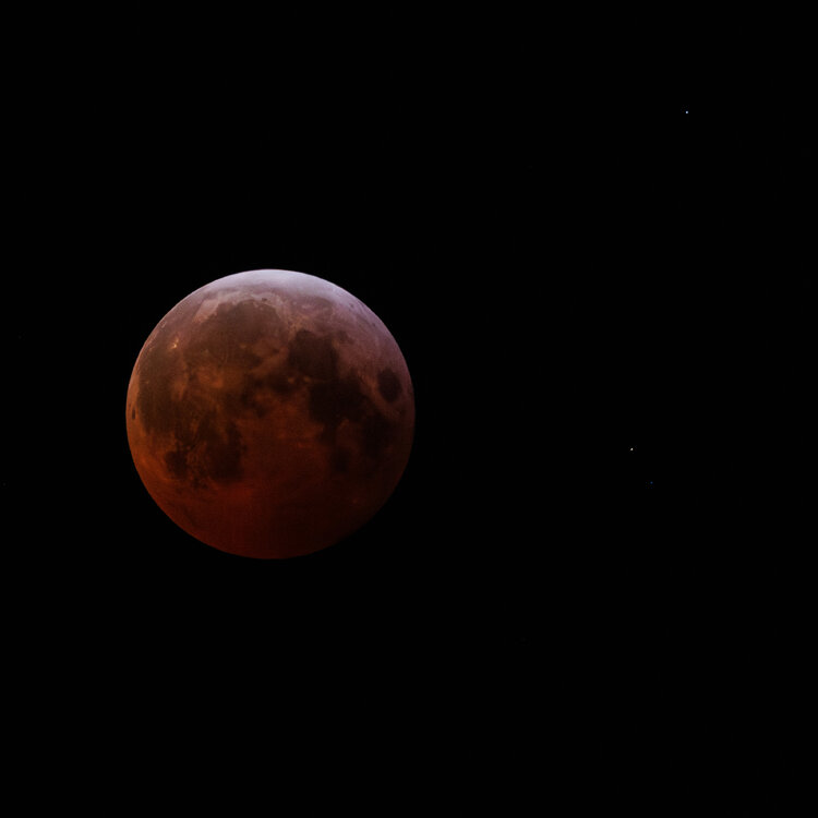
LOL!!! Nah, I wouldn't do that! I guess I figured people might wonder why the hell I didn't just crop it to be right in the middle of the image. Which would have been fine, I normally do that afterward with lunar photos I take. But in this instance, I noticed all the stars visible around it, so I wanted to crop it such that they would also be visible. Plus, just an artistic license here, sometimes keeping space on either side of a main subject creates an interesting balance, or imbalance. If I had done a time series of the eclipse as it approached totality, I would have centered it of course, for that. In fact, 3 years ago (last total lunar eclipse visible in this area) I did just that. For this one, knowing there would be a lot of cloud cover and the fact that it was middle of the night (3 years ago was near sunrise, pre-dawn hours, and it was clear!), I didn't really care to wander outside several times hoping to capture gaps in the clouds. So I decided to just go out right around totality. I almost was going to give up on this one, to be honest! I went out around 2:45am, wandered around looking in the approximate area where the moon was supposed to be and...nothing! Very frustrating. I was about to just call it a failure and go back to bed, when I then saw it in a thin gap through the clouds. I stuck around for about 20 more minutes, there were more decent gaps here and there, and I grabbed several shots (hoping a few would turn out decent enough!).
-
Lunar eclipse from the other night (Mar. 14). There was a lot of cloud cover, but fortunately enough breaks to enable me to get a few good shots. I purposely cropped this with the moon off-center, so that the stars (visible on the right) would be in the photo.
-
-
Tulip photos coming soon for you! Well, sometime in April or there about!
-
We need the second coming of Jesus (the waiter) to serve us drinks as we await the inevitable conclusion!!
-
I'd echo pretty much these same things. British Museum, maybe some of the others (art museum type things), Churchill War Rooms, and there's I believe a WW-I museum too (since the US wasn't in that one as much, it's a remarkable perspective from Britain to see how impactful that war was in Europe). Oh and St. Paul's Cathedral...when I was there many years ago you could walk up the stairs in the dome area to the top or near it, and look outside. Stunning view! Food...as @WxUSAF says, Indian cuisine is what you should look for in England, they should have plenty of good Indian places in London. I'd also recommend a nice place for some good ol' fashioned fish and chips! And any number of the local pubs, you'll probably find beers that you can't get around here, and when I was there several places had different stuff on tap, it wasn't always the same in each pub. And of course...use the London Underground by all means, and buses, to get around town. Just remember to wait on the correct side of the road so you're going the direction you want, hahaha! You know, because those Brits drive on the wrong side!!
-
A'la "Other than that, Mrs. Lincoln, how did you like the play?"
-
This is a good comment. One has to hold out some hope that this won't continue forever. Even if one's first "real" job right after college isn't exactly related to your chosen career (such as meteorology), do what you can, and eventually you can get into what you wanted to originally do.
-
Must be nice to say that from a place of privilege if you're not in that "9 percent", who are losing their jobs for no apparent good reason.
-
Oh my! The Reaper getting all moist and misty-eyed!! So sentimental now in retirement!!!
-
I feel the same...though I'll add, it's not just the whim morons, it's specifically designed to be cruel and hurtful.
-
So...a normal winter in these parts, then!!
-
Never underestimate the Reaper! He's got a little list, you know! (From Gilbert and Sullivan's "Mikado", Ko-Ko the Lord High Executioner): As some day it may happen that a victim must be found I've got a little list — I've got a little list Of society offenders who might well be underground And who never would be missed — who never would be missed!
-
Yup, when the weenies get CRAS, the Reaper in all his glory gets going!! Off to carousel with you!!
-
-
I mean really, we endlessly parse the 84-hour NAM and the ICON for every single snow event, for crying out loud!
-
Eggplant!!!
-
At risk (oh well!) of likewise getting a bit too political in this forum, I'll have to disagree with your 2nd paragraph somewhat. I'm not one for "both-siderism" to be honest. That's the bane of our awful media situation as it is because too few call out the truth. While individuals, not necessarily politicians, on both the left and right may go too far in what they say, the FACT is that there is nothing on the political left in this country (i.e., Democratic party) anything like the right. Not a single Democratic politician has proposed or done anything remotely similar to what the other side has done in terms of blatant violation of law, political norms, or ethics. Nor have they put up a convicted felon on state charges and one charged with serious federal felony crimes as their standard-bearer for President. One may disagree with proposed policies but it's nothing like what we see going on now. I'm very much to the left in my views, and there are certainly aspects of some liberals that piss me off, but in terms of who is making policy, the Democrats are pretty centrist by world-wide standards. Really, only one side is hell-bent on utterly destroying the very institutions that make this country what it is. This all has me VERY worried and frightened to be honest. But as I said, sorry to get too political here, maybe my inner @psuhoffman in part feels I must speak up just a little bit because these issues are now impossible to avoid. Besides, it ain't going to be snowing anytime, which pisses me off, so screw it, I'll vent!
-
It's definitely been favoring "BS" around here for some time now!!! Sorry couldn't resist. But to be a little serious, it does seem we've not had many "true" Miller-A storms of late.
-
I'm half-following to the end, myself, to be honest. I still hold out hope for one more decent snow before we're done for the season. And of late (many years?) we've had better snow chances and more events in early-mid March than any time in December.