MAG5035
-
Posts
5,882 -
Joined
-
Last visited
Content Type
Profiles
Blogs
Forums
American Weather
Media Demo
Store
Gallery
Everything posted by MAG5035
-
Fall/Early Winter 2019 Forecasts and Discussion
MAG5035 replied to pasnownut's topic in Upstate New York/Pennsylvania
Good to see a lot of folks in here scored/are scoring some snow this morning. I only had a couple tenths worth of snowfall here as the deform band set up probably about 20-30miles east of here early this morning. NWS State College reported 1.5" at the office and I'll be finding out here a little later if my hunting area on Tussey southeast of town ended up with more. Next focus for possible winter weather appears to be next weekend. Models have been progging a deep low developing into the northern plains, while a strong Canadian high sets up to our north. A pretty classic ice event look. Sometimes this setup with the parent low so far west can yield front end snowfall too but there doesn't seem to be a deep cold push behind Wednesday's system to be very sure on that. GFS has been more insistent on this scenario but I saw the Euro had that look as well last night. Def something to keep an eye on this week. First week of December looks cold behind this potential system. -
Fall/Early Winter 2019 Forecasts and Discussion
MAG5035 replied to pasnownut's topic in Upstate New York/Pennsylvania
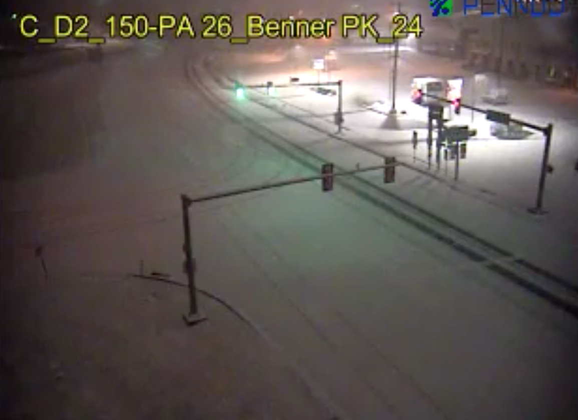
Judging by the 511 cams around the State College area currently, it appears that UNV is going to have it's measurable snow. Several cams showing snow covered roads. This solid band of heavier precip in the central mountains region may end up warranting an advisory first thing this morning for a few counties.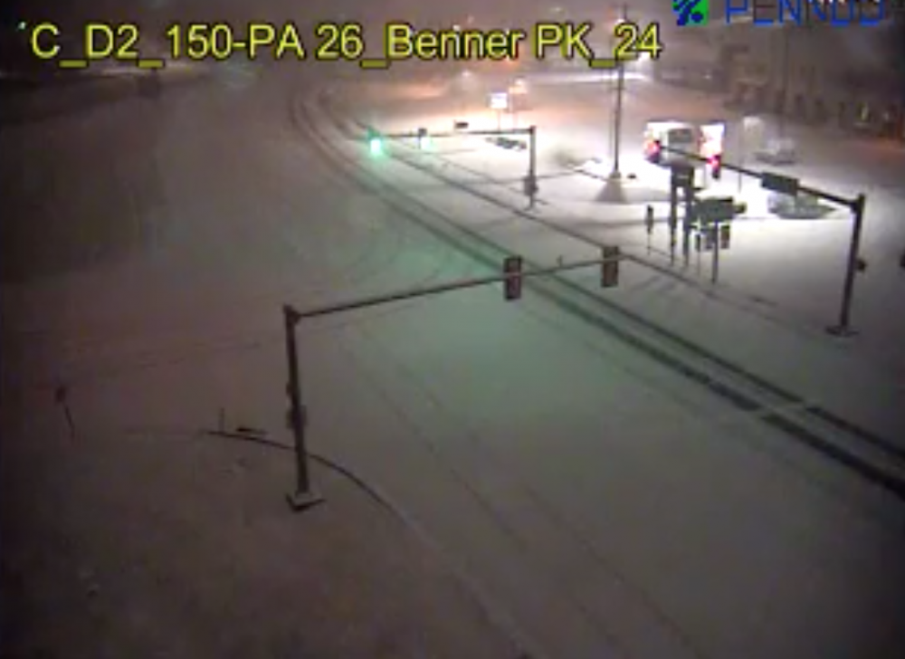
-
Fall/Early Winter 2019 Forecasts and Discussion
MAG5035 replied to pasnownut's topic in Upstate New York/Pennsylvania
All snow, and coming down decently. Working on a coating. -
Fall/Early Winter 2019 Forecasts and Discussion
MAG5035 replied to pasnownut's topic in Upstate New York/Pennsylvania
Changeover is starting to occur down here. Mostly sleet now. -
Fall/Early Winter 2019 Forecasts and Discussion
MAG5035 replied to pasnownut's topic in Upstate New York/Pennsylvania
Some winter action to report on from nearby (4 miles up the road). The Allegheny front has some fairly notable ice accums ongoing. Wopsy Rd@Skyline Dr above Altoona: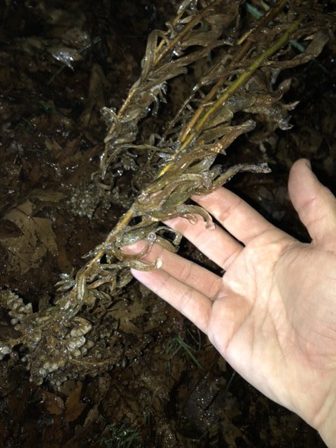
-
Fall/Early Winter 2019 Forecasts and Discussion
MAG5035 replied to pasnownut's topic in Upstate New York/Pennsylvania
The way the pattern appears to be shaping up for the second half of the month is certainly favorable for a potential early season event(s). Considering the month we're talking about is still November, the progged establishment/stability of what is pretty much a winter-type pattern is notable. It's not a "one off" type thing where we briefly might line up things for a snow event and it's back to being 60ºF and above average in a few days. It's more of a seasonal temps at best (generally below average) with a fairly suppressed storm track that keeps the cold air close and provides realistic opportunities for early snows. Going off some of today's runs (12 and 18z), GFS and Euro differ some in alignment in that D6-10 timeframe. The GFS seems more amplified with the western ridge and overall high height anomalies in the high latitudes (specifically Canada), providing a bit of a colder look and more suppression to the storm track. The Euro is flatter with the western ridge but more amplified with a Greenland ridge in the NAO realm. The flatter western ridge would imply a more zonal pattern that's a bit warmer (but still workable). I do think the more highly amped western ridge the GFS had provides the better potential. We'll see. -
Fall/Early Winter 2019 Forecasts and Discussion
MAG5035 replied to pasnownut's topic in Upstate New York/Pennsylvania
Happy one year anniversary: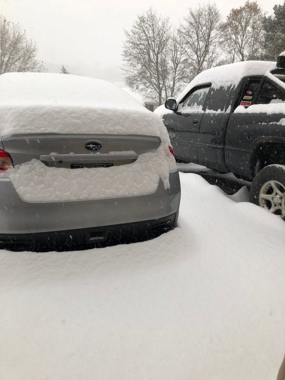
-
Fall/Early Winter 2019 Forecasts and Discussion
MAG5035 replied to pasnownut's topic in Upstate New York/Pennsylvania
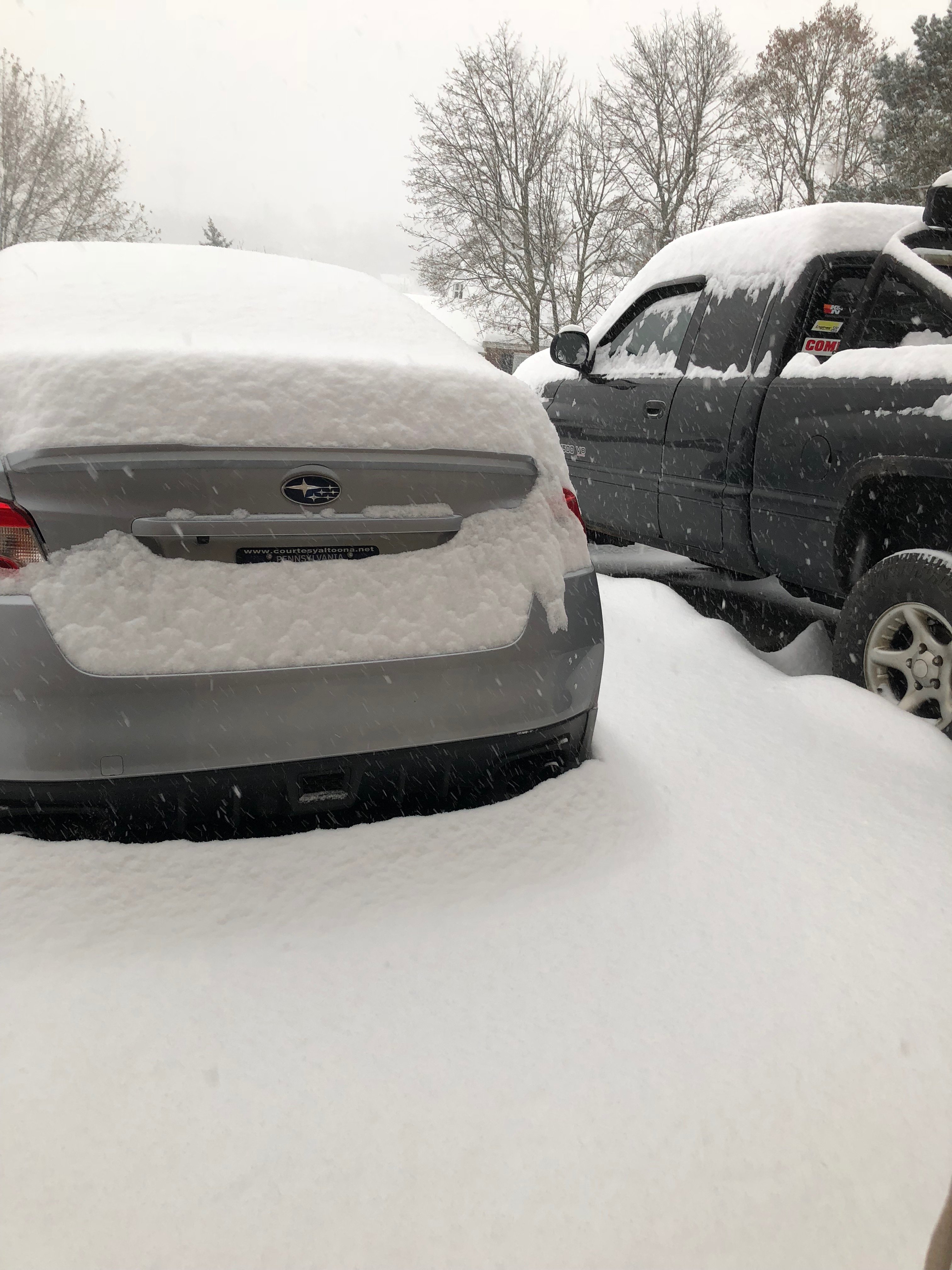
Pretty snow squally day around here, although the bare ground and earlier sun in between melted most light accums off. Glass table on the deck has about a half inch on it, so that's probably a fair representation of the running total for the day. It also didn't take long to pile up I-80 today in multiple places in Ohio and PA. -
Fall/Early Winter 2019 Forecasts and Discussion
MAG5035 replied to pasnownut's topic in Upstate New York/Pennsylvania
The prospect of some potential snow in at least some of the region late in the week is certainly earlier than we generally see but it does occur in the early half of November from time to time. Let's briefly discuss what the models currently have progged next week in the form of a major shot of cold air. That is a whole other thing if that were to come to fruition. Euro and GFS send in sub 504 thicknesses which is quite anomalous for the dead of winter much less the Nov 13-15ish timeframe. We're talking highs not out of the 20s and single digits/ teens low temps depending on the region of PA and if there happens to be any snow on the ground anywhere. Simply put, the D6-10 timeframe looks straight up wintry. If it indeed ends up being that cold or even close to that, one would hope we can score some kind of event out of it. Sans any kind of synoptic event, NW PA and the Laurel's would stand to benefit from a potentially favorable trajectory and ∆T's that figure to light up the lakes like a Christmas tree with a few days of -10 to -15ºC 850 air overhead. Edit to add, the Great Lakes temp map shows Lake Erie (by far the warmest lake by virtue of it also being the shallowest) largely in the upper 50s to near 60ºF or so as of Sunday Nov 3. I haven't looked over in the upstate NY thread much yet, but I'm sure the LES gurus are quite excited about the potential of that. So that's like a 20-30ºC ∆T between lake surface and 850mb (5k feet). -
Fall/Early Winter 2019 Forecasts and Discussion
MAG5035 replied to pasnownut's topic in Upstate New York/Pennsylvania
Today's 12z run had a similar look with the wave and pressing cold high running a slug of moderate precip across the state albeit a bit warmer thermally... relegating most of the potential accumulating snows to the Laurel's and the northern tier generally above I-80. Doesn't appear that the low levels get cool in time in the south central and Sus Valley, with 925mb-surface temps lagging. It certainly could indicate an overall rain to snow type scenario for most though, just not notable accums once towards the Sus Valley . Either way, a major shot of cold coming behind the potential system. Canadian and ICON have this system and wave of precip positioned similarly while the GFS is way SE keeping PA completely dry. That's just the take on the models as they look currently but this system is certainly worth keeping an eye on (just in time for switching back to standard time). Timing of the system vs press of the cold air will be important. Given how early it is things will have to align just right, but this is an impressive cold airmass for early November on the playing field so something to the tune of our early event last November is quite possible. I'd personally rather see this type of cold pattern come to fruition in the latter half of November but it's good to see some potential action right off the get go. -
Fall/Early Winter 2019 Forecasts and Discussion
MAG5035 replied to pasnownut's topic in Upstate New York/Pennsylvania
And I can confirm a few flurries flying around in the wind here as well now. November looks to open up quite cold. -
Fall/Early Winter 2019 Forecasts and Discussion
MAG5035 replied to pasnownut's topic in Upstate New York/Pennsylvania
NWS Pittsburgh reported it snowing at the office there (near the airport) within the last half hour which officially would go as a T. 10th Halloween with snow since 1890. -
Fall/Early Winter 2019 Forecasts and Discussion
MAG5035 replied to pasnownut's topic in Upstate New York/Pennsylvania
Yea I think the LSV is more mixed out (evidenced by some gustier surface winds out ahead) and has a much better chance of seeing severe gusts mixed down with the leading line of storms. -
Fall/Early Winter 2019 Forecasts and Discussion
MAG5035 replied to pasnownut's topic in Upstate New York/Pennsylvania
FROPA came through here with torrential rain but very little wind. Stable boundary layer stayed pretty firm here as it usually does in these type of situations. Probably will be another couple hours before things finally get mixed out post front and the winds ramp up. -
Fall/Early Winter 2019 Forecasts and Discussion
MAG5035 replied to pasnownut's topic in Upstate New York/Pennsylvania
Def one of the more confident and stronger worded special weather statements I've seen for the area. Severe watch issuance is a quite likely and potentially may come with a tornado watch for the southern counties for potential QLCS tornadoes given the dynamics. Winds not very far aloft are screaming, even 850mb winds on mesoanalysis are showing 45-55 knots over PA. It won't take much for the impending squall line to tap down severe wind gusts. Some CAPE being shown in the south central as well (few to several hundred J/kg) which is notable in this type of later fall setup with the high low level shear present. This lends to the potential for QLCS tornadoes imbedded within the squall line. Lastly, the Laurel's/Alleghenies will be seeing their first flakes of the season late tonight/early tomorrow morning with the remaining moisture behind the front. This may also include the immediate central areas off the Laurel's (UNV/AOO region). Any accums should be little to none, but some of the highest Laurel's areas could get a coating. -
OCMD now in a tropical storm watch that was issued earlier on, as I'm sure your aware. You might get to see some action after all.
-
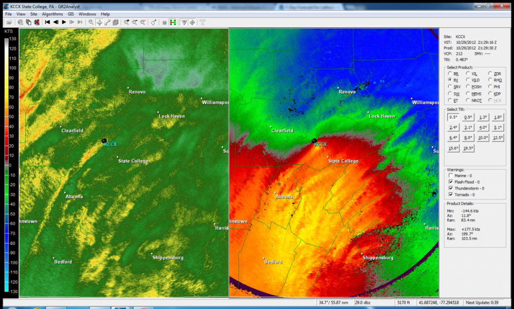
Sandy was definitely the windiest system here of any recent central PA major tropical system incursions, which back this way would involve Fran (96), Isabel (03), Frances (04), and Ivan (04). The flooding issues of the latter two are certainly well documented but they didn't have too much wind. Sandy of course was an extremely anomalous event all around. It was several hours of near constant wind, which we ended up losing a tree or two out of it. But just a couple miles away there was an area that pretty much a whole section of woods got laid out from the high winds. I probably still have the velocity image somewhere on my laptop of the 80-90kt velocities over the whole area. Edit, I found it:
-
There will certainly be the usual issues of high surf/riptides/beach erosion and perhaps some minor coastal flooding as the hurricane eventually gets lifted up past that region. But the storm track vs the orientation of the coastline there probably would suggest not too many major issues. A track on the farther western envelope of guidance would likely involve Dorian passing thru mainland NC to get there, so you'd be talking a weaker system in that case. Although, the storm center passing very close would invite at least some storm surge potential (likely 2-4ft type stuff). Model guidance has generally been keeping if fairly far offshore from Ocean City, MD after getting very close to the Carolina's and perhaps impacting the Outer Banks region. So OCMD could get into some of the outer stuff, but the core of what's left of Dorian at that point looks to stay offshore. It will be also be moving much quicker at that stage of the game too as it's being picked up. That's my take on it currently, obviously there's still a lot of questions yet surrounding what this hurricane is going to do. Ocean City could also decide to be cautious and evacuate tourists out till the storm passes if it were to end up coming very close. This could also be interesting at the coastal New England/Nova Scotia level, 12z Euro looked to phase in some energy to a probable extratropical transitioning Dorian and make for a pretty significant impact on Nova Scotia.
-
While it's quite early in the game for pondering such things, I don't particularly think our region is going to see effects from Dorian save for maybe glancing the southern LSV portions of the subforum with some rain or something. Typically to bring one of these storms into our region you need downstream ridging/blocking in eastern Canada and the western Atlantic and I'm not quite seeing that on the models. Once the storm curves it's going to eventually be picked up and shot north/northeast after really slowing down on it's approach to Florida. So in terms of the rest of the SE coast and eastern seaboard/coastal plain up to New England, yea I would certainly be keeping an eye on the developments of it. But for our region at this point I think it's unlikely. The 12z Euro is interesting that it keeps Dorian off the Florida Coast, perhaps even sparing the coast much hurricane strength impacts if it continues to be on the smaller side in terms of extent of hurricane force winds. It will be interesting to see how this evolves the next day or two. This will be a very strong hurricane on approach to Florida, likely a cat 4 and perhaps a high end one at that. If it in fact largely stays offshore of Florida then the SC/NC coast would be under the gun for a stronger potential impact. Although typically in these cases it would feature a weakened hurricane to some degree with influences from being picked up and waters that are warm but not quite as warm as it is in now. Def still major hurricane potential (Cat 3) but I think Florida would see the top strength of Dorian if it made landfall there (Cat 4 potentially).
-
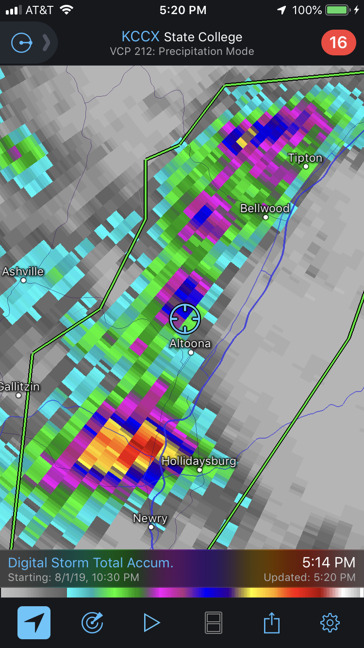
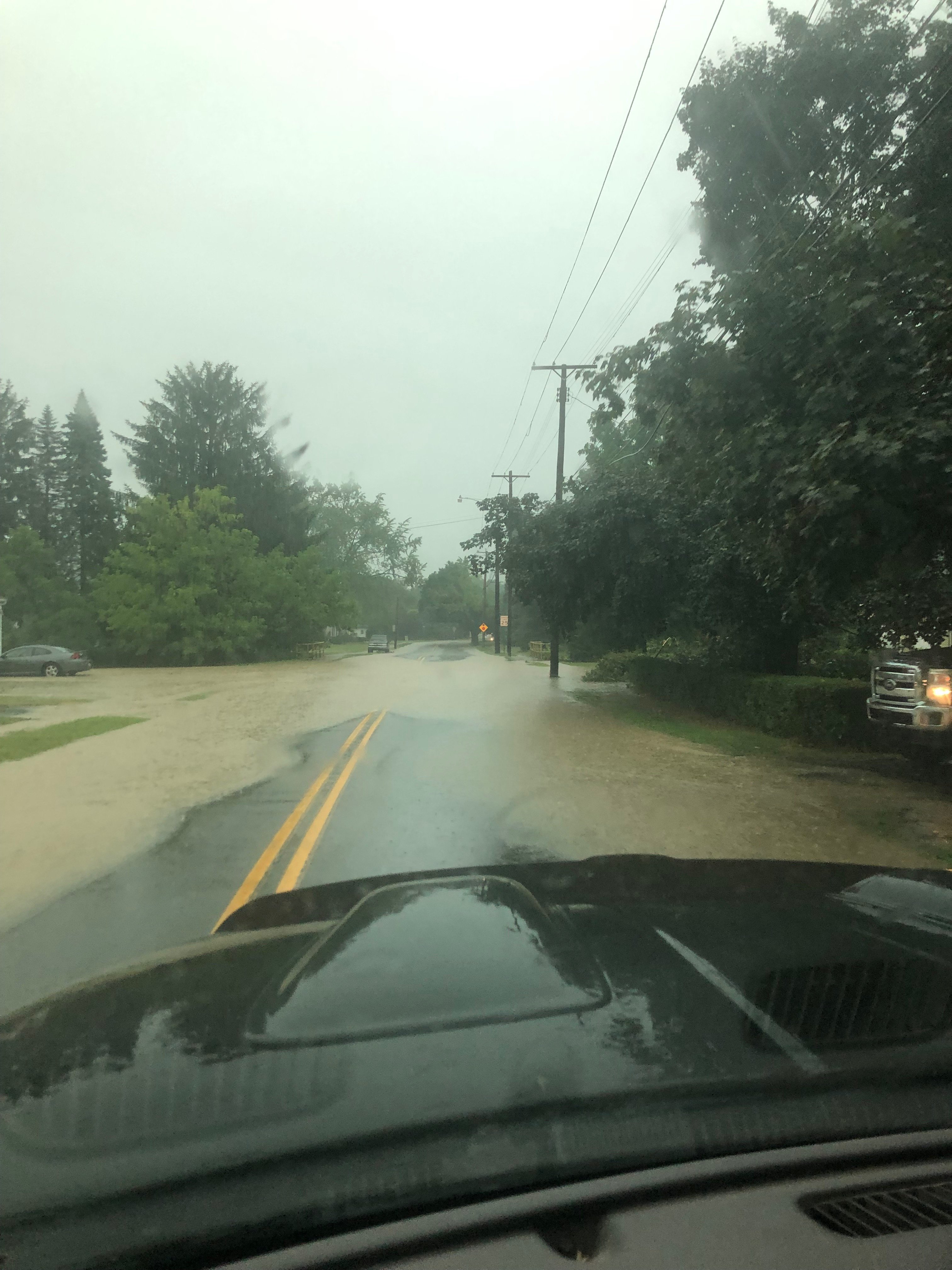
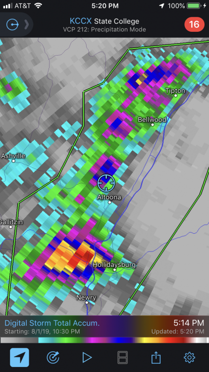
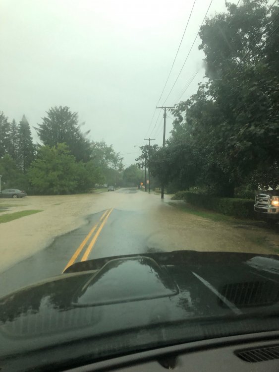
Well it had been drying out pretty nicely around here in the last few weeks. Then today happened: I was on the edge of the approximately 3" or so area on the doppler estimate.. and that all fell in the better part of an hour or so. Also the worst lightning storm I've seen in awhile.
-
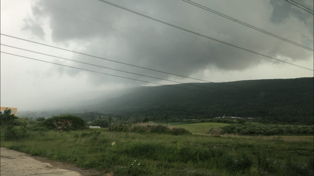
Here was a screenshot picture off one of the videos I took this afternoon. Looking north toward the hook and the meso crossing over the mountain. I made a good intercept considering I rarely get a chance to do such things around the immediate area. This one wasn’t strong enough to drop a funnel but as I said earlier it did have rotation.
-
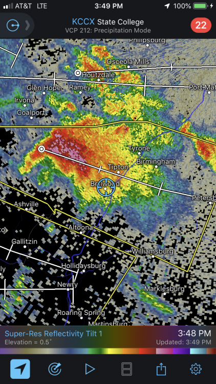
I’m in Bellwood right now so i probably won’t have to go anywhere to see what happens with the hook echo on the cell bearing down. EDIT: I forgot to hit send on this. Ended up going a couple miles south on a hill to get below the hook and have a look. There was definitely rotation but no funnel that I could see.
-
Wow, a near state-wide tornado watch just issued for PA. I think things will clear out more in the Sus Valley as we get into the later afternoon, which is evident on satellite. Mesoanalysis is showing pretty big CAPE already advected into the western and central counties.. on the order of >3000 j/kg (surface based). A lot of mesoanalysis parameters look fairly impressive for this neck of the woods. The combination of the large CAPE and modest helicity has 0-1km EHI numbers >1 and in the 2-4 range (most in northern PA attm) over a big portion of central/western PA. That in itself is a solid indicator of a tornadic threat from thunderstorms today. Pretty high bulk shear numbers and bulk richardson numbers (BRN) in the 10-45 range over a good portion of central PA would suggest cellular and supercells as the dominant storm mode today vs lines or clusters. Large hail is also a notable threat as well given the large CAPE. There is definitely high potential for a pretty significant severe outbreak late this afternoon.
-
Devastating tornado strikes Joplin, Missouri
MAG5035 replied to Hoosier's topic in Weather Forecasting and Discussion
Also, if you go back to the 2nd page of this thread (post 45) you find a poster that quoted JoMo's last few posts before the storm hit.. the second of which saying about the sirens going off. TIme on that post was 5:17 CDT, right at the time of the warning (VTEC31) issuance. 10 minutes later was his last post about the couplet being nearly overhead. Whatever happened to that particular thread (or portion of this thread) where people were posting as the storm was unfolding? I seem to remember that folks might've been watching that first warned cell when the Joplin cell suddenly exploded into the monster tornado signature just outside of town. There's of course those couple chaser videos that show this tornado going from a developing multiple vortice to a massive wedge in about the time it takes for the doppler to make one scan. I know that's one of the many aspects of this storm that fascinates me..practically watching the whole wall cloud drop to the ground in a minute or two. -
Devastating tornado strikes Joplin, Missouri
MAG5035 replied to Hoosier's topic in Weather Forecasting and Discussion
Very glad to hear that you and your family are ok.