MAG5035
-
Posts
6,078 -
Joined
-
Last visited
Content Type
Profiles
Blogs
Forums
American Weather
Media Demo
Store
Gallery
Everything posted by MAG5035
-
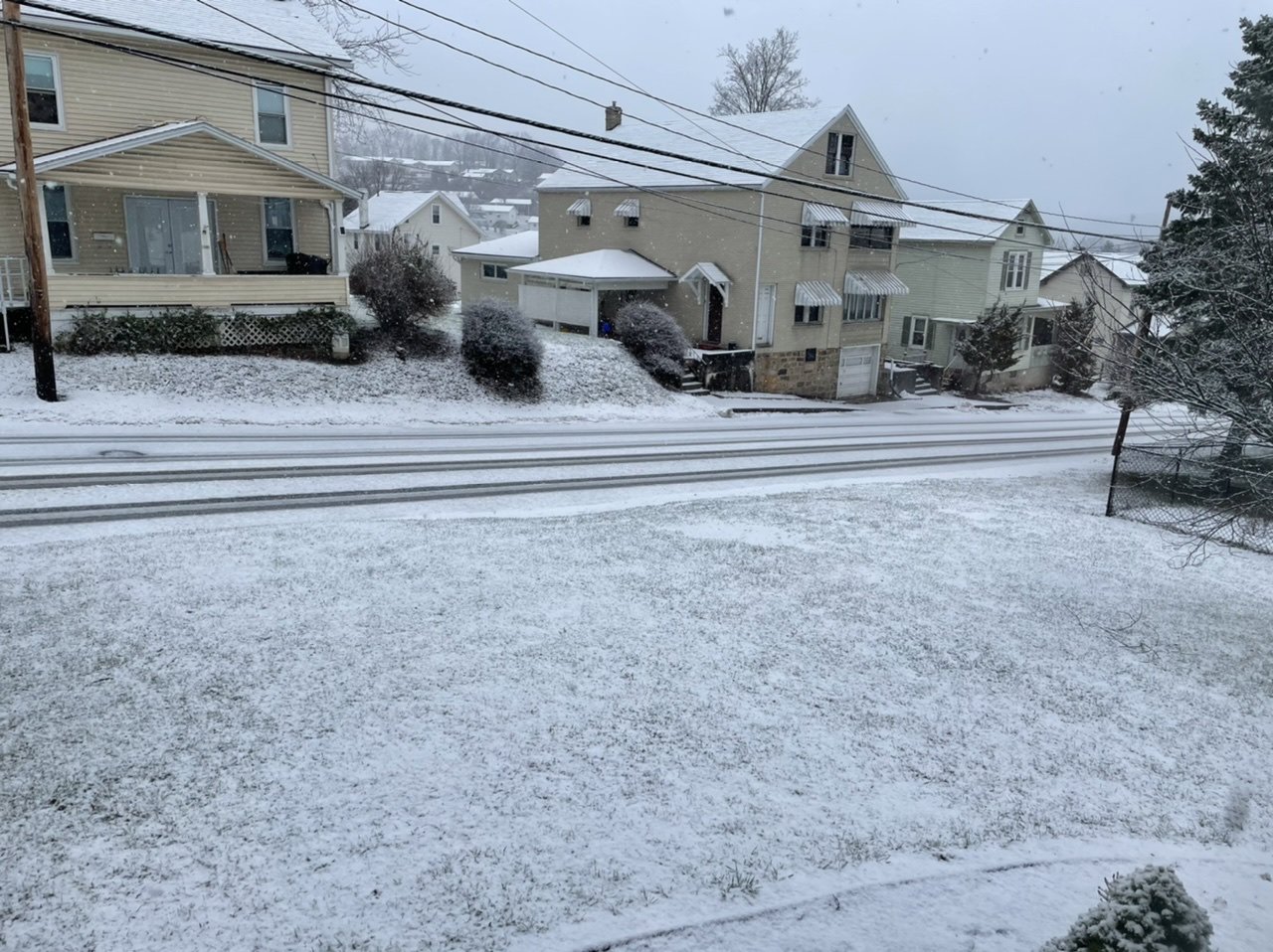
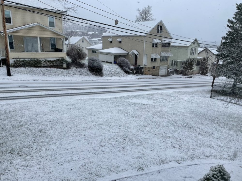
It stopped snowing around this time in the afternoon Sunday. It has remained cloudy and literally within a degree or two of 35ºF in the 72 hours since then. I dunno about any of you guys, but I'd actually like to see some sun and clear weather for a couple days.
-
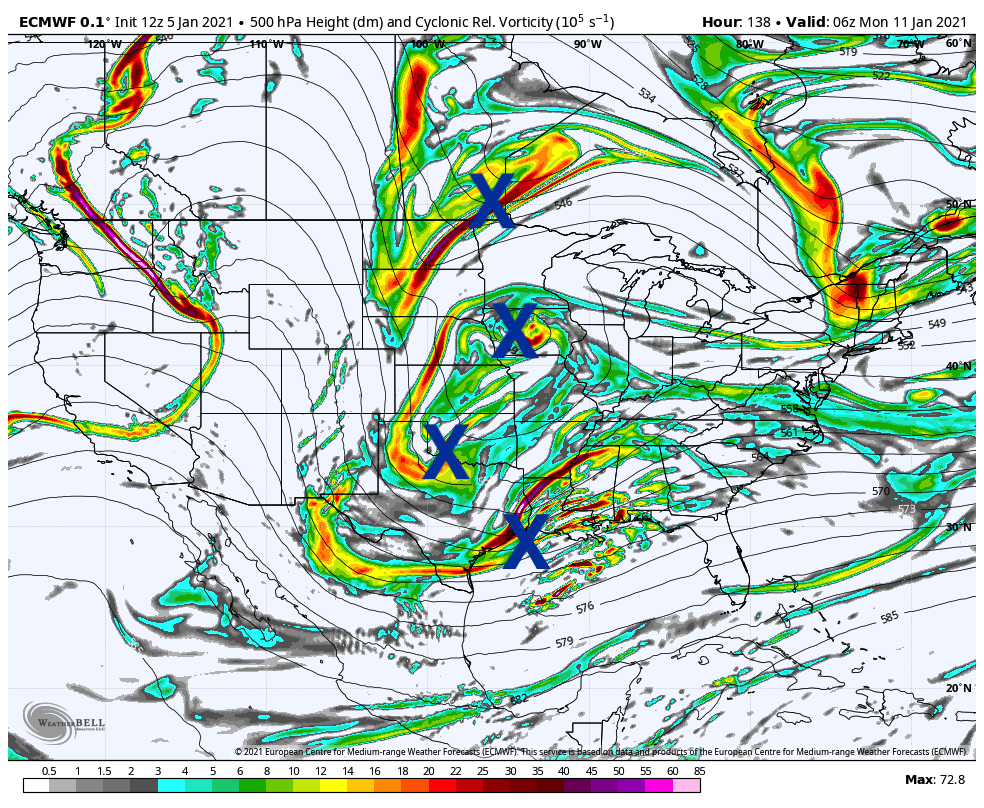
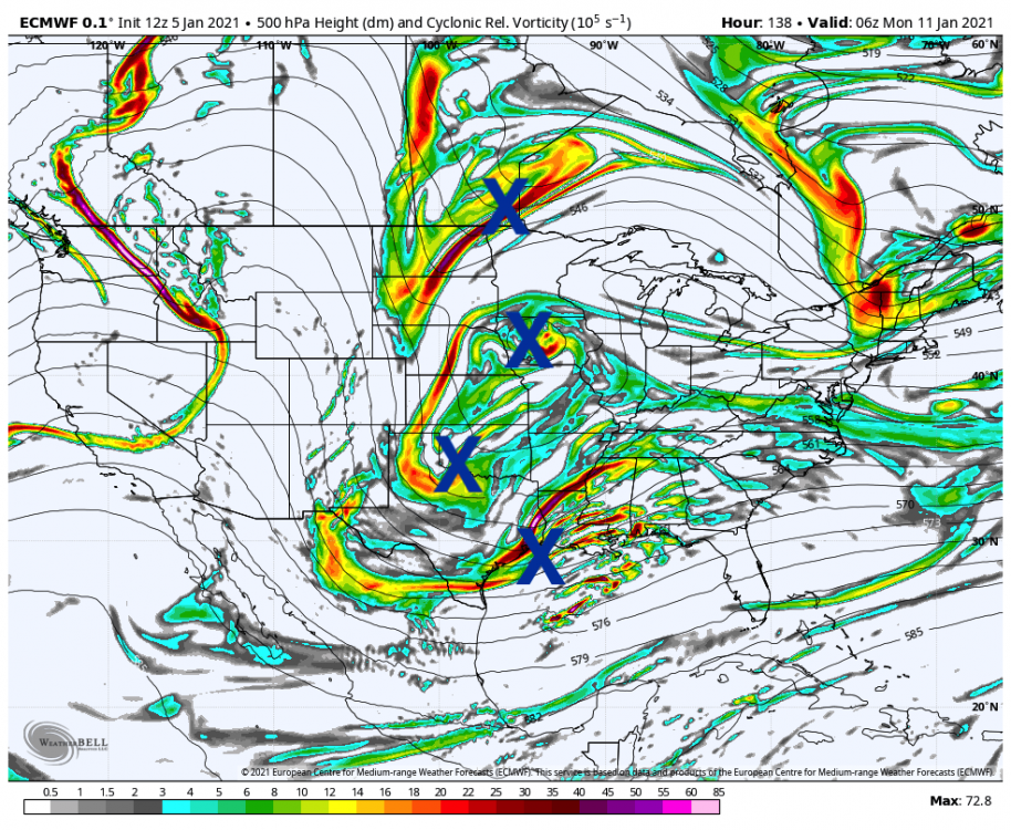
Like I said this morning, I think this stands a better chance than Friday's event which is now pretty solidly looking like a southern slider. And also as mentioned, models are wildly inconsistent with it. I had mentioned this morning about the 0z Euro basically having no system and you see what the 12z did. The overall pattern is better for the potential of the coastal storm, the big difference being the western ridge has really built in this timeframe along with some lessening of the dominance of the NAO block. That forces the northern branch to finally try to drop down in the east (dependent on how much amplification) and allow a potential phasing opportunity with the multitude of shortwaves running around. The Euro obviously succeeded at some phasing at 12z and I don't even think it was a complete one either. Can actually count up to 4 different shortwaves involved at one point in the early stages of this (135hr frame in this example), although ultimately it looked more like a typical phase once to the timeframe of initiating the coastal storm. Now I'm not saying "OmG QuAdRuPlE PhAsE" here but it's a good example of the overall chaos and why we're seeing wild swings in model runs with a lot of imbedded shortwaves. Basically it's the classic "storms and rumors of storms" setup you see a lot with established -NAO and some western ridging to go with an active pattern, which models usually have a lot of trouble with especially in the mid range. GFS seemed to keep the streams more separate but there's still a bunch of shortwaves in the flows with some different timing. Result is not much interaction and no coastal storm. Gonna be awhile til we see anything firm on where we go with this potential, but in the meantime we'll have to watch the next couple days if we get an overall storm signal out of this on a majority of guidance or if this fizzles completely.
-
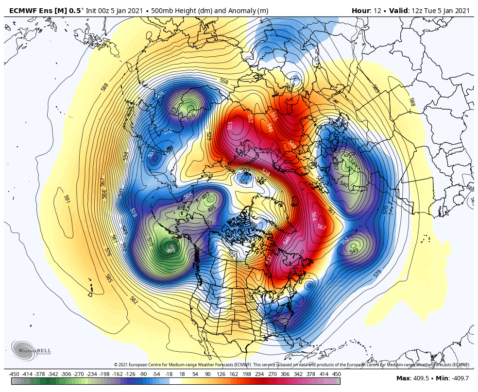
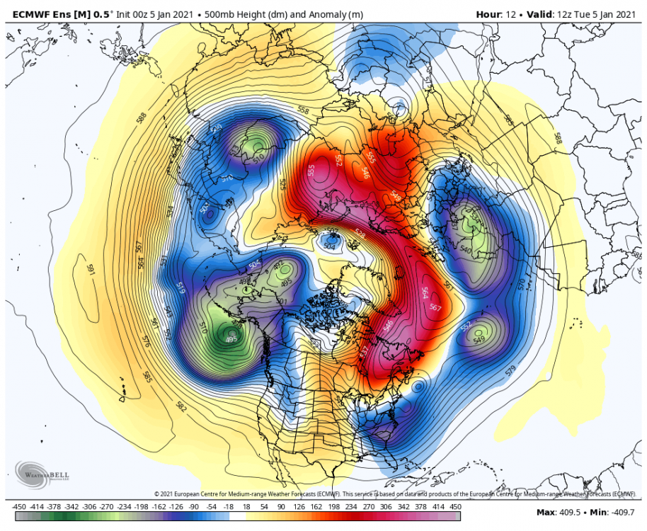
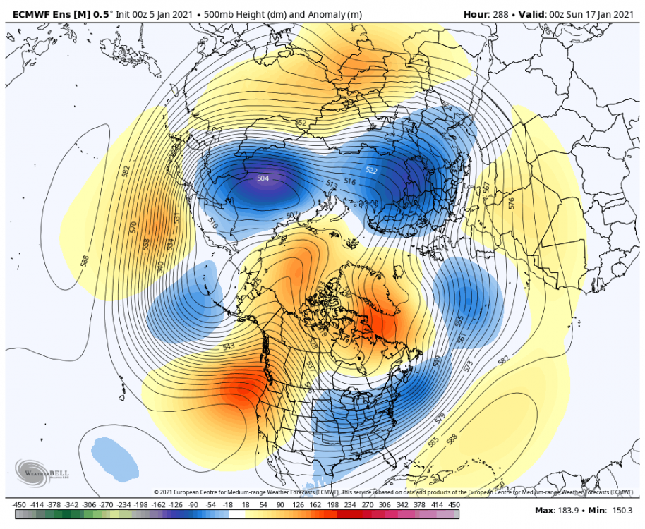
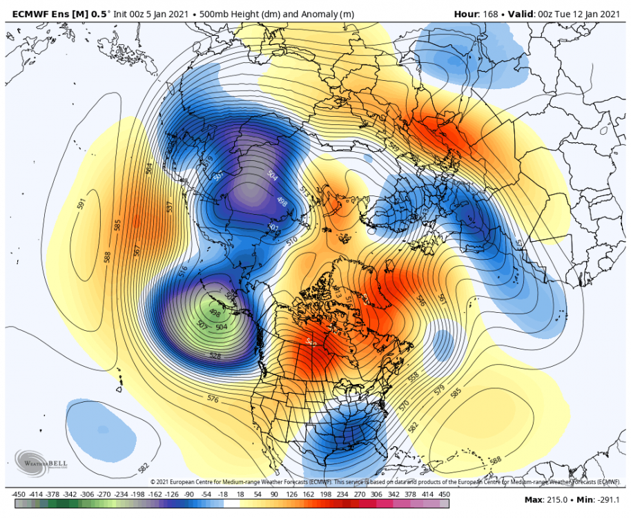
Friday's system is definitely shaping up to get blocked well under us. I thought a couple days ago this may eventually come back up enough to swipe at the DC region or perhaps even into the southern tier LSV. But now it's looking like interior southern VA is as close as it gets. Name of the game whenever you have a significant NAO/AO blocking regime, we're gonna lose some stuff underneath us. This system's coming at the point when teleconnection forecasts are generally at their most negative for the NAO in the forecast period (about a -3 on the WB forecasts). There's also isn't much western ridging to really amplify the system either at this point. The next system being progged out in that D6-7ish timeframe probably has a better shot but hasn't been really consistent. The overnight Euro for instance pretty much didn't even have it. That may end up being south too but I think it's a better chance for at least the Mid-Atlantic folks to get their first system, we'll see. Still looking at the bigger picture here, I said a couple previous pattern posts ago that I was eyeing the second half of Jan more than the first half and I would consider scoring a snow event in the next couple weeks to near mid month a win. And really it has been even if some didn't get snow out of Sunday's system. Take away the dominance of the blocking regime we have in the NAO/AO realm with the current look in the Pac with that +EPO and very low heights in the Gulf of Alaska and we probably have very little chance in what would be a much warmer regime. The blocking is suppressing the storm track and providing just enough marginal cold air (in what really isn't at all a cold pattern) with the Pacific air flooded CONUS to give us a chance with each system the next 6-10 days. I think the system after next has a better shot since it seems we tone down the NAO/AO a little bit and it's in the timeframe where the Pacific/western US side of the equation is starting to look more favorable. Models/ensembles have all been showing a big shift in the Pac, building ridging in the EPO realm up into AK where we have very low heights now while keeping a -NAO/AO. We need to inject some actual Canadian cold into this pattern and that's how it gets done. This is also a better alignment to involve the northern branch better with any potential phasing opportunities. Here was the overnight Euro ensemble for 12z this morning, D7 (near the timeframe of that second event) and D12. Look how much the Pac improves especially between the D7-D12 ones. The GEFS is doing the same general thing as well. Shaping up to be quite wintry after mid month if that comes to fruition. Current: Day 7: Day 12:
-
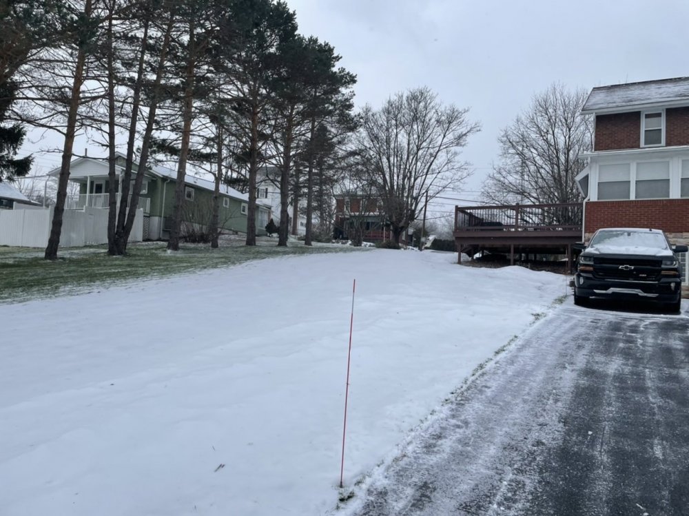
Slotted out here at 1.1", def a really wet snowfall. I'll bet some of that 3-5" the models were cranking out ends up coming to fruition somewhere in between UNV and IPT.
-
Wow I haven't seen flakes this big in a few years. Pouring half dollar snowflakes in this band.
-
Passed the 0.5” mark, moderate to heavy rate.
-
Same here, it didn't take long to start accumulating (on the roads too).
-
Transitioning over to snow now.
-
Mostly sleet falling currently after a bit of a damp start to this. Had a glaze of ice on the car first thing this morning. Now to see if this gets to snow quick enough so it can do something accumulation wise.
-
Still not totally sure what to make of today's system. Looks like two different waves of precipitation. Surface temps have cooled off nicely overnight and most areas near or below freezing. However, temps per mesoanalysis at the 925mb (southern third of the state) and 850mb level (most of the state) still above freezing. This means the initial wave of precip arriving later this morning likely to be a mix, which is the main basis of the advisory for the Sus Valley (for the possibility of a T of ice). The second and probably main wave of precip arrives in the afternoon associated with the upper level low itself. Under this is where we have the cooling at 925 and 850 to support an all snow column. Track of the weak mid level low features seem a tad NW to me, thus I kind of support CTP having the best snows from UNV on to the NE instead of LSV locations like MDT. This could cover more of the central counties depending on how precip develops though. Near term guidance has generally been putting the best QPF from the upper level low from the central counties to NE PA. Dare I say Williamsport appears to be the new snowtown these days haha.
-
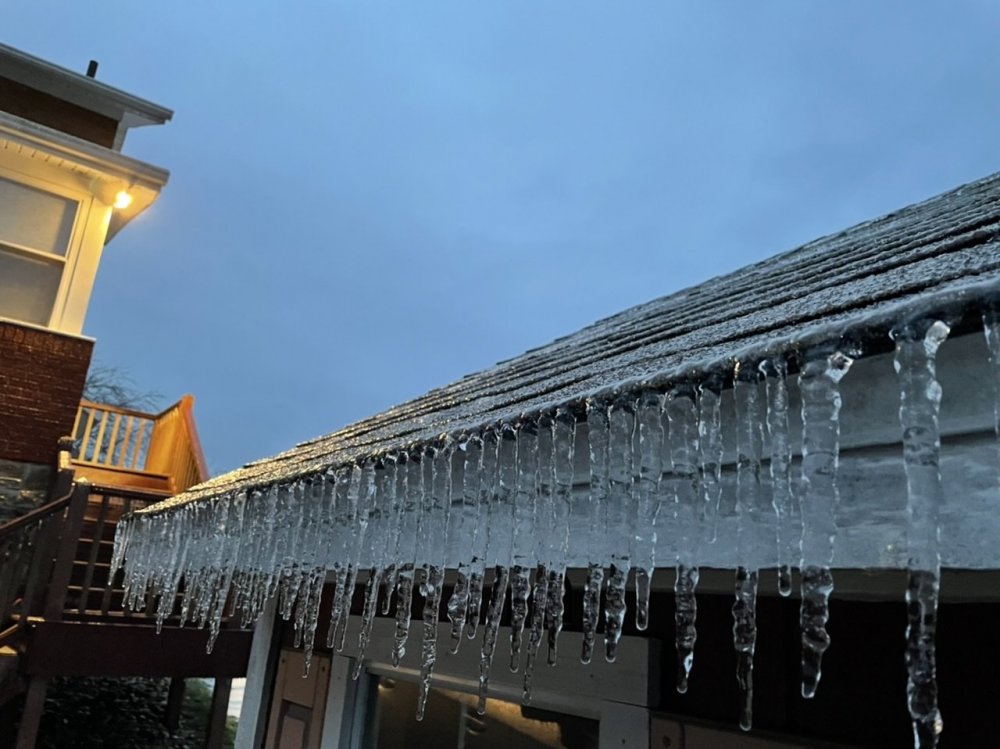
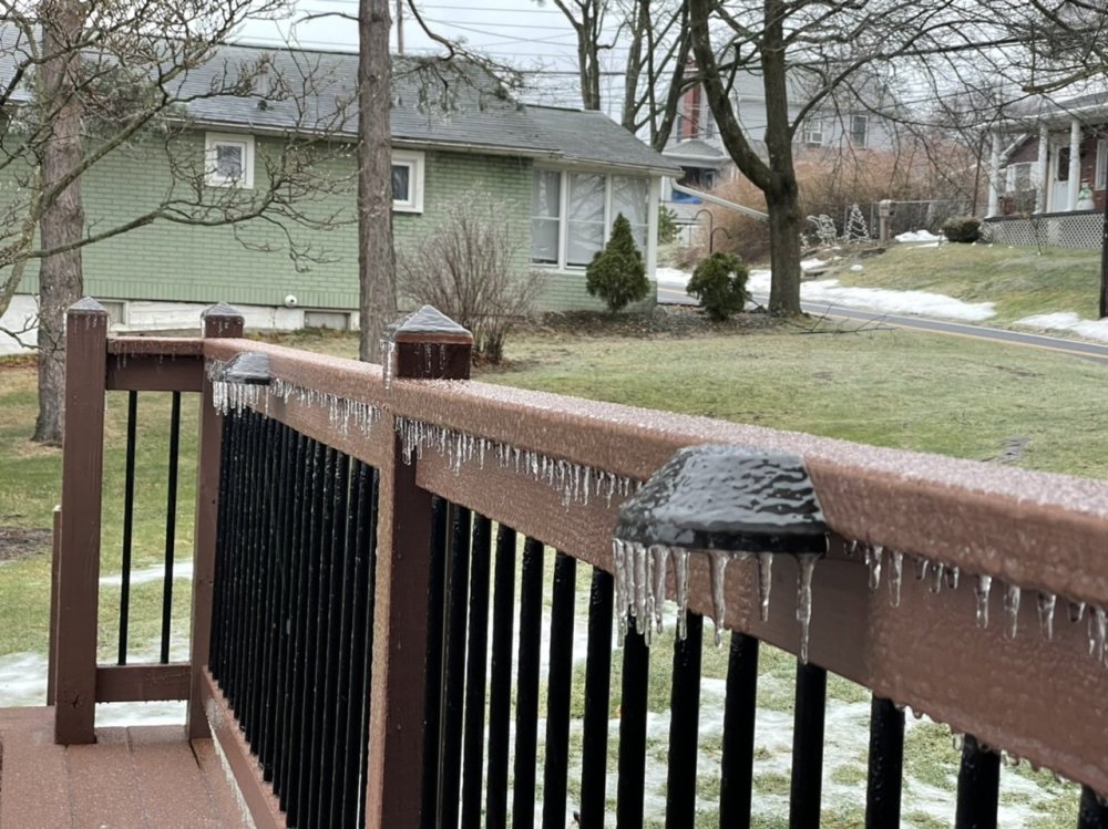
Was able to get a couple general measurements of the ice. Looks like about 0.2" of ice accrual. Temps still hovering in the 33-34ºF range.
-
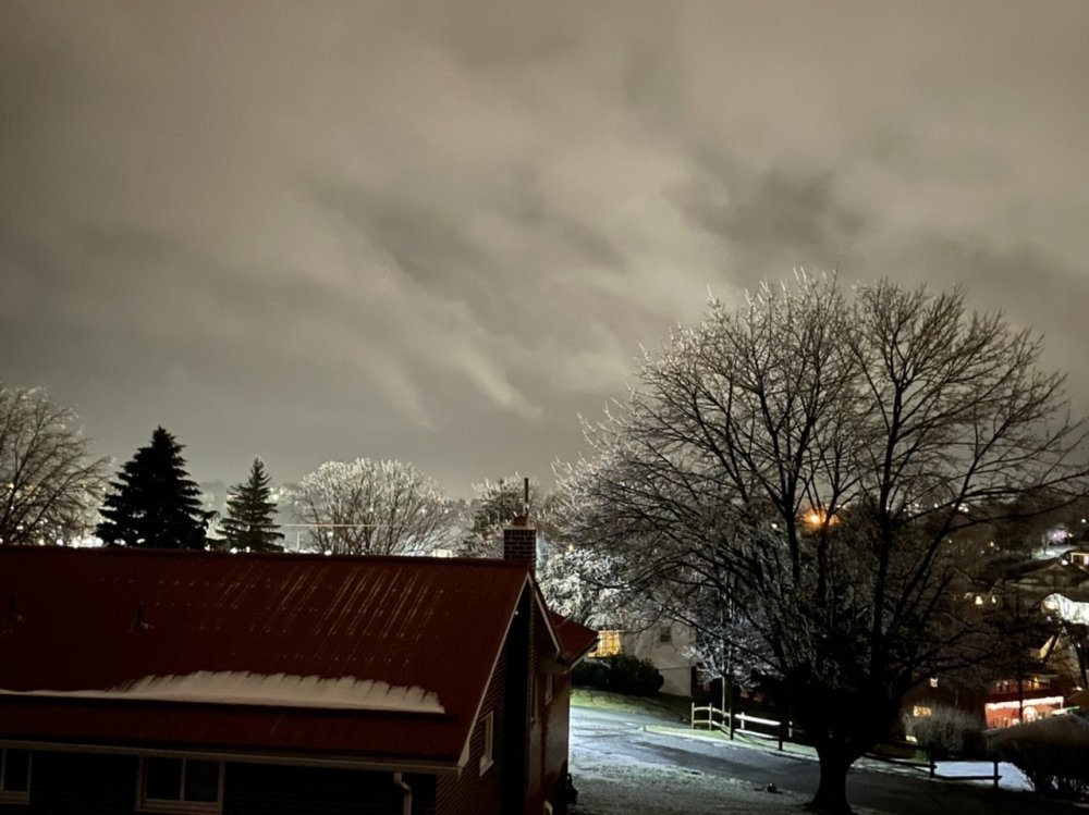
I upgraded to an iPhone 12 Pro a few weeks ago, it has one heck of a camera system. Really excels at the low light stuff, and also showing we’re still in the thick of the icing phase of this system here.
-
Have had some sleet occasionally but all freezing rain currently. Starting to be pretty noticeable on the trees. Have a feeling this is gonna end up more towards a warning level ice event.
-
You only need a T of freezing rain to verify a WWA, which is fairly likely even in H-burg.
-
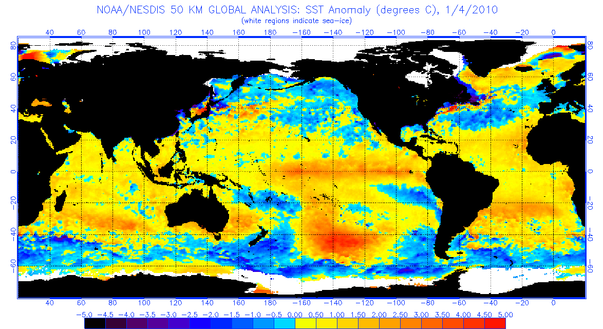
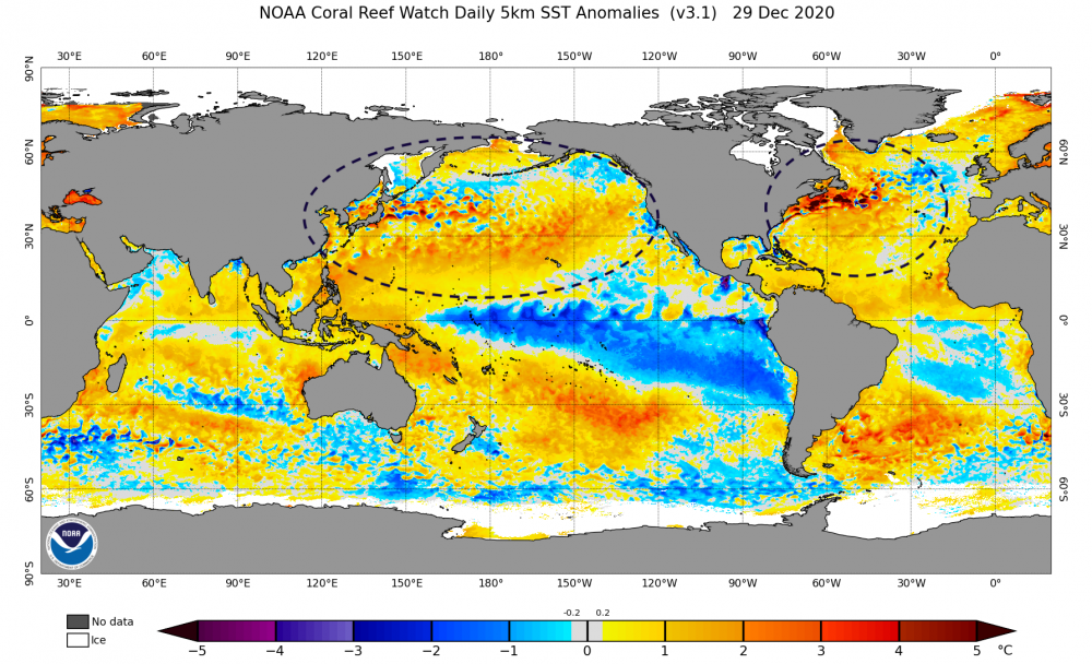
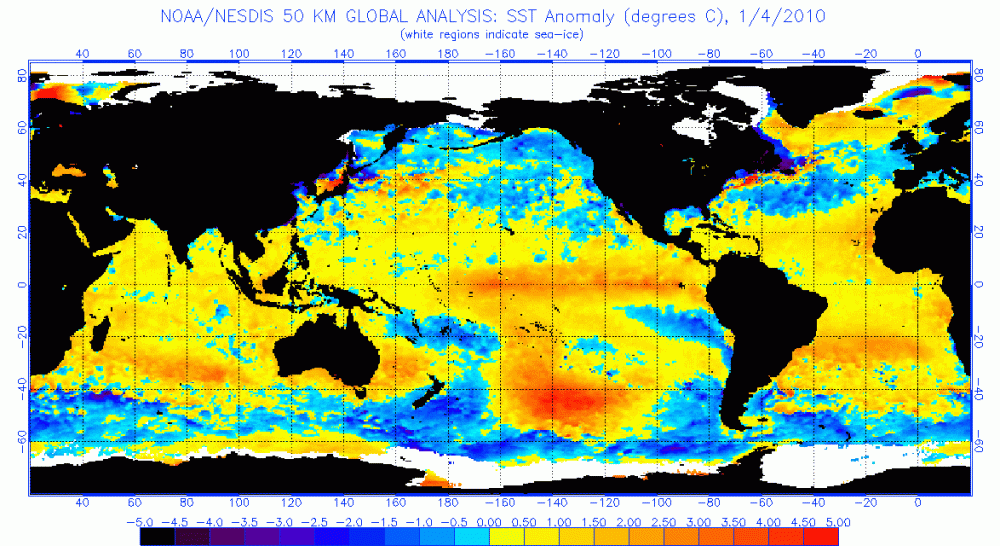
Generally in agreement here. While not completely flipping the EPO, ensembles have been at least neutralizing it some as it's gotten out past next week. It's a key thing to happen, because we do have an issue of source region of cold initially which likely manifests in the coastal later this week probably not getting cold enough at the low levels for much snow in PA (more likely toward interior NY/New England) and probably the next system of note that comes about later next week. But you can see it on the models.. once they build any semblance of higher heights on/just off the west coast, it's enough to get the eastern US right where we want it. With that block over the top, we don't really need a raging -EPO ridge to succeed (though an EPO ridge would be nice). We just need to tone down the Pac jet enough as to not flood the CONUS with Pacific air under this awesome block we have materializing in the NAO/AO realm. I'm pretty confident were going to get there.. it just might be around week 2 of Jan or so where we really start seeing this. The 09/10 comparison is relevant here.. simply because we haven't seen that kind of a strong and stable NAO/AO blocking regime since 09/10 and the early part of the 10/11 winter. What I'm curious to see is where the obvious differences between this winter and that winter take us. Of course the big difference is we're working a solid La Nina vs 09/10's solid Nino. The other thing is the SST anomalies in the north Pacific. I was going to post about this earlier in the month, but then the big snowstorm showed up and that was the big topic. But pretty much when comparing past Nina's of the last 25 years+, you won't find one with the + anomalies in the N Pacific that this one has. Most of them are quite cold there. The most recent Nina in 2017-18 is about the closest comparison but still had more colder water. My big worry initially when seeing anomalies like this going into the winter was the assumption of not much help from the NAO/AO and seeing hostile teleconnections from the Pac side materialize. One could see the potential torch in the making. The blocking is a game changer, and now suddenly one can see the potential from an active pattern and suppressed storm track from the blocking. Back to 09-10, here's what that looked like at this point. The Atlantic and the Gulf of Mexico got even colder with respect to average when February rolled around. But yea, huge difference in SST makeup. I tend to suspect that the much warmer N Atlantic this year might help keep a tighter storm track to the coast and you might not see quite the suppression you saw in the 09-10 winter, which was certainly less memorable in New England.. or Williamsport for that matter if we're talking about this particular subforum haha. There were some folks in here that got next to nothing from Feb 5-6, 2010. It's going to be interesting to see how all this shakes out going through January. If we hang onto the -NAO/AO regime we're definitely going to have chances.
-
Currently getting a brief period of steady snow early this morning, ahead of what's looking like a really icy New Year's Day later on tomorrow around here.
-
Models have been pretty solid on this threat for the last couple days once they started sticking that high pressure to our north. The high itself has gotten stronger on the progs too as we've gotten closer. It's a pretty good setup for a straight-up ice event, especially in the interior counties. Mid-levels are easily shot already lacking much cold aloft and the system cutting well west. The fairly strong high solidly anchors the sufficient cold we do have in the low levels. The cutting low pressure is weakening as if lifts northward, so it may draw out the ice longer in the central counties. I'd say this is probably an area-wide advisory event in the making, and potentially a WSW worthy one in interior central/north central PA, dependent on QPF and if sleet is a more predominant p-type during the first part of the event. Canadian joined the Euro today having that kicker system right behind this potential ice event. Both were very marginal in their cold air availability for snow (Canadian somewhat better).
-
With the EPO/WPO forecast to go way positive during at least the opening week of January, I don't think we're going to live up to this high latitude blocking pattern's potential initially. An active Pac jet (+EPO/WPO) is going to ensure trouble in getting access to any decent cold into our part of the CONUS in a pattern that had already been kind of lacking it since our big snow event with the exception of the couple days in the aftermath of the X-mas eve system. If we break this down, or better yet get a -EPO ridge to build.. then you force a better alignment from a colder source region (such as NW Canada). That coupled with the high latitude blocking in the NAO/AO realm.. ideally shifting westward a bit in time would provide a much colder pattern and a suppressed storm track that is less apt to try to cut in the east. We're just not fully there yet. Personally, I'm eyeing up the second half of Jan more than the first half and considering anything we do score in the next two weeks a bit of a bonus. We have a pretty decent strat-warm event seemingly in the cards in the first part of January and it usually takes a couple weeks to start realizing whatever the results are in terms of cold air outbreaks in the mid latitudes. The -NAO/AO regime is looking like more of an overall theme rather than just a passing fad and pretty much couldn't get a more opposite look from what was just getting warmed up this time last winter up in that realm. This significant of a NAO/AO blocking regime was not something I was expecting to see out of this winter. Barring a major change up there or the MJO suddenly busting out into a strong 4-5-6 pulse (currently not looking very likely attm), i'm fairly confident in saying that we're going to eventually see a really good period of winter weather set up at some point.
-
Might not want to sleep on this New Year's event potentially becoming some kind of a wintry mix event in C-PA. Models have been toying around with sending the first piece up into the lakes, pulling a front across and holding back a good bit of energy for another wave to roll up. While the southern wave builds, models have been getting some high pressure in place over us/just to our north. Positioning of the mid-level features (850 & 700 lows well west) definitely aren't looking ideal for an extended snow event, but get that high over us for at least a bit and we probably are going to be dealing with some kind of messy mix event on at least the front end.
-
Western Pa / Pittsburgh area Winter Discussion ❄️☃️
MAG5035 replied to north pgh's topic in Upstate New York/Pennsylvania
You guys definitely killed it this month over there in western PA. If we can speed up by about 12hrs what appears to be a really similar situation to yesterday shaping up on New Year's Eve/Day, maybe there can be some snow added to December's total haha. -
Merry Christmas everyone, it did somehow manage to be a white one here.
-
Straight-up moderate to heavy wind driven sleet at the moment, maybe a couple flakes. Starting to accumulate and deck's starting to freeze.
-
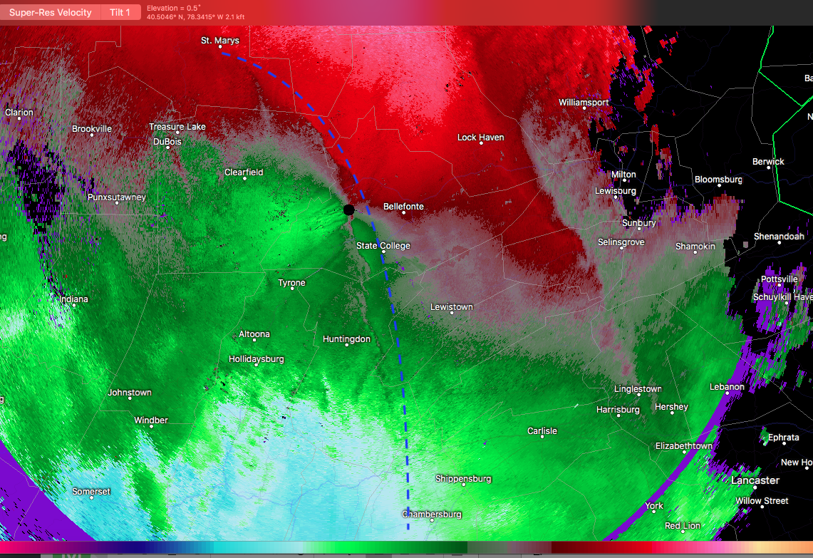
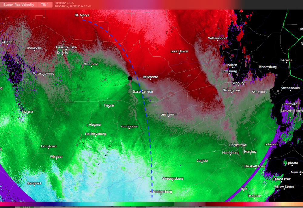
There's two boundaries that are noticeable on velocity images. One associated with the thin line of intense rainfall in the warm sector (impacting H-burg and LSV) and a secondary boundary further west, which i've noted with the blue dash.. that is the actual cold front boundary.
-
I still don't think much makes it over to the Sus Valley but we'll have to see how much precip hangs on behind the cold front. Short range guidance like the HRRR and NAM haven't had much lingering by the time it's cold enough. There could perhaps be enough to witness a changeover period and perhaps a coating in spots in the region east of I-99 over to the Sus Valley. The big thing to watch first thing tomorrow morning is for untreated stuff to freeze up.
-
Changeover is starting to occur. Sleet, rain, maybe some wet flakes. Temp back to 35ºF.