MAG5035
-
Posts
6,078 -
Joined
-
Last visited
Content Type
Profiles
Blogs
Forums
American Weather
Media Demo
Store
Gallery
Everything posted by MAG5035
-
Down under 4ºF already here.
-
Well at any rate, looks like the Euro has the storm today haha. The Canadian did too, but it was slower by about a day or so and it was just approaching our region by it’s hour 240.
-
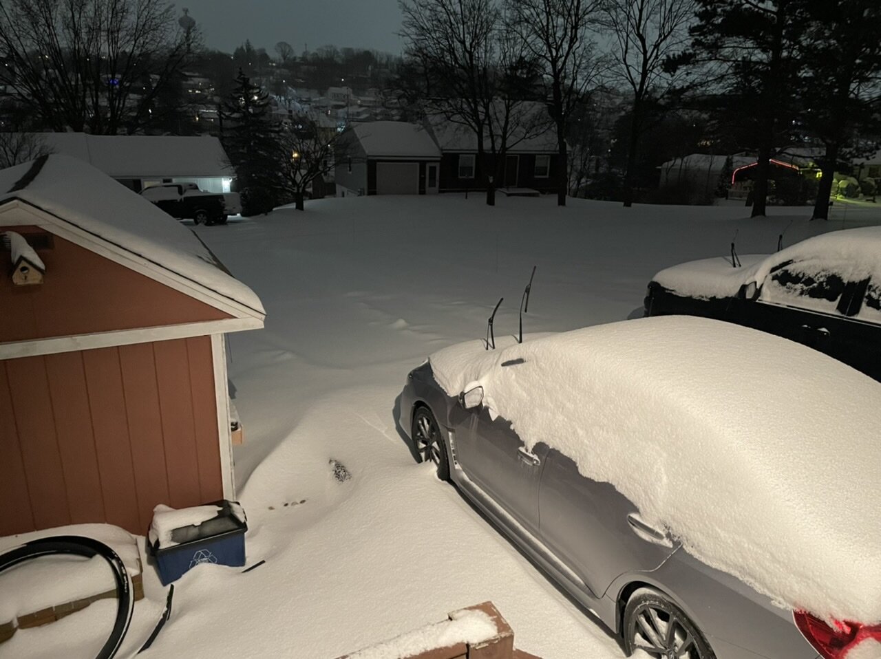
Some obs: Currently 12ºF with 2ºF dewpoint. Temps fell below freezing overnight last night around 330am and were in the low 20s most of the day. Snowpack is a pretty uniform 3-4” hard pack around the yard. Some deeper spots where it drifted.
-
I didn’t really see anything that jumped out to me on the 18z GEFS guidance regarding that event. The storm signal is there, but it’s pretty scattershot on low positions and they’re mostly well offshore. That’s to be expected at that range but it wasn’t anything crazy in terms of a major storm signal. Surely the overall pattern for a bigger event is pretty favorable, but this is difficult pattern to assess individual storm potential out past 5 days or so. Our Sunday/Mon event at the beginning of this week wasn’t seen much at all consistently until it was within that timeframe, for example. There’s a lot of different shortwaves running a very progressive pattern and we need to line things up to pop a bigger storm… and models simply aren’t going to see that consistently even in the medium range. I think our next potential widespread event looks to be the Tuesday-ish one, which will depend on a closed 500mb ejecting out of the SW and how that interacts with the dominant northern stream regime. Probably not a major event but it could be a light to moderate one if this heads the way of what the GFS has been showing. GEFS/Euro EPS shows it to some degree too. Something to monitor. I know some folks keep asking about where the clippers have been, well this is a pattern that’s good for producing them. So I wouldn’t be surprised if we score one or two of those during our cold 8-14 day stint. There is a weak clipper system progged before that Tuesday potential around Sunday eve, but that probably only has minor snowfall focused in the western half of the state.
-
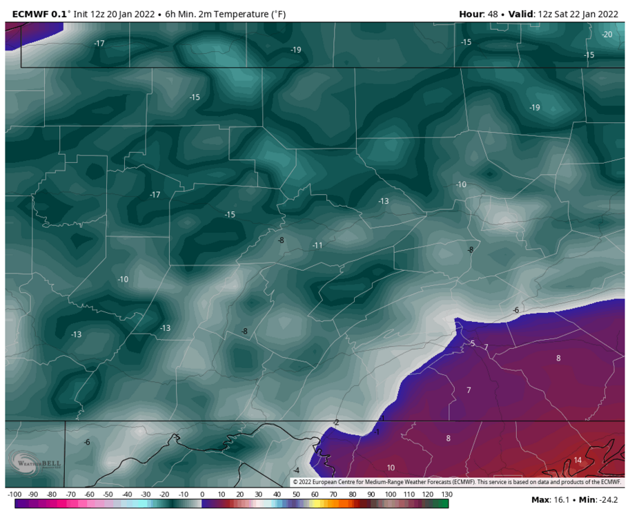
Friday night has the potential to be a really cold morning not seen the last couple winters. Looking at models today everything is cold, but Euro looks like it’s envisioning an ideal radiational cooling night. I saw this shared in the Upstate NY thread, but interesting take from BGM Seeing the whole area under PWAT’s of 3-5 HUNDREDTHS of an inch is pretty nuts. For reference that’s about 10-15% of the average PWAT value this time of the year, which is already about the coldest/driest time of the year climo wise. When the atmosphere is that dry, it presents the opportunity that if winds calm and the surface decouples, temps at least in local favored rad cooling spots could nosedive. So I don’t know if the Euro’s widespread significantly below zero temps comes the whole way to fruition but I can easily see some of the favorite rad cooling spots in the central counties bottom out at -10 to -15. And up north I wouldn’t be surprised at a -20. Even spots in the Lower Sus Valley where most of the pack was lost may undercut guidance and get near 0 or a couple degrees below. But we’ll see if we can get the clear skies and calm winds to maximize that potential.

-
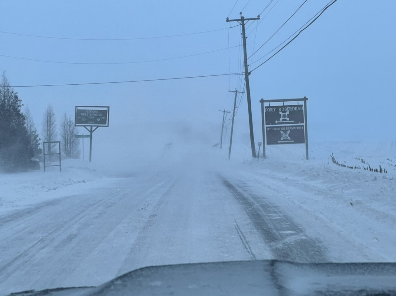
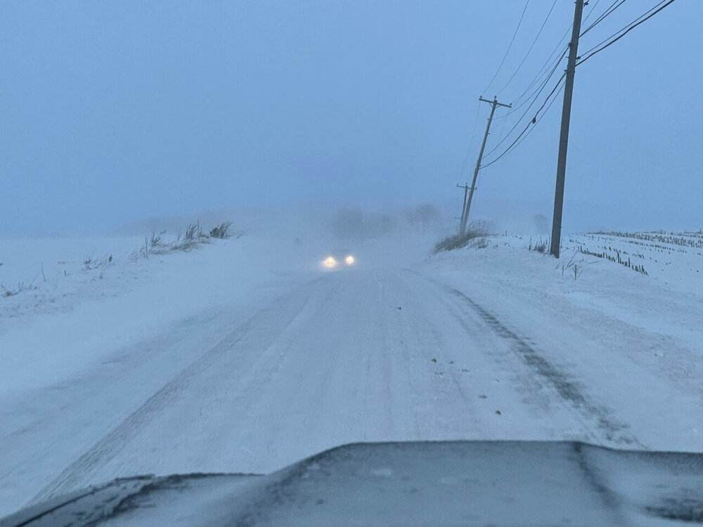
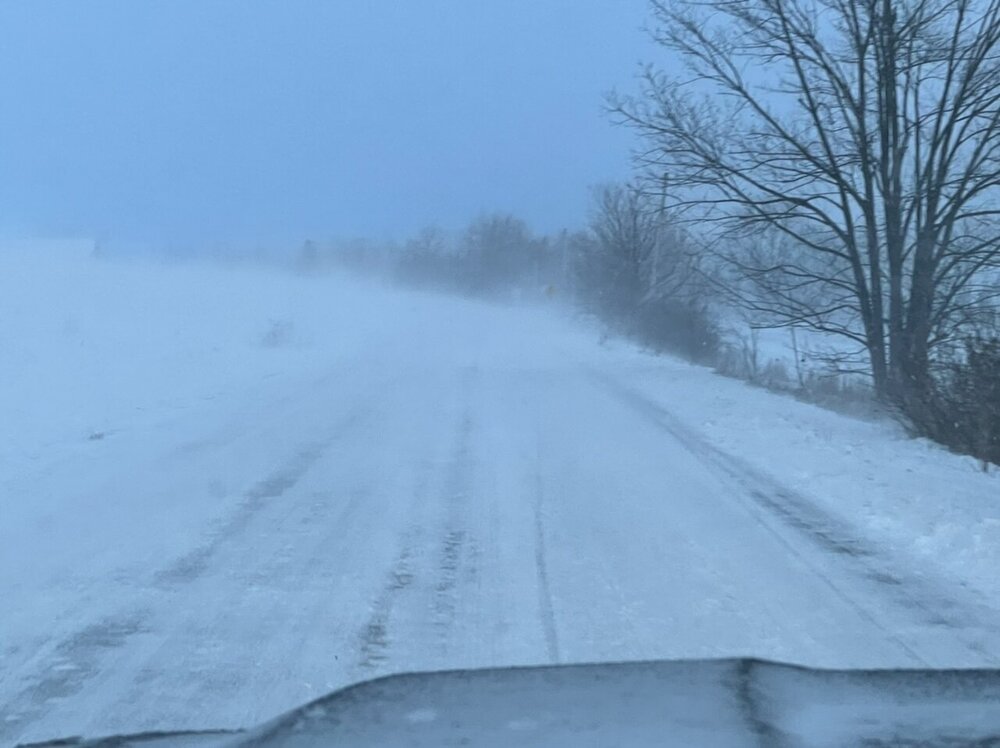
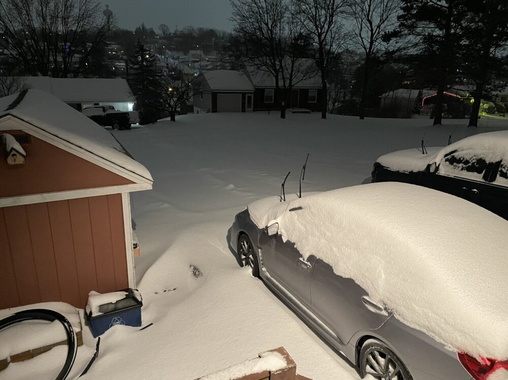
This was outside of town out in the valley before dark. Lots of blowing and drifting. Most secondary roads/streets are still in pretty rough shape.

-
The mean western ridge axis being approx near the West Coast certainly gives this a chance to get us in the thick of things if we can phase shortwaves. Euro does this most successfully while the GFS southern stream 500mb wave digs down more in the SW/slows down and missed interacting with the northern shortwave.
-
Snowing and blowing as I’m back into some of the backend stuff. Probably been roughly an inch since this morning though it’s been blowing around so I’ll have to see if I can get a decent measurement. I picked a really good time to have an actual weather station. Some notables.. as I mentioned my pressure bottomed out near 981mb about 5am or so. Temps did edge above freezing from about 230-430am but only made it as high as 32.9ºF. High gust so far is 32mph, but this wind is just getting going.
-
I think the more inside track of the low was what allowed the NAM to “nail” the warm surge since the low pressure ended up going right over my head. I bottomed out at 981mb this morning a few hours ago, probably the lowest MSLP around here since Hurricane Sandy. The low coming in this far really didn’t become evident on guidance until the near term yesterday since the consensus had generally been curling the rapidly deepening low into eastern PA, not dead center in the state. That was enough of a difference to not only allow a changeover to rain but also get some of the heavier rain and wind tapped down with the occluded frontal passage before the dry slot into the Sus Valley. NAM never really saw the half decent front end snows in the LSV until it was already happening. All models weren’t cold enough at the beginning of the storm either from the Laurels eastward in the state.
-
There some regeneration of precip on radar down this way and it’s straight light freezing rain, so now the pack is crusted over already.
-
Yea I think you guys will still salvage some more snow even though the best deform ended up NW of the city. It should still swing back through some as the storm lifts up out of central PA overnight and probably rebuild some. Definitely been a fascinating storm to watch.
-
Temp is up to 28ºF now, pressure is DOWN to 987mb. Living the dry slot life currently.
-
Also, here was a snow pic right at the sleet transition a bit ago. There actually had been some half decent drifting.
-
CTP did hoist wind products (advisory for 15-25 gusts to 50mph) for good portion of the area in the wake of the system tomorrow and incorporated wind impact into the ongoing warning in the Laurel’s. Also didn’t completely rule out needing a blizzard warning there tomorrow either. Per short term portion of the discussion:
-
That line could be the mechanism I mentioned yesterday that would be needed to tap the high low level winds and provide some semblance of the high surface wind gusts that models like the GFS have been showing a lot leading up to this. Will have to keep an eye on it the next couple hours to see what sneaks up into the LSV. Specifically this portion.
-
Ping Ping. Going to be clearing boards at 5.2” so far. Sleet with 21ºF, winds NNE 7 G14, and pressure crashing now down under 996mb.
-
Starting to flirt with the mixing zone on the CC product. Still all snow for now but will see when the next patch of brighter echoes get here shortly. HRRR has been pretty consistent on an approx 11pm transition to sleet here so that’s probably looking pretty good. Also starting to get near the dry slot as well, though I expect some rebuilding of echoes to a degree.
-
Gorgeous storm
-
Right around the 4” mark now, with moderate to heavy continuing. Temp has been rising but still in the teens (19.4ºF), Pressure down to 1002mb.
-
One thing I’m noticing on the meso surface obs is that most ASOS stations have winds of a NE component to them in central/eastern PA, and even all the way down in all of Sterling’s CWA. So that’s likely to at least hold some surface cold for awhile. Sleet will probably be a more predominant mix type for a while after transistion as it will take some time to modify 925mb.
-
M 2.4”, Heavy snow. Temp has torched to 14.2ºF lol. Wind NNE 5 G 8, Pressure 1007mb
-
I was past the first inch when I measured about 20min ago. Heavy snow, 13.1°F(!!)/ 10.8°F This is the coldest synoptic event I’ve seen in years
-
Snow has begun here in the last 15-20min with a dusting. 16.5ºF/2.8ºF
-
Yea I”m not sure, could be a difference in whatever algorithms they use to generate the p-type too. Because WeatherBell’s winter conditional QPF are all separated now, there isn’t anything lumped with snow accumulation.
-
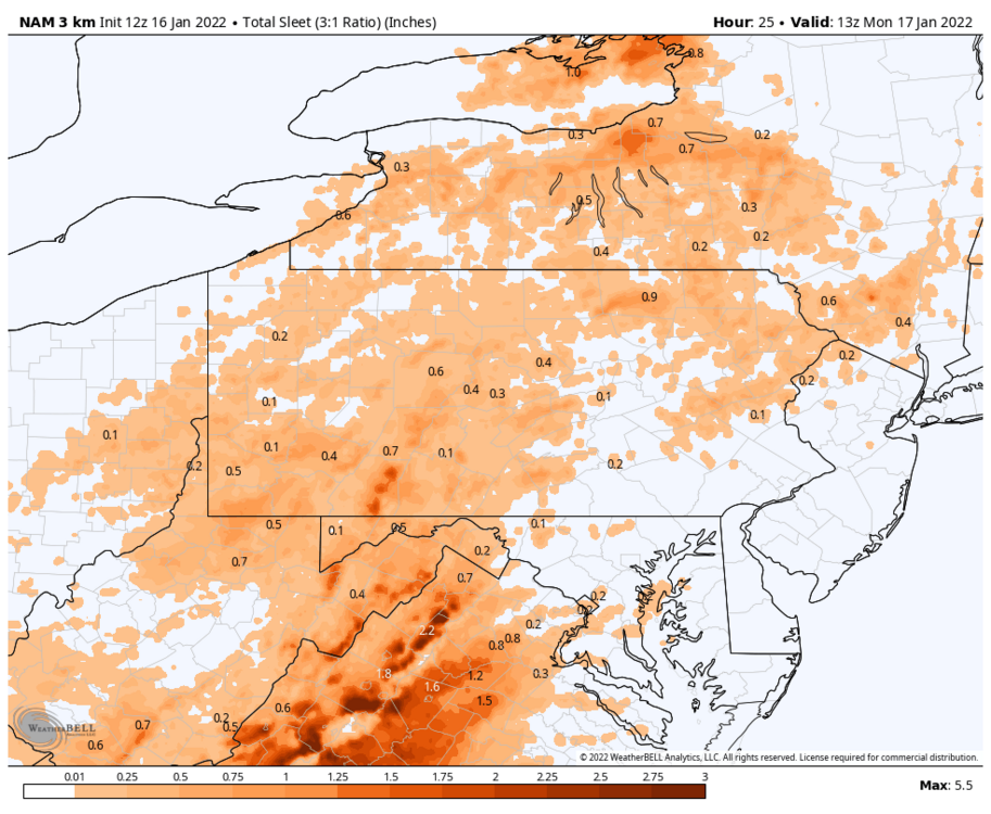
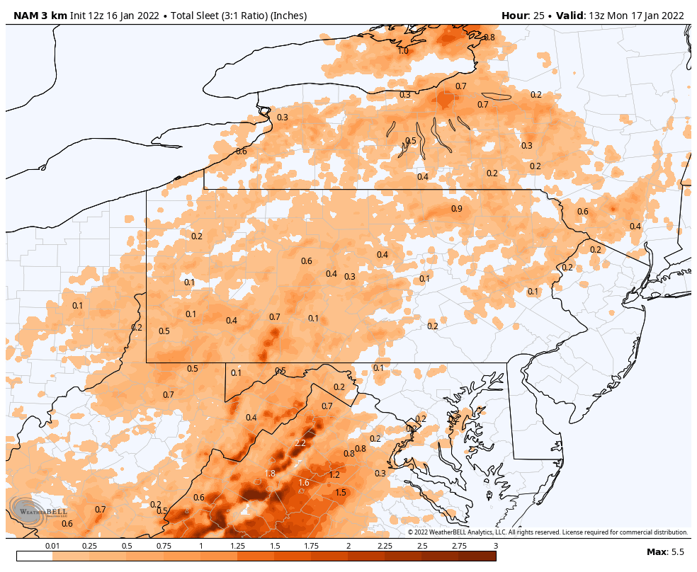
Yea being 7 years old that’s right when those WB maps/products first came out. Early on they were known to be really exaggerated on the edges where there was mix like the Tropical Tidbits maps are. TT literally says on their accumulation maps total snow/sleet. But WB changed their algorithms at some point and are a good bit better and I consider it fairly reliable. Gotta remember type of models make a difference too. A global model like the Euro/GFS aren’t going to see the finer details and sharpness with these transition areas. But any rate on Weatherbell all p-types are separated now. if I want a sleet map, I can pull one up. They calculate accum for sleet on a 3:1 ratio for most of the models. Euro has been colder thermally and has had a more of a straight snow-rain transition with little in between in PA. Here’s the 3k NAM’s sleet map.