MAG5035
-
Posts
5,882 -
Joined
-
Last visited
Content Type
Profiles
Blogs
Forums
American Weather
Media Demo
Store
Gallery
Everything posted by MAG5035
-
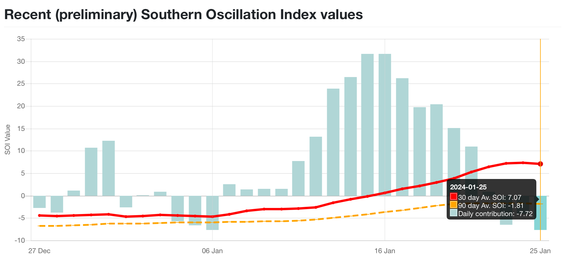
My general take on this Sunday event is it favors elevational areas like the Laurel’s,North Central, and Poconos for the best chance of accumulating snows. I like the progged track and the ridge axis out west plus high heights to our north should ensure that track goes to the coast underneath PA. It’s just another case of this winter having a good storm track and no actual cold to work with. A more wintry solution likely hinges on dynamics helping cool the column as the coastal low winds up. I think the Sus Valley’s best chance comes from if there’s a couple meso bands as the coastal starts pulling away, something the Euro looked like it was toying around with despite being notably drier overall than the GFS with this system. Either way, progged surface and low level column temps are super marginal even where it’s favored to snow. I think the mid-week period next week might actually be a somewhat better opportunity. 12z GFS dropped a beautifully tracked clipper and other guidance has been showing some kind of energy that could bring a swath of precip where there’d be colder temps aloft in the wake of Sunday’s coastal to support a snow column. Pattern supports such a thing, we have a big western ridge. Clippers have been non-existent the last few years because we haven’t had much +PNA the last few years. So we’ll see. Can’t progress the ridge axis east too fast either because that would push the track of the prospective clipper too far NE for us to really get into it. 12z Euro has the clipper energy but went wild card also sending a potent shortwave straight from northern Nunavut down the east shore of Hudson Bay to phase in a monster trough and cut-off low in the NE US. An evolution that isn’t even in the ballpark of other guidance today. Barring the Euro’s pretty wild D7-10 evolution actually coming to fruition, we look to maintain a mostly average to above average temp regime likely through the first week of Feb. Eventual return to any sustained cold is going to in part depend on the MJO. GEFS mires the MJO in 6, Euro EPS mires it in 7. None of the extended guidance take it into 8 until about mid-month or so. Having it in 7 would at least be better than 6. Downturn of the SOI (daily negatives the last few days) may lend support to that index maybe going for at least 7 but we’ll see if that sustains and we get more sustained negative values that would indicate a switch that would favor the 8-1-2 phases. SOI is basically a comparison of pressure anomalies between Darwin, Australia and Tahiti. Positive SOI values indicate lower than normal pressures in Darwin (associated with convection that typically drives phase 4-5-6 MJO) There was a period from about the 10th to 21st of large positives in that index (lots of Indo-Pacific convection) which preceded the current run of phase 4-5-6 we’re in now. The running 30 day average of that index is at +7.. sustained +8 or more would technically indicate La Niña conditions via that index. Very rare to unheard of with a strong Nino going on in terms of SST’s (ONI value this week is +1.7ºC). Sustained -8 or less would indicate El-nino and even the 90 day average is in the ENSO neutral category. Big time disconnect between the SST El-nino and what the atmosphere has been doing. Certainly going to be an interesting thing to review when we tally whatever happens the rest of the winter. Moving onward, the recent reversal of the NAO/AO to positive has also helped drive the warm-up, which like in December is going to be most focused in terms of + anomalies in the northern US and Canada. We do see these values along with the EPO head back to negative getting towards week 2 in the ensembles to go along with a PNA that will remain positive. That should help source region for us, though Canada may still be quite warm (vs average). So I think we’ll get a pattern that will continue to give us chances while we’re currently in that few week period at the bottom of the curve climo-wise, but sustained below average cold doesn’t seem likely the next 1-2 weeks.

-
Did finally struggle bus past 2” here (2.1”). Very light steady snow and 26ºF. Have to see if some of these meso modeled streamers set up around here later on this evening when the reinforcing cold starts settling in on NW flow. Most roads look decent. Yea, solar is a factor but it’s still pretty weak. Either way, height of the day plus light rates makes it easy for road crews to handle (plus a boat load of treatment already on the road from a wintry week).
-
Light snow and 24ºF. Reached 1.8”, which is the amount I got for the Tuesday event.. so suppose I’ll exceed that one. Rates have been light all morning though, I measured 0.8” at like 6 this morning.
-
Moderate rates and 23ºF. Approaching an inch.
-
Harrisburg is much farther from the State College radar than here. The further away from the radar the higher the radar beam is. What’s showing over Harrisburg is about 7,000 feet overhead vs here 50 miles closer to the radar where the beam height is about 2,000 feet. It’s seeing what’s still virga over the Harrisburg area. Snow should be beginning soon over there, likely within the next hour or so.
-
Light snow has started here, 25/20ºF
-
Actually has cracked above freezing here at 32.7ºF, with a bit of a southerly breeze. The dewpoint however is all the way down to 1.6ºF. Like I mentioned a few posts ago, the airmass is very dry today.. so all the virga floating around is likely to take a good while to reach the ground. I don’t expect much until the main show gets here in the late overnight hours.
-
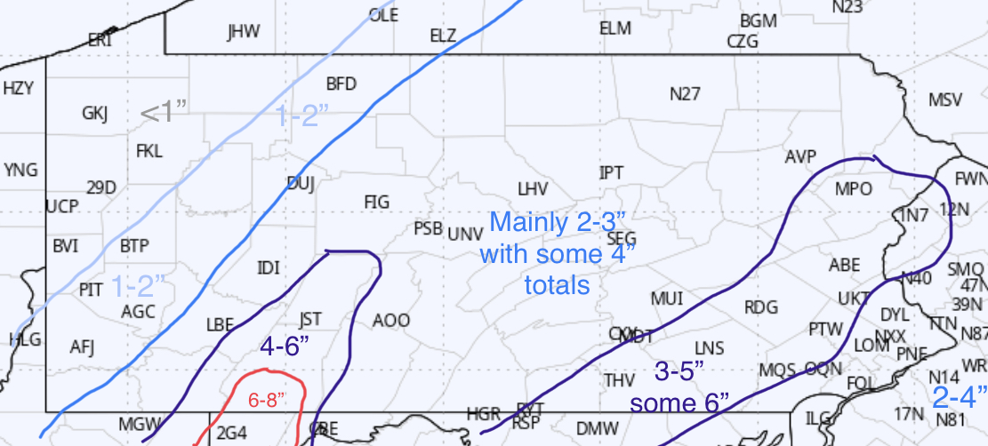
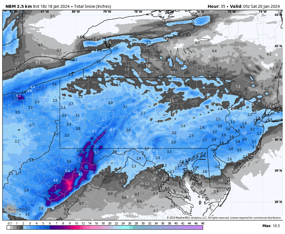
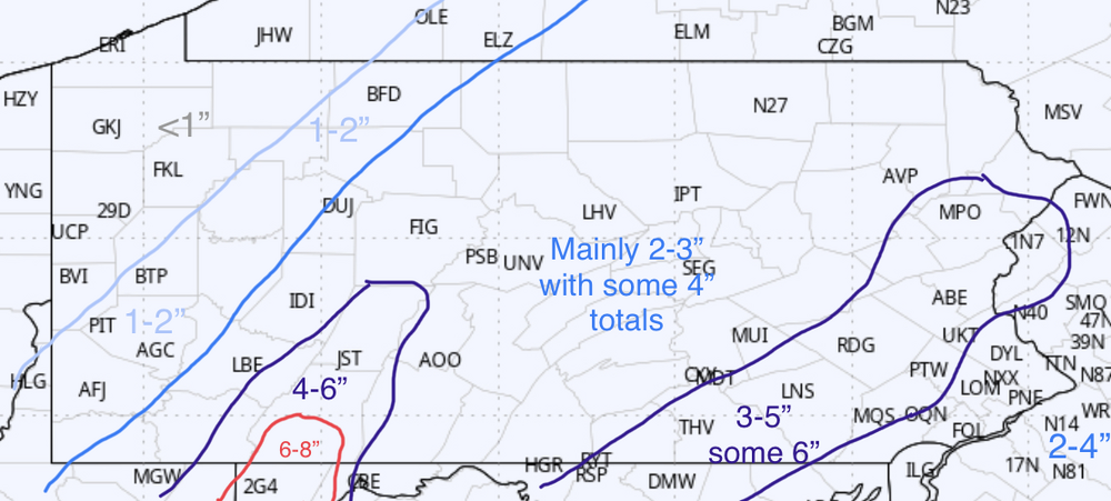
Might as well add some maps to the map collection in here. Here’s the 12z HREF and the 18z NBM HREF is pretty bullish on somewhat higher totals statewide. Here’s the NBM, and a note about it. This isn’t a straight 10:1 OR a Kuchera map. It applies ratios through its other modeled data, which is probably more accurate. So it has Harrisburg for example at 3.0” and 0.21” QPF (about 14:1). NBM is notably drier northern tier and NE quarter of PA. What do I think? I may draw up a map at some point this evening but right now I basically think that this a statewide 2-4” event with 4-6” (some >6” totals) in the Laurels. There exists the chance that we could have a stripe across central or southern PA that may be a more widespread 4-5” area too like what the HREF shows.
-
We’ve had warm air advection ahead of our next system that started overnight last night and the airmass is really dry today, with dewpoints in the single digits to low teens statewide. Some stations in the Laurel’s actually have below zero dews right now, like JST at -2.
-
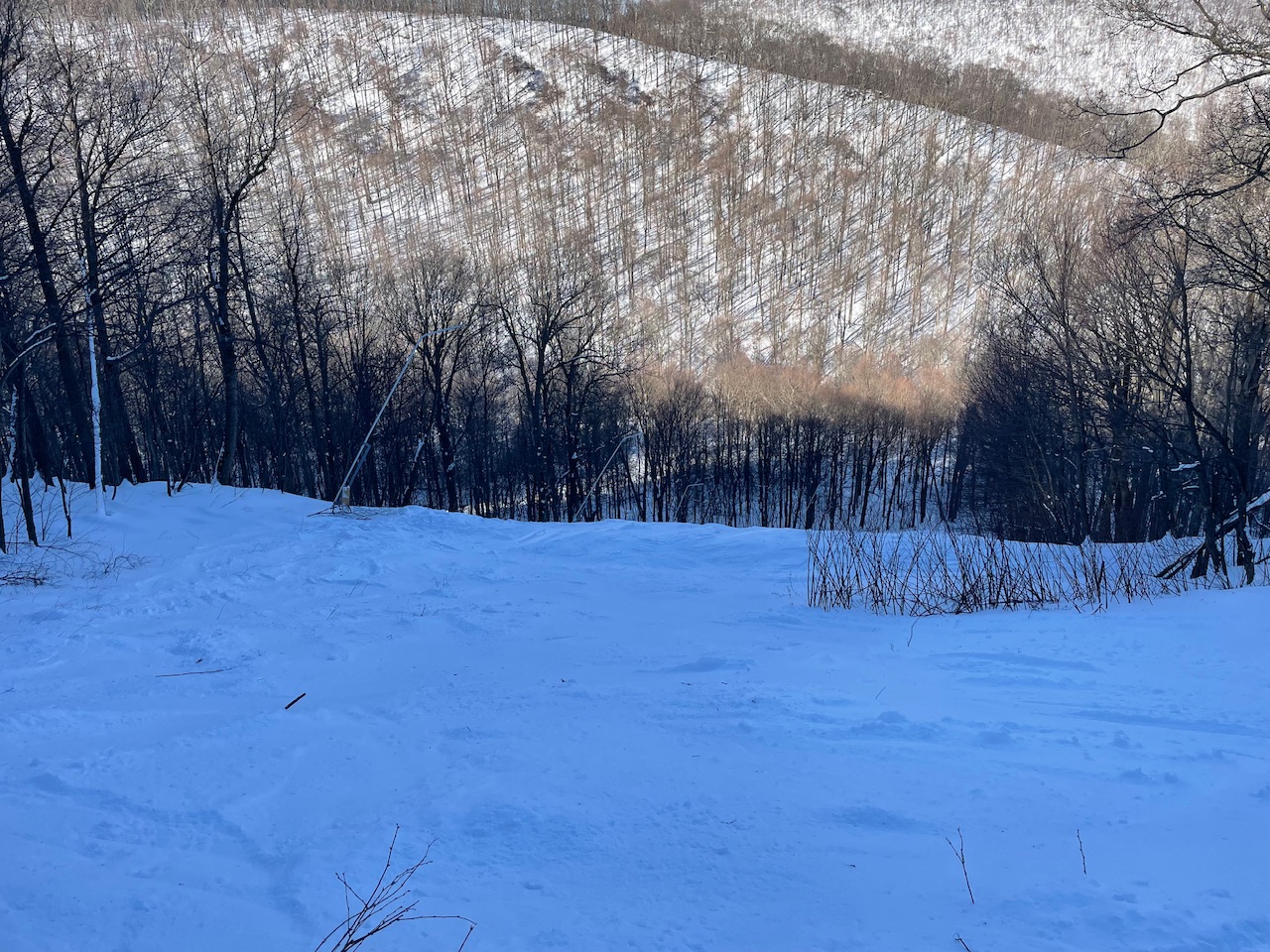
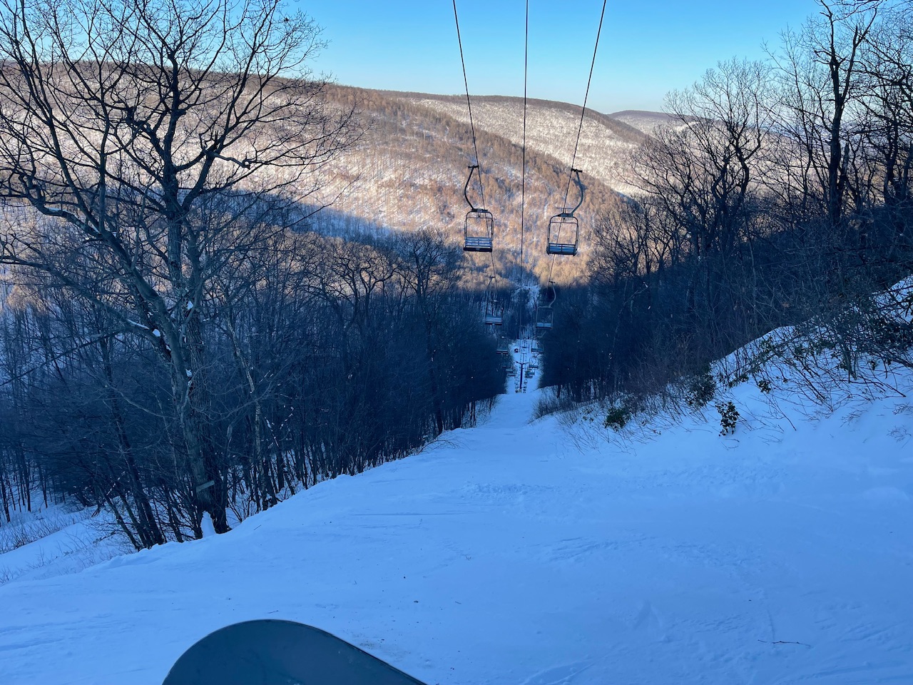
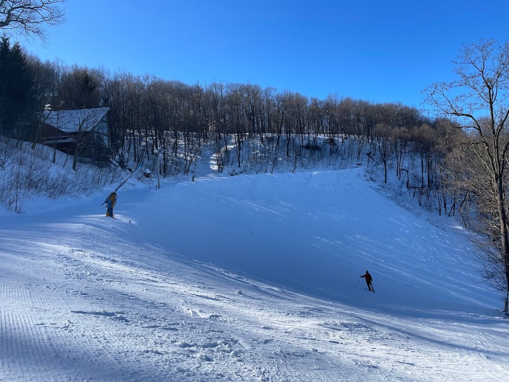
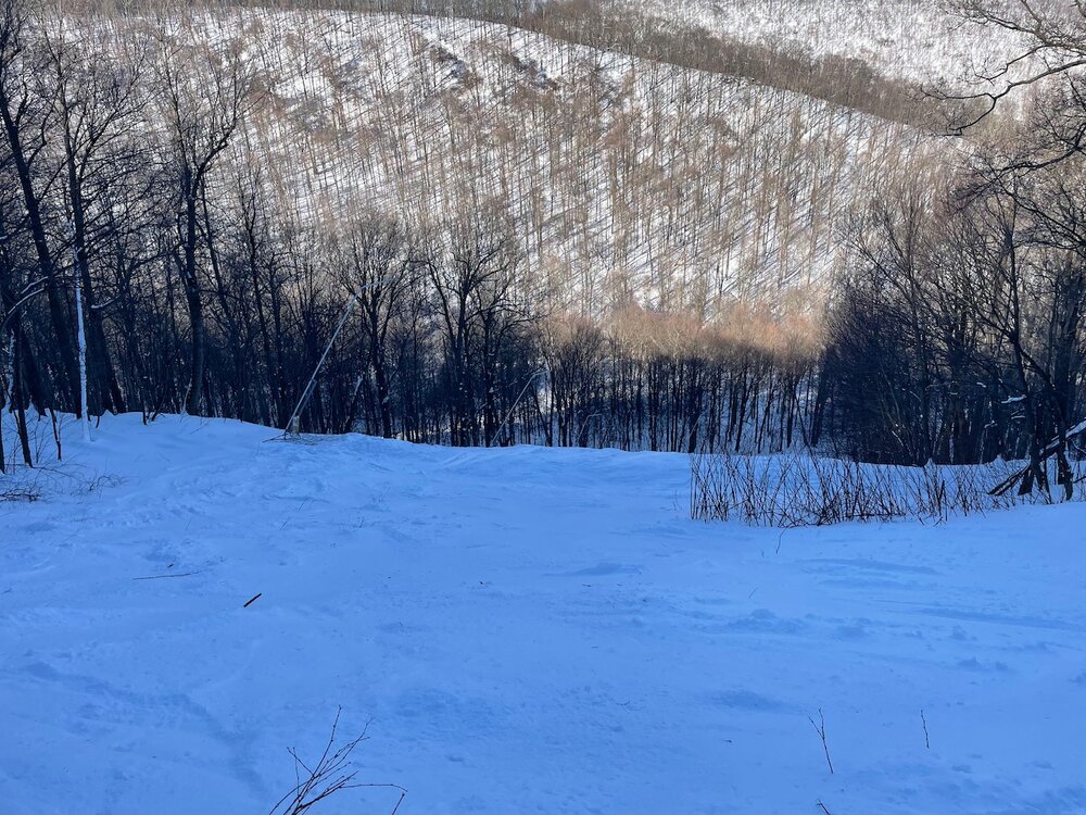
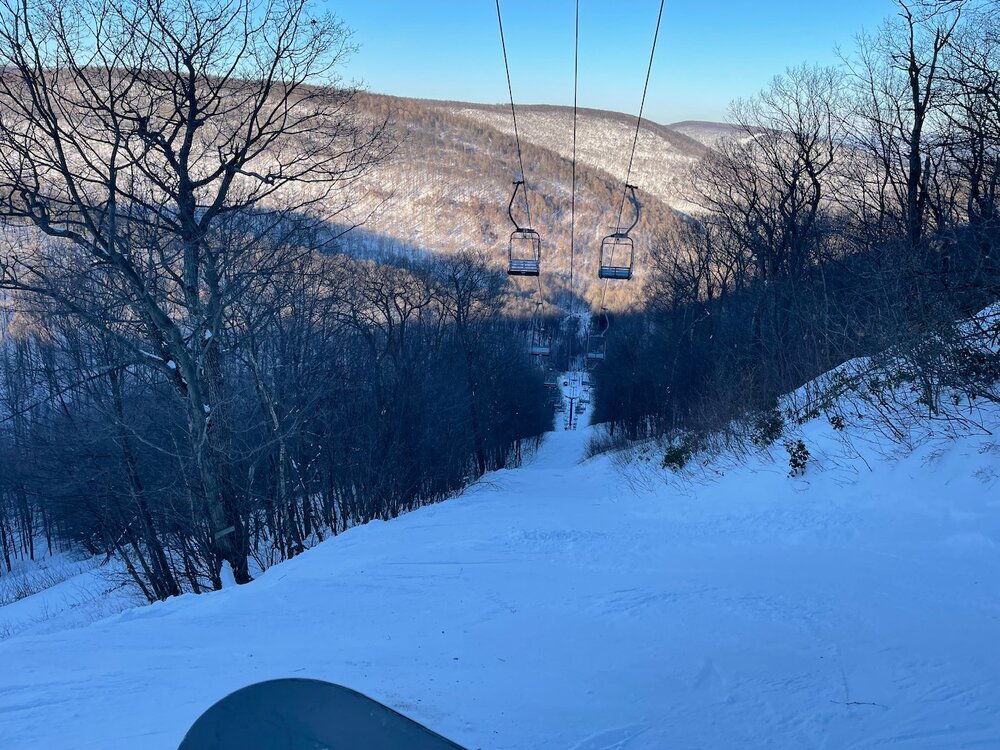
Nice day up here at Blue Knob, 100% of the mountain is open. Barely cracked 10°F for a high up here. Good day for taking some of the trails less traveled.
-
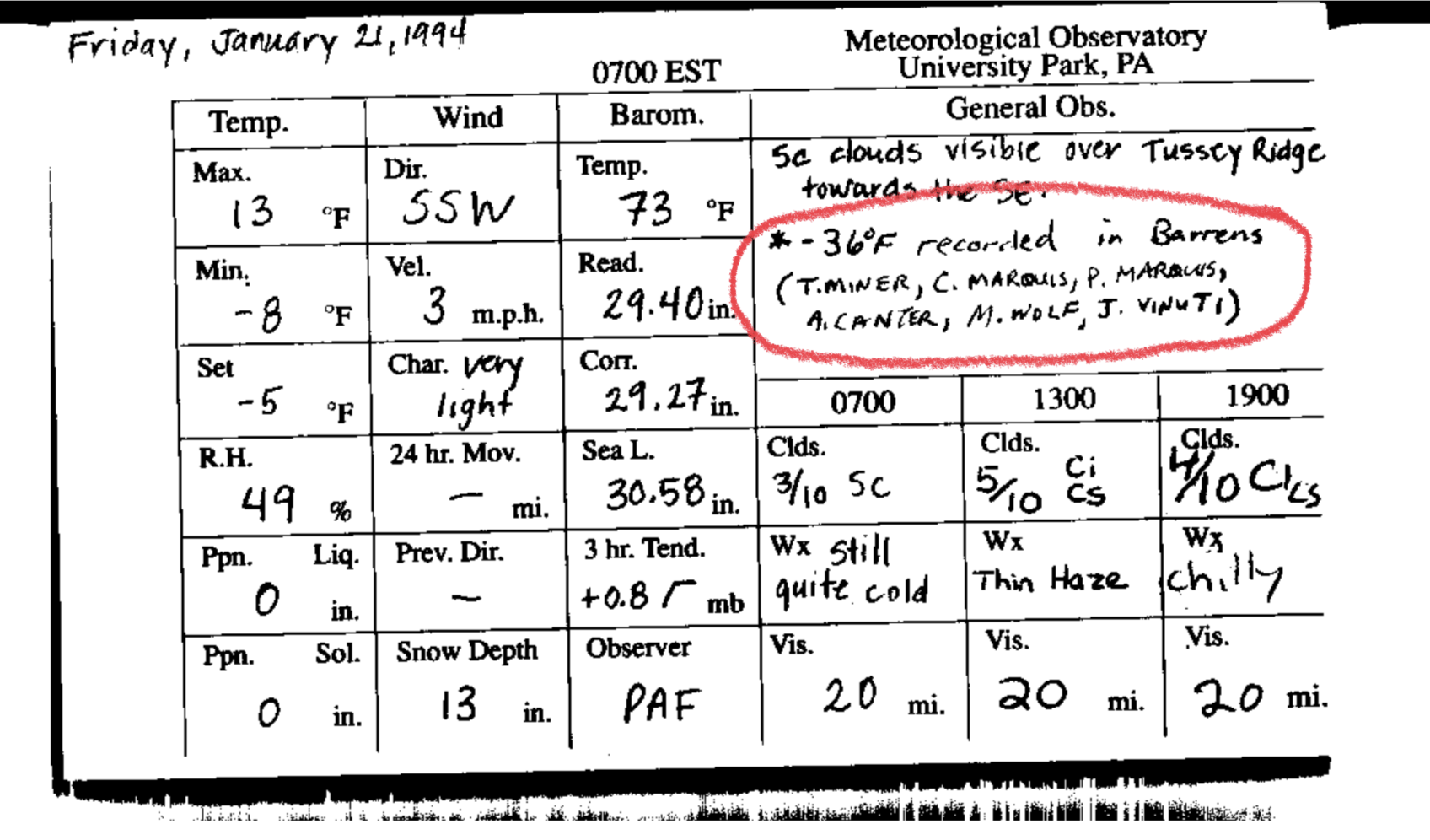
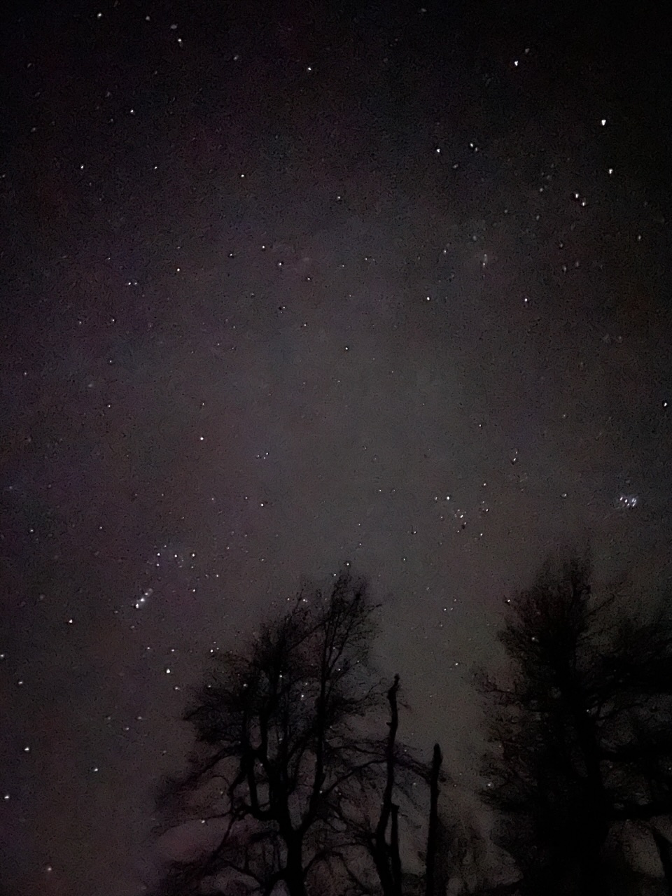
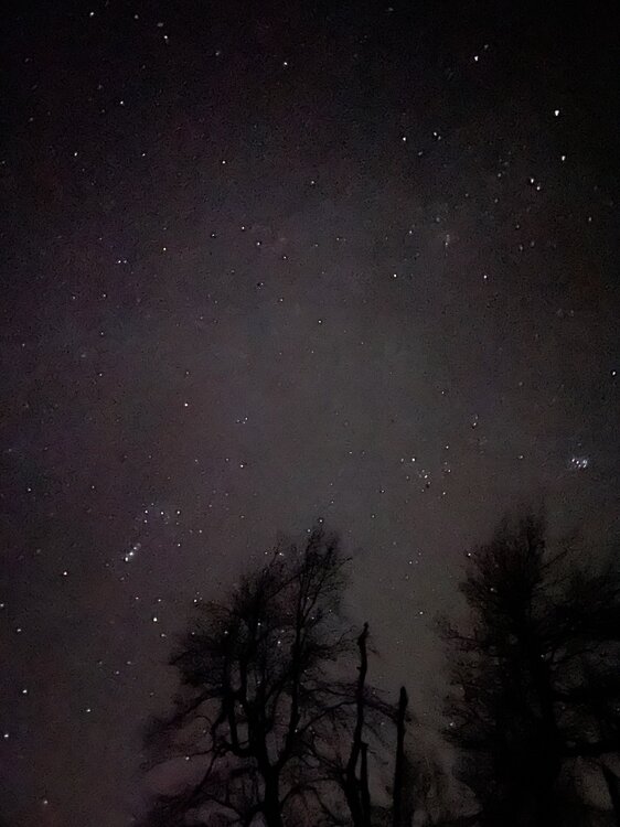
During the January 1994 outbreak they managed to get a -36ºF out in the Barrens while the low temp on campus was -8ºF. It’s an ideal area to radiate on a calm, clear night.. especially with a snowpack. It’s also one of the better dark areas in C-PA for stargazing outside of the north-central once you get further outside of State College. I got some good pictures during the Geminid meteor shower in December on Tussey Ridge, one of the ridges that makes that valley. Saw hundreds of meteors the night I went up there. I don’t have any fancy cameras, this is just an iPhone pic

-
Only 1.8” was my total snowfall today. Temps never got out of the teens at any point and down below 13ºF currently.
-
Light snow and 19ºF. Only have about 1.7” of new snow currently, with a bit of a crust on it. I slept most of the overnight but there must have been a lull and some freezing drizzle at some point here. Definitely didn’t get into better lift and snow growth. Better returns and rates seem a bit further NW over the Pittsburgh/western PA counties.
-
One thing to note, CCX radar has been out since about 6 or so.
-
Passing the 1” mark here. Nice steady powder snow falling and 19ºF. Here was my snow map posted before lunchtime today. Not that I’d change it now but I’m fairly happy with it with how the event is evolving. And I did see some of those LSV counties are now warned… something I suspected might happen.

-
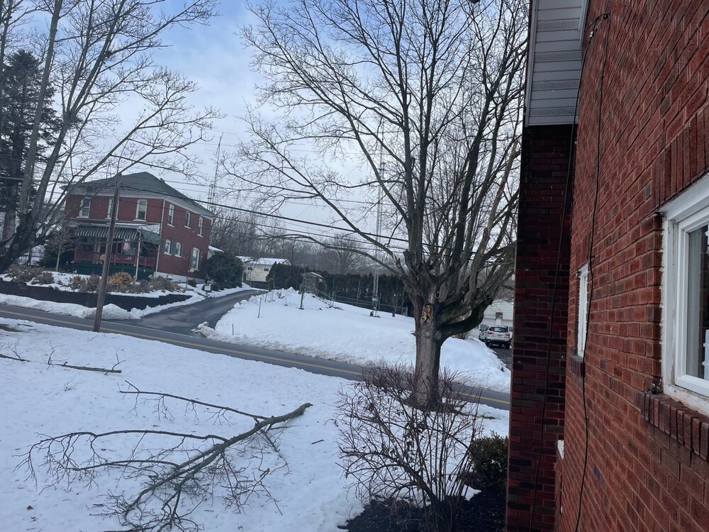
Light to moderate flurries and 19º/9ºF I gotta go elsewhere to watch the Steelers game unless I want to watch it on my IPad. Cable company isn’t coming til tomorrow to reattach my cable line that got ripped off the main line from the wind taking out a tree branch Saturday. No TV or internet, glad I have cellular on my IPad. Had to use my neighbor’s Wi-Fi to get my WS-5000 back broadcasting my obs to Ambient.
-
Alright here’s my clown map for the storm, I saw a couple of you guy’s mention about snowmaps before the first storm so I’m gonna put one out for a change. Basically this is a general 2-5” event for all of C-PA. Meso guidance showing a stripe of perhaps a bit more somewhere in the LSV, likely coinciding with whereever the stripe of best forcing sets up. I think Adams/York/Lancaster have a half decent shot at needing a low end warning at some point. Other possible high spots are in the Laurel’s where upslope and even better ratios might add a few inches. This event should break NYC/Central Park’s streak without an inch of snow and settle down the Mid-Atlantic/95 folks some.
-
The southtowns of Buffalo have been getting crushed by a nearly stationary LES band all afternoon. The entire timeframe that game would’ve been played today likely would’ve been a whiteout. I guess this is how cleanup is going haha https://x.com/darrenrovell/status/1746610698400976960?s=20
-
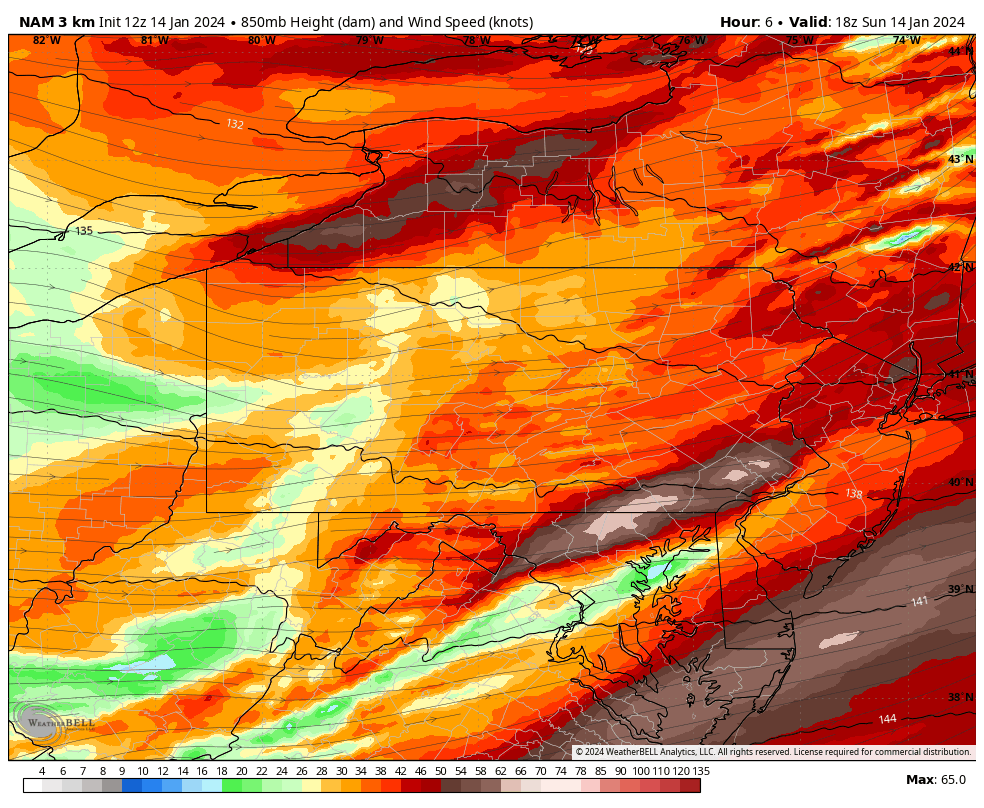
The morning 12z 3k NAM did have this around lunchtime. These are 850mb winds at 18z (1pm) with a 65kt max in York/Lancaster. That likely mixed down pretty efficiently with the combo of the arctic frontal passage/sunshine/significant cold air advection and westerly winds downsloping into the Sus Valley. The previous 17z frame had the 60kt+ max over the Rou… whatever time bubbler had his 67mph gust. They did have advisories out but sounds like it was a bit more potent than that. Winds should be starting to settle down as we get into the evening.

-
I think it’s safe to say our phasing big storm potential is probably off the table with regards to Tuesday. However, I do think the wave of lighter snows coming across PA is still viable as we drop in the northern branch trough and try to force some precip development. That’s still on the majority of guidance in various forms. Gonna need good ratios to yield anything advisory worthy, which given the cold column in place should be doable. A 15:1 on a tenth or two of QPF with some decent surface cold would be enough for an advisory event in the Sus Valley. I’m already starting to pay more attention to the high res and short range guidance to get a handle on this. One thing I’m noticing is a precip hole in the south central part of the state. Since this is modeled to be more of a wave now with later and further offshore/weaker coastal development, predominant low level flow is of a WSW component. So that implies potential downsloping off the Alleghenies and a potential precip shadow in play.
-
I’m sure the state of emergency declaration probably did in any chance of them going thru with the game. You’re either telling people to stay off the roads or you’re not. Pittsburgh’s only a bit over 200 miles from Buffalo, you think Steeler fans or Bills Mafia would actually stay home and not try to go to the game? Haha
-
Wind gust just took a branch out, which then took my cable line down.
-
I’m just waiting for the NFL to announce they’re going to play the game Monday night or something. The NY governor declared state of emergency for that part of the state last night. As much of a spectacle that it would be on TV, I dunno how you logistically play the game when it comes to getting the fans there in those conditions with the state of emergency declaration.
-
I didn’t notice the Mid-Atlantic folks started a storm thread earlier this afternoon, that explains everything haha.
-
The SE breeze here this afternoon is definitely more feisty than the one with Tuesday’s system. High gust of 31mph. Temp/dewpoint at 40/28ºF.