BlunderStorm
-
Posts
1,235 -
Joined
-
Last visited
Content Type
Profiles
Blogs
Forums
American Weather
Media Demo
Store
Gallery
Everything posted by BlunderStorm
-

Historic Christmas Cold & maybe snow?! Dec 23rd-30th
BlunderStorm replied to Wurbus's topic in Tennessee Valley
-
Historic Christmas Cold & maybe snow?! Dec 23rd-30th
BlunderStorm replied to Wurbus's topic in Tennessee Valley
I have 3 limiting factors I've become conscious of, 1) Big A Mountain downslope for NW flow events. 2) Clinch Mountain downslope for Miller A events. 3) Warm air advection heading all the way up the Clinch to my doorstep although less than everyone SE of me. I think the big issue for Grundy is the low elevation, it's hard to flush out the warm air from the maze that is the Appalachian Plateau. -
Historic Christmas Cold & maybe snow?! Dec 23rd-30th
BlunderStorm replied to Wurbus's topic in Tennessee Valley
A moment of silence for @BuCoVaWxfrom that SWVA GFS screwjob. lol. I'd say the same to kv and carver joking too... but the kingsport snowhole is a genuine phenomenon. -
Historic Christmas Cold & maybe snow?! Dec 23rd-30th
BlunderStorm replied to Wurbus's topic in Tennessee Valley
Thus far the anecdotal evidence presented from the high plains is indicative of an overperformer. With that said I'm not sure how that translates east of the Mississippi 24-36 hrs later. Are we clutching at straws or is there a realistic possibility models are slipping with this? At this point I'd be monitoring available moisture like a hawk. -
Historic Christmas Cold & maybe snow?! Dec 23rd-30th
BlunderStorm replied to Wurbus's topic in Tennessee Valley
I'm excited for the new extreme analog will get from this event should it ever come again in the next few decades. This is the ultimate "cold crashing into the valley" scenario. -
Historic Christmas Cold & maybe snow?! Dec 23rd-30th
BlunderStorm replied to Wurbus's topic in Tennessee Valley
Was it this one? "Octavia" as the WC dubbed it was the most snow in a day I can remember up my way. 16 inches! I believe on Feb 16th of 2015. https://4.bp.blogspot.com/-kf3uvQ71W_A/VOKJlBhTAfI/AAAAAAAAAhI/401QH79ixiQ/s1600/radar.jpg -
Historic Christmas Cold & maybe snow?! Dec 23rd-30th
BlunderStorm replied to Wurbus's topic in Tennessee Valley
06z 3kNAM Kuchera map on Pivotal sure is a beaut for most. -
Historic Christmas Cold & maybe snow?! Dec 23rd-30th
BlunderStorm replied to Wurbus's topic in Tennessee Valley
06z NAM is solid and an improvement from 0z. Notably the valley snowhole SE of Knoxville to Chatty is still there but smaller. -
Historic Christmas Cold & maybe snow?! Dec 23rd-30th
BlunderStorm replied to Wurbus's topic in Tennessee Valley
Even more of a negative tilt if anything, the slp is 40 miles west and 2 mb deeper at 54. A better run for west and central TN, though it sputters out over the great valley. -
Historic Christmas Cold & maybe snow?! Dec 23rd-30th
BlunderStorm replied to Wurbus's topic in Tennessee Valley
At this range I'm not sure if that is a positive or a curse. But yeah, I like what we're seeing with the more robust anafrontal precip. -
Historic Christmas Cold & maybe snow?! Dec 23rd-30th
BlunderStorm replied to Wurbus's topic in Tennessee Valley
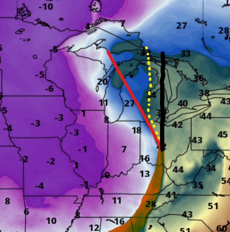
@fountainguy97Just adding to what you said, 18z GFS for 1 AM Friday juxtaposed with the 12z EURO's front placement (difference highlighted) and negative tilt (in dotted yellow). Some of the difference is in the speed of progression but some of it is indeed the cold hitting harder overrunning the precip. As an aside interestingly the Euro has Iowa roughly 10F colder at the same hour.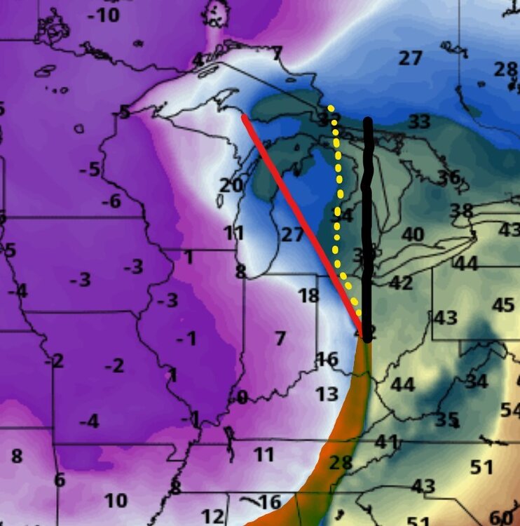
-
Fall/Winter Banter - Football, Basketball, Snowball?
BlunderStorm replied to John1122's topic in Tennessee Valley
That was a hell of a game between the Jags and Cowboys. Congrats @jaxjagman -
Historic Christmas Cold & maybe snow?! Dec 23rd-30th
BlunderStorm replied to Wurbus's topic in Tennessee Valley
Pressure marginally higher at 42 on the Euro between the highs. EDIT: By 60 the difference is more discernable, the low may pop up further east giving western folks more to work with. Let's see... EDIT: At 78 discouragingly a low in hudson bay is stronger perhaps weakening the bridge of high pressure. EDIT: 96, Welp, this probably won't resolve well. Looking very cutty, very quickly. -
Historic Christmas Cold & maybe snow?! Dec 23rd-30th
BlunderStorm replied to Wurbus's topic in Tennessee Valley
We're gonna need a hail mary of an eastward trend, that or some trailing energy once the low wraps the cold in. -
Historic Christmas Cold & maybe snow?! Dec 23rd-30th
BlunderStorm replied to Wurbus's topic in Tennessee Valley
Honestly I had my finger on the trigger for sparking one tonight, so don't feel too anxious about it lol. As for expectations if I can get a white ground under marginal temps for Christmas I'll call it a W. Of course that's an easier feat up here. -
December 2022 Medium/Long Range Pattern Discussion Thread
BlunderStorm replied to Carvers Gap's topic in Tennessee Valley
Almost all the cold of the Canadian but with a sub-forum wide snowstorm to boot. Honestly if something akin to that verifies a good snowpack would probably even things out low temps wise. I'd eat my gloves if the canadian verified and pulled off -10s in KY without a snow layer.- 582 replies
-
- 3
-

-
- snow
- freezing rain
- (and 4 more)
-
December 2022 Medium/Long Range Pattern Discussion Thread
BlunderStorm replied to Carvers Gap's topic in Tennessee Valley
It would seem general consensus for a storm is still elusive. The GFS fell in line so now for 12z it's the Canadians turn to be Dr. NO. That said it seems to evolving closer to the GFS with the overall progression in the southern stream trending north. Hopefully the high stays further west for this slightly later window so it isn't dashed into the Atlantic.- 582 replies
-
- 1
-
-
- snow
- freezing rain
- (and 4 more)
-
Fall/Winter Banter - Football, Basketball, Snowball?
BlunderStorm replied to John1122's topic in Tennessee Valley
18z has Santa coming in with a Stone Cold Stunner!
-
Currently 29.7 with light snow showers. This marks my first accumulation for the season.
-
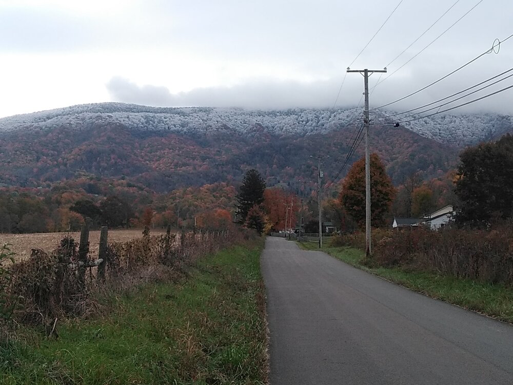
Clinch/Beartown Mountain this morning.
-
The high for tuesday was shortly after midnight at 38.4 while falling to the low 30s by morning. During the early evening I managed to crack 37 before falling back to 36 and staying there til now. I noticed some flurries flying this morning but didn't experience any accumulation. If Big A or Clinch mountain saw anything I may take a picture or two in the morning with things cleared out.
-
The recorded low this morning was 29.4. This marks my first frost, bout right on schedule. Things warmed up pretty nicely though into the 60s this afternoon.
-
Fall 2022 Medium/Long Range Forecast Discussion
BlunderStorm replied to Carvers Gap's topic in Tennessee Valley
If I'm not mistaken cool and dry conditions once in October are considered ideal for fall foliage. Display wise we may all be in for a treat. So long as those reds oranges and yellows aren't flames. -
It's looking like Octobers debut this year is going to feature a high in the 40s. Wowza. Winds were negligible beyond a moderate breeze. My digital rain gauge is unreliable though I can say the total has been modest, ~1.25" or so. Hopefully that should suffice for the next two dry (?) weeks ahead. I gotta say, I wish Ian tracked further west for the rest of y'all.
-
Is there any appreciable possibility of partial regeneration in the southern half of the storm? Or will interaction with the cold front/dry air/mid-lat shear dash that?