-
Posts
1,171 -
Joined
-
Last visited
Content Type
Profiles
Blogs
Forums
American Weather
Media Demo
Store
Gallery
Everything posted by BlunderStorm
-

Historic Christmas Cold & maybe snow?! Dec 23rd-30th
BlunderStorm replied to Wurbus's topic in Tennessee Valley
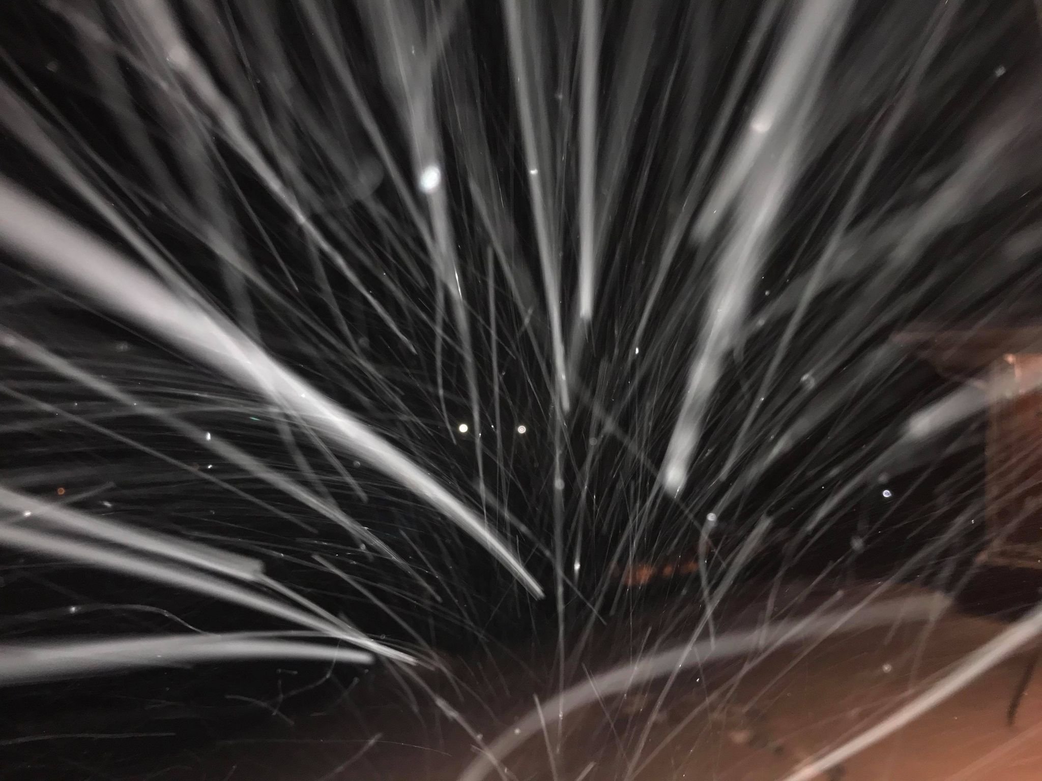
Sub-zero at -1.3. Not really flurrying but some microscopic ice crystals are sparkling under light. Maybe picked up from the wind, not sure. -

Historic Christmas Cold & maybe snow?! Dec 23rd-30th
BlunderStorm replied to Wurbus's topic in Tennessee Valley
I recorded a high of 6.6 at 2:30 and have been steadily dropping since. Now it's 1.4. Feels like temps have averaged roughly in the lower negative teens. -

Historic Christmas Cold & maybe snow?! Dec 23rd-30th
BlunderStorm replied to Wurbus's topic in Tennessee Valley
I'd be almost shocked if it didn't go negative tonight man. I mean, we saw this coming but this is some crazy stuff! -

Historic Christmas Cold & maybe snow?! Dec 23rd-30th
BlunderStorm replied to Wurbus's topic in Tennessee Valley
Update: After a short power outage and some shut eye. Fortunately we had propane heaters (ventilated just in case) for just these types of situation and battery banks, so it wasn't anything too bad at least for us. As for the snowfall here accumulations were negligible. Roughly a 1/10th of an inch stuck, fairly disappointing all considered. In other words where one part of the valley is shafted, so is the rest for this one. No latitude nor elevation gain could save me with this one. With that said the temps have been quite impressive. Up to now I've been holding steady between 4 and 5 degrees. I suspect it'll make an afternoon rally but I'd bet money double digits aren't on tap. The severity of lows tend to correlate with a west to east gradient where comparably the cold has more time to settle in for most of yall. -

Historic Christmas Cold & maybe snow?! Dec 23rd-30th
BlunderStorm replied to Wurbus's topic in Tennessee Valley
Winds ramping up to roughly 10 sustained with 20+ gusts. Meanwhile temps remain steady at 42. -

Historic Christmas Cold & maybe snow?! Dec 23rd-30th
BlunderStorm replied to Wurbus's topic in Tennessee Valley
https://www.wymt.com/weather/cams/ The WYMT Studio Cam shows it absolutely ripping during the transition in Hazard KY. -

Historic Christmas Cold & maybe snow?! Dec 23rd-30th
BlunderStorm replied to Wurbus's topic in Tennessee Valley
@Kentucky@Jesse from KY@AnthonyEC How're things going west of the KY/VA line fellas? -

Historic Christmas Cold & maybe snow?! Dec 23rd-30th
BlunderStorm replied to Wurbus's topic in Tennessee Valley
42 and rain starting to sprinkle. Front hours away, gonna be skating rink. -

Historic Christmas Cold & maybe snow?! Dec 23rd-30th
BlunderStorm replied to Wurbus's topic in Tennessee Valley
Granted, the Euro in the past few runs threw us somewhat of a bone but I digress... lol -

Historic Christmas Cold & maybe snow?! Dec 23rd-30th
BlunderStorm replied to Wurbus's topic in Tennessee Valley
I love seeing reports from the deep south getting some flakes out of these systems. You know there's got to be some really excited kids down there wanting something even resembling a white christmas. (all negative aspects brushed aside) -

Historic Christmas Cold & maybe snow?! Dec 23rd-30th
BlunderStorm replied to Wurbus's topic in Tennessee Valley
Dang, was really rooting for that smooth transition... Here's hoping your switchover is quick! -

Historic Christmas Cold & maybe snow?! Dec 23rd-30th
BlunderStorm replied to Wurbus's topic in Tennessee Valley
12-23, 06z averaged precip on the Euro over the past 6 runs. -

Historic Christmas Cold & maybe snow?! Dec 23rd-30th
BlunderStorm replied to Wurbus's topic in Tennessee Valley
-

Historic Christmas Cold & maybe snow?! Dec 23rd-30th
BlunderStorm replied to Wurbus's topic in Tennessee Valley
I have 3 limiting factors I've become conscious of, 1) Big A Mountain downslope for NW flow events. 2) Clinch Mountain downslope for Miller A events. 3) Warm air advection heading all the way up the Clinch to my doorstep although less than everyone SE of me. I think the big issue for Grundy is the low elevation, it's hard to flush out the warm air from the maze that is the Appalachian Plateau. -

Historic Christmas Cold & maybe snow?! Dec 23rd-30th
BlunderStorm replied to Wurbus's topic in Tennessee Valley
A moment of silence for @BuCoVaWxfrom that SWVA GFS screwjob. lol. I'd say the same to kv and carver joking too... but the kingsport snowhole is a genuine phenomenon. -

Historic Christmas Cold & maybe snow?! Dec 23rd-30th
BlunderStorm replied to Wurbus's topic in Tennessee Valley
Thus far the anecdotal evidence presented from the high plains is indicative of an overperformer. With that said I'm not sure how that translates east of the Mississippi 24-36 hrs later. Are we clutching at straws or is there a realistic possibility models are slipping with this? At this point I'd be monitoring available moisture like a hawk. -

Historic Christmas Cold & maybe snow?! Dec 23rd-30th
BlunderStorm replied to Wurbus's topic in Tennessee Valley
I'm excited for the new extreme analog will get from this event should it ever come again in the next few decades. This is the ultimate "cold crashing into the valley" scenario. -

Historic Christmas Cold & maybe snow?! Dec 23rd-30th
BlunderStorm replied to Wurbus's topic in Tennessee Valley
Was it this one? "Octavia" as the WC dubbed it was the most snow in a day I can remember up my way. 16 inches! I believe on Feb 16th of 2015. https://4.bp.blogspot.com/-kf3uvQ71W_A/VOKJlBhTAfI/AAAAAAAAAhI/401QH79ixiQ/s1600/radar.jpg -

Historic Christmas Cold & maybe snow?! Dec 23rd-30th
BlunderStorm replied to Wurbus's topic in Tennessee Valley
06z 3kNAM Kuchera map on Pivotal sure is a beaut for most. -

Historic Christmas Cold & maybe snow?! Dec 23rd-30th
BlunderStorm replied to Wurbus's topic in Tennessee Valley
06z NAM is solid and an improvement from 0z. Notably the valley snowhole SE of Knoxville to Chatty is still there but smaller. -

Historic Christmas Cold & maybe snow?! Dec 23rd-30th
BlunderStorm replied to Wurbus's topic in Tennessee Valley
Even more of a negative tilt if anything, the slp is 40 miles west and 2 mb deeper at 54. A better run for west and central TN, though it sputters out over the great valley. -

Historic Christmas Cold & maybe snow?! Dec 23rd-30th
BlunderStorm replied to Wurbus's topic in Tennessee Valley
At this range I'm not sure if that is a positive or a curse. But yeah, I like what we're seeing with the more robust anafrontal precip. -

Historic Christmas Cold & maybe snow?! Dec 23rd-30th
BlunderStorm replied to Wurbus's topic in Tennessee Valley
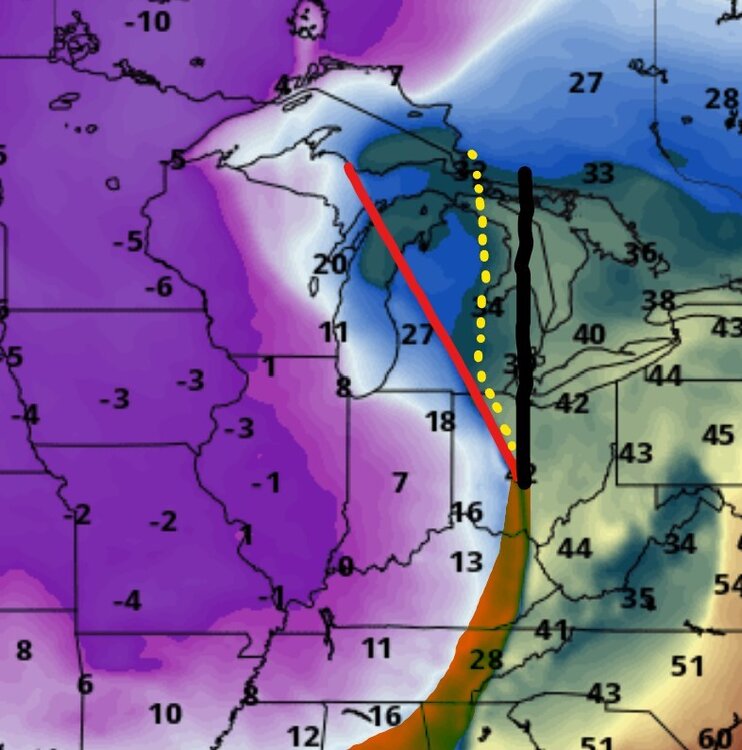
@fountainguy97Just adding to what you said, 18z GFS for 1 AM Friday juxtaposed with the 12z EURO's front placement (difference highlighted) and negative tilt (in dotted yellow). Some of the difference is in the speed of progression but some of it is indeed the cold hitting harder overrunning the precip. As an aside interestingly the Euro has Iowa roughly 10F colder at the same hour. -

Fall/Winter Banter - Football, Basketball, Snowball?
BlunderStorm replied to John1122's topic in Tennessee Valley
That was a hell of a game between the Jags and Cowboys. Congrats @jaxjagman -

Historic Christmas Cold & maybe snow?! Dec 23rd-30th
BlunderStorm replied to Wurbus's topic in Tennessee Valley
Pressure marginally higher at 42 on the Euro between the highs. EDIT: By 60 the difference is more discernable, the low may pop up further east giving western folks more to work with. Let's see... EDIT: At 78 discouragingly a low in hudson bay is stronger perhaps weakening the bridge of high pressure. EDIT: 96, Welp, this probably won't resolve well. Looking very cutty, very quickly.


