SnowDawg
-
Posts
1,070 -
Joined
-
Last visited
Content Type
Profiles
Blogs
Forums
American Weather
Media Demo
Store
Gallery
Everything posted by SnowDawg
-
The mean trough is starting to trend a bit too far east for my liking on the ensembles. Much further and could look like this past weekends cold with storms not organizing til out over the Atlantic. Hopefully they'll tick back west over time.
-
GFS suite slowly taking baby steps towards the EPS over the last few runs. Time will tell if it folds entirely or they meet somewhere in the middle.
-
GEFS will always follow the OP to an extent as it suffers from underdispersal issues. Doesn't mean it's wrong, just an important thing to remember. It's GFS vs everybody else right now. Tendency after the last few winters is just to go with the warm look, but seeing people like Eric Webb and BAM adamantly against the idea of a persistent western trough gives me pause. Frustrating as it may be, guess we'll wait and see.
-
If the EPS had moved towards the GFS solution then I'd be super worried, instead it doubled down and improved an already great look. Even on the GEFS it looks more delayed than denied. GFS has been wrong on long range warmth at least twice already this season. Long ways to go, enjoy the model watching roller coaster lol.
-
I think at minimum the 4th-6th is the first period to watch to see if we can get some members to start to cluster around anything. Right now there is definitely a small signal in the noise, but still far too many scenarios on the table to draw any conclusions. 12z EPS showed these at the same time, I'll take it at this lead.
-
We're never gonna reel anything in from 380 hours but it's nice to see operational runs lining up with the potential seen on the ensembles.
-
An actual Miller A in fantasy land at 12z.... Brought a tear to my eye just seeing it.
-
This is from a recent post from Eric Webb. "Also, the destructive interference between the MJO & ENSO (which might cause RMM to enter the “null” phase or “circle of death”) will actually favor a colder pattern over the Eastern US in early to mid January here by reducing the amount of convective heating & +U that’s being fluxed into the pacific jet, favoring some pacific jet retraction."
-
I generally just remember them constantly shutting down any hopes that last winters cutter parade would turnaround. I'd say the same For Eric Webb last year. No hype, just straight brutal honesty.
-
Hopefully the folks over at BamWx are as right as they were last year. I think the worry about a warm canada is overblown, IF and only if the pattern is truly PV driven in January. If not, then yeah it'll take a while to slowly build cold air back in. But a north south stretched lobe of the PV parking itself in the Hudson Bay, funneling air straight off the pole, is not a slow building scenario. https://x.com/bamwxcom/status/1868717494594089454?s=46&t=BVabKZBl0JP2qfoqs7LgyQ
-
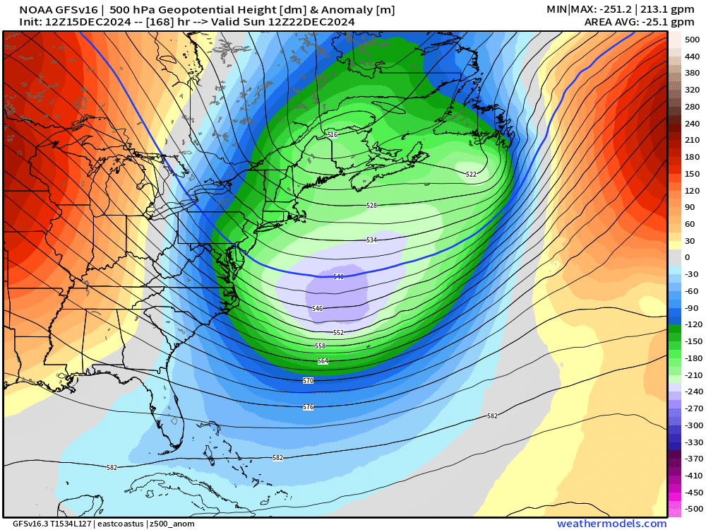
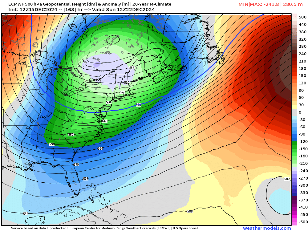
GFS remains insistent on just dumping the cold out into the Atlantic. It and the GEFS want to center the ridge over the plains while the Euro and EPS are more over the Rockies.
-
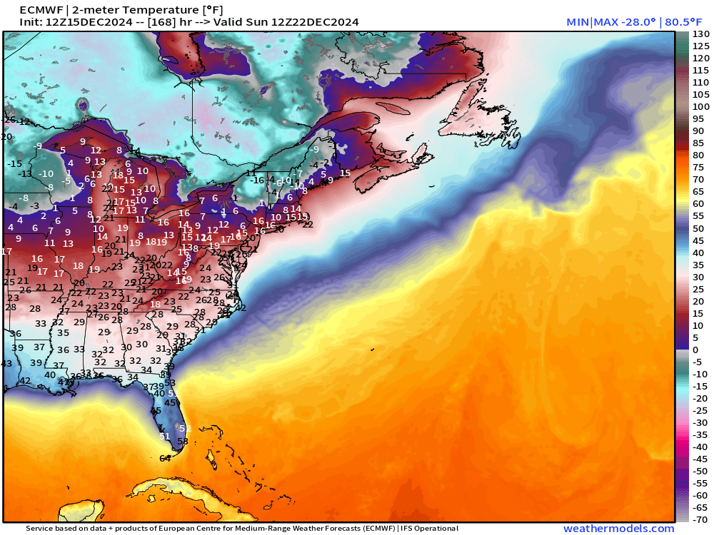
Much better ridge trough alignment on the euro for extremely efficient cold air transport. Instead of being fed moderated Midwest air off the broad western ridge on the GFS, we have cold air dumping essentially due south out of eastern Canada. Quite the cold air source to pull from if we can just tap it. Hopefully the Euro is on to something with shifting that ridge back west a bit.
-
I would also say for the pre-christmas days despite the ensembles not being enthused yet, and the op runs backing off a touch, it's certainly still close enough to keep an eye on. Despite this drought making it feel otherwise, I'd say most of our winter events in the past, other than the true big dogs, trend towards us inside the last 120-144 hours or so and we reel them in right up to the end. Small adjustments in the ridge/trough alignment and the different pieces of energy could still make a big difference. I know I'd be happy just to see some token flurries around Christmas.
-
That's the thing, according to the ensmbles there was never much of a chance to begin with. OP would show a big run and the GEFS would never budge. Gotta remember the true randomness of the op runs and compare them to their ensemble suites before getting worked up. Easier said than done I know, I'm just as guilty as anyone lol.
-
Long range GFS has falsely turned warm in the long range at least twice this month alone. As for the snow chances, the ensembles never budged, shoulda been a dead giveaway there was nothing much there. For now the ridge axis out west just seems too broad, which in turn is pushing our trough too far east.
-
Would kill for just a nice stout CAD with some overunning. Not asking for much. Just a few inches of snow and sleet would make me happy just to end this drought.
-
Love the potential, need to start seeing some ensemble support. If we could just get that started in the Gulf instead of off the coast this whole board would be slammed.
-
DT updated his seasonal outlook in his weekly video yesterday and honed in on the same +TNH pattern as above. Nothing is ever guaranteed, but it's nice to see some experts saying the potential is out there to at least have a pattern that puts us in the game in the heart of winter. Certainly more than we've been able to say the past few winters.
-
Gosh, now Tennessee is about to pull a rabbit out of the hat again. I swear I've never seen that region get as much snow as they've got the last couple years. Just unreal, the rich get richer.
-
Well at least this winter is proof that we can still get Miller A's. This is like the 4th one. Of course they've all been warm rain storms...but beggars can't be choosers I guess lol
-
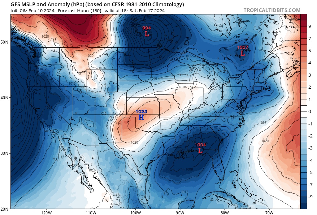
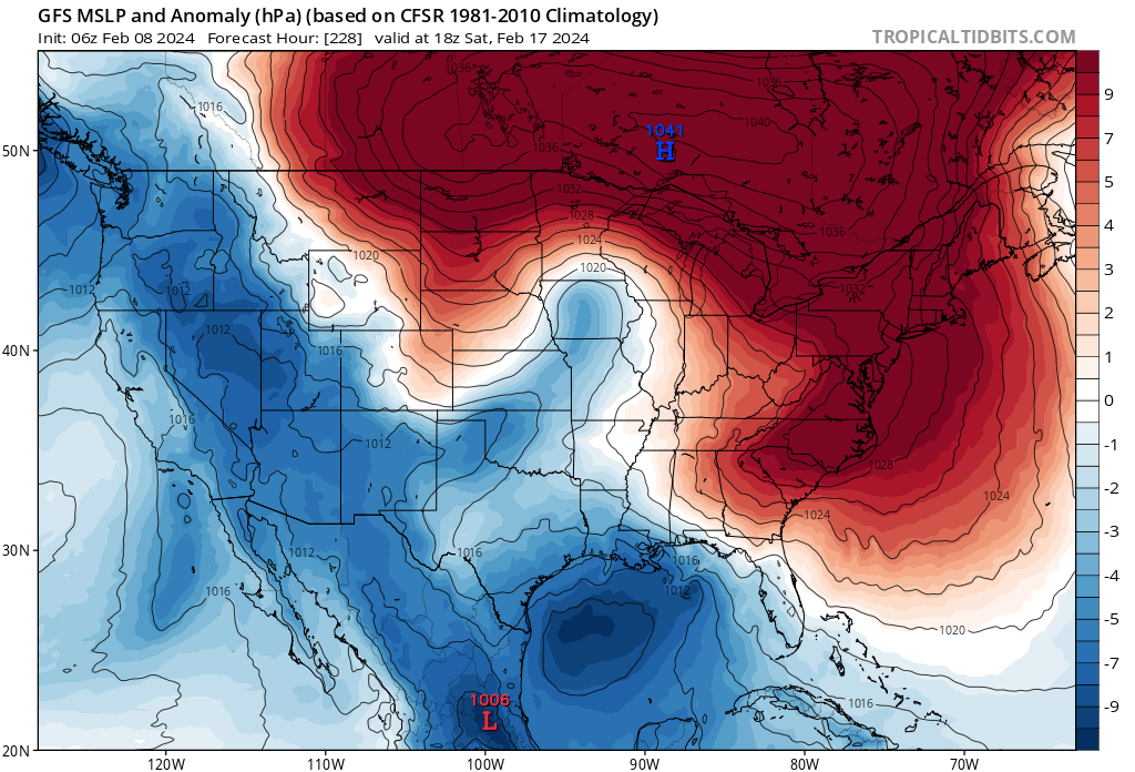
I've said it all winter, this is the most La Niña looking El Niño I've ever seen. It's just an endless onslaught of low pressures rolling through southern Canada into the NE, meaning we can never build any decent HP to work with. Overactive northern stream, classic hallmark of a La Niña. It's like after the 3 year Niña some features are lagging to adjust. It took 48 hours to go from this... to this...

-
Knew a run like that would happen eventually. There's been plenty of members like that in the ensemble the whole time. We've been slow and steady losing the PNA on modeling for a while now, that's critical for our cold air delivery. Is what it is unfortunately. This multi year trend of the pacific always screwing us is just unrelenting. I just don't see a way out of it, and next year's La Niña will only serve to keep that pattern rolling. Math says climo favored areas luck into something eventually, and who knows maybe this is still the one, but extended winter weather appears a thing of the past until something can break this pacific regime we've found ourselves in.
-
Verbatim I got blanked there, but I'd take that look and bet on CAD being a bit better.
-
If that dang pacific trough would back off and quit nudging into the west coast we'd be in business big time and not have so many sticking points in the forecast that could go wrong. Seems a proper PNA ridge continues to just be impossible to come by like it has been for years now. Lack of snow has not been surprising given that fact. To me it's the most important factor because it encourages the northern stream to dig hard.
-
Just need that to amplify sooner and that's a proper region wide slider. You can see how when it finally strengthens off the coast it pulls cold air into the system. Timing moved a bit towards the GFS, still think a slower southern wave is better for us but I'm sure it's gonna bounce around a bit for now.