SnowDawg
-
Posts
1,070 -
Joined
-
Last visited
Content Type
Profiles
Blogs
Forums
American Weather
Media Demo
Store
Gallery
Everything posted by SnowDawg
-
Oh wow that was an absolute perfect run for the N GA mountains... Heavy deformation band snow all in the overnight hours.
-
Well I'm hopeful for this one here in the NE GA mountains while atmittedly concerned about the borderline temps. I'm just happy that what comes after this over the coming weeks should only get better, and we're not staring at this marginal event as our only foreseeable hope.
-
Compared to its 18z run which was a lot better track wise, the 50/50 is way weaker on that run. We need that Thursday/Friday system to really bomb out in the 50/50 region I feel.
-
Stuck on the sleet mix line. Line will be past in the next hour. Hopefully it'll flip all snow long enough for a dusting. Flow snow usually doesn't make it here but the Hi-Res models have been ambitious.
-
Heavy mixed bag here in northeast GA. Falling sideways though in 40mph winds.
-
Goodness....that's 2ft plus in Central Tennessee and it's not even done lol
-
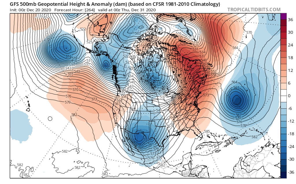
If things truly play out the way the models insist on right now, I have to question how much the NAO even means to us. EPO feels far more important at the moment. Maybe the MJO can force it to flip by early/mid January.
-
Quite the contrast with the run before it. Hopefully it's onto something with the storm track sliding south a bit.
-
Ensembles definitely the place to be for now. Swings are far less violent. GFS is whiplash inducing at the moment.
-
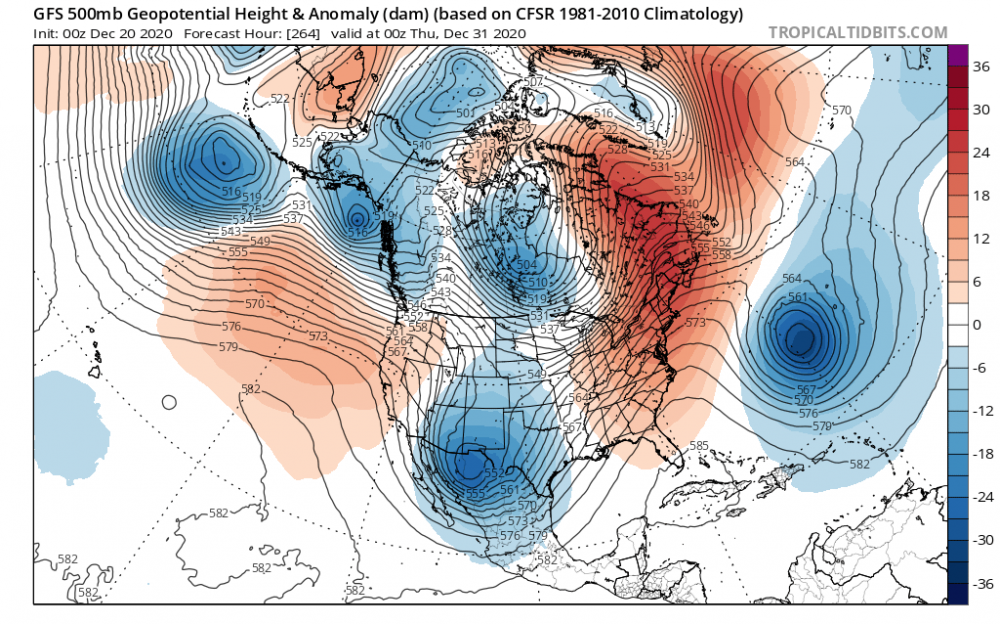
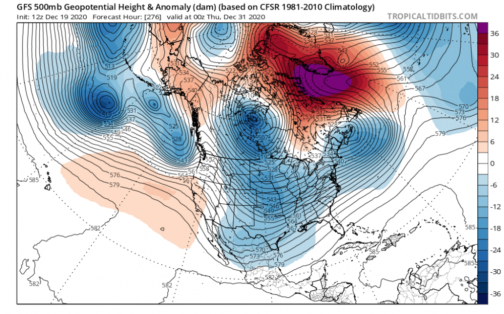
Going from this:to this:from just 12z to tonight is wild. Obviously still tons of big changes to come on this model. First run in like the last 8-10 that didn't have some degree of troughing over the east at this time. I vote toss lol
-
My little county here in NE GA is still at 98% without power. I don't know what all has happened to the grid, but it must be an absolute mess.
-
That extra-tropical transition on the Euro looks like it could make for some pretty nasty weather in the mountains. With all the rain we've had tree damage could be pretty bad if it's right.
-

2019/2020 Mountains and Foothills Fall/Winter Thread.
SnowDawg replied to Tyler Penland's topic in Southeastern States
Snowing good now even below 2500 feet here in North GA. Still too warm for accumulation though. I'd guess above 3500-4000 though in this area are subfreezing. Pretty to watch nonetheless. Hopefully temps will be in a better spot for round 2 later tonight. -
2019/2020 Mountains and Foothills Fall/Winter Thread.
SnowDawg replied to Tyler Penland's topic in Southeastern States
Nothing like this thread during a good NW flow to make a fella wanna move lol -
That's great! Better than me temps wise. Never got lower than 33 because of the warm bubble at 925. About a half inch in areas of the yard that aren't too wet. From what I've heard, Clayton itself has no accumulations.
-
Tiger, GA. In the furthest Northeast county in GA.
-
Dropped from 35 to 33 in about 30 minutes. Grassy areas now getting coated good.
-
Yep and I'm sitting right around the 925 level so my wind occasionally flips south and I get a burst of warm wind. It did drop quite a bit at my last update though so it's getting there.
-
Heaviest rates yet. 34.9 and refusing to drop, still melting on contact. Rates causing elevated surfaces to slush up a bit.
-
GFS, CMC, and Euro all agree on a ULL driven system in that same exact timeframe. Obviously a little far out but bears watching.
-
I don't think the surface is going to cooperate in time before the good moisture is gone IMBY. Shame, these snow rates are incredible but it's pure white rain.
-
Over 0.25 QPF now waisted to this point.
-
Very heavy snow now, melting on contact of course...
-
Can confirm mostly snow/Sleet here now. White rain at this point though, surface temps not budging much for now. Believe it's cause I'm around the elevation of the 925 layer and there was a warm bubble that surged north at that level over North GA this morning.
-
Just saw a video from one of the high rise buildings in Atlanta with flakes mixed in to the rain. Pretty cool, but also kind of a kick in the face sitting here in the Mtns watching it rain lol