SnowDawg
-
Posts
1,070 -
Joined
-
Last visited
Content Type
Profiles
Blogs
Forums
American Weather
Media Demo
Store
Gallery
Everything posted by SnowDawg
-
It’s really close to identical honestly, just shifted north a bit causing differences on the southern fringes and down along the southern blue ridge escarpment. Selfishly would love to see it move just a bit more towards this look, definitely looking like there’s potential for someone to get a big one out of this though.
-
I mean is the source cold air just pathetic for peak winter? A 1044 high and a surface low in North Florida on the Para and its still almost all rain in NE GA damming regions. 9 times out of 10 I swear a high that strong puts us in the game in the past.
-
This was a nice call. GFS immediately delivered a big dog fantasy run within just a few hours lol.
-
Had a little sleet earlier. Now 34.5 and all rain.
-
And finishes putting the nail in the coffin for the SW mountains.
-
It looked absolutely fantastic for the SW mountains all afternoon until it suddenly didn't. So believe it at your own peril I'd say.
-
HRRR just cut QPF by half or more for a lot of the SW mtns in NC and GA. Dry slot becoming a problem?
-
GSP pouring water on my fire before it even gets startedHRRR looks great for North GA, NAM doesn't. Clear to see which one they favor.
-
Dang, jealous right now. Still not a thing reaching the ground up here and 39.7, temp even went up a bit on that last update. Heavier rates just keep dying before they can get here making evap. cooling very inefficient.
-
Got a friend all the way down in Gwinnette County that had wet snow mixed in with the rain earlier. Said temp fell to like 35.7 under that heavy band earlier.
-
Man I hope so. Still so unsure about this one as its moved back and forth so many times. Still worried about that potential dry slot and of course the marginal temps and how much mixing could cut our totals.
-
Hearing some wet snow reports in the northern suburbs of Atlanta. MPING has a few mix reports as well.
-
Just speaking to what I'm seeing trying to compare the two in NE GA the NAM initialized way too warm with its 3pm temps. Showed mid 40s when ground truth is 39. Don't know if that's what's causing the changes with outcomes though.
-
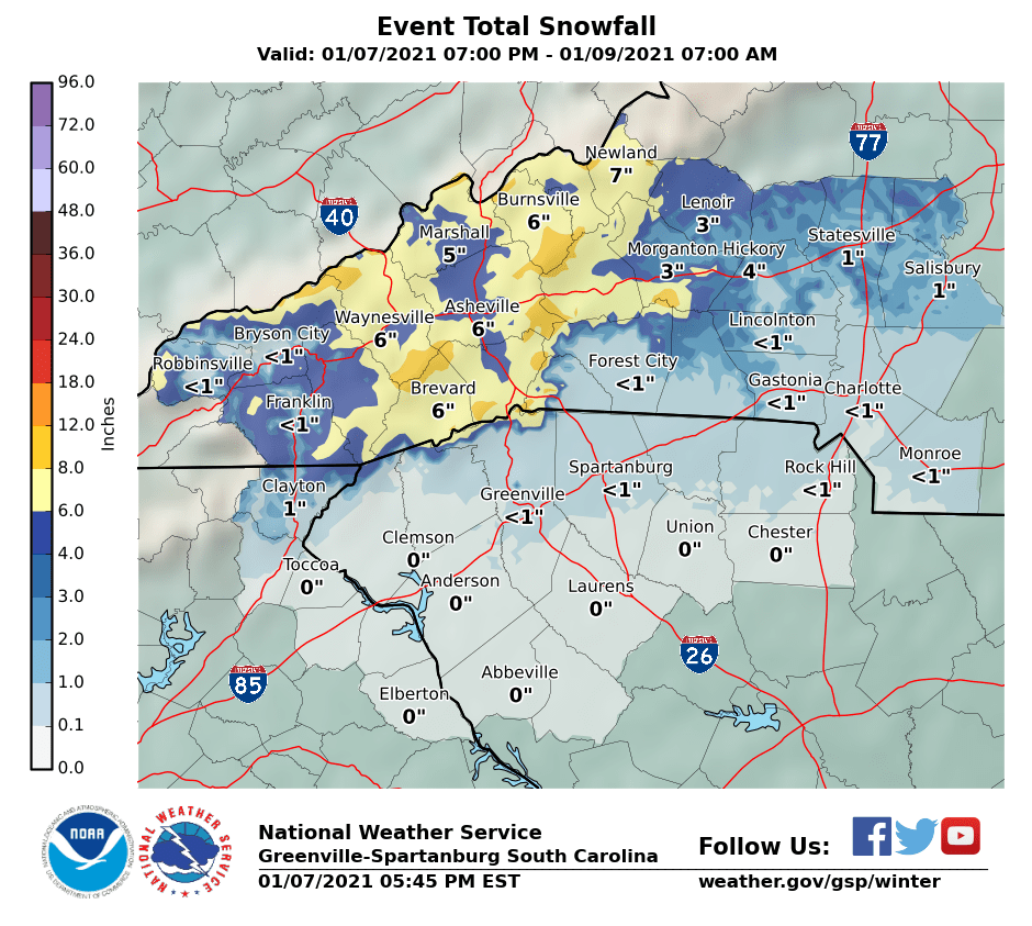
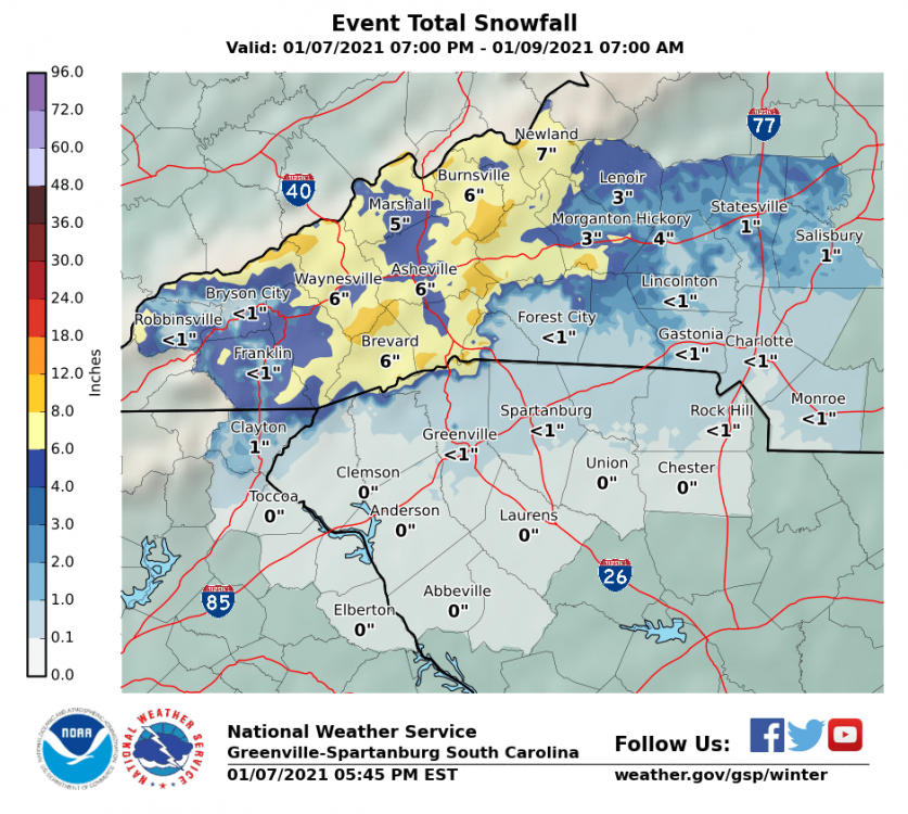
New map from GSP
-
GSP just upped totals significantly down here. It was under a half inch before this.
-
Still holding in the upper 20s here in North GA with a thick cloud deck right now. Was supposed to be in the upper 30s by now. I don't wanna read any signicance into it but I am curious.
-
We're definitely not at warning criteria here in Rabun, GSP just issued the warning in cooperation with the Atlanta office to avoid confusion. So I am under a WSW with a forecast of less than a half inch
-
Although the main run and the control are both cutters the mean is more of a coastal solution. And unsurprisingly so it's max strip of mean snowfall runs through WNC.
-
Welp...outside of the 3km NAM at long range every model has been pretty depressing tonight for North GA, that GFS run most of all.
-
I definitely think you'll see some flakes. I haven't been really sure how to feel about it all yet with how things keep jumping around. I felt pretty good for an advisory level event here in Rabun, but it's so borderline for more than that it's infuriating lol. And then the 12k NAM comes in and brings the sharp cutoff right to my doorstep and has me worried all over again.
-
Difference on the south side of the storm in North GA between the 3km and 12km is stunning.
-
Canadian cut QPF big time in WNC/Upstate/NGA same as the GFS. GFS got ensemble support for slightly weaker/dryer solution too. Wonder if the Euro comes in similar?
-
Oof...it basically cut QPF in half over Western Carolinas and N GA.
-
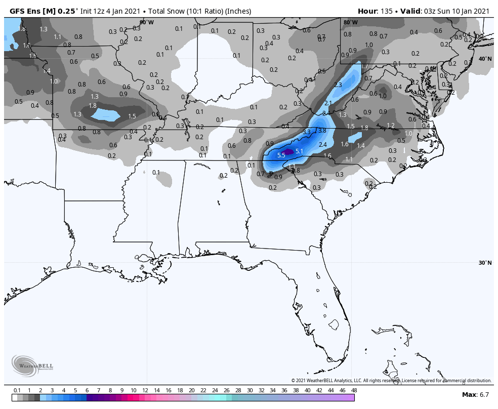
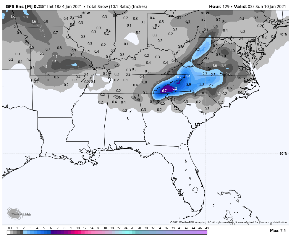
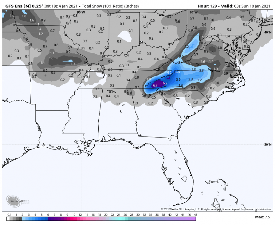
18z GEFS mean looks as good or improved for most across the board compared to 12z. 12z: 18z:

-
Oh man 6-12 County wide here in NE GA, and I thought the 12z was about as good as it could get lol. Wonder how much surface melting will be an issue or will the heavy rates be able to push the 0c thermals to the ground?