SnowDawg
-
Posts
1,070 -
Joined
-
Last visited
Content Type
Profiles
Blogs
Forums
American Weather
Media Demo
Store
Gallery
Everything posted by SnowDawg
-
My gut tells me the NAM may be a bit too aggressive with the warm nose right now, but needless to say we really need that front end punch to be aggressive. With high rates, picking up just an extra hour or two over the NAM'S transition time could be significant.
-
Euro very reminiscent of last month's awful storm. Extremely disorganized into almost two separate pieces with a big dry slot between.
-
Wow...this winter sucks. Couldn't have even imagined being left out of a winter storm watch after the 06z runs yet here we are...
-
Been thinking the same myself. Seems like an outlier, but I also know it's history with sniffing out warm noses and after that last bust in January it certainly shakes the confidence a bit.
-
3km NAM came back in more aggressive with the warm nose than it did at 06z. Ton of QPF went to sleet that run. Again pretty high up there cause the 850s and 925s are well below freezing til bulk of the precip is basically gone.
-
GFS moving the vortex east much quicker this run, should help move things back the other way from where it was.
-
How is the RGEM with P-types? Doesn't appear to be much mixing like on NAM.
-
Wow warm nose is killer. Soundings have me at or below freezing the whole event but after the few hour thump at the start it's all sleet and zr from there. Warm nose is way up there compared to normal though, like 750-775 mbar.
-
With the temperatures that follow and the amount of people that depend on electricity for heat, that widespread of a devastating ice storm could turn deadly. Really pray nothing like that happens.
-
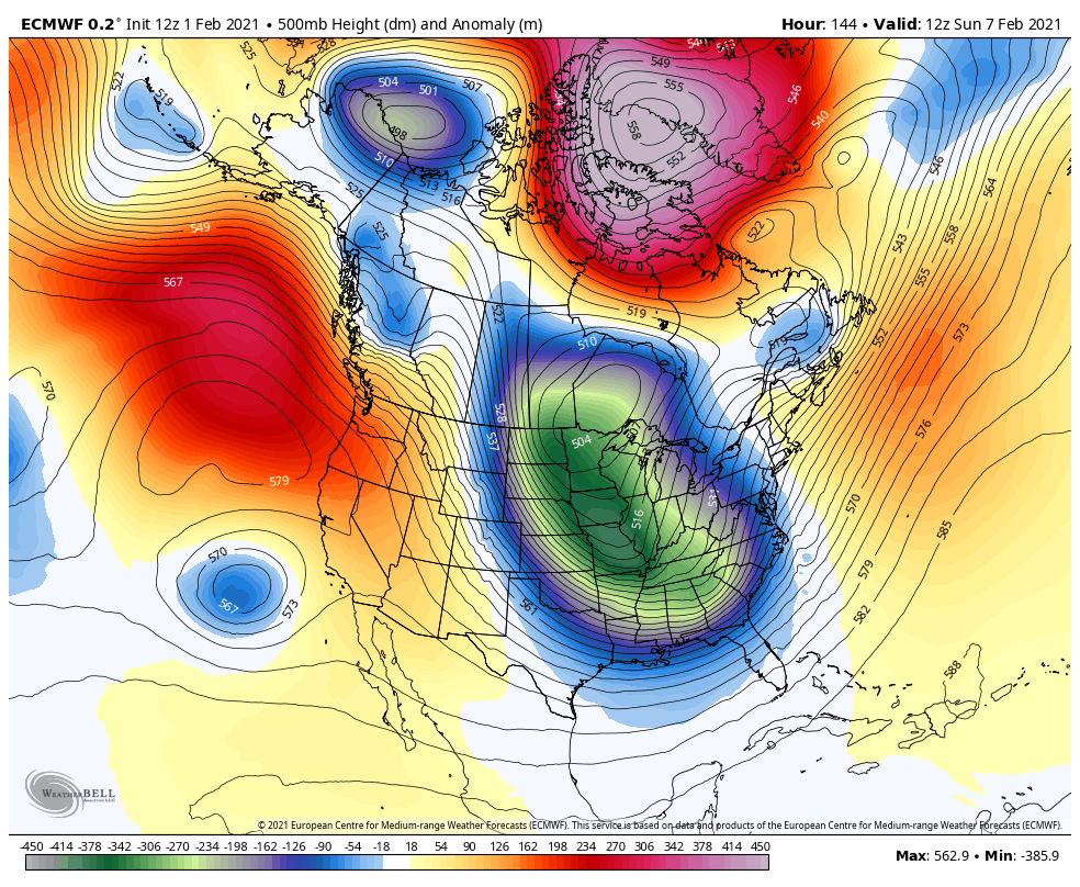
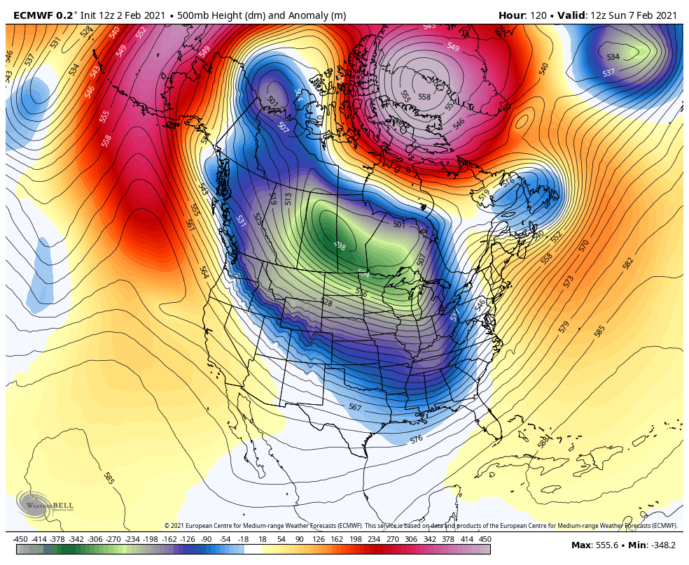
Idk it still trended towards its OP run even if it masked it well. It still sped things up by at least a half day and the thermals were way different. The 850 freezing line was way further south on the 0z GEFS than the one above. The issue as far as I can tell is the SE Canada Vortex isn't getting out of the way like it was on yesterday's runs. Keeps our wave from slowing down and amplifying.
-
Looks like it's trending upwards as well. Quite the island for the future GFS right now.
-
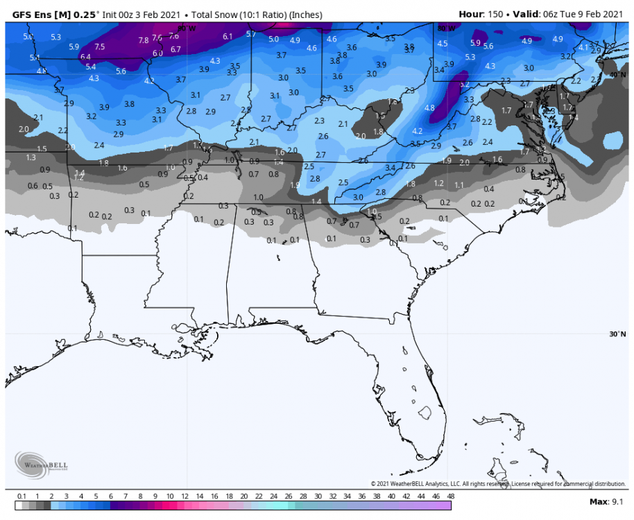
Noticed a few ensemble members with this strip of snow across the deep south earlier today. Interesting.
-
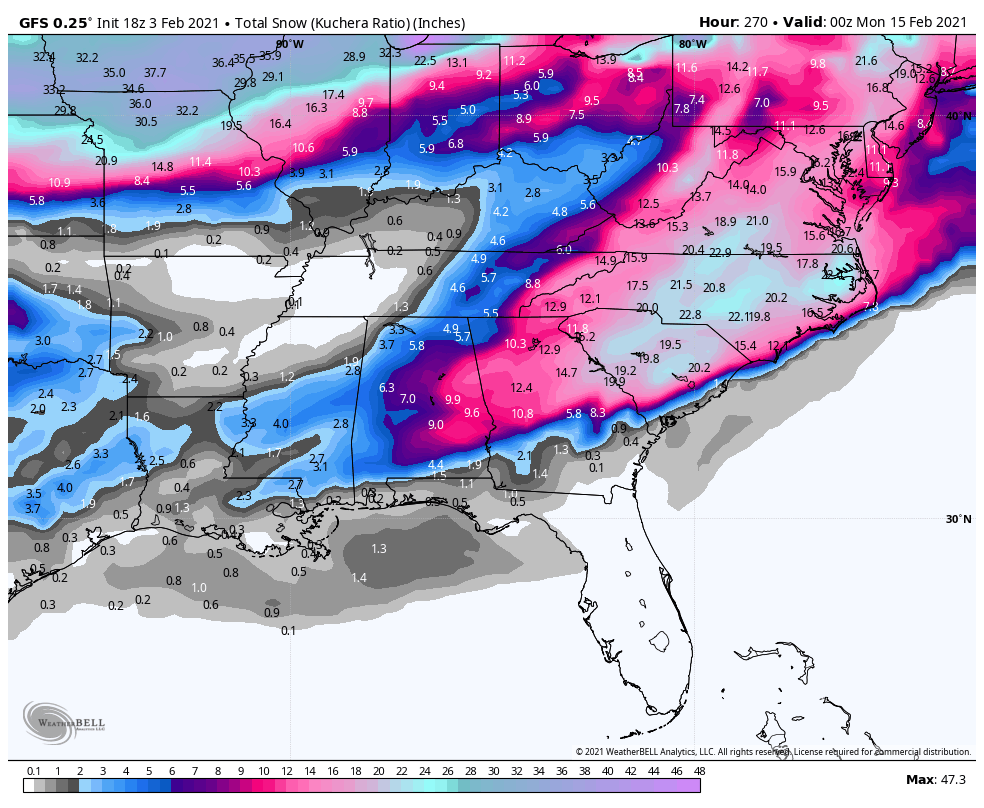
Haha, oh my goodness... The entire state of NC over a foot with Kuchera ratios.... That may be the greatest SE winter storm of all time. Too bad it's so far out lol

-
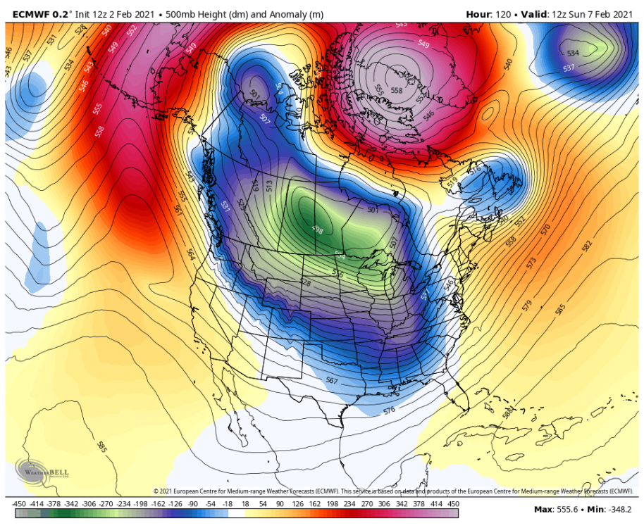
GEFS mean for the first system.
-
I'd take that look and bet that it's just wrong on the NW expanse of the precip.
-
This is my worry as well. The big cold was showing Sunday-Tuesday now it's backed up to the end of the week. The first storm now looks borderline marginal and we keep kicking the can waiting for better cold. I hope it does materialize mid-to-late next week but at this point wouldn't be surprised to find ourselves kicking the can down the road again by this weekend.
-
Trying to understand what differences turned the cold blast into a cold brush at hours where I expected a bit more consistency from the models lol. Does this baja low on the 12z yesterday contribute to the higher heights in the western US, and thus forcing the cold further south? That feature is cometely gone today.

-
The models couldn't even tease us for more than 24 hours?!? Euro already turning our historic cold into a SE ridge lol. I just can't see with how much colder this winter has felt compared to the last few that I'm sitting 6 inches below average on snowfall.
-
So compared to yesterday's runs, what is it that is making that big PV cold blast just slam on its brakes and only deliver a glancing blow?
-
Good signs all around thus far. Really hope we can get a bit better shot of cold behind the weekend system to have a better chance of snow mid week vs a sloppy icy mess.
-
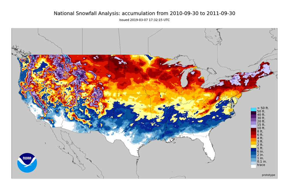
Agreed from North GA. 09/10 and 10/11 back to back are the best winters we've seen in 30 plus years, discounting the monster at the end of 93 of course.
-
I didn't pay this one much attention down here in the GA mountains but it's definitely a lot colder than it was supposed to be right now. 28.5/25.1. Forecast from GSP was low of 32 without even any frozen/freezing at onset.
-
Of all the potential CAD'S we've had this far, I feel this one has the most potential to trend stronger once we get to Hi-Res guidance. As long as the high is of good strength and gets in a good location, this one actually has some legit cold to work with in the NE for the first time this winter.
-
Decent bit faster. At 0z on the 28th the GFS is just starting to form the weak surface low back around Louisiana/Mississippi, while the UKMet already has it there in south/central GA. I’d guess we want the slower solutions allowing the HP more time to get into position.
-
Gfs slowed the wave down a bit looks like allowing CAD to build in out ahead a little better. Beyond frustrating seeing all that snow deep into SC yet nothing at all in GA lol. Hanging my hopes on an under-modeled CAD.