SnowDawg
-
Posts
1,070 -
Joined
-
Last visited
Content Type
Profiles
Blogs
Forums
American Weather
Media Demo
Store
Gallery
Everything posted by SnowDawg
-
Tiger, just south of Clayton right at 2000 feet. Grounds white well to my south and the north but we're struggling to moisten up the boundary.
-
Wow that's awesome. I must've been stuck between the best rates so far. North end of the county is turning white and your getting some stick age down there now, but I've just had a few intermittent flizzards and it's only down to 39.7.
-
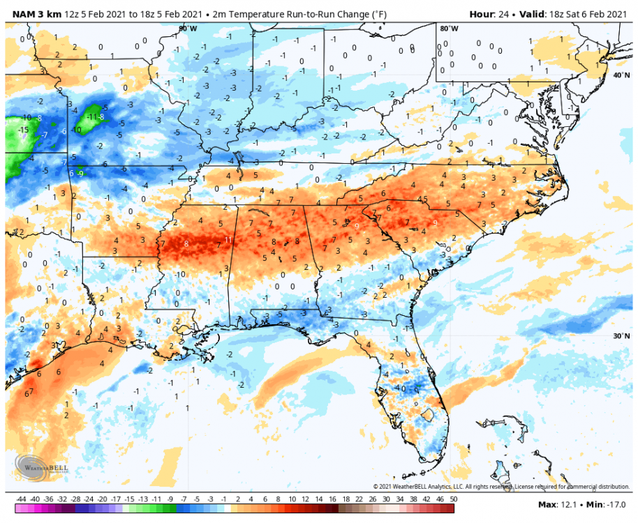
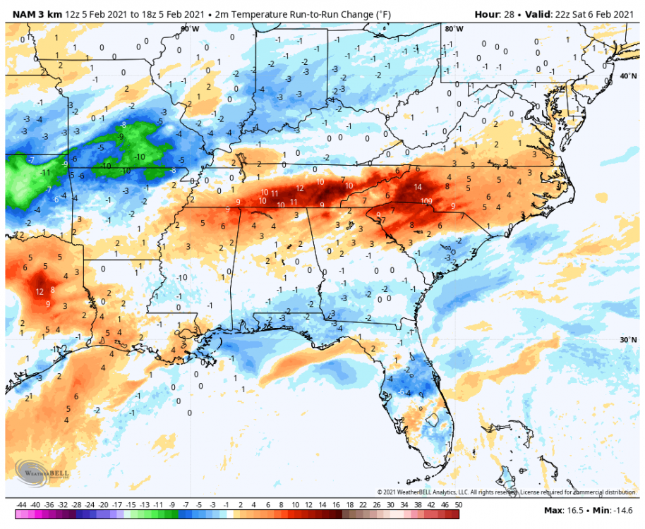
Not good boys...Even the NAM is underestimating the strength of the warm nose apparently. special 18z sounding from KFFC shows a stronger warm nose than what any of the models depict, but the NAM is closest. How far this warm nose works north and west, into the area where temps are closest to or below freezing, will determine the extent of the wintry precip. They dropped my totals for the 3rd time today and only give me a single hour of all snow and transition to all rain by 11....
-
I think they may expand the advisories with the main afternoon update in the next hour or so.
-
Quite literally what it did to me back January. It even got GSP to jump on big increase in totals right at game time. That bust hurt bad lol
-
I'm assuming current wet bulb temps are actually better than expected based on this from the latest discussion from GSP: Dewpoints remain low w.r.t. the forecast, with even the new values entered last hour now proving too high, reflecting the dry high pressure that will eventually support in-situ CAD, developing after warm frontal precip spreads in from the south later this aftn. Will have to take another look at p-type this afternoon and evening as a result, but even with good wet-bulbing temps are warm enough that precip probably will start as rain everywhere except the higher mountains. This definitely adds up cause my forecast dew point was 23 at 2pm while in reality it was 14.5
-
42.5/16 dew point still crashing all day since 9:30. A few flurries/graupel reaching the ground occasionally now.
-
I'm at 43/17 down here. Dew point has been crashing pretty hard since about 9:30 when it was like almost 23.
-
Down to 26 here, wishing this thing could've been about 12 hours faster and be moving in about 4 AM.
-
Again though, it's kind of on an island with bringing the precip in that late. Most other modeling starts here sometime between 1-4. It holds back until like 7.
-
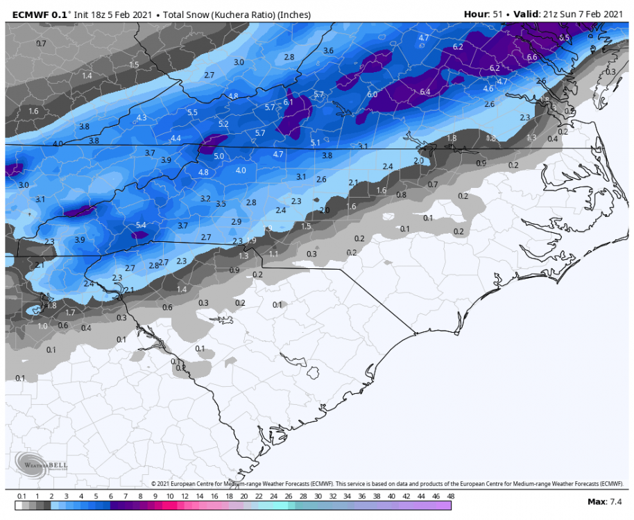
Does GSP include sleet in their snow totals like they do in the text products? Cause specifically my forecast is for 2-4 inches of snow and sleet, and hell with that NAM look I could have 1-1.5 inches of sleet alone.
-
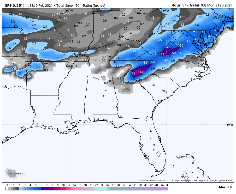
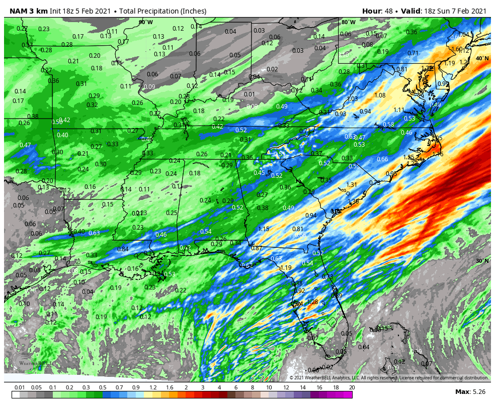
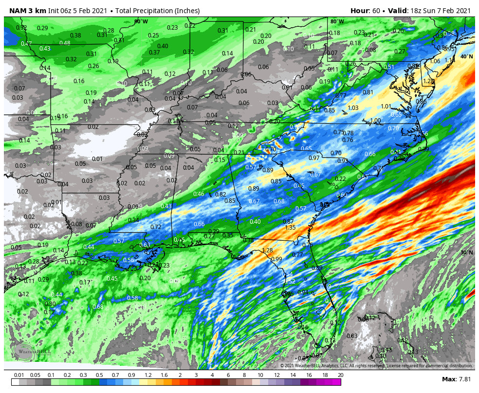
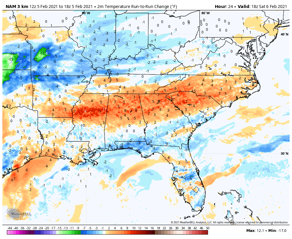
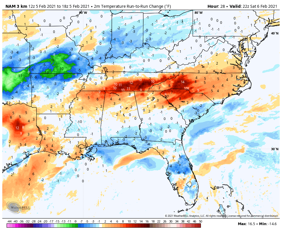
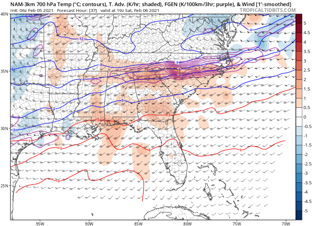
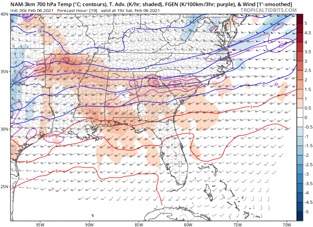
For whatever reason the 700mbar frontogenesis band, that is responsible for delivering our precip out ahead of the heaviest rates with the 850mbar frontogenesis in the evening, was a lot weaker and slower that run. This is it and it's precip response from the good 06z run this morning valid 2pm tomorrow: And this is the same timestamp on the latest run: As @burrel2 said this is the crucial part of the storm, not the warm nose. This earlier onset and more QPF ahead of the best forcing and rates would help cool the column and have us primed and ready to accumulate snow immediately once the best rates arrived in the evening. Without it the whole thing is screwed up.


-
Honestly big picture wise the NAM trended towards the other models that run. But it's much later timing of the front end of the precip and the raging warm nose it's showing are causing the big differences.
-
That warm nose is so freaking strong... Every other model needs vast improvements if it can't see a warm nose that strong and the NAM does.
-
Significant improvement from 18z in my book. Really need the NAM to look better to feel comfortable with it though.
-
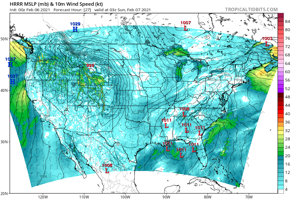
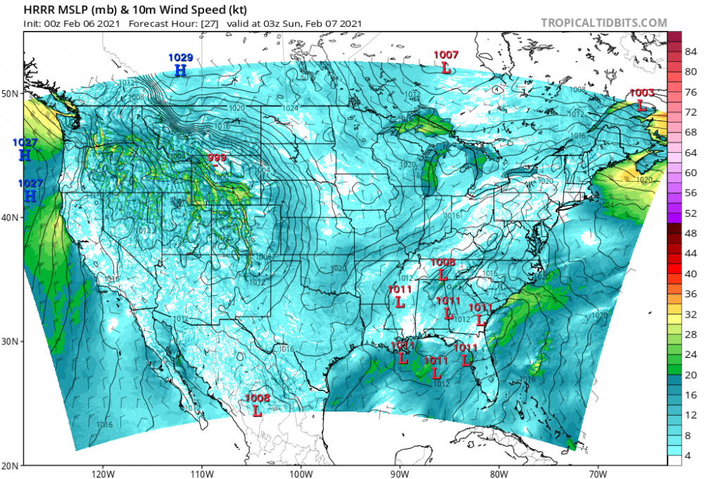
Tropical Tidbits got a little confused about where to put the surface low on the HRRR lolJoking aside though it keeps the primary along the Gulf a lot better than it did at 18z.
-
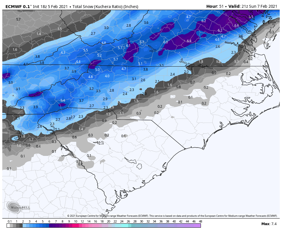
Euro for Upstate/WNC/GA folks: Definite improvements from the 12z run.
-
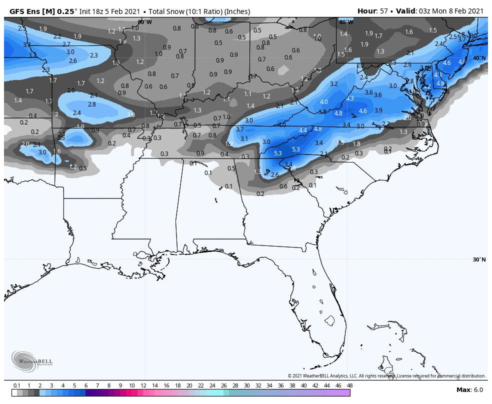
Pretty well matched up. The mean trimmed some off the edges in basically all directions and lowered the totals along the escarpment a bit from 12z, probably just from eliminating some high outliers.


-
Huge impact in the low in the TN valley getting amped up. 06z was our peak run for snow in NGA and the Western Carolinas and the QPF looked like this: Now it's this: This trend keeps up its turning into a true Miller B Ohio Valley/Mid-Atlantic/NE storm.


-
Went from 4-6 hours of snow before mixing to 2 if I'm lucky. This winter is absolutely terrible. One of the worst in decades for me at this point.
-
It gets worse... Edit: And even worse for some areas. No way changes this big don't have an impact. Same story aloft much warmer.
-
Sheesh....NAM coming in slower meaning more sunlight in the morning and less evaporative cooling early on.
-
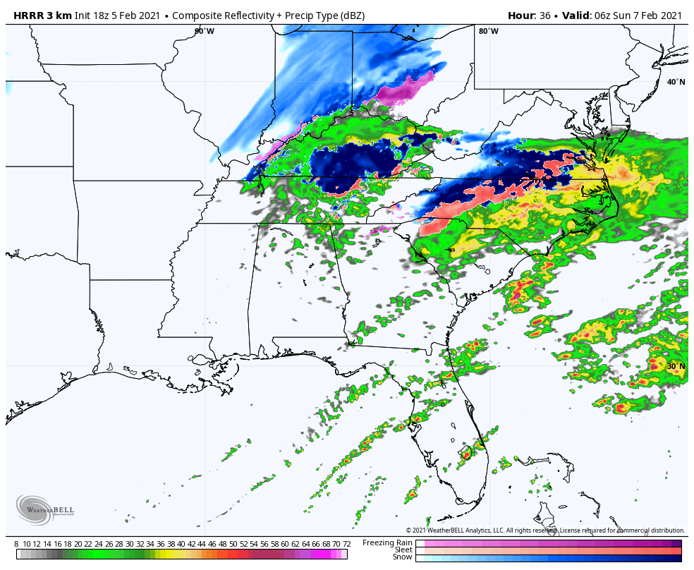
HRRR like a dead match with the Euro on the split precip field. Front end thump is okay but then it's a massive dry slot. January nightmare all over again... So weird with all other modeling trending NW and amped. Guess we'll see if other modeling takes steps this direction at 18z and 0z.

-
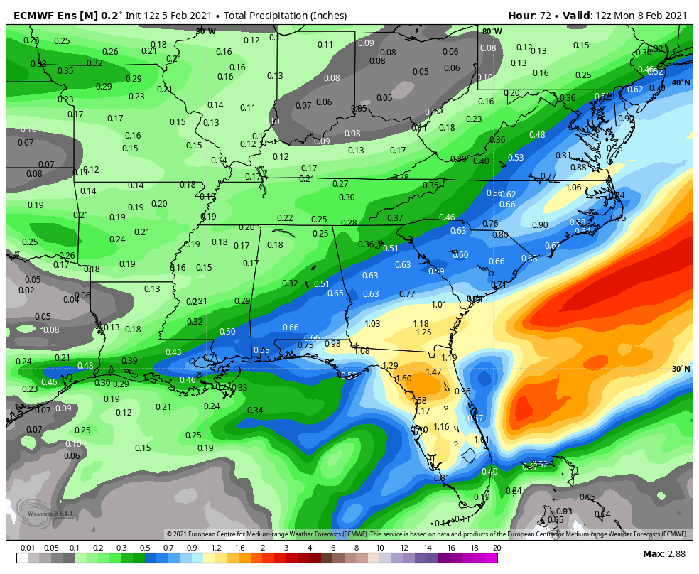
EPS Mean and Control follow the OP with a sudden drop in QPF...

-
I think @SnowGoose69 called it perfectly and the Euro is doing exactly what he noted with the models over-correcting to the SE ridge in the 4-7 day time period and we'll see it go back to a more reasonable solution in between the extremes over the coming days.