ORFDawg2013
-
Posts
472 -
Joined
-
Last visited
1 Follower

About ORFDawg2013

Recent Profile Visitors


-

Richmond Metro/Hampton Roads Area Discussion
ORFDawg2013 replied to RIC Airport's topic in Mid Atlantic
Didn't go into today with much expectations, and pleasantly surprised at what happened, all things considered. Would have liked a legit storm with heavy accumulations, but we did get spoiled a lot last winter. -
Richmond Metro/Hampton Roads Area Discussion
ORFDawg2013 replied to RIC Airport's topic in Mid Atlantic
Just met a lady in my building elevator who had never seen snow. She's was from Brazil! -
Richmond Metro/Hampton Roads Area Discussion
ORFDawg2013 replied to RIC Airport's topic in Mid Atlantic
Definitely the prettiest snow of the season for us! None of that pixie stick stuff from the last "storm" that blew around everywhere. This is a paste job! -
Richmond Metro/Hampton Roads Area Discussion
ORFDawg2013 replied to RIC Airport's topic in Mid Atlantic
Shame this low isn't sitting off of Hatteras with temps in the upper 20s for us! -
Richmond Metro/Hampton Roads Area Discussion
ORFDawg2013 replied to RIC Airport's topic in Mid Atlantic
We've got flakes flying in Norfolk! Accumulating on elevated surfaces. Grass not so much yet. -
Richmond Metro/Hampton Roads Area Discussion
ORFDawg2013 replied to RIC Airport's topic in Mid Atlantic
ORF 100% saturated at 35.6F so we're going to need some evaporative cooling to happen -
Richmond Metro/Hampton Roads Area Discussion
ORFDawg2013 replied to RIC Airport's topic in Mid Atlantic
Wakefield just issued Winter Weather Advisories and updated Watch areas to Warnings -
Richmond Metro/Hampton Roads Area Discussion
ORFDawg2013 replied to RIC Airport's topic in Mid Atlantic

-
Richmond Metro/Hampton Roads Area Discussion
ORFDawg2013 replied to RIC Airport's topic in Mid Atlantic
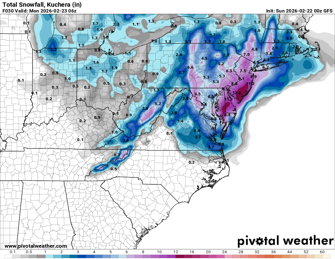
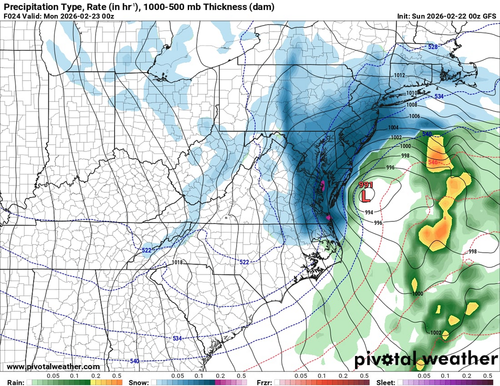
00z GFS put some nice rates down on the coast!
-
Richmond Metro/Hampton Roads Area Discussion
ORFDawg2013 replied to RIC Airport's topic in Mid Atlantic
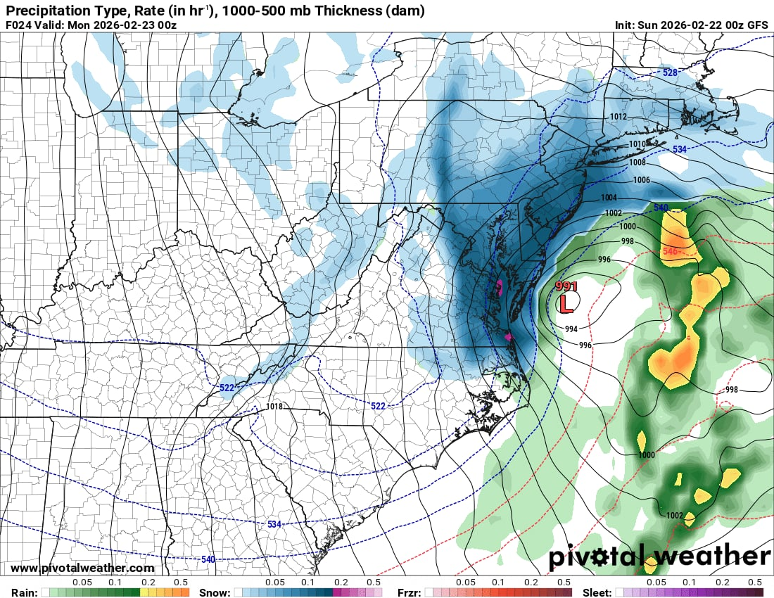
Oh I was just saying that based off the 18z Suite -
Richmond Metro/Hampton Roads Area Discussion
ORFDawg2013 replied to RIC Airport's topic in Mid Atlantic
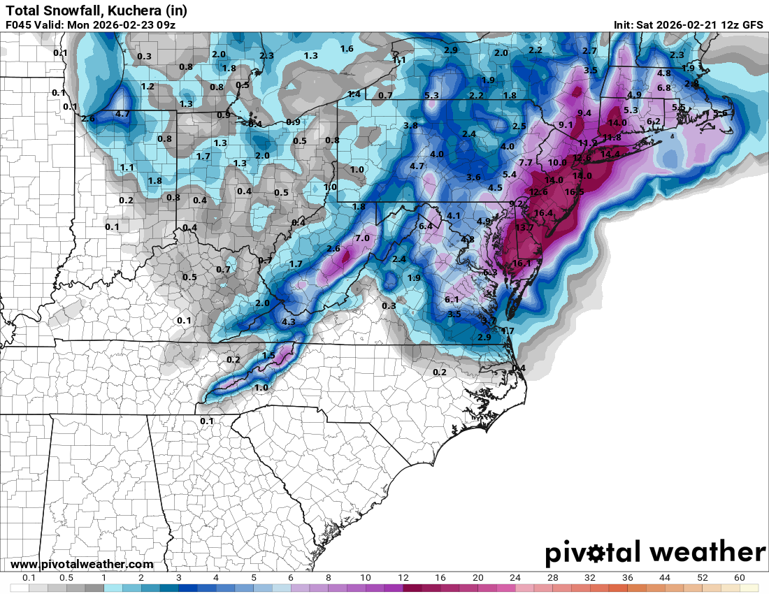
Maybe trending to more of a significant event for Southside HR? -
Richmond Metro/Hampton Roads Area Discussion
ORFDawg2013 replied to RIC Airport's topic in Mid Atlantic
I don't subscribe to any of the model sites so I just have to hope other people post our region. Wasn't an issue in the last storm since NC was in on it, but the other MA folks don't throw us a bone. -
Richmond Metro/Hampton Roads Area Discussion
ORFDawg2013 replied to RIC Airport's topic in Mid Atlantic
-
Richmond Metro/Hampton Roads Area Discussion
ORFDawg2013 replied to RIC Airport's topic in Mid Atlantic
yeah, I guess we're "elsewhere?"........... -
Richmond Metro/Hampton Roads Area Discussion
ORFDawg2013 replied to RIC Airport's topic in Mid Atlantic
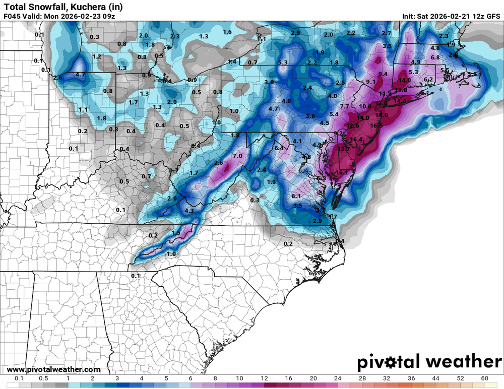
Latest from Wakefield