AMZ8990
-
Posts
1,227 -
Joined
-
Last visited
Content Type
Profiles
Blogs
Forums
American Weather
Media Demo
Store
Gallery
Everything posted by AMZ8990
-
According to the fine folks in Ark/Kansas Thread, The HRR was 10 degrees too warm on their forecast for today. Had them at 42 and they haven’t got over freezing all day. Looks like they’ve picked up 1-3 inches of surprise snow in spots that weren’t expecting much. Figured some of you would enjoy knowing the HRR forecast overdid the high temps today in northern/central Arkansas
-
Thanks, CG. And I’m right there with you man. Not having uniformity along all models is nerve racking, especially when we are this close to said event. Hoping for the best while simultaneously preparing my mind for the worst, lol.
-
NWS must of seem something they liked last night, they bumped totals up to 3-6 instead of 2-4 in my neck of the woods.
-
For my west Tn and part of middle Tn folks. Here is a map NWS Memphis put out early this morning. It puts down 3-6 for most of west Tn except the far northwest corner of the state. I-40 from Jackson to Nashville looked like it Was in a good spot again, Good look for the majority of west Tn also though. https://www.weather.gov/meg/winter
-
I’ll say this, the EURO has been consistent with this look. Hard not to bite on this with that consistency. Gonna be a long night of tracking ahead!
-
It’s a waiting game at this point guys and gals. The Models (specifically short range ones) are gonna spit out some wonky looking solutions while they try to figure out the temperature profiles/timing in the possibly affected areas. This is a long duration event though, so don’t get hung up on seeing rain in the forecast because Everyone is gonna see some rain before they get snow with this event. And Often times those rain to snow events Produce the biggest snows as well.
-
It went crazy on the 6z run, big totals in SW Tn that run
-
Same thing on the west side of the state. Says 2-4 for MBY.
-
NWS Memphis had this below to say in their special weather statement for west Tennessee. Also- Winter storm watches now up for about 10 counties in north central Arkansas as well. ...Winter Storm to impact the Mid-South This Weekend... A potent upper level low pressure system will move into the Mid-South this weekend. Rain will begin to mix with snow across Northeast Arkansas and the Missouri Bootheel Saturday afternoon and will change to all snow by sunset Saturday evening. The transition from rain to snow will occur across the rest of the Mid-South from west to east Saturday Night into Sunday as colder temperatures spread into the region. It is too early to pinpoint exact amounts and locations of the heaviest snowfall. Snowfall amounts will be heavily dependent on the exact track of the system. At this time, it appears the greatest potential for a moderate to significant snowfall will occur across areas along and north of the Tennessee and Mississippi state line. However, all the Mid-South will likely see winter weather impacts with this system. Travel will become hazardous Saturday Night into Sunday. Stay tuned to the latest forecasts.
-
Appreciate that, buddy!
-
I Had thunder and lighting on Sunday at my house. Here recently that’s meant a lock for an incoming snow in the area. We will see if that holds true again this time, personally I think it will. And for the record, the Euro did outstanding with the last storm.
-
Had it this morning on my way into work in Collierville, lots of lightning on a morning drive is always fun to see. Wouldn’t surprise me if some of you guys see the same later today. Rain is torrential also
-
Had some thunder and lighting this morning on my way into work in Collierville. Rain is coming down HEAVY now. It’s Gonna be a gully washer for a lot of people as this system moves across the state today.
-
For MBY seems like the euro did the best job sniffing out where the rain snow line would set up. Pretty impressive honestly
-
I think your in a good spot, Jax.
-
Modes act like they want to bulk that precipitation up once it crosses the Mississippi River too. Hopefully it continues to build like the models show and we can have more areas see some snowfall.
-
Gfs was too far south with the snow line In southwest Tn. Had us in the 1-2 range. I’d bump the southern edge up 30miles north at the least
-
25 miles south of Jackson and there is no snow at all. Cutoff line is steep as advertised. I hate situations like that
-
If Your In central Tn the radar looks really good for you guys. Just some light freezing rain so far on the southwest side of the state.
-
 Roads are pretty hazardous this morning in hardeman county. Lots of ice patches and snow on the highways/ side roads. I’m surprised it stuck so well to the roads honestly
 -
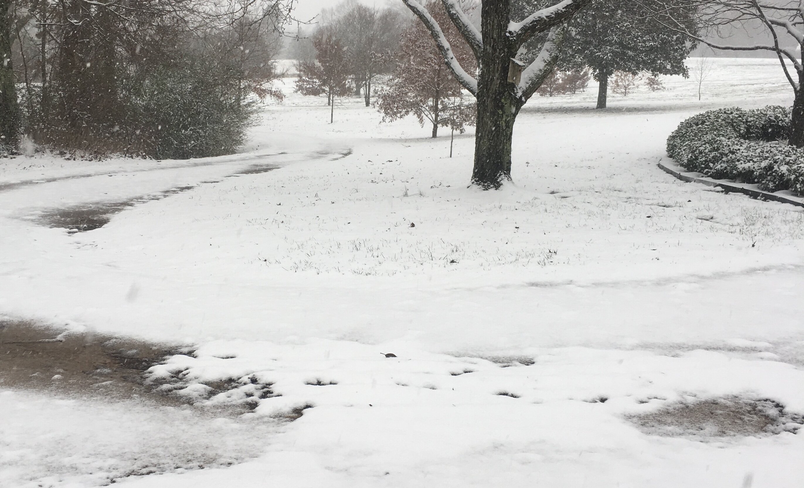
Front yard, and yeah man it is awesome! Definitely over achieved here
-
I agree brother, definitely makes for a great Sunday afternoon!
-
Large flakes coming down now in bolivar at a moderate rate. Looks like we will have a few hours of this.
-
Thanks Houston. Light to steady rain mixing in with some sleet right now in bolivar.