AMZ8990
-
Posts
1,227 -
Joined
-
Last visited
Content Type
Profiles
Blogs
Forums
American Weather
Media Demo
Store
Gallery
Everything posted by AMZ8990
-
At WestTennWX, would you be willing to change the name of this thread so we can integrate the Monday -Tuesday system in it as well?
-
 NWS Memphis taking the threat seriously right now. Looks like winter storm watches have already gone up In southern Oklahoma and north central Texas. Below is what NWS has to say for West Tennessee. WINTER WEATHER TO IMPACT THE MIDSOUTH OVER THE NEXT WEEK... Active winter weather is forecast through next week. Extended Cold temperatures are expected well into next week as several weather systems cause a mixture of winter precipitation, some of which could be significant. Wind chills Sunday and Monday are forecast to fall below zero north of I-40 with single numbers in most other places. Friday night into Saturday light freezing rain/drizzle may cause travel hazards, especially across north Mississippi. There is increasing confidence in a major winter storm later Sunday and Monday over the Mid-South. Significant snow, sleet and freezing rain may occur causing noteworthy impacts. Yet another winter weather event may follow for Wednesday/Thursday next week. Stay tuned to the latest forecasts and weather conditions. Learn about winter weather safety and prepare ahead of time at www.weather.gov/safety/winter $$
 -
The folks in the Oklahoma/Texas/Kansas Arkansas thread are pretty pumped up from what I’ve read. Euro dumps a lot of snow on them on Sunday to start the show off
-
Would be similar to our last good winter storm it seems like, (january2018). An inch or so of sleet and ice on the bottom with a few inches of snow on top. With another system 2-4 days after that dropped another 1-3 of sleet/snow. We were in a similar situation with brutal cold air in place for a week or so also, don’t think it was quite as cold as what’s being modeled now though. Snow/sleet stayed on the ground nearly 10 days. Longest I’ve ever seen the ground stay white in my 20 years in west Tn. The similarities of these two time frames/storm systems is interesting.
-
Pretty good consensus amongst the models right now for the storm on Monday into Tuesday. Euro was the most bullish on totals, keeps West/Middle Tn In rain/ice longer than any of the other models but still puts down an inch for a good portion of west Tn. All 5 models are on the same page at this point though, so that’s something we’ve got in our favor
-
How did the UKMET do at range with your Christmas snow? I feel like I remember the GFs being pretty locked into it from a ways out but I may be remembering wrong
-
From what I’ve seen, yes. I’m glad it underperformed though versus the alternative. Some places north of 40 got some decent sleet accumulation also, saw some pics of white covered roads in Tipton county this morning.
-
Had some thunder in hardeman county as well. Icing wasn’t too bad down my way. Got a good glaze (.10 maybe) of ice on all the trees and stuff but that’s about it. We dodged a bullet with this ice storm.
-
Most definitely. Those are some down right frigid temps being depicted
-
I hope so! Would be a once every 30 year type storm if it verifies. GFS
-
Wind chill values may drop into the single digits along and north of I-40 Friday morning and across much of the Mid-South Saturday and Sunday mornings. Below zero wind chills are possible across northern areas of the Mid-South Sunday morning. Snow will be possible by early next week with accumulations possible. NWS Memphis already mentioning the Sunday thru Tuesday possible system in their hazardous weather outlook. They’re usually pretty bullish on these things so it’s somewhat note worth that they mention it.
-
The magnitude of this is jaw dropping honestly. I realize it’s still a long way out but you don’t see scenarios like this on models everyday! In regards to Holstons second post. The ice depiction is not something we’d want to see in this setup, the sheer duration of the event/events could lead to devastating outcomes if ice is involved.
-
That would cause a lot of problems if it goes down as depicted here. Fingers crossed it doesn’t get that bad
-
I agree carver! Right now storm tracks are hammering the the dakotas, Nebraska, Iowa, northern Missouri, etc. it’s only a matter of time before that track moves south a bit, (hopefully). If and when it does, it could be a big time event for somewhere in our forum area. They were getting hammered day after day in Des Moines while I was up there, and central Missouri got pounded yesterday as I was on my way home, it was a very difficult drive to say the least. I say all that just to reiterate how much energy is flying around the lower 48 right now. Given the cold air in place to our north, we have a lot of variables in are favor to produce a good storm over the next 5-10 days.
-
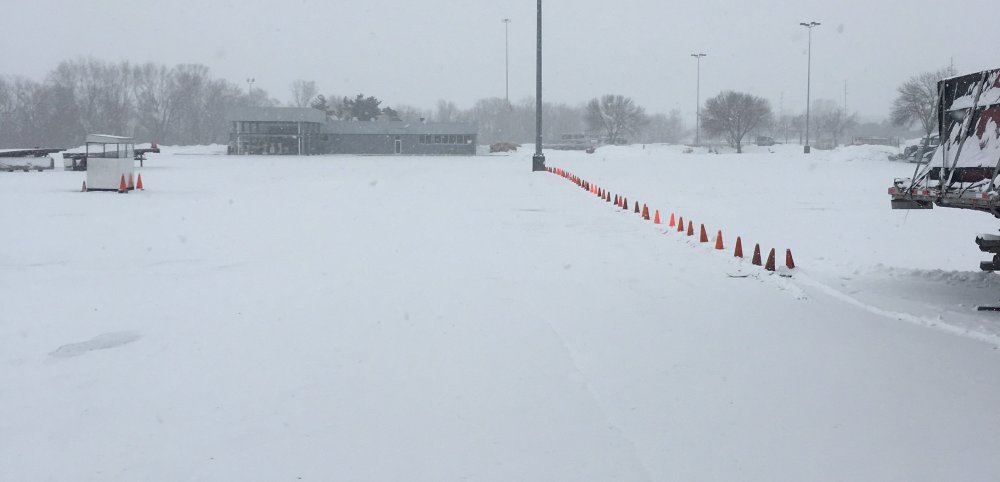
I’m still in Des Moines guys so I figured I would share a pic with y’all. Light snow most of the day today. Wind chill tonight is supposed to be around -30!!! Next 5-7 days are going be brutally cold as well, I’m gonna freeze my butt off!
-
Almost, one county over to the east of the High would be my house.
-
Lots of energy flying around the lower 48 that run. Pretty cool to see so many different systems modeled to come near or threw the forum. Gotta love all that potential!
-
Had some lighting strikes in Hardeman county tonight, decent little cell pushed through around dinner. All rain now
-
January 27th-28th Boom or Bust Snow Event/Obs
AMZ8990 replied to John1122's topic in Tennessee Valley
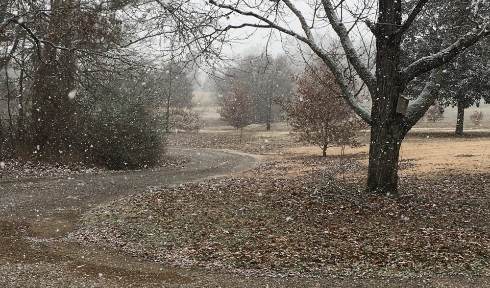
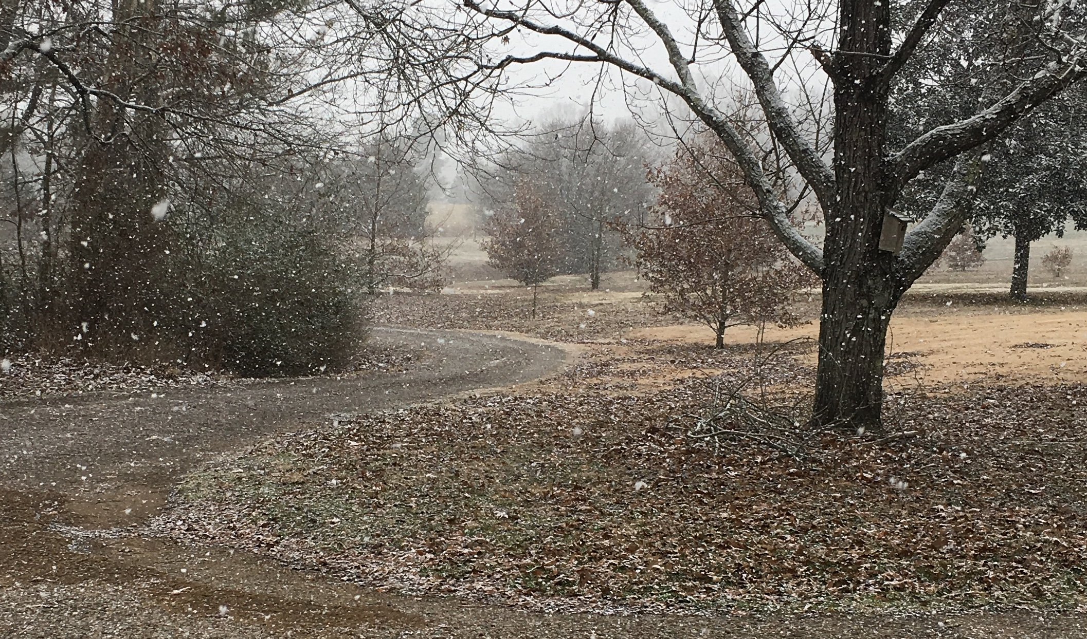
That’s an awesome view! -
January 2021 Medium/Longterm Pattern Discussion.
AMZ8990 replied to AMZ8990's topic in Tennessee Valley
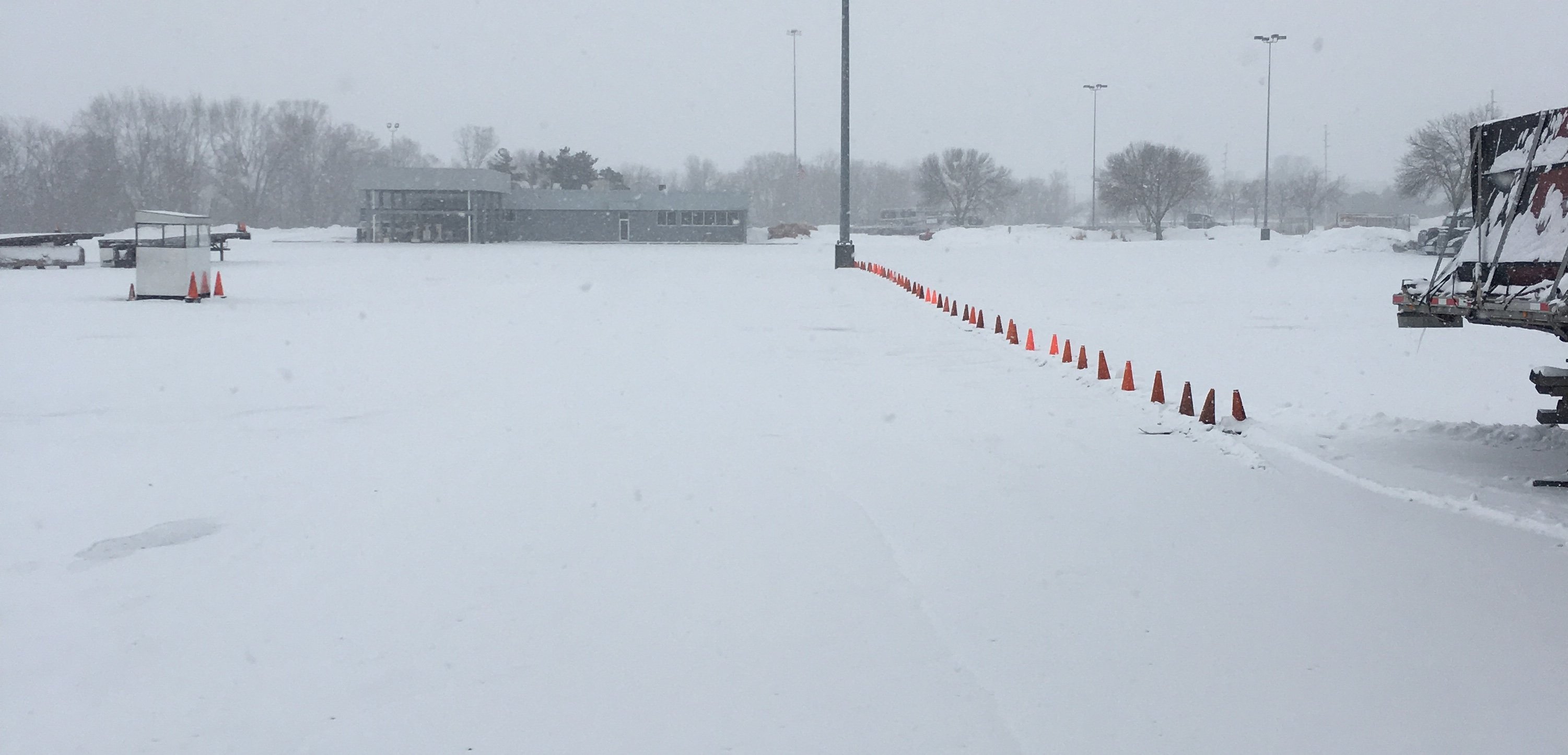
Picked up about 3 inches so far up here in Des Moines.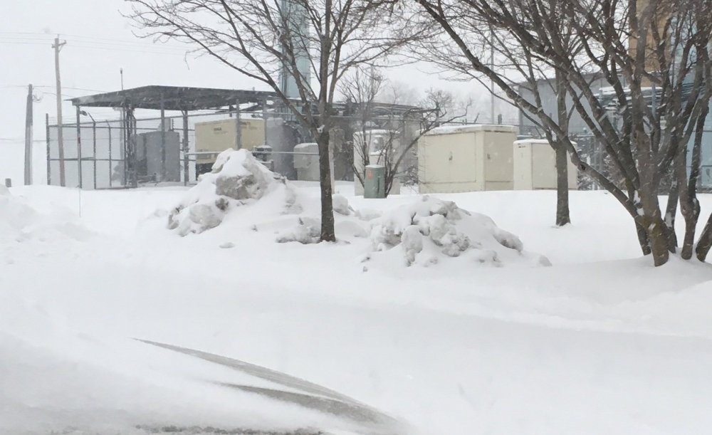
- 849 replies
-
- 12
-

-

-
Jan 24-26th Potential Something Part 2
AMZ8990 replied to Chicago Storm's topic in Lakes/Ohio Valley
2-3 on the ground in Des Moines atm. -
January 2021 Medium/Longterm Pattern Discussion.
AMZ8990 replied to AMZ8990's topic in Tennessee Valley
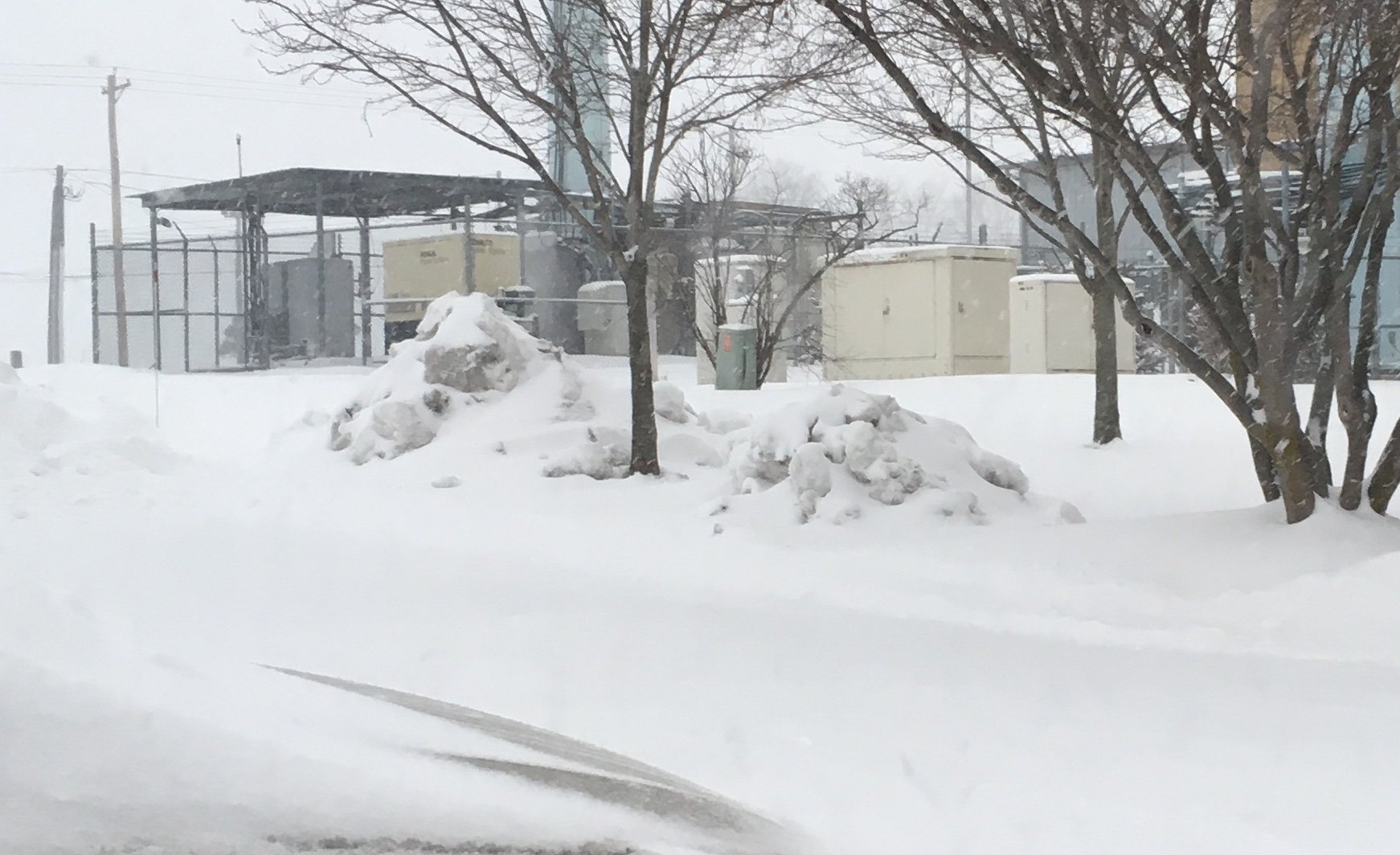
I’m heading up to Des Moines Iowa today for work guys, winter storm warning tomorrow in that area too. Calling for 8-12 inches, I’ll send you guys some pics if the storm pans out! I Hope the forum can score a storm or two while I’m gone! -
January 2021 Medium/Longterm Pattern Discussion.
AMZ8990 replied to AMZ8990's topic in Tennessee Valley
I agree. We complain about our back yard but those guys up north are actually in prime areas for snow and they’ve had a rougher go of it the last 2 years. -
Wish i I was there
-
Jan 11-12 Mississippi Mauler: Will it or won't it?
AMZ8990 replied to John1122's topic in Tennessee Valley