ajr
-
Posts
379 -
Joined
-
Last visited
Content Type
Profiles
Blogs
Forums
American Weather
Media Demo
Store
Gallery
Everything posted by ajr
-
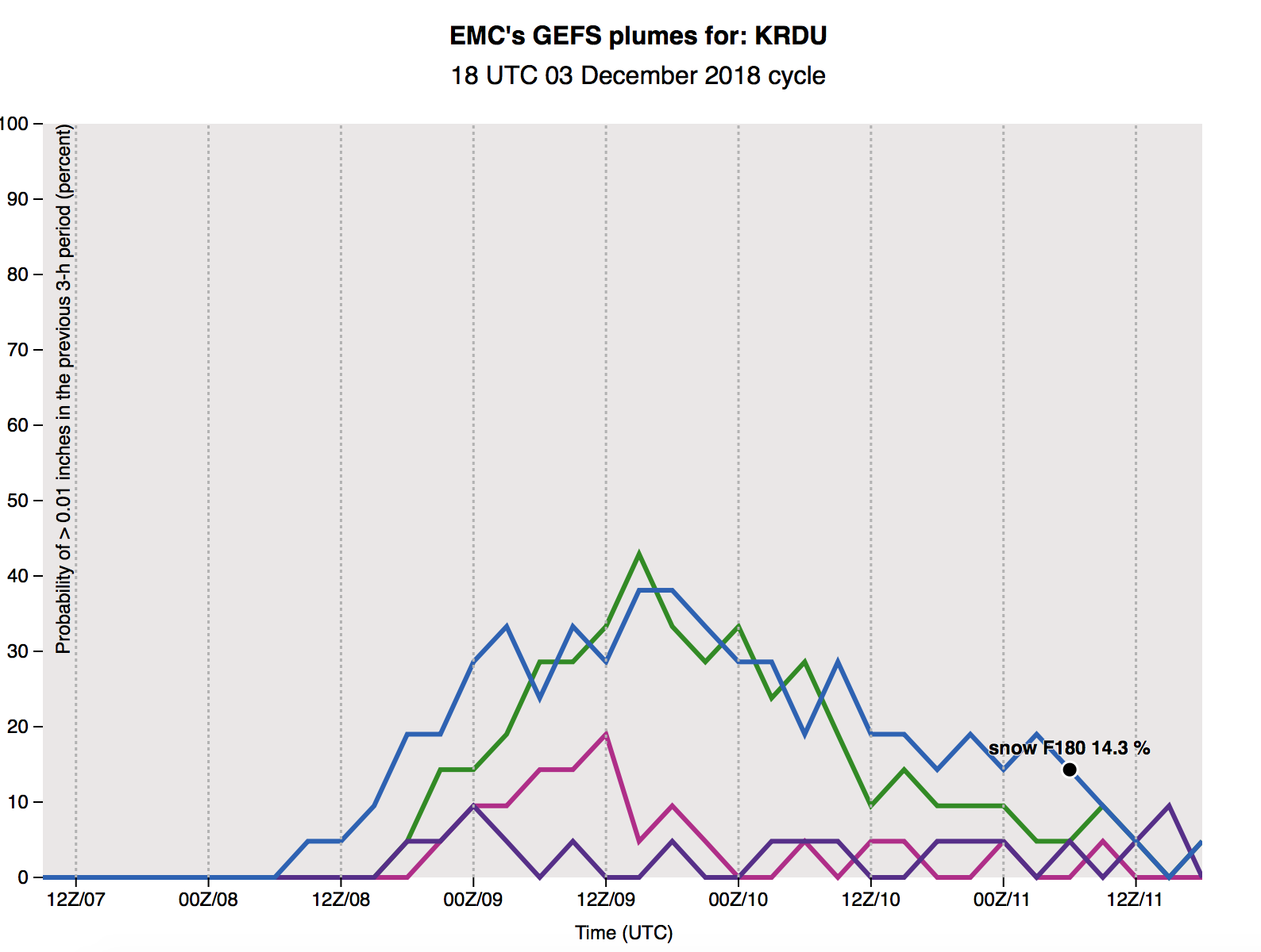
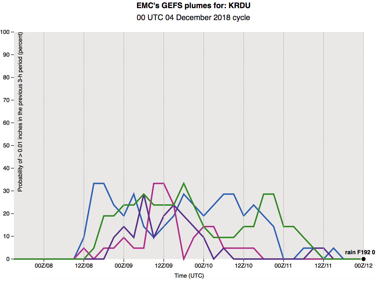
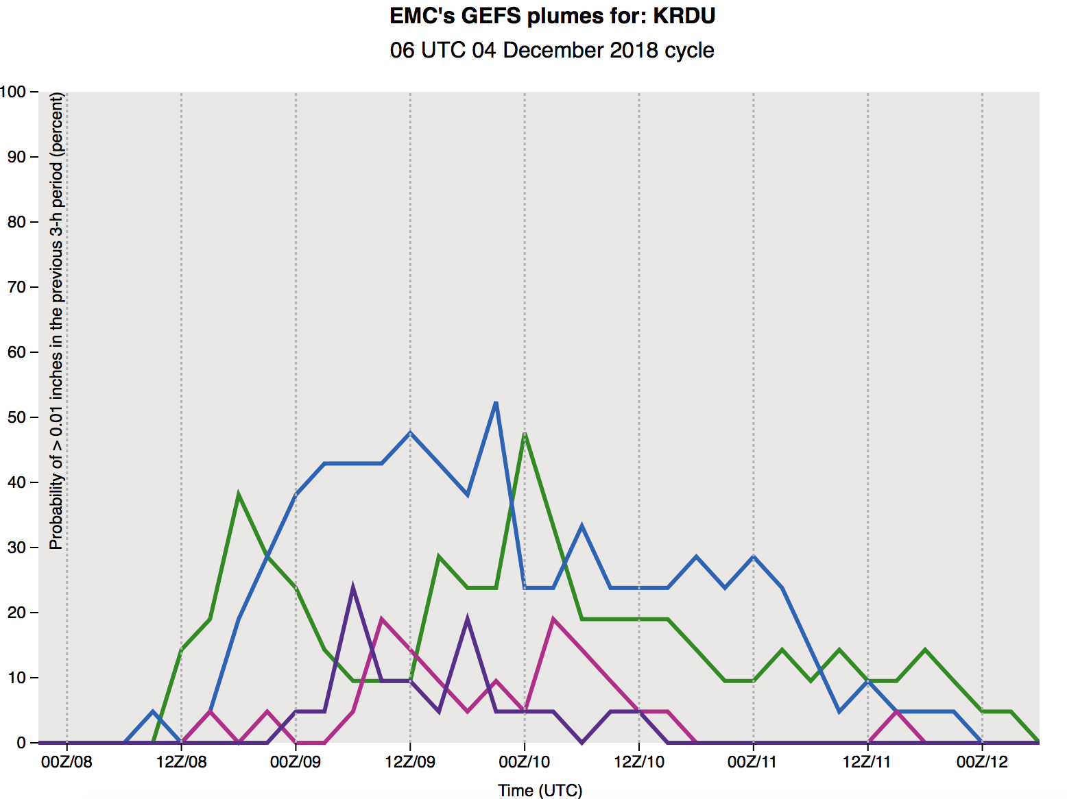
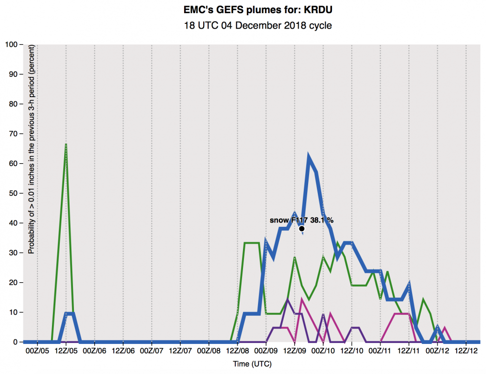
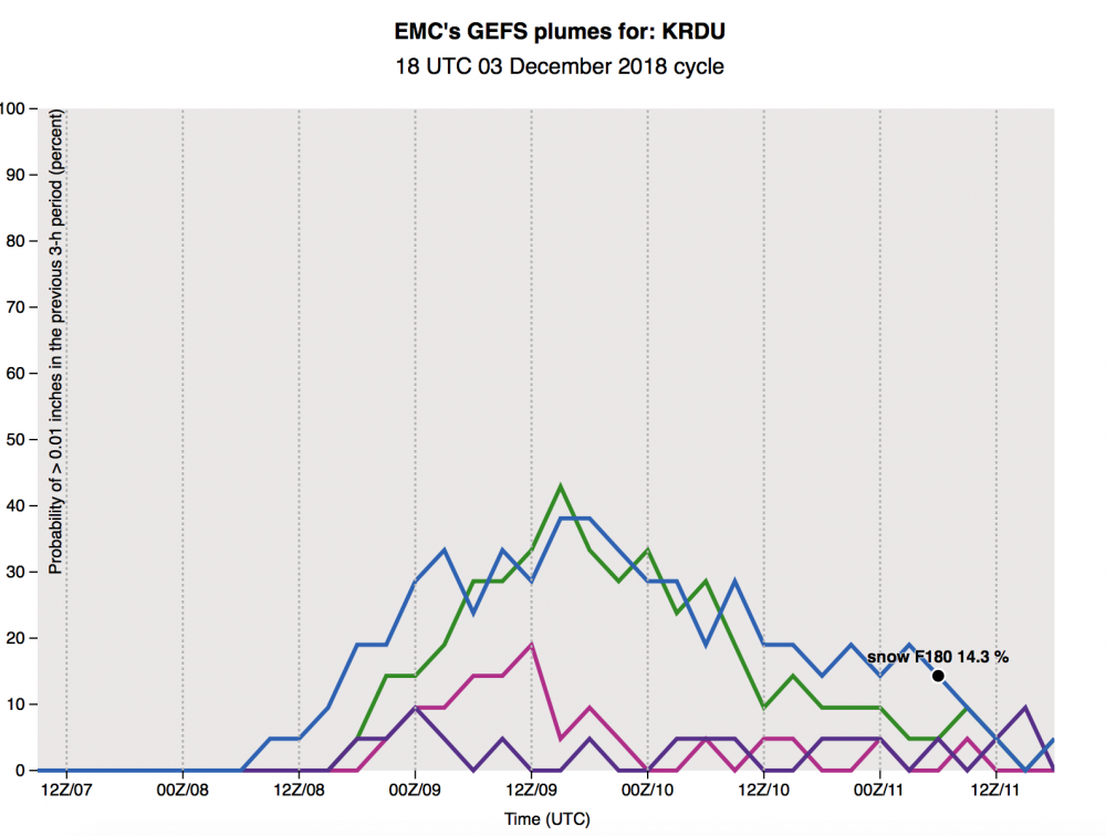
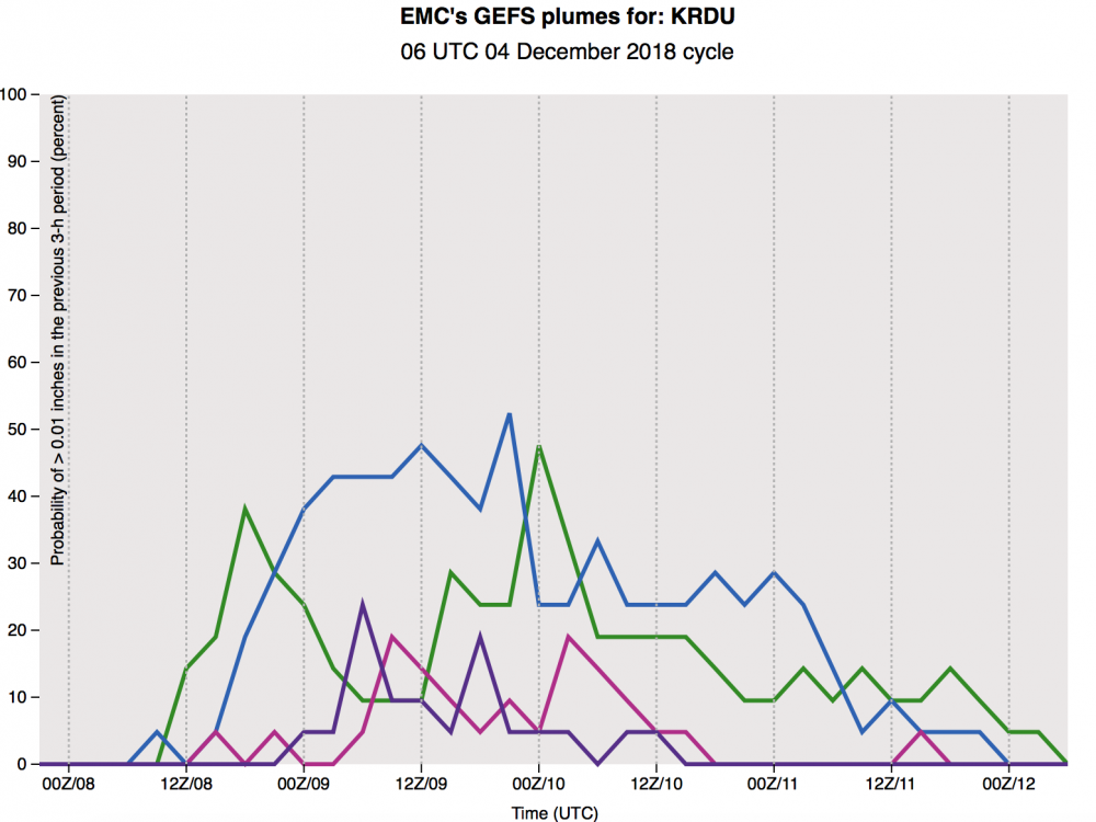
GEFS plumes with a big jump in snow % for RDU
-
The FV3 has this system continuing into Monday night, Tuesday AM with snow showers
-
Can you post maps?
-
Really threading the needle here..
-
Slowed down a bit through 84
-
18z GFS further south through 72
-
Can you post?
-
The trend at the 850 level that past few runs has been nice
-
That still looks like a foot of snow in Chapel Hill... unreal
-
To support this idea, this is exactly what is showing in p-type breakdowns on the GEFS - while still a mixed bag, the 6z has higher prob of snow (30-40% vs 20-30%)
-
That's what I remember as well (in particular to Jan 2017 also)
-
I’m used to seeing a snow map like that on just ONE ensemble member and us hoping for that... never the mean. Have we ever had a GEFS mean that nice 5 days out?
-
Slightly faster but weaker low.. slightly colder at the 850 level through hr 90
-
Slightly weaker southern wave, slightly colder through hr 66 on the 6z FV3
-
That’s good to hear - in the past few years the NAM has handled temps better than globals (Jan 2017 comes to mind)
-
The trend in temps on the Euro is worrying... our cold air is moving out before the storm hits
-
Unreal that the EPS mean is 10 inches for parts of central NC more than a few days out from the system
-
18z FV3 looks about the same through hr 90
-
Might be premature, but just ordered a sled for my son
-
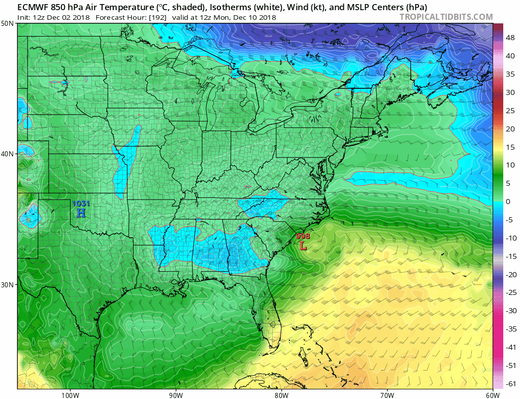
Not just you - you can see the cold air from Canada slowly making it further into CONUS at the 850 level
-
Sounds like perfect timing
-
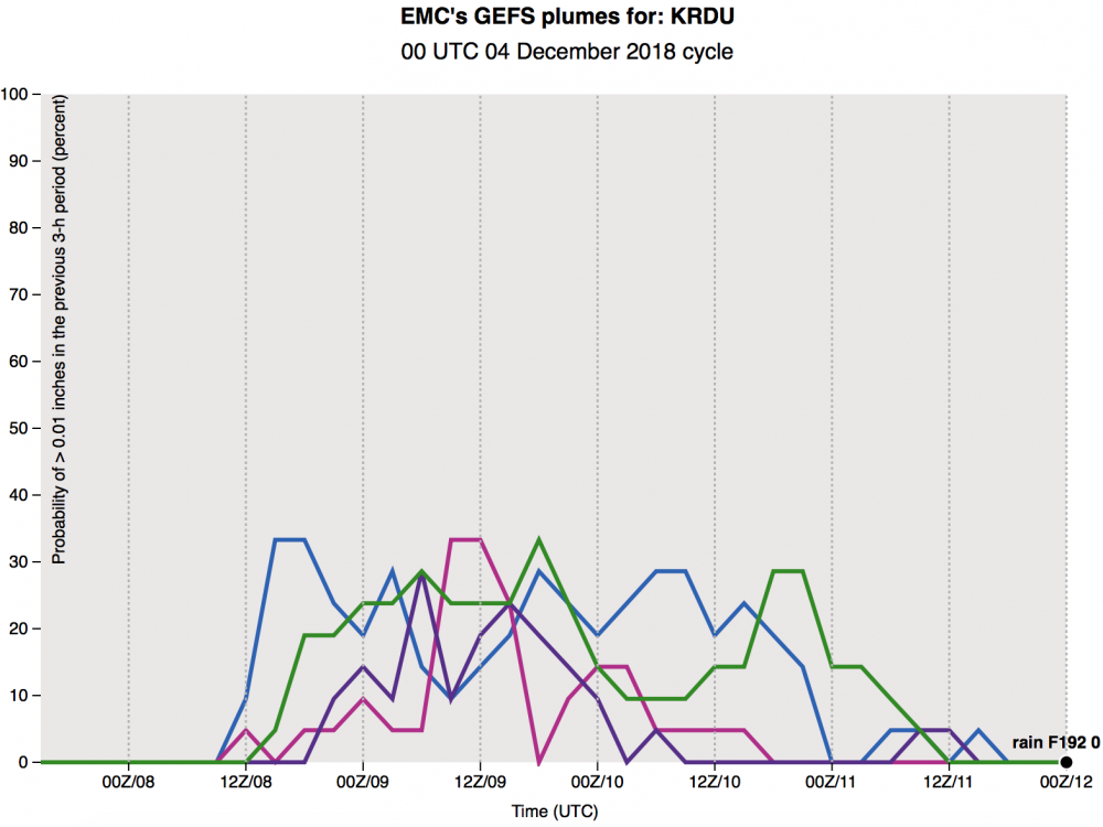
18z GEFS is going to be more surpressed it looks
-
All caveats aside, when is the last time we’ve seen such a consistently modeled powerful winter storm modeled this far out?