ajr
-
Posts
379 -
Joined
-
Last visited
Content Type
Profiles
Blogs
Forums
American Weather
Media Demo
Store
Gallery
Everything posted by ajr
-
Hmm.. why is RAH upping totals? Surely they know global eye-candy at this range isn’t that helpful..
-
Sorry I’m catching up here, but what are we making of this terrible 18z NAM run? We tossing?
-
You probably know better than I do but I thought that was more of a QPF overperform vs temps
-
I’ll feel better about this if the NAM keeps improving.. the sting of Jan 2017 is still there. I can’t think of a storm where cold overperfromed models in the RDU area..
-
WRAL snowfall map - seems bullish to me
-
It’s powered by the tears of snow weenies - gotta stock up before it goes live in January. A marvel of modern engineering, really.
-
Fwiw
-
Sleet fest!
-
Good catch.. you can see this at the 850 level when it starts cooling as precip develops https://imgur.com/gallery/kn7vwoOp
-
The cold air (including up north near the PV) is taking a jog back north the past few NAM runs..
-
-
As others have mentioned most data (someone else said “99%”) fed into models are from satellites.
-
I went through the big Jan 2017 bust thread, and recurring theme was keep an eye on the NAM and then HRRR for temp profiles... globals don’t have the resolution to sort out in detail factors like CAD.
-
Game on!
-
Just FYI Cobb method via Bufkit thinks we're mostly rain/snow mix and only gives about 2" of snow to RDU: http://www.meteor.iastate.edu/~ckarsten/cobb/cobb.php?model=gfs&site=krdu
-
Look at GEFS plumes for KRDU for the most recent 00z run and a day prior, huge increase in the probability of snow (vs rain): 12/5 00z: 12/6 00z:
-
From RAH this morning: Overall reads as more bullish compared to prior ("It's too early for specific amounts, but an inch or two is not out of the question in the Triad region, with a non-zero chance of greater amounts.") - I'm not sure what it means to be "too cute with any snow amounts" though.
-
The southeast trend is real folks - you heard it here first
-
The overall pressure fields look fairly similar — a little weaker up north and maybe a tad slower with the low.
-
Just because it's an important feature with this storm I wanted to look at data supporting some of the things we talk about... turns out there is actual data supporting under modeling of CAD, both in onset and erosion (the latter appears mainly with forecasting low temperatures, i.e. prematurely cutting off the CAD at night). https://vtechworks.lib.vt.edu/bitstream/handle/10919/83476/Lindeman_SA_T_2018.pdf?sequence=1&isAllowed=y
-
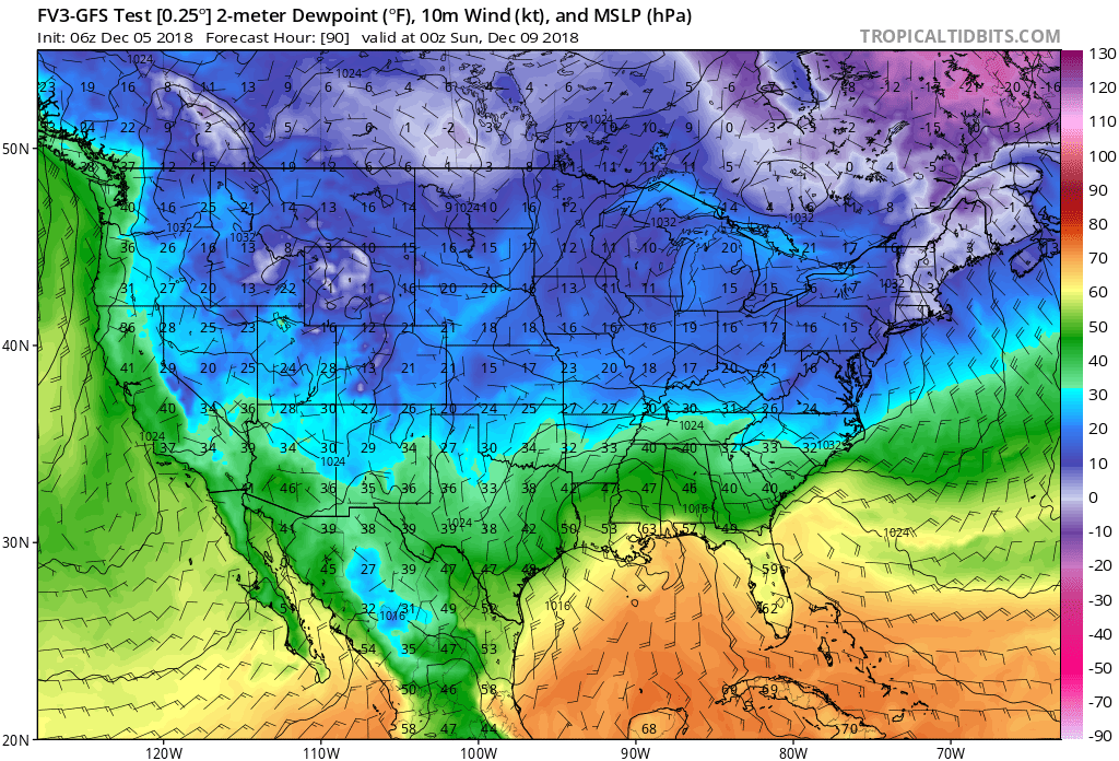
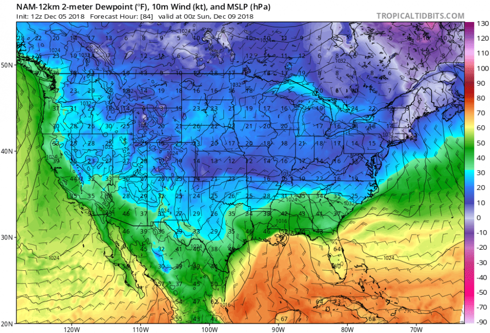
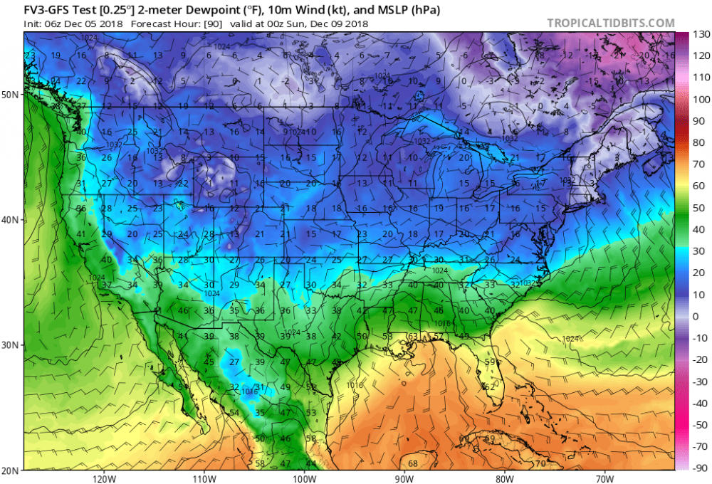
Yep.. pretty big (and nice) differences with DPs compared to the FV3
-
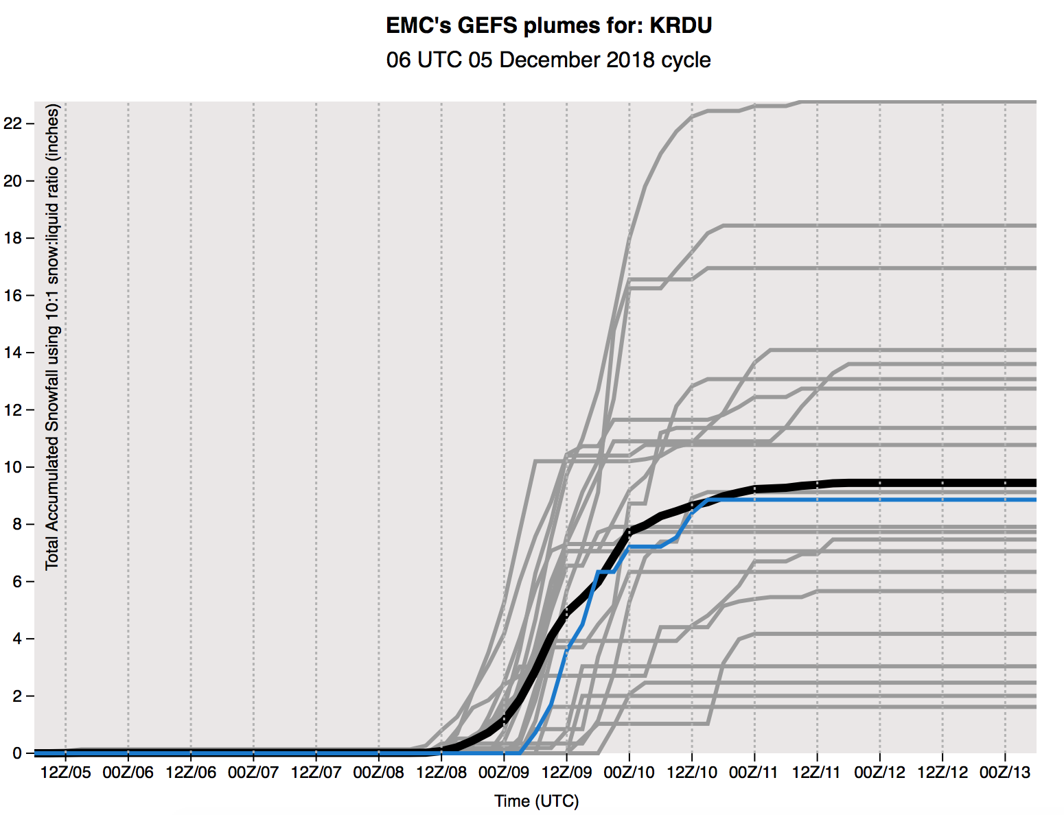
Haven't seen this posted yet... here are 6z GEFS plumes for KRDU.. trended up overall with some impressive outliers

-
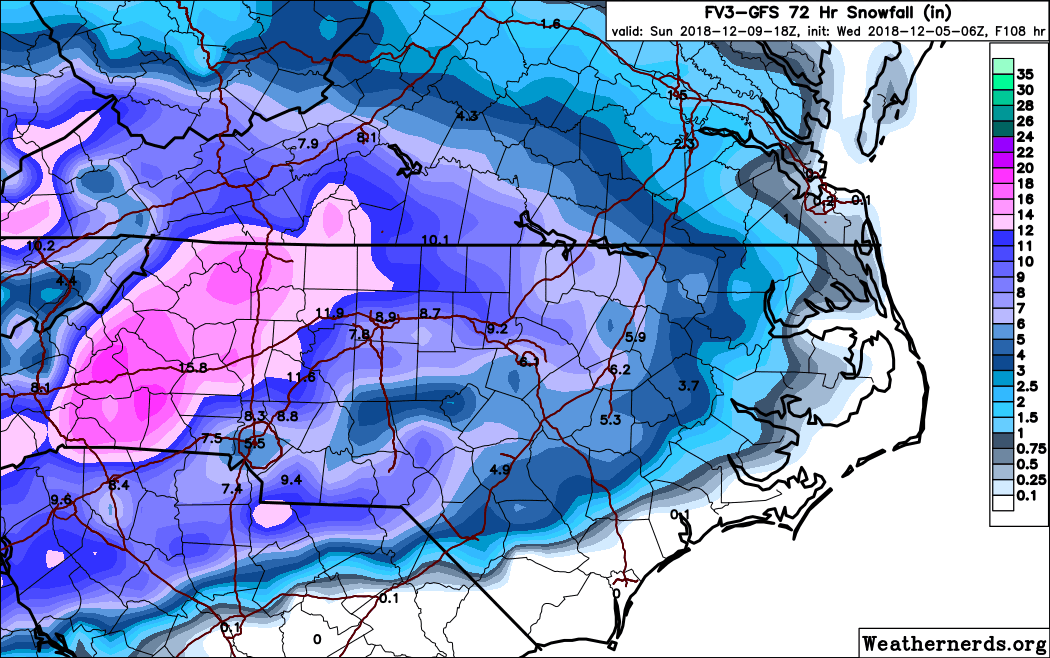
6z FV3 holding steady

-
Holding steady-ish on the phasing front (can’t see any bad signals here yet)
-
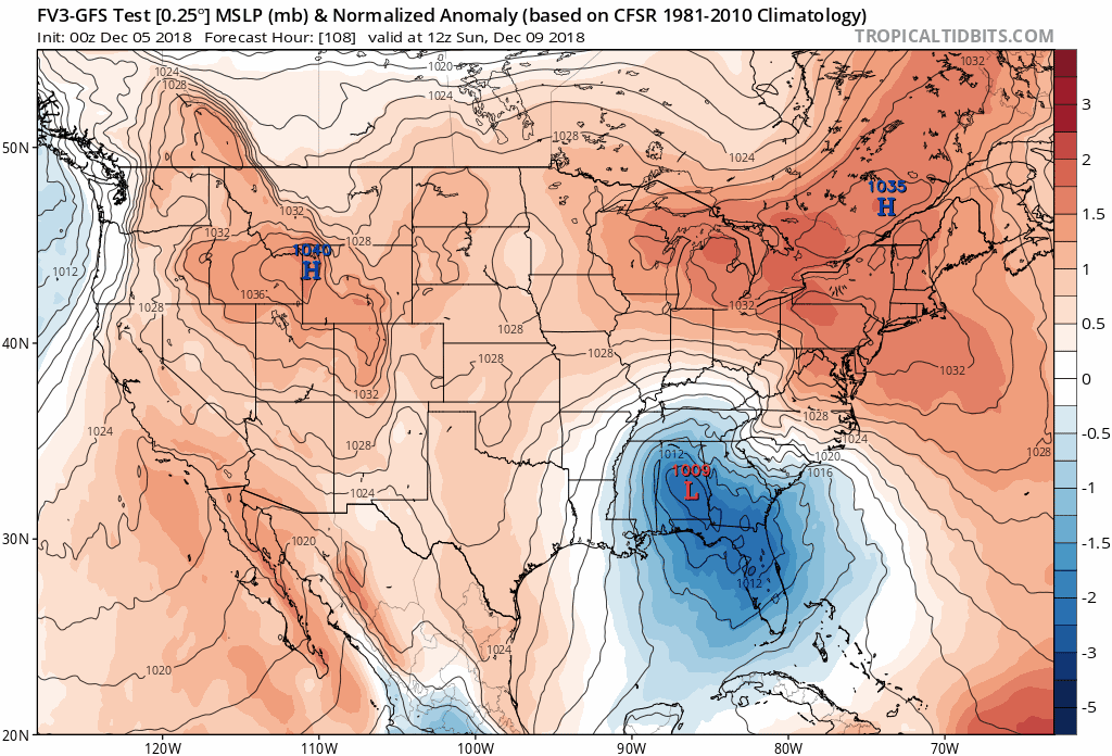
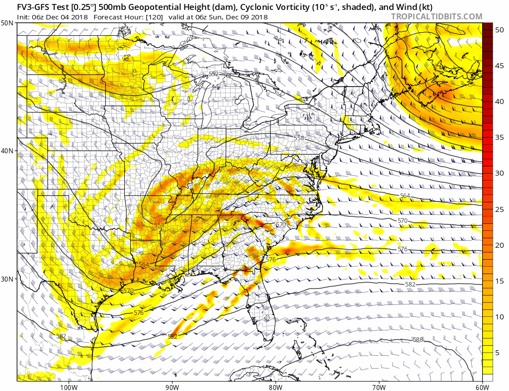
FV3 is colder with a more stout wedge - LP location good at hr 96 over Pensacola with snow throughout NC and upstate SC