

mikem81
-
Posts
1,113 -
Joined
-
Last visited
Content Type
Profiles
Blogs
Forums
American Weather
Media Demo
Store
Gallery
Everything posted by mikem81
-
Take with the typical NAVY grain of salt, but noticeable this close to an event
-
Thought the GEPS was interesting in terms of track
-
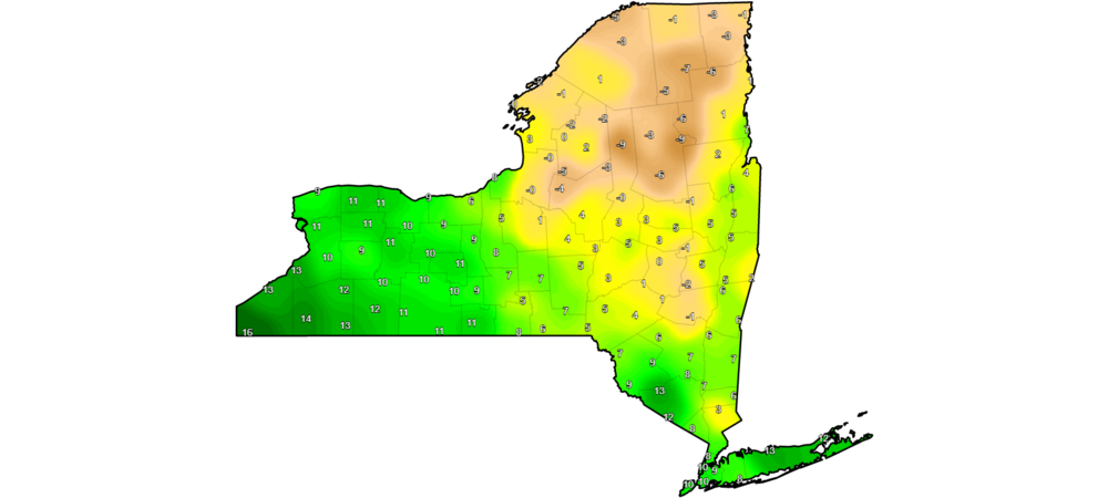
Heavy now here down to 33
-
Anyone have good link to Radar. Some are down..
-
Its snowing here is SW Nassau. 34.7 degrees. was 36 an hour ago
-
32/14 right now. No way dew points for supposed to be this low now… seems like temps should fall into high 20s with steady precip unless winds really turn off ocean quickly
-
DP forecast is way off so far...
-
The NAM is known for insane shifts like this. Really just can’t take it seriously until it has 2-3 runs in a row of something similar
-
-
December is much more common for huge gradients on the city when the Atlantic is 55 degrees...
-
THE GFS has a colder look early on but the primary made in father north before the weak coastal. All comes down to where coastal pops up (delmarva or LI)...
-
Its very close....
-
versus
-
Thats looks like intense sleet for the metro....
-
Usually a HP sliding east of Maine into the Atlantic is the sign of no snow. I see a HP in perfect position on all the models here and hints at earlier coastal development...
-
A lot depends on how the storm tonight winds up into Canada and where it ends up bringing the confluence down into..
-
How is LGA higher than JFK???
-
Need the Tuesday storm to form a 50/50 low to create some sort of block and lock in the HP
-
Pretty consistent ensemble support a week out. Need earlier coastal and weaker primary. EURO known to hold that primary into the lakes the longest at this range.
-
I think water temp this time of year make SWFE better than if it were December. Ocean is at 40 instead of 55 so the SW wind is less of an issue but it can still get ugly at 850 and sleet...
-
Starting new thread to track. For now EURO amped/ GFS middle/ CMS south
-
Can we start a thread for next Friday to bifurcate discussions of wind, march in general versus a potential winter storm?
-
Id work on generating more ocean effect snow with SE winds somehow....
-
When its 90 in June in CP and 70's on the Island its amazing. The city is awful on summer days


