mikem81
-
Posts
1,113 -
Joined
-
Last visited
Content Type
Profiles
Blogs
Forums
American Weather
Media Demo
Store
Gallery
Everything posted by mikem81
-
Snowfall NYC subforum Jan 6 and OBS if needed
mikem81 replied to wdrag's topic in New York City Metro
Typically SWFE tend to amp up as they get closer. We actually fear this as it means mix to rain for our area and snow for New England. This is a rare event where we are hoping for the historic trend to occur and amp this just enough to get some good precipitation into our area with little fear precipitation type issues -
Snowfall NYC subforum Jan 6 and OBS if needed
mikem81 replied to wdrag's topic in New York City Metro
I dont think there will be more clarity on this until tomorrow afternoon when the energy is closer to the NW coast and the LP block starts to form in a certain spot in SE canada -
The NAM is not happening. Maybe SE MASS gets 3-6 inches. Maybe. Radar does not support the NAM at all.
-
Did any of the models have the intense precip coming onshore now in SNJ?
-
Refresher snow & obs between ~midnight and Noon Sat Feb 17 2024
mikem81 replied to wdrag's topic in New York City Metro
https://weather.cod.edu/ My favorite auto refresh radar site is down. Anyone with other good ones? -
Refresher snow & obs between ~midnight and Noon Sat Feb 17 2024
mikem81 replied to wdrag's topic in New York City Metro
NAM slightly north. Looks like .3-.4 of precip by 12Z tomorrow from SW to NE in NYC metro -
Refresher snow & obs between ~midnight and Noon Sat Feb 17 2024
mikem81 replied to wdrag's topic in New York City Metro
In that case look at the current radar. The northern bands are much further east of the southern part of the storm... https://weather.cod.edu/satrad/?parms=regional-northeast-comp_radar-24-1-100-1&checked=map&colorbar=undefined -
Refresher snow & obs between ~midnight and Noon Sat Feb 17 2024
mikem81 replied to wdrag's topic in New York City Metro
It snows much longer up in the NYC area (at least on the models) based on the configuration of the precip shield.. -
Refresher snow & obs between ~midnight and Noon Sat Feb 17 2024
mikem81 replied to wdrag's topic in New York City Metro
-
2/13 Significant/Major Winter Storm Discussion & Observations
mikem81 replied to Northof78's topic in New York City Metro
Similar amounts here in Garden City. Should finish between 6 and 7 depending on this last band. -
2/13 Significant/Major Winter Storm Discussion & Observations
mikem81 replied to Northof78's topic in New York City Metro
Someone in Suffolk may get a foot. will be much closer to 6 inches in Nassau -
2/13 Significant/Major Winter Storm Discussion & Observations
mikem81 replied to Northof78's topic in New York City Metro
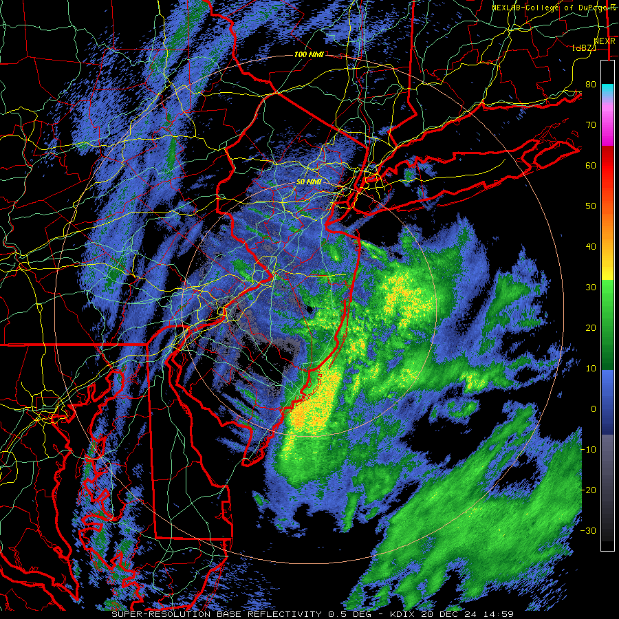
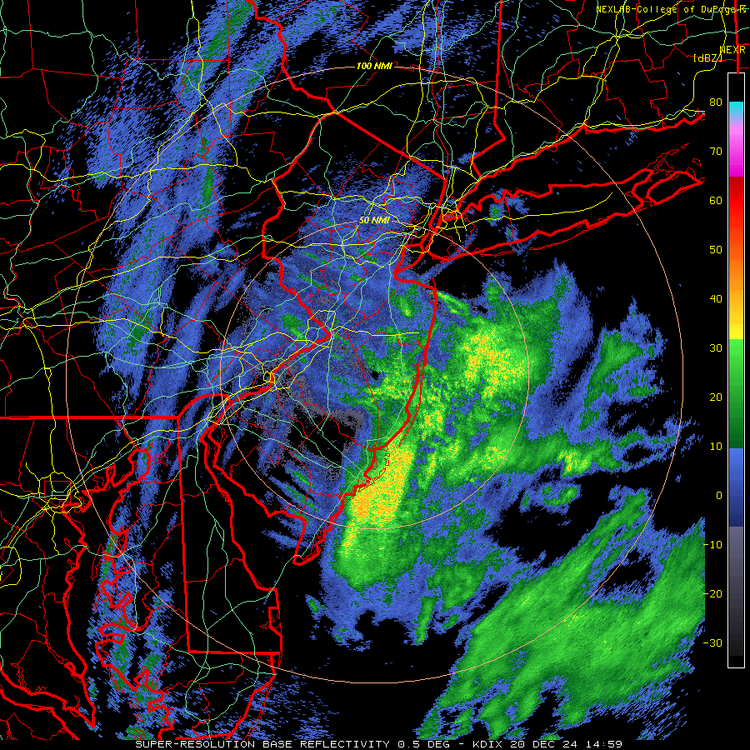
Its my go to radar.. https://weather.cod.edu/satrad/nexrad/?parms=DIX-N0Q-1-12-100-usa-rad -
2/13 Significant/Major Winter Storm Discussion & Observations
mikem81 replied to Northof78's topic in New York City Metro
These are the good returns. Seems like another hour of heavy stuff east of NYC and 2-3 hours Suffolk east -
2/13 Significant/Major Winter Storm Discussion & Observations
mikem81 replied to Northof78's topic in New York City Metro
I think the 6-8 for area from Queens and East is a good call with some locally higher measurers from the typical suspects.. -
2/13 Significant/Major Winter Storm Discussion & Observations
mikem81 replied to Northof78's topic in New York City Metro
Yes. I had 1.5 inches at 815 and almost up to 4 inches now -
2/13 Significant/Major Winter Storm Discussion & Observations
mikem81 replied to Northof78's topic in New York City Metro
This is the key. If this can pivot a bit instead of racing east, NYC/LI and C-NNJ can get a few more hours of SN+ -
2/13 Significant/Major Winter Storm Discussion & Observations
mikem81 replied to Northof78's topic in New York City Metro
Moderate snow here in south garden city. Sticking already. 32.4 degrees -
2/13 Significant/Major Winter Storm Discussion & Observations
mikem81 replied to Northof78's topic in New York City Metro
Down to 998. Keep an eye on strength and location. SPC Hourly Mesoscale Analysis (noaa.gov) -
2/13 Significant/Major Winter Storm Discussion & Observations
mikem81 replied to Northof78's topic in New York City Metro
-
2/13 Significant/Major Winter Storm Discussion & Observations
mikem81 replied to Northof78's topic in New York City Metro
-
2/13 Significant/Major Winter Storm Discussion & Observations
mikem81 replied to Northof78's topic in New York City Metro
999 SLP -
2/13 Significant/Major Winter Storm Discussion & Observations
mikem81 replied to Northof78's topic in New York City Metro
Here is the LP. Keep an eye to see if it drops to 995 or below in next few hours... -
2/13 Significant/Major Winter Storm Discussion & Observations
mikem81 replied to Northof78's topic in New York City Metro
I wouldnt call the EURO 979 LP "weak" by any standards... -
2/13 Significant/Major Winter Storm Discussion & Observations
mikem81 replied to Northof78's topic in New York City Metro
Pretty decent agreement. SLP will track over the delmarva. The question remains whether it gets tucked a bit and strengthens by Cape May (NAM/GFS/RGEM) or goes due east (EURO/UKIE) -
2/13 Significant/Major Winter Storm Discussion & Observations
mikem81 replied to Northof78's topic in New York City Metro
Yes. NO one has sad this. Start time is approx midnight for light rain transitioning to Snow by 4-5am... Sunrise is close to 7AM.