

TullyHeel
-
Posts
12,875 -
Joined
-
Last visited
Content Type
Profiles
Blogs
Forums
American Weather
Media Demo
Store
Gallery
Everything posted by TullyHeel
-
It didn't happen in the high risk area, though.
-
If it's cloudy and rainy tomorrow morning the most we will see around here is very isolated storms, and probably to our south and east like they all were last year.
-
I mean there were still over 20 tornadoes reported today. Doesn't sound like most of them did much damage, though. Not sure if that meets the criteria for a high risk and PDS watch. I don't think tomorrow will meet the hype the local mets here are giving it. WRAL has been hyping the heck out of tomorrow's threat since Monday.
-
Only need 4 levels to begin with. And the descriptions don't make since. Slight and marginal are the same thing, and something that is enhanced is greater than something that is moderate.
-
I've had more severe storms the last decade when I'm not under a watch versus when I am.
-
We usually bust low with severe weather like we do with snow around here. The times we have a true outbreak and it meets the severe criteria we're under is rare. Most of the time it is very isolated stuff versus widespread storms and tornadoes.
-
That's what usually happens around here, too, and what keeps us from having a lot of severe storms and tornados instead of maybe one or two very isolated ones. An outbreak is very rare, and the worst case scenario usually doesn't happen.
-
That is what I am hoping. It's either that or some small showers and storms earlier that prevent us from getting the severe stuff later.
-
I hope not. I think it all depends on how long it takes to clear things out overnight and when the warm air gets here. A lot of times we get saved by the clouds hanging around longer than expected.
-
Sounds like we are going to be really lucky if one of these tornados today doesn't hit a highly populated area with as many as there have been already.
-
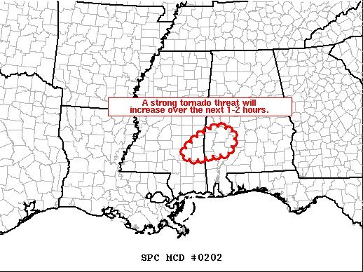
SPC's discussion for tomorrow is scary, too. ...North Carolina/South Carolina/Georgia/Virginia/Florida... A positively-tilted upper-level low will move into the Tennessee Valley on Thursday as a 75 to 90 kt mid-level jet moves across the Southeast and Carolinas. At the surface, a low will move eastward into the central Appalachians. At 12Z, a warm front will be located from northern Georgia eastward across northern South Carolina. This boundary will move northward across central and eastern North Carolina during the morning. To the south of this front, surface dewpoints across the warm sector will be in the mid to upper 60s F. As surface temperatures warm, a pocket of moderate instability is expected to develop to the south of the warm front across eastern North Carolina by late morning. Convective development will be aided by the low-level jet. Severe thunderstorms associated with large hail, wind damage and a tornado threat, is expected during the mid morning hours. Further to the west, a band of large-scale ascent associated with the approaching upper-level system will overspread the central Appalachians around midday. Thunderstorms are expected to initiate just ahead of this band of ascent around midday and move eastward into the Appalachian foothills during the early afternoon. Ahead of the storms, the environment will consist of MLCAPE in the 2000 to 2500 J/kg range, 0-6 km shear of 50 to 60 kt and storm relative helicities of 300 to 350 m2/s2. This will support intense supercell development. Tornadoes, wind damage and large hail will be likely with the stronger storms. A long-track tornado will be possible along or in the vicinity of the warm front. The time of maximum threat is forecast to be in the 18Z to 22Z time window. A regional outbreak of severe storms, along with several significant tornadoes are expected from discrete cells that develop across the warm sector from central North Carolina southward across much of South Carolina. Further to the southwest into Georgia, a line of strong to severe thunderstorms is expected to move into the area form the west during the morning. A corridor of moderate instability is forecast to develop just ahead of this line by late morning with instability continuing to increase through the afternoon. This line of storms will have access to a strong low-level jet, extending northeastward across south-central and eastern Georgia. the environment should have MLCAPE of 1500 to 2000 J/kg along with 0-6 Km shear of 60 to 70 kt. This will be favorable for supercell and severe bowing line segments. Supercells that form in the line may produce tornadoes, wind damage and large hail. A potential for significant tornadoes will exist with cells that form at the north end of gaps in the line. This band of storms is expected to be accompanied by widespread wind damage, moving across eastern Georgia and South Carolina during the mid to late afternoon. Wind gusts of greater than 65 kt will be possible with the more intense bowing line segments. The southern part of the band may extend as far south as the Florida Panhandle, where a severe threat will exist in the morning and early afternoon.
-
-
I just hope we have enough cloud cover around tomorrow to keep things from really getting bad here. We usually need some clearing and some sun to create the spark for an outbreak here. Hoping that doesn't happen and the models are overdoing it for my area.
-
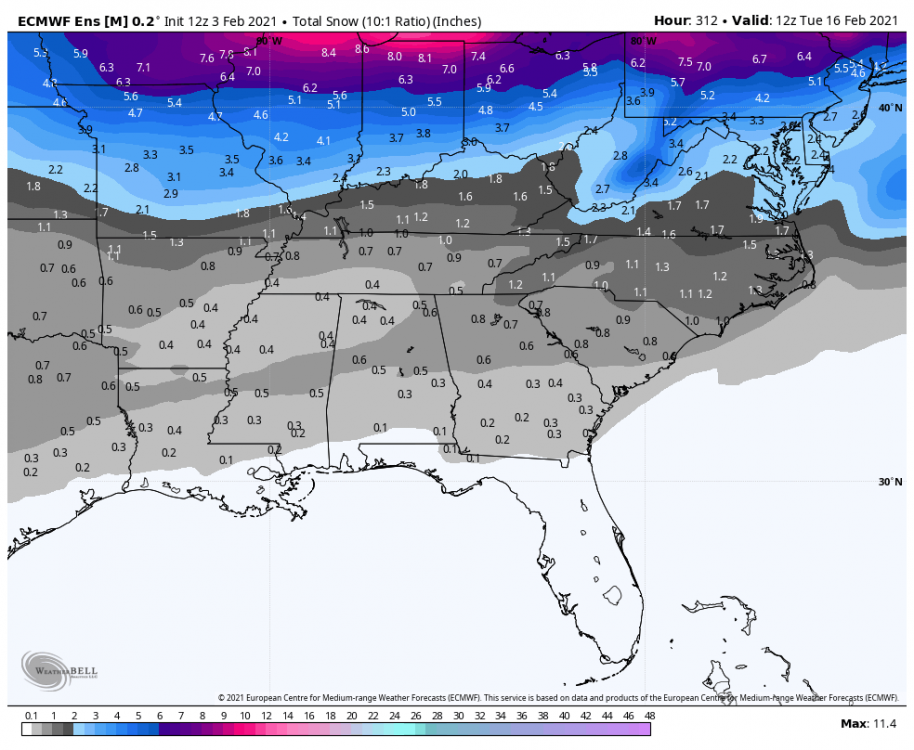
This looks a lot like the GFS run with the heaviest axis of snow in the same location.
-
The good thing is the 11th-13th timeframe has been popping up with storms on some model runs the past few days. It does appear to be a period with a strong storm signal at this point. But I don't want to kick the can down the road any longer.
-
I believe the GFS was the first one to pick up on the storm we had around here on Jan 28. Euro appears to be going from one extreme to the other.
-
GFS, para GFS, and the GEFS are a thing of beauty. Going to be a long 10 days.
-
Still plenty of time for the Euro to shift south. It didn't shift south with the storm tonight into tomorrow until last night.
-
I think we'll see the Euro look better with the weekend threat as we get closer just like with the storm tonight into tomorrow. I still think it is better with what actually happens than the GFS, but it just has slower trends than the GFS. GFS seems to latch on one solution and hold on to it forever or make huge jumps. Euro seems to be more gradual with its trends.
-
Euro might actually be coming in the middle of the GFS and UK like I wanted.
-
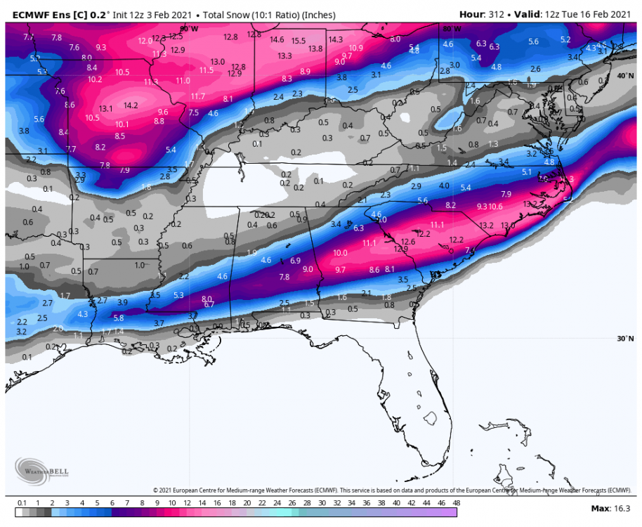
That's just a huge difference in a few hours.
-
Maybe the Euro can take the CMC and GFS and meet in the middle.
-
Didn't the GFS have most of NC covered with snow and a foot in central NC the last run?
-
This looks like the best chance we have had this winter for a big storm for NC. At least we have a shot, just have to see if it works out.
-
Some folks, the same folks as always, are always going to be pessimistic unless it's wall to wall cold and threats showing up every week from December to March. It's their usual shtick.


