

Organizing Low
-
Posts
17,685 -
Joined
-
Last visited
Content Type
Profiles
Blogs
Forums
American Weather
Media Demo
Store
Gallery
Everything posted by Organizing Low
-
Anddddd we snow coming down at a good clip already , juicy flakes from BTV they were on it .NEAR TERM /THROUGH TONIGHT/... As of 610 AM EST Friday...It`s finally the moment we have been waiting for over the past several days as the warm nose is beginning to decay and cold air is beginning to spill into northern New York. We have seen the boundary between snow and freezing rain advance about 30-40 miles over the past two hours and it`s just a matter of time until this line works into northern and central Vermont.
-
Steady frzra our there currently from BTV....more frzra AND more snow , insane .NEAR TERM /THROUGH TONIGHT/... As of 1238 AM EST Friday...The forecast remains quite challenging tonight and had to make several changes based on the latest model guidance and observations. Thermal profiles on both the global and high resolution members show a +5 to +7 degree warm nose pretty much anywhere east of the St. Lawrence Valley. Because of this, freezing rain was added to the grids through the overnight hours with up to a tenth of an inch of freezing rain possible before the freezing rain changes over to snow during the early morning hours. As it stands, it looks like freezing rain will change over to snow between 14Z and 15Z for Burlington, 17Z to 18Z for Montpelier and after 18Z for far southern Vermont. Freezing rain amounts across southern Vermont have been increased to 0.25 to 0.40 inches in response the delay in precipitation changing over to snow this afternoon. Actually ended up bumping up snowfall totals across northern New York and northern Vermont based on the latest guidance. More information to follow in the routine update between 3 and 4 AM.
-
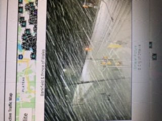
Sorry for the sideways image oops
-
Echoes came through here and were frzra meanwhile the backside heavy snow has blossomed as modeled, and is knocking on the door in south Ottawa. traffic cameras confirm the snow storm is getting going.
-
Those nam winds are crazy impressive on the coast. Thanks for posting dendrite. Should be near blizzard conditions here tomorrow afternoon.
-
Radar is blossoming just to my northwest. It’s snowing in Toronto , Ottawa and Montreal. snow appears to be perhaps 15 miles to my northwest as the crow flies. I’m hoping that it’s not hours of tease Show , but it might be. So close !
-
2 inches here , 23 degrees snizzle all day and glazed windows for all We watch the radar and wait.
-
1.5 inches here on the front end not much to write home about as first part underperforms The 3-5 forecast though the model trends were all over it time for some sleep
-
Thank you westerly ! much appreciated.
-
Light snow has begun here 18 degrees.
-
If someone could post the Euro snowfall map that would be great. my rudimentary look At free maps seems it is a bit cooler than the us models.
-
for sure the backside sting looks good, but I think the models have raised enough red flags to know that is optimistic at this point. still some time for correction I suppose.
-
It’s clear what the trends are best snows look to be in Saint Lawrence valley and not Champlain valley. South shore of Montreal down towards Vermont border and back along eastern Ontario and upstate NY. Even Ottawa is in the game all of a sudden. Sitting in the NW most corner of Vermont I suppose my chances are better than anyone, but the amped trends do not bode well. Would not normally be Too upset , except will be some wicked banding for this neck of the woods and was looking forward to that. Someone Just Nw of me is going to get plastered.
-
Wow if this play out those fantasy run from the GFS that caught my attention over The Weekend will be essentially dead on. great to be in the lolli zone
-
We had a great storm in November but this will end up being the storm of the season up in N Vermont if the GFS pans out. But the NaM and euro not so much. I will give the GFS credit for being Generally consistent for the better part of 5 days on this one. In any case , Looks like a 2 parter, extended duration event. These days I only post when there’s potential for something memorable , so I guess I am cautiously optimistic ?
-
https://ottawacitizen.com/news/local-news/snow-snow-go-away-ottawa-breaks-record-for-snowiest-january-and-we-all-suffer
-

March 12/13/14 Blizzard/Winter Storm/WWA etc
Organizing Low replied to Bostonseminole's topic in New England
PNS BTV remarked a public ob of 18.5 in st albans, but i will esimtate my final to be between 16-17 inches....a pleasant surprise here in the CPV -
March 12/13/14 Blizzard/Winter Storm/WWA etc
Organizing Low replied to Bostonseminole's topic in New England
snow continued to spread E to W as the decaying storm spins over NB, in fact snow fell most of the day in eastern ontario which is absolutely not upslope/ lake effect, or any combination of any other factor other than the decaying low and its atlantic moisture fetch/upper low....about 15-30cm deposited in eastern ontario and SW quebec in addition, massive totals coming out of NE NY and VT nearing 3 ft...snow continues here, approx 14 inches as of 7pm when i came into work the total and amount of snow deposited by this storm and its remnants in the NE is staggering IMO... -
March 12/13/14 Blizzard/Winter Storm/WWA etc
Organizing Low replied to Bostonseminole's topic in New England
Just drove down the Champlain valley to btv, I was somewhat shocked to see everything plastered , the amount of tree loading and the blowing snow on the roads, has the ‘day after’ look if you know what I mean Meanwhile Snow continues ....and btv late to the warnings now -
March 12/13/14 Blizzard/Winter Storm/WWA etc
Organizing Low replied to Bostonseminole's topic in New England
sorry to hear all the stupid BS over Ray’s totals , I agree with don Sutherland wholeheartedly. -
March 12/13/14 Blizzard/Winter Storm/WWA etc
Organizing Low replied to Bostonseminole's topic in New England
approx 8 inches here as of 8am got under a nice moderate band last night, still coming down solid, under the radar stuff .... will hit double digits today with the prior snowpack, its deep winter out there as you all know haha -
March 12/13/14 Blizzard/Winter Storm/WWA etc
Organizing Low replied to Bostonseminole's topic in New England
pretty incredible to see accumulating snow and at times moderate snow rotating from E to West, and now rotating back all the way into eastern ontario and the ottawa valley where they too have picked up several inches. impressive storm... -
March 12/13/14 Blizzard/Winter Storm/WWA etc
Organizing Low replied to Bostonseminole's topic in New England
snow starting to pick up here now, BTV finally recongizes that they really dont know how much snow is going to fall in the next couple days lol expecting several inches tonight , BTV throwing out the possibiliy of some defo snow with the upper low....interesting what a storm! -
March 12/13/14 Blizzard/Winter Storm/WWA etc
Organizing Low replied to Bostonseminole's topic in New England
congrats dude, extremely happy for you on a selfish note, you verify my call of 24+ lollies, outstanding storm there was never a doubt -
March 12/13/14 Blizzard/Winter Storm/WWA etc
Organizing Low replied to Bostonseminole's topic in New England
oh and yes where is Ray??? SN- here, had about 0.5 so far, we rolllllllllllllll haha
