TPAwx
-
Posts
583 -
Joined
-
Last visited
Content Type
Profiles
Blogs
Forums
American Weather
Media Demo
Store
Gallery
Everything posted by TPAwx
-
Good luck fellas and be safe. On Bayshore a few feet above sea level fronting Hillsborough Bay, nowhere to hide here. Will take the 0z UK. 0z Euro is sickening. 06z ICON actually landfalls slightly south, it would not be fun but the track avoids the worst for many.
-
So far it’s been “we need to get ready but it’s probably not going to be a direct or bad hit,” now it’s sinking in that it actually could be significant or worse. And in Evac Zone A here it’s literally a “sinking” feeling
-
Tropical Storm Ian Discussion Number 12 NWS National Hurricane Center Miami FL AL092022 1100 PM EDT Sun Sep 25 2022 The storm has become better organized-looking on satellite imagery, with strengthening central convection and developing banding features. Upper-level anticyclonic outflow also appears to be increasing over the system. Flight-level winds, Doppler radar velocities, and dropsonde data from a NOAA Hurricane Hunter aircraft indicate that Ian's intensity is now near 55 kt. Ian has turned toward the northwest and the initial motion estimate is now 315/11 kt. During the next 48 hours, the tropical cyclone is expected to turn toward the north as it moves along the western side of a mid-level high pressure area. Later in the forecast period, a broad mid-tropospheric trough over the eastern United States is likely to induce a slightly east of northward motion. However, around 4 days, the steering currents are forecast to weaken as the trough moves to the east of Ian's longitude. Some of the guidance model tracks such as that from the GFS have, again, shifted to the east, mainly after 48 hours. The official track forecast has been shifted somewhat to the east of the previous one and is mainly a blend of the latest ECMWF and GFS predictions. It should again be stressed that there is still significant uncertainty in the track of Ian, especially in the 3-5 day time frame. Users should not focus on the details of the track forecast at longer time ranges. Observations from the aircraft indicate that the tropical cyclone is developing an inner core, so significant intensification is likely to occur during the next couple of days. The SHIPS Rapid Intensification Index indicate a fairly high chance for rapid strengthening during the next 24 to 36 hours, and the official forecast reflects this likelihood, calling for Ian to become a major hurricane over the southeastern Gulf of Mexico
-
It was pretty shocking to experience as most here had their guard down after escaping the worst of Irma. Also a good reminder that a lower end TC with lots of stacked energy can be extremely impactful here.
-
Once this gets to a Major and if the track still is close to TB, 75N and I4 will be a parking lot by late afternoon Tuesday.
-
Feeling good that I booked our hotel options Friday. Was just out to get groceries and gas, both a breeze because there’s a home football game in progress. Priorities and such.
-
Yeah we are at risk of property loss except what fits in the cars. Still high uncertainty with the track and intensity at this stage, could easily miss to the south.
-
If you are referring to landfalling Majors, sure. But you know by now from following the thread that a TS or Cat 1 on certain trajectories can inflict extreme impact and damage around TB. You should be just fine up there in Wesley Chapel, Florida.
-
While waiting for the 12z suite, here’s a good review of TB risk factors and scenarios https://twitter.com/TB_Times/status/1573736400196960258
-
Yeah it’s noise but for an actual outcome a huge variable. Surge much more amplified with 12z, while 0z lingers and dumps 20+ inches. Local flooding is common with summer downpours of 1-2 inches, can’t imagine what this would do.
-
Sandbags would be a nice aquarium feature for my yard with the Euro//UK solutions.
-
Nightmare fuel, tho thankfully can’t treat with any confidence this far out.
-
Great to see west and weaker trending, relative to previous solutions.
-
The NHC track forecast during this period has been adjusted slightly south and west of the previous one, in line with the track consensus aids. Beyond 72 h, there is still a large amount of cross-track spread in the guidance as Ian emerges into the eastern Gulf of Mexico and approaches Florida. Hopefully, data collected from special radiosonde releases beginning later today and a scheduled NOAA G-IV flight will help resolve the steering flow around Ian and deep-layer trough that is forecast to be over the eastern U.S. early next week. The guidance envelope has once again shifted westward this cycle, and the official NHC track forecast has been adjusted in this direction as well, though it still lies slightly to the east of the TVCA and HCCA aids. Further adjustments to the track forecast may be needed given the increased uncertainty in the day 3-5 period.
-
Always lots of focus on winds but yeah it’s mostly about the water here. I had a 4ft surge IMBY from eroding TS Eta and the center was 45 miles offshore. Of course with the heavy tree cover and vegetation here winds at TS or higher will leave a huge mess and power outages region-wide.
-
Region wide run on water and basics started yesterday. Many Target and Publix locations out of water already. Most here take hurricane hype in stride given the rarity of actual impacts, but feels like more are in tune with scarcity after the 2020 pandemic driven issues with staples and necessities. You snooze you lose.
-
Late in the period, the guidance indicates the storm will begin to recurve toward Florida. As mentioned before, the track models are in general agreement with this scenario, however there is a large amount of cross-track spread at 72 hours and beyond. In fact, the east-west spread in the guidance at 96 hours is about 180 n mi, with the CTCI and ECMWF along the eastern side of the envelope, and the GFS, HWRF, and GFS ensemble mean along the western side. The overall guidance envelope has shifted slightly westward this cycle, and the NHC track has been nudged in that direction and lies just east of the various consensus aids. Given the spread in the guidance, and the still shifting dynamical models, additional adjustments to the track forecast may be needed in subsequent advisories. Users are reminded that the long-term average NHC 4- and 5-day track errors are around 150 and 200 n mi, respectively.
-
Didn’t realize Tampa city limits are 100 miles north of town
-
Along with an acknowledgement of increased track uncertainty late in the forecast period.
-
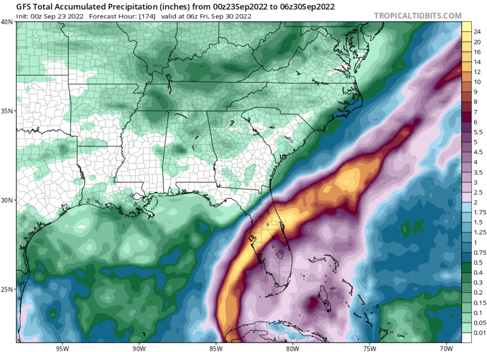
That GFS solution lays an atypically long duration S to SW fetch on TB and the coast. Lots of water to deal with even tho it stays offshore.
-
Always wise to get a jump on prep. I’ve seen enough from the 12z GFS to book a hotel in GA for next week as a contingency. Will most likely not be needed.
-
37 events over 175 years, 11 in the last 50 years. Reckon we all have subjective views on the meaning of frequency and rarity.
-
Interesting for sure. We’ve beaten the Tampa thing to death, but it’s pretty rare for a major to landfall anywhere in Florida.
-
It’s not the worst case scenario based on that track. Yes it would be a significant impact and highly disruptive. Trajectory needs to be mid to north Pinellas Country to maximize surge potential. And correct, Tampa will not be hit directly by a major hurricane next week.
-
lol