TPAwx
-
Posts
583 -
Joined
-
Last visited
Content Type
Profiles
Blogs
Forums
American Weather
Media Demo
Store
Gallery
Everything posted by TPAwx
-
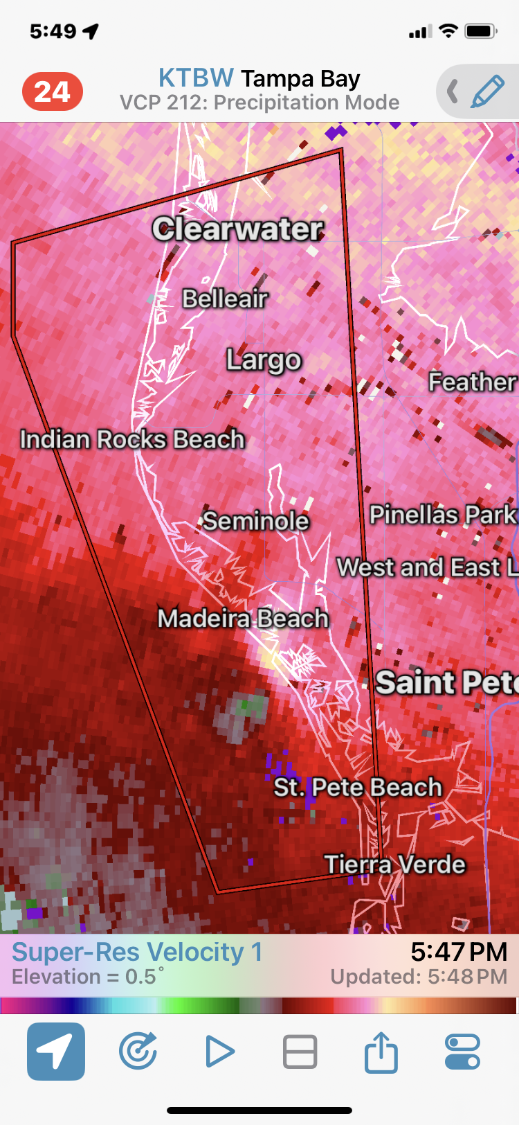
Surprised at the lack of Zone A evacuation orders for Hillsborough and Pinellas (they have a partial) Counties. Surge and wind impact should be more amplified than the last two I-storms, had to evac for both. edit - just issued for Hillsborough Zone A
-
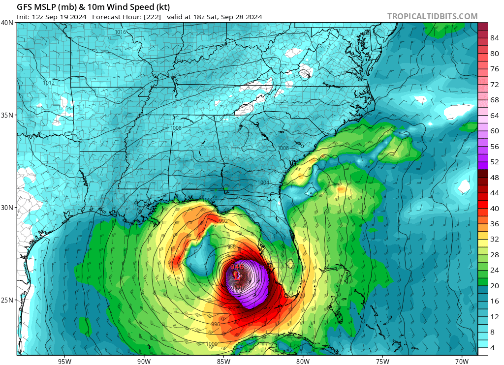
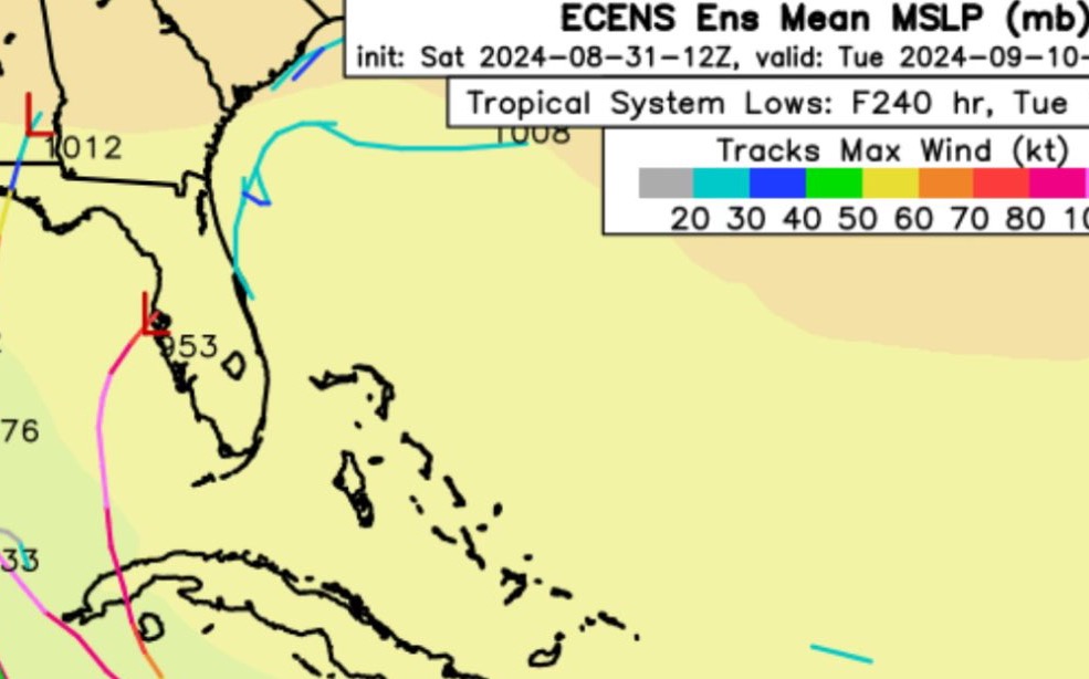
0z HMON initializing @ 991 and then is quickly overdone with deepening.
-
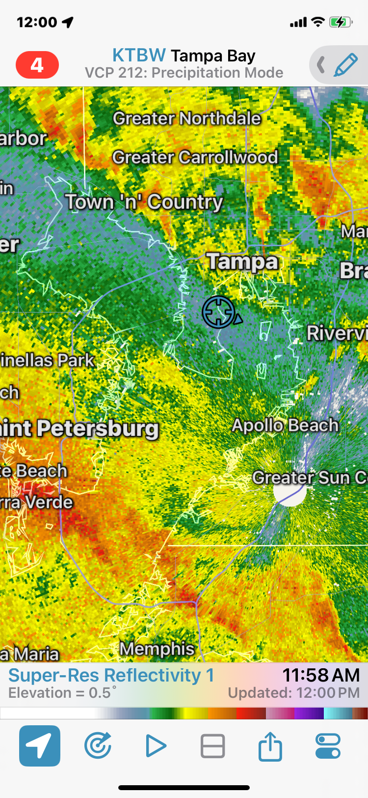
Interesting X handle but very relevant observation. Recent downpour gave us 5” in 90 minutes. Cars on Dale Mabry had water over the wheels.
-
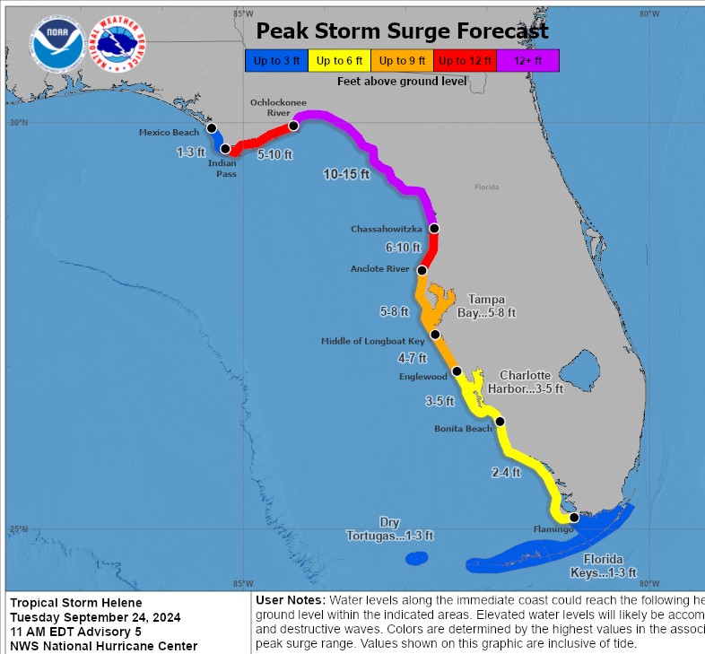
For landfall position or also track up the Gulf? Helene will push a lot of water as is, every degree East is impactful for surge up the FL West Coast.
-
Can’t get tweets to embed properly, but Andy Hazelton saying the 12z hurricane models will have TDR/Tail Doppler Radar ingested and should be more realistic with outputs.
-
Wouldn't be surprised to see most segments hit or exceed these levels
-
Proactive and appropriate IMO for a coastal/low lying county and area. Not in the current cone but as others as noted Helene will push a significant surge along the FL West Coast.
-
Another bonkers HAFS-B run in progress, grain of salt of course. That wind field and onshore flow with the 0z GFS would be suboptimal for the coastal counties of TB.
-
HMON and HAFS-A also markedly weaker.
-
HAFS-B at 39 is slightly NW of 12z and 37mb weaker. Lunchtime run was clearly out to lunch.
-
Pretty sure it’s a potential scenario and not a forecast yet. But yes problematic. Would be a total loss for me.
-
12z GFS is slightly weaker and NW of 6z, not very significant differences at this stage Landfall Thursday evening in Big Bend.
-
All these northern tourists cluttering up the storm discussion.
-
Most of the ex-Euro solutions leave minimal prep and evac time here and thru the panhandle. Unlike the typical CV systems that are on the public radar for a week or more.. This one is only starting to get local attention this AM.
-
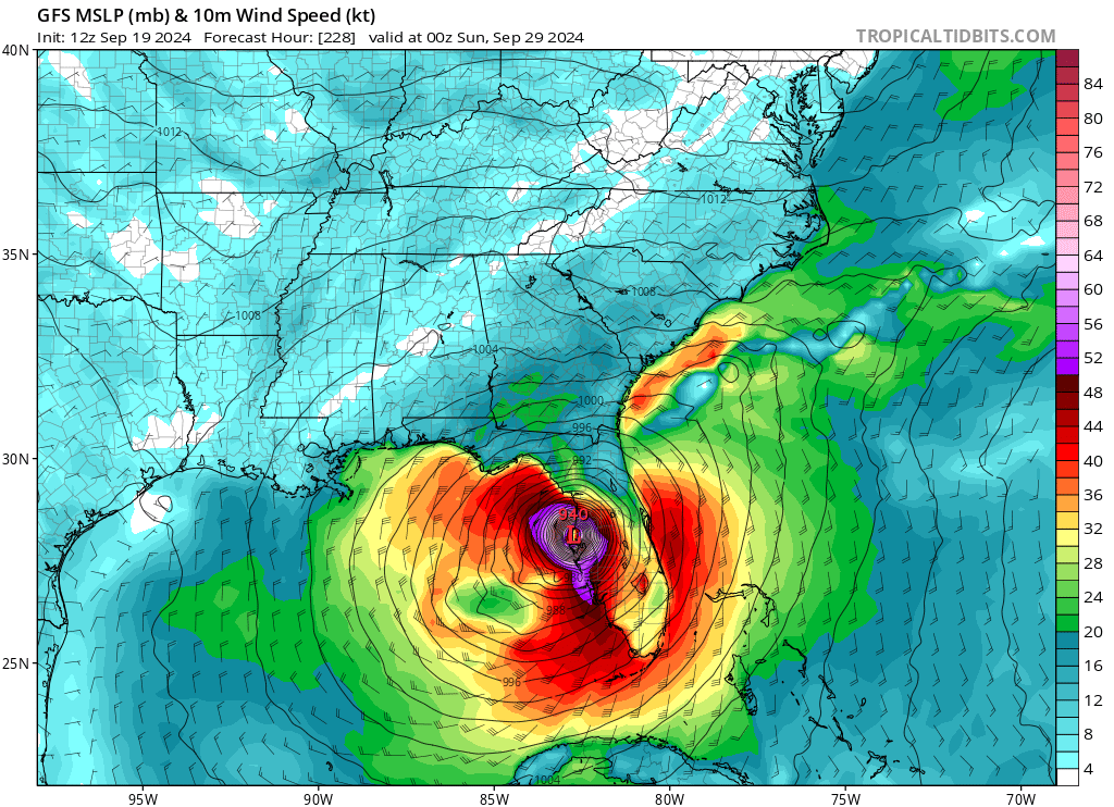
Obviously in la la land range and one of many op runs that won’t come to pass. But yeah that’s textbook no bueno scenario for TB region.


-
What a beast of an op run
-
Ok now GFS
-
Probably an H storm so for sure a miss in TB. We only take I storms seriously.
-
Farewell and adieu to you fair Spanish ladies…. Kidding aside, this member is a slightly less intense version of the scenario that takes out parts of the TB region.
-
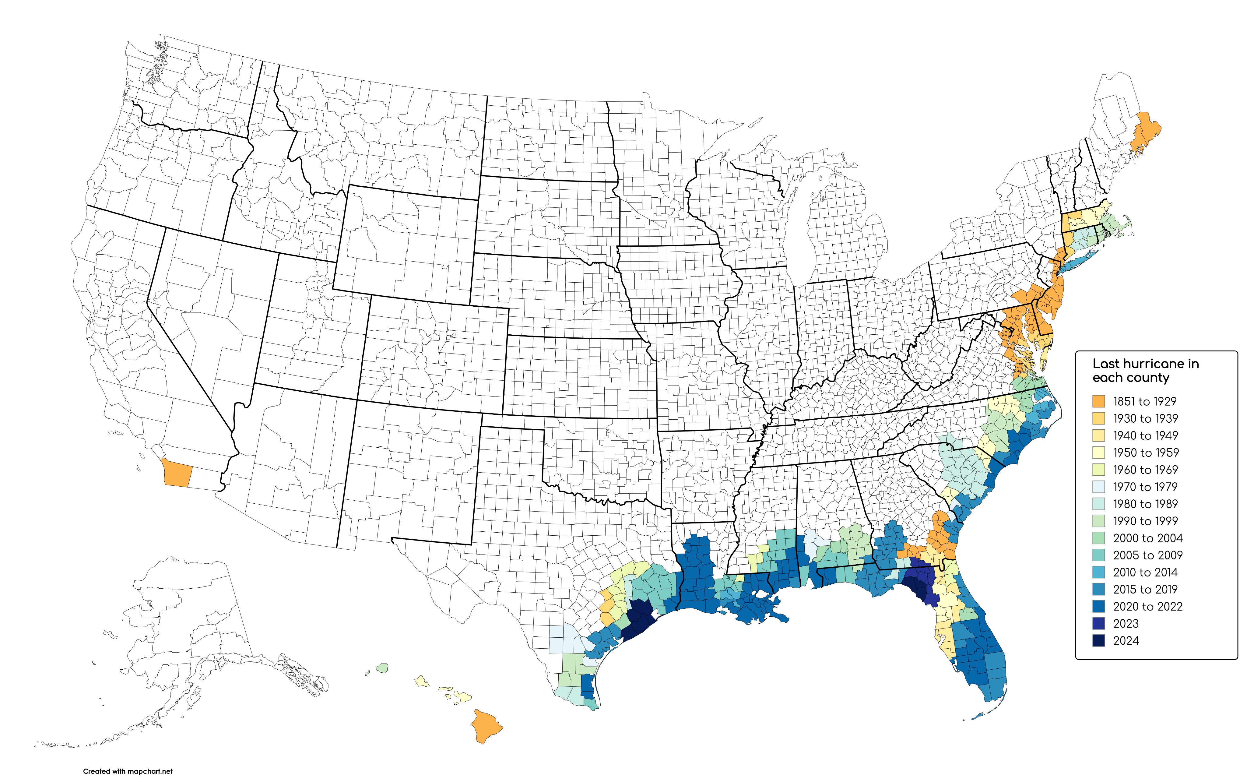
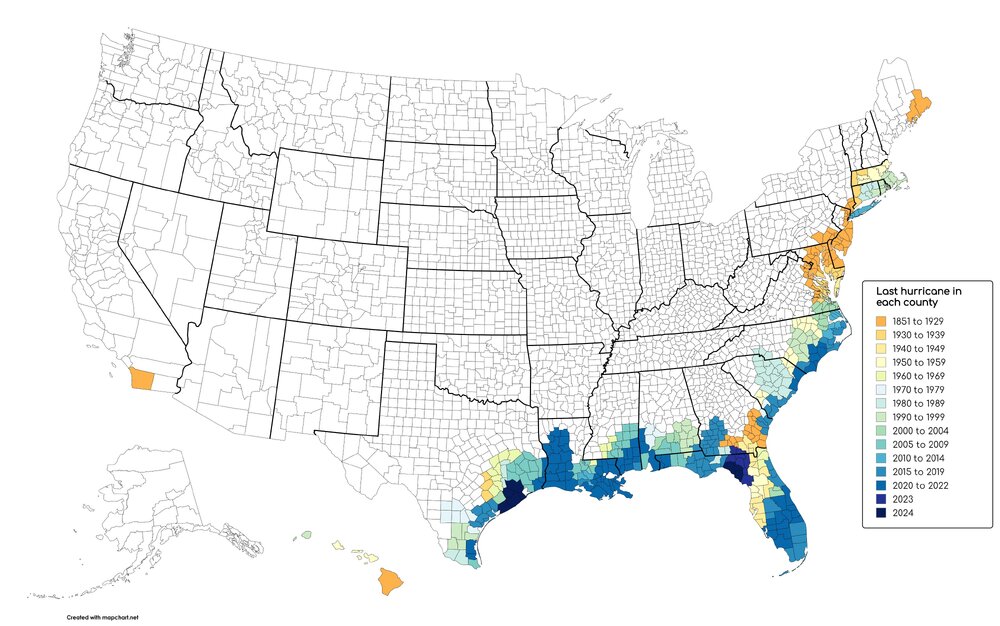
Interesting data. Not only has Tampa avoided a major since 1921, we haven’t experienced sustained hurricane force winds since 1946. https://x.com/CC_StormWatch/status/1829345028109410766
-
Gotta say for MBY Debbie had notably prolific banding and rainfall rates compared to recent tropical systems. TPA officially ended up close to 7”. We were under training for long stretches. Would add a few inches for our total.
-
Waterspout coming onshore

-
103 years since the last major landfall. We’ve had decaying tropical storms push significant surge and impact, the next major on the worst case trajectory/location will be a nightmare for the region.
-
In between bands at the moment. No gauge but we’ve easily had over 2” so far. Coverage should pick up later today and overnight.

-
12z GFS op slightly east for landfall Mon AM