TPAwx
-
Posts
583 -
Joined
-
Last visited
Content Type
Profiles
Blogs
Forums
American Weather
Media Demo
Store
Gallery
Everything posted by TPAwx
-
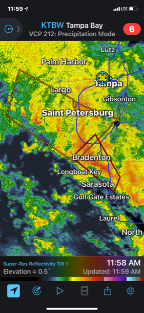
Standing water already an issue on the roads across South Tampa. Some pretty hefty downpours moving though but the wind has been minor thus far.
-
Some spin ups with this band coming ashore
-
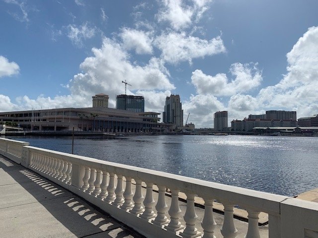
Primary concern with DI is Tampa General Hospital, but their power infrastructure is elevated so they should be ok with this one. I live at water’s edge right across from TGH and will post pics if anything materializes.
-
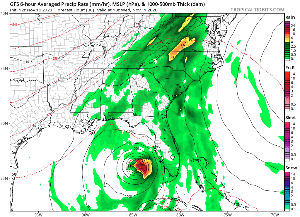
High tide at midnight, should be close to max storm impacts. We’re under a 2-4ft surge warning. As you know much of Tampa is prone to flooding from BAU heavy rainfall.
-
-
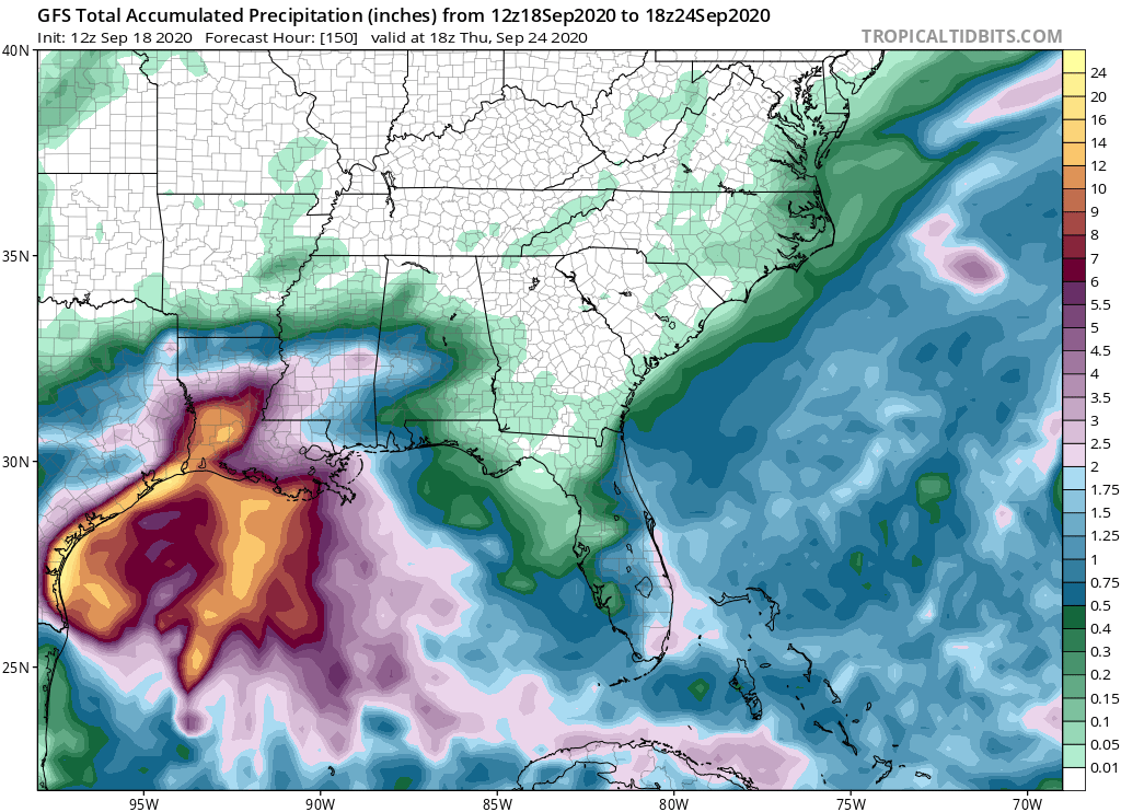
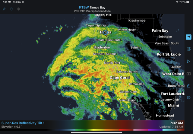
For the TB region Eta will be the most impactful system since Irma. Looks to be a prolific rain maker and localized flooding will likely be the main headline, perhaps some pockets of wind damage due to downed trees. Just getting into the initial bands here this morning.
-
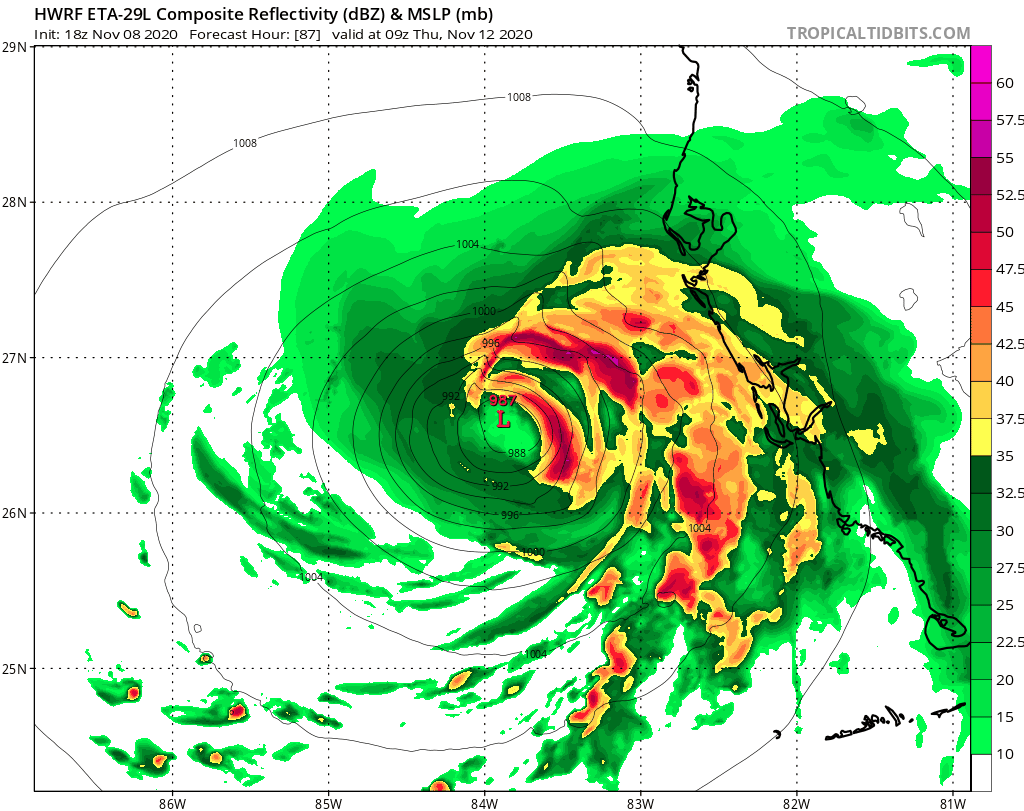
Just upgraded to Hurricane Eta Hurricane Eta Tropical Cyclone Update NWS National Hurricane Center Miami FL AL292020 735 AM EST Wed Nov 11 2020 ...ETA BECOMES A HURRICANE AGAIN OFFSHORE OF SOUTHWESTERN FLORIDA... Reports from a NOAA Hurricane Hunter aircraft and Doppler radar data indicate that Eta has re-strengthened into a hurricane offshore the southwestern coast of Florida, with maximum sustained winds of 75 mph (120 km/h), with higher gusts. SUMMARY OF 735 AM EST...1235 UTC...INFORMATION ---------------------------------------------- LOCATION...25.8N 83.8W ABOUT 130 MI...210 KM WSW OF FT. MYERS FLORIDA ABOUT 170 MI...270 KM SSW OF TAMPA FLORIDA MAXIMUM SUSTAINED WINDS...75 MPH...120 KM/H PRESENT MOVEMENT...NNE OR 15 DEGREES AT 15 MPH...24 KM/H MINIMUM CENTRAL PRESSURE...983 MB...29.03 INCHES $$ Forecaster Stewart
-
-
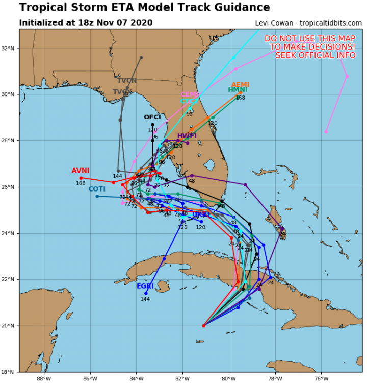
Based in the prior NHC discussion that would seem to imply more of a eastern trajectory, which the HWRF is showing (as did the GFS). New Euro looks to be weaker and further offshore. edit: Euro comes ashore in the Panhandle, so also further East than 0z. Seems to be some signals in the guidance that ETA could end up stronger.
-
GFS coming in with an interesting scenario for Tampa Bay region. Fades out to the west after the last frame.
-
18z HWRF has an amusing scenario late week for Tampa Bay. lol

-
-
12z GFS has landfall in the Keys, up the spine and then out off Tampa Bay, and then landfall in the Panhandle. OK
-
Nope. Would be on brand for 2020 tho.

-
The more salient question is how does this compare to Sandy?
-
Well that’s not good.

-
I’m in Evac Zone A in Tampa, so while worth monitoring this is way too far out and the trajectory and details will absolutely change.
-
Wouldn’t be shocked if this guy has a really extensive collection of blowup dolls and skinsuits
-
2019 Atlantic Hurricane Season
TPAwx replied to AfewUniversesBelowNormal's topic in Tropical Headquarters
Euro op stays offshore but brings a sustained strong fetch up to the NE. A few ensembles cut across the FL peninsula but most stay offshore. Mostly good news relative to 0z. -
2019 Atlantic Hurricane Season
TPAwx replied to AfewUniversesBelowNormal's topic in Tropical Headquarters
-
2019 Atlantic Hurricane Season
TPAwx replied to AfewUniversesBelowNormal's topic in Tropical Headquarters
To say the Euro had a different solution overnight on 95L is an understatement. Cat 3 off Carolinas and then landfall in southern NJ as a Cat 2. -
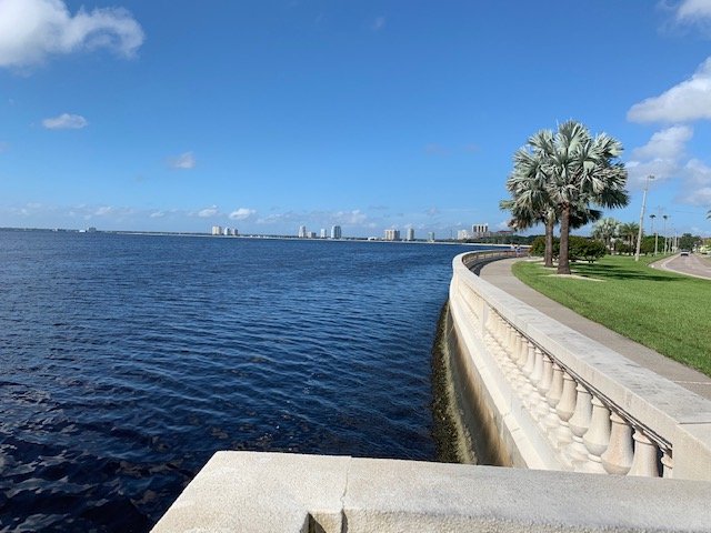
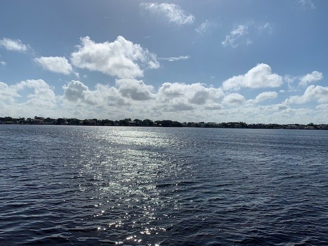
Meanwhile, a serene morning here in Tampa Bay. Always reminded that if a system like Dorian approaches TB at a particular direction, my neighborhood is under 30+ feet of water.