TPAwx
-
Posts
583 -
Joined
-
Last visited
Content Type
Profiles
Blogs
Forums
American Weather
Media Demo
Store
Gallery
Everything posted by TPAwx
-
Yeah you’re totally right, except for the lack of forecasted strengthening and limiting influence of the forecasted shear. What are those experts thinking anyway?
-
The local bulletin for you is appropriate given the track. Same here, we had training downpours all day and lots of street flooding, very typical. It doesn’t take much with a TC to be impactful here, but it won’t get broader attention because it’s not a major. The state bulletin is more about a certain attention seeking someone who’s seeking attention.
-
Primarily geographic location relative to typical Atlantic/Gulf TC tracks. Last major to hit was 1921, there’s some good analysis on the variables that keep the region out of the direct bullseye for most cyclones. We don’t need a hurricane per se to have a significant impact, see Eta from last year. A low end hurricane landfalling in northern Pinellas would do a lot of damage across TB, and a major would be devastating.
-
Sending advance Thoughts & Prayers as you prepare to contend with massive local impacts from occasional breeziness and scattered showers. Looking forward to the play by play.
-
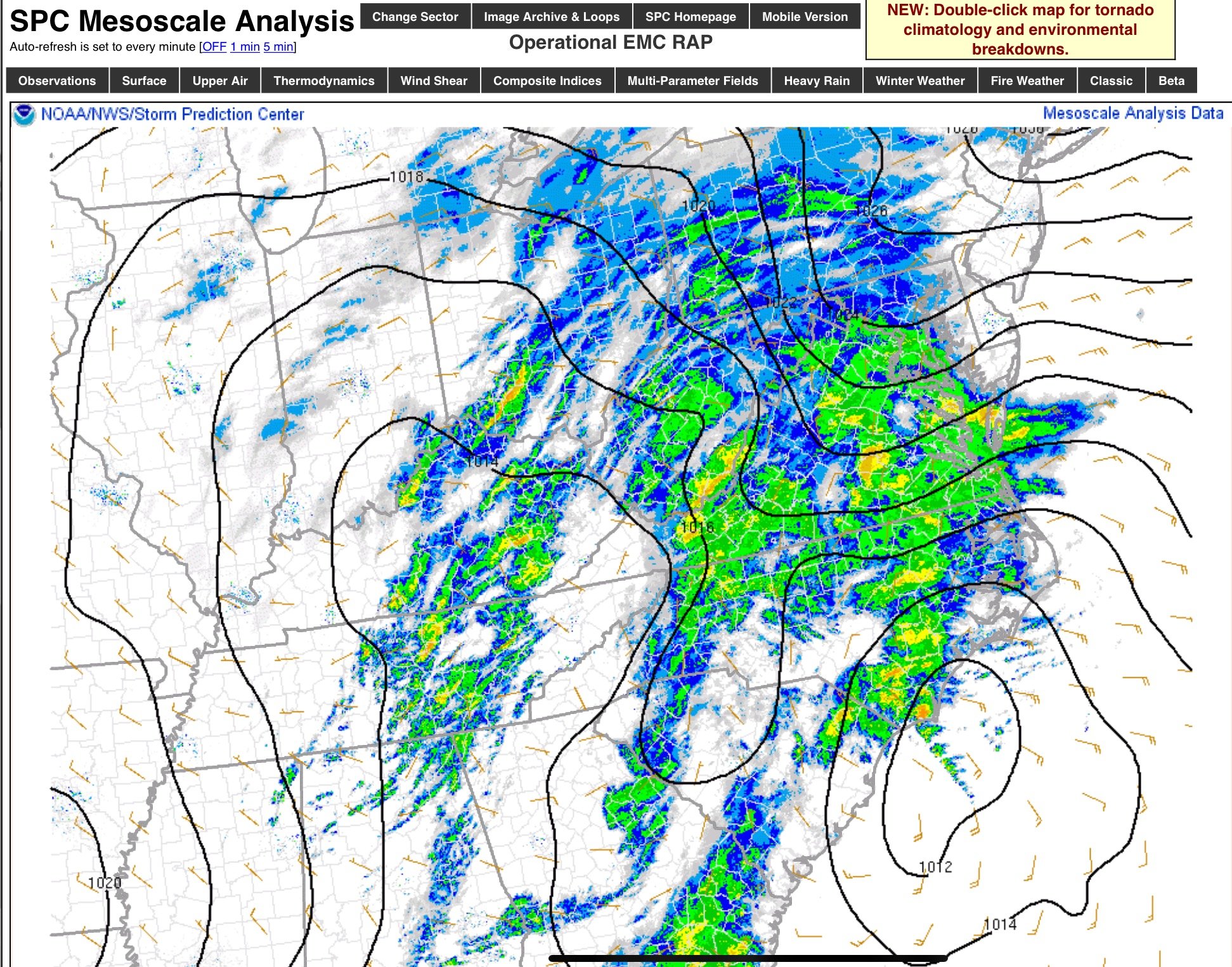
Both are way out but interesting track divergence between 6z HMON and HWRF HMON up the middle of the peninsula while HWRF rides the coast along Pinellas Countty as a strong TS or Cat 1. Not worst case trajectory but a high impact and damaging event for TB region with that track.
-
In Tampa this week we’ve been dealing with BAU street flooding from PM storms, and then the stench of dead fish and airborne irritants from red tide pushed in by onshore flow. Didn’t have a early July TS on the bingo card, still a wide spread for tracks so mildly interested but not concerned at this point.
-
Was curious how far this thing can persist. Hard to imagine it could get to the south of Atlanta, but it’s an exceptional system.
-
Do folks really keep helmets on hand?
-
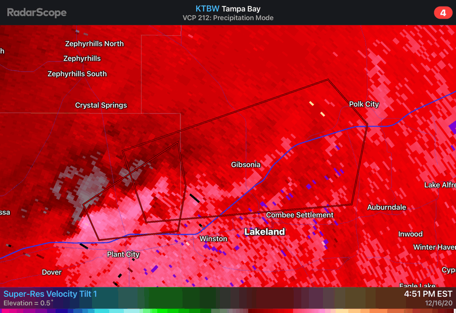
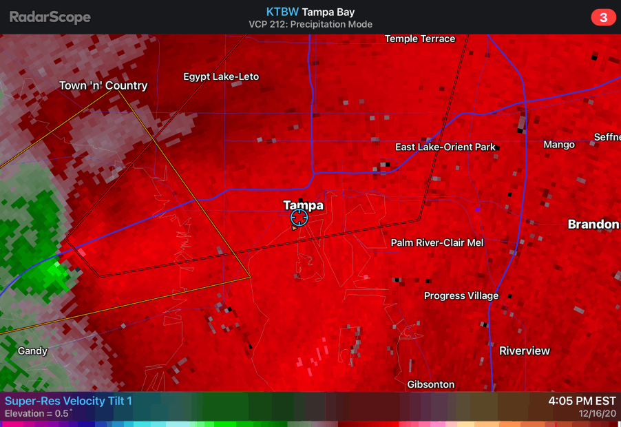
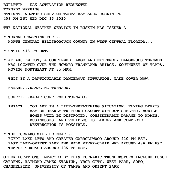
I’ll go with the pros at SPC over Random Internet Contrarian Guy Who Seeks Attention. The parameters and set up support a very significant and impactful event today.
-
Jan 31st - 33rd Storm Obs and Disco like it's 1979
TPAwx replied to Bob Chill's topic in Mid Atlantic
You are dumping on a data simulation of snowfall amounts 156h in the future? -
Lived in NOVA for every significant snow from 78 to 2016. The first rule of DC winters was and remains: Lucy is rarely denied her glory.
-
January Storm Term Threat Discussions (Day 3 - Day 7)
TPAwx replied to WxUSAF's topic in Mid Atlantic
Tempted to come up for this one, if Euro holds serve 96 hours out. Need a change from running the AC and wearing shorts. -
-
-
Not too common here.
-
Enjoy whatever you get up there. Lived in IAD area for a long time and spent endless hours tracking these things only to be Charlie Brown football’d almost every time. Eventually learned to accept that any falling snow in Dec was a bonus to be appreciated and enjoyed. Dec 2009 and a few others were notable exceptions of course. 73/62 here.

-
It was 39 down here in Tampa last week. Sucks y’all can’t manage to combine precip and temps for a proper winter storm.
-
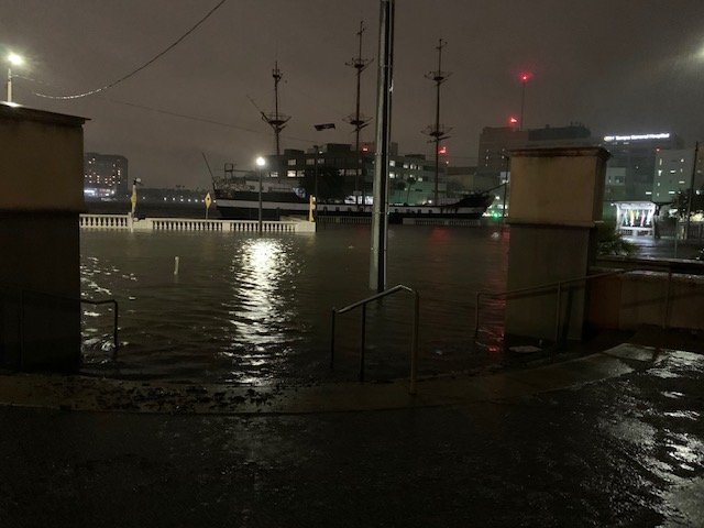
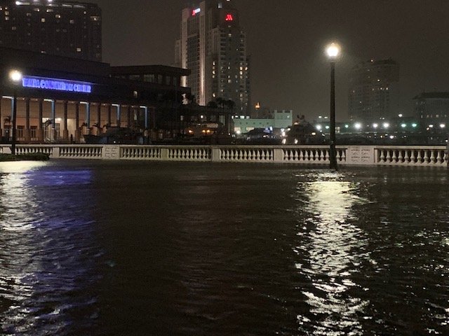
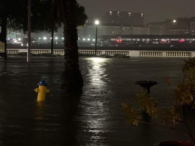
Appears Tampa had a 4 foot surge on top of high tide, which will certainly have widespread impacts across the area.
-
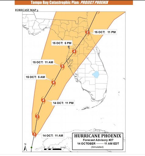
Instructive storm for Tampa area. The angle of approach and landfall north of Clearwater (Eta will come ashore around Crystal River or Cedar Key) somewhat echos the worst case scenario Hurricane Phoenix simulation. That of course would be a massive Cat 4/5, and would bring a 30+ foot surge through downtown. So obviously not apples to apples. But Eta is a 65 mph TS and is bringing an impressive degree of flooding thus far. This is not a typical angle of approach for systems here, with the wind and surge stacking and funneling up the Bay and rivers. It’s easy to see how a major+ would be epically bad and likely catastrophic.
-
Yeah the headline is a bit misleading. This is a half mile south of downtown. Bayshore is a 4 mile long sidewalk with 2 traffic lanes in each direction.
-
It’s already completely flooded over at the north end near downtown. More extensive than I anticipated. Got hit by a strong gust and almost fell off a ledge into the water.
-
Gonna go check this out now.
-
Just returned from a walk, it’s considerably warmer than earlier so I assume there’s a Hot Tower in the vincinity.
-
Wind has really started to pick up here in Tampa.
-
My neighborhood. Water will likely breach over into the road later this evening. Houses on the other side of Bayshore should be ok.