

TPAwx
-
Posts
583 -
Joined
-
Last visited
Content Type
Profiles
Blogs
Forums
American Weather
Media Demo
Store
Gallery
Everything posted by TPAwx
-
Yeah it’s not going to take 30 hours to cross the peninsula.
-
Unfortunately for those that marinate in such scenarios, the odds are near zero that it happens, ever. Of course a Cat 1 on the Hurricane Phoenix trajectory would cause billions in damage here, so a big hit doesn’t need to be a high end storm.
-
Wanting a TC or post tropical system with massive accumulated energy to visit YBY is a bit like the dog catching the car, FAFO, etc.
-
-
More like 100 miles N around Cedar Key but it’s just one of many TBD op run track simulations
-
Yeah nothing says Fall like a 101 heat index
-
TC development patterns and steering currents are unfavorable for frequent local impacts, this goes back at least 175 years in available records. Eroding TS Eta caused more impact IMBY and for many here than Irma, which set off panic for a week out. We really don’t want anything of significance to landfall near or a bit N of TB.
-
6z GFS says Farewell and Adieu to Tampa/St Pete area. Not far off from worst case track and surge scenario, albeit less intense. We’ll see lots of these super bad simulations jumping around the map over the coming days.
-
Thoughts and prayers as you contend with ongoing moderate showers and breezy conditions. Stay vigilant.
-
Horrific. Very detailed and engaging first person account of the Amazon warehouse on msnbc a few minutes ago. Should be on video later.
-
There’s a level of enthusiasm for weather and meteorology, and hurricane tracking, that’s understandable and a lifelong passion for many. And then there’s sociopathy. Helpful to understand the difference, and not claim exemption due to “muh weather forum.”
-
That’s fair, tho Memphis and Nashville have great food and music scenes.
-
You really don’t want that HMON solution up yonder.
-
it’s actually pretty funny that the admins allow a red tagger parody account.
-
Yeah science and data based forecasting by top expert professionals is totally overrated.
-
Thoughts and Prayers as you contend with all of this weather that is unusual in Florida except for many days during June, July and August of every year. Just a bit of rain here also.
-
This weekend you’ll be posting about how you are getting ready for the wicked outer bands and then how disappointed you are with the weak outer bands as the system misses you by a large margin.
-
The region and Tampa proper appear to have gotten through with less impact relative to potential outcomes. Onshore flow will continue thru 1230 high tide, but surge looks like 2-3ft near downtown. An early start to what could be a long and interesting tropical season.
-
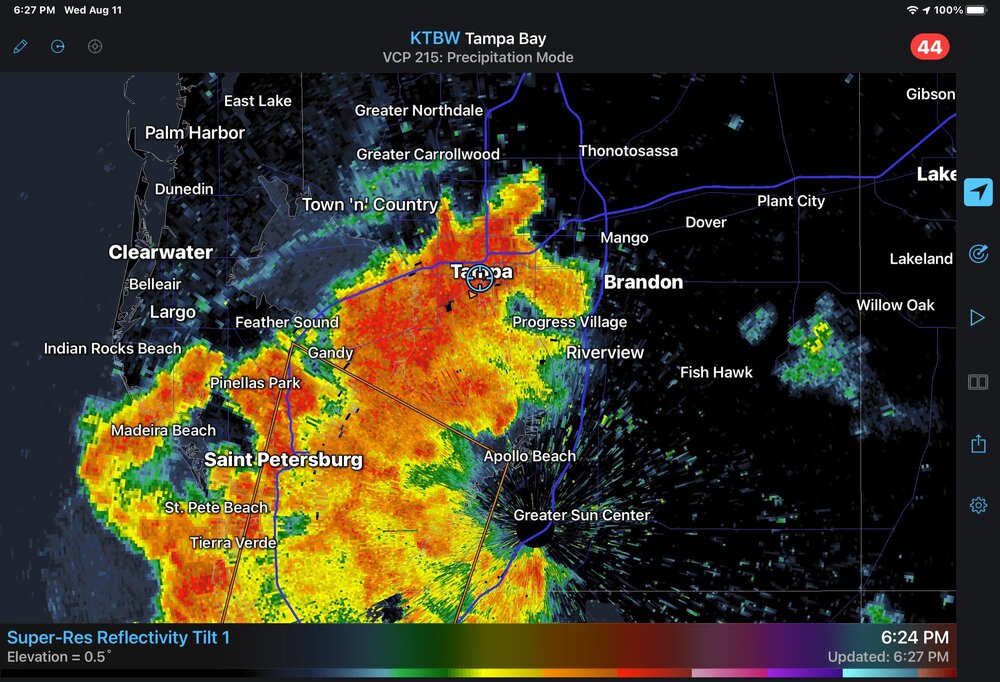
Radar has a juicy band setting up from Tampa metro to east of Sarasota, will be pivoting thru and dumping during the overnight. High tide at 320AM with the coc close to due west offshore. 3-5ft surge seems on target, could be a tad higher.
-
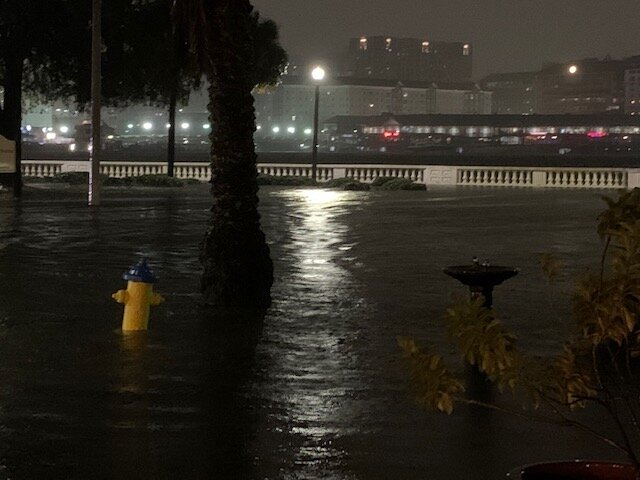
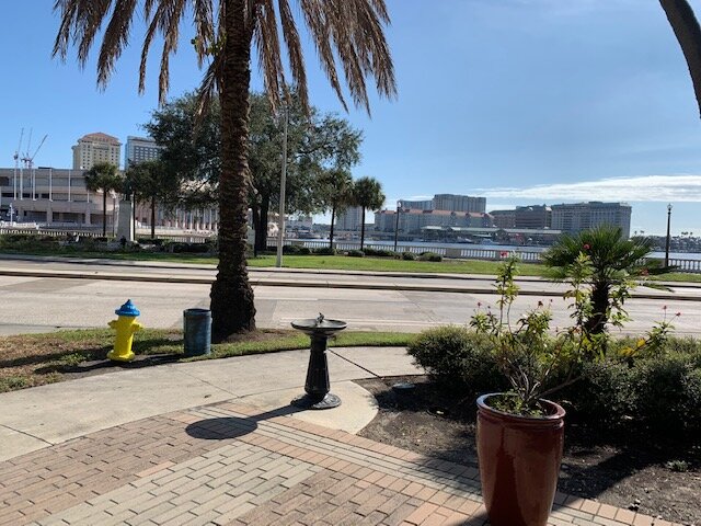
These are my during/after Eta pics. Surge just under 4 ft, and Elsa will be higher and on top of high tide.
-
Wut Tampa has widespread street flooding with heavy PM thunderstorms. Elsa close to or at Cat 1 and with this trajectory will bring a surge on top of flooding from heavy rainfall.
-
Really unfortunate to see signs of intensification beating back the dry air and shear. This track was going to be bad news for the TB region as a tropical storm, and we don’t need a stronger system. Out of town for Elsa so just an observer for this one.
-
Yeah it will absolutely be an impactful TS for the Tampa Bay area unless there is a major track shift.
-
Significant strengthening is not anticipated though due to moderate wind shear


