TPAwx
-
Posts
583 -
Joined
-
Last visited
Content Type
Profiles
Blogs
Forums
American Weather
Media Demo
Store
Gallery
Everything posted by TPAwx
-
40-year NOVA alum watching from afar. Great pics and looks like a nice winter event for most of you! All those winters up there trained me to never count on the high-end scenarios from any model run. 4+ is pretty good, even if a bummer after signals for much higher totals.
-
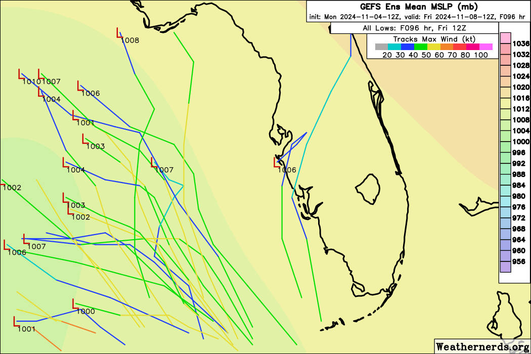
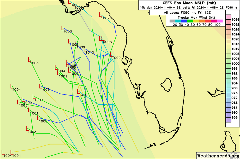
GEFS has two main clusters. Largest into Central America, other to NE tip of Yucatán or just East and across Gulf to far SW FL.
-
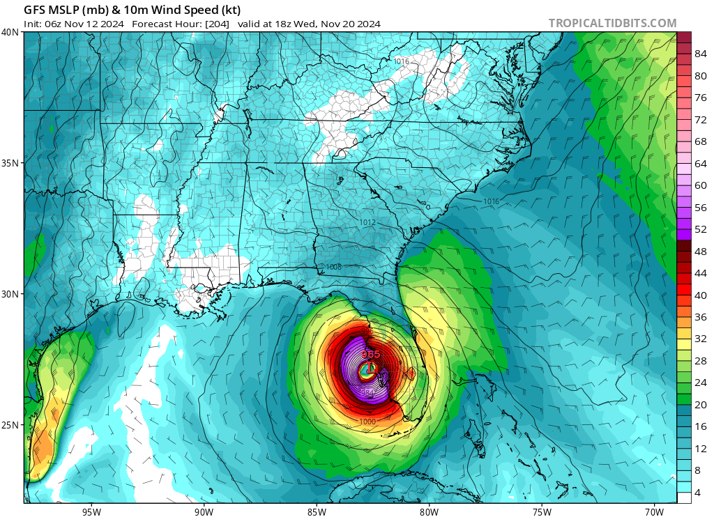
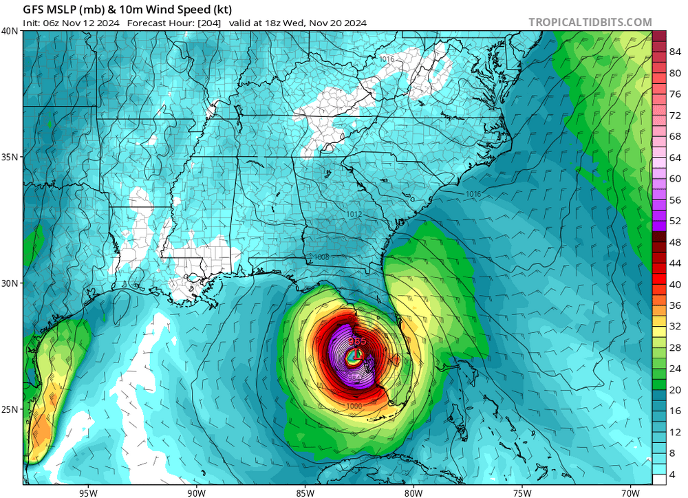
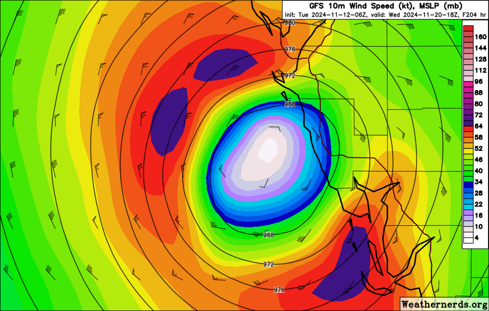
Well this GFS op goes to 922 before heading to the NE Yucatán. Assume this ends up between Ft Myers and Marco later in the run.
-
GEFS has a cluster moving over the Yucatán into the Gulf to the FL central West Coast, and a second moving over Western Cuba into South FL.
-
That’s fair, especially so if it was just one run in isolation. GFS is getting persistent with signaling a strong TC into the Gulf and landfalling on FL West Coast next week. 18z has a 2 or 3 landfalling just north of Crystal River next Wednesday.
-
Nothing to see here. Just a major landfalling on FL West Coast a week before Thanksgiving.
-
A few EPS members shift east but remainder are into central Gulf.
-
Just one run but some eastward clustering.

-
A few GEFS members go over west/central Cuba then cut across SE Florida and out to sea.
-
12z GFS op has a major in the Eastern Gulf at 300+. Obviously too far out at this point.
-
TPA peak wind gust was 85 with 12” total rainfall. 72% power outage rate in Hillsborough County as of last update. Daybreak will reveal scenes of trees down everywhere and damage to structures. Tons of standing water, we get that here from PM summer thunderstorms, let alone a foot of rain. Significant impact but manageable. Anything close to peak surge would have been an entirely different story this morning. We’ll see versions of that devastation down the coast. No idea of personal impacts. Lost power and feeds to the security cameras at 9 last night. Not expecting any structural flooding from the rain, but may have tree damage to the house.
-
-
+ Structual damage from downed trees and extended power outages.
-
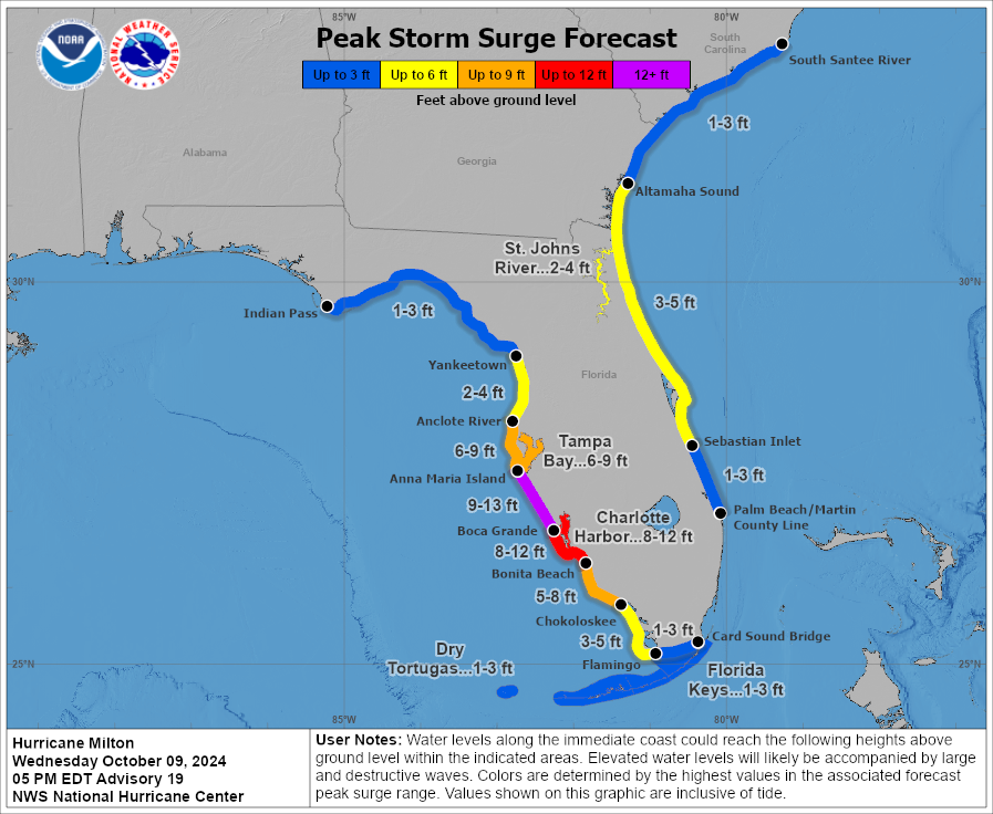
Unless Milton tugs due north in the next few hours the worst case surge scenario is off the table for Tampa. From 10-15 to 9-12 and now 6-9. High winds from the northern eyewall will do a number on the oaks and tree canopy. Lots of roofs and structural damage. Flash flooding from the heavy rainfall. Extended power outages.
-
Primary impacts for Tampa will likely be wind driven damage and flooding from excessive rainfall. Trees down on houses, extended power outages. Surge expectations are trending downward.
-
3 of 4 hurricane model landfalls clustered at Anna Maria Island/Holmes Beach. HAFS-A a bit south near Sarasota.
-
6z HAFS-B landfall near Sarasota/Siesta Key early AM Thursday. 950s.
-
6z GFS landfall Longboat Key/Sarasota early AM Thursday. Slightly south of 0z.
-
Just a feeling of gut wrenching dread and absolute lack of control this morning.
-
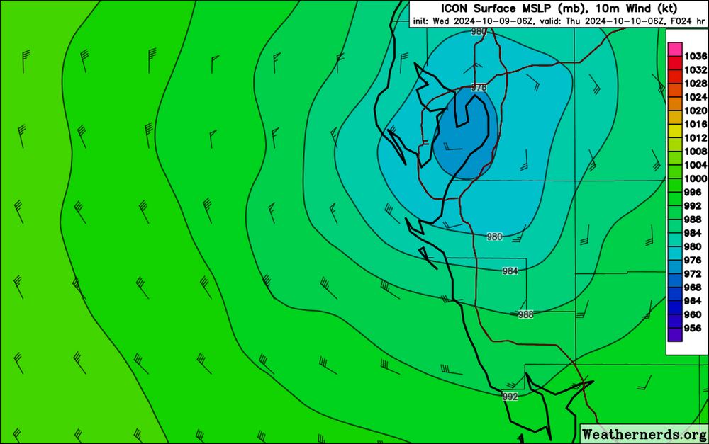
6z ICON centered over and tracking right up TB. Late PM Wed/early AM Thurs.
-
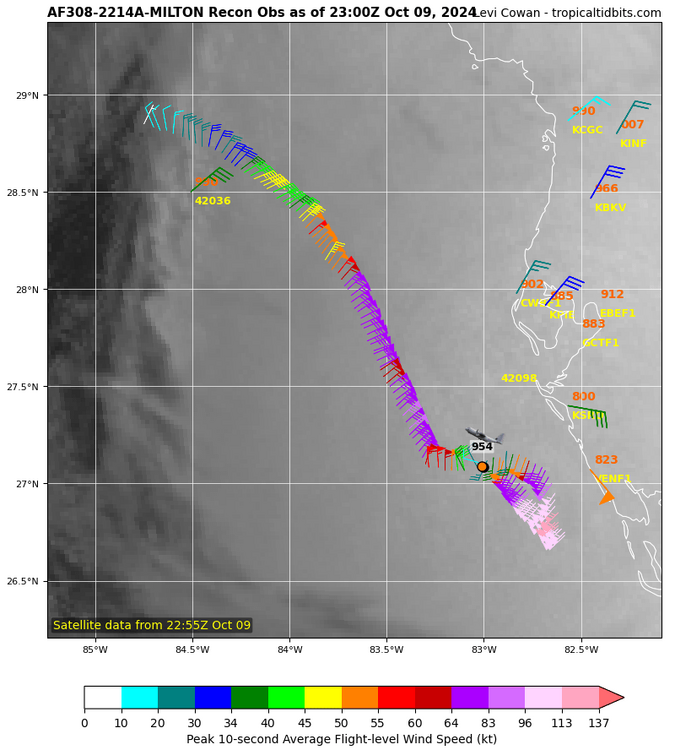
Down to 907. Forecast track slight adjustment north. Hurricane Milton Advisory Number 17 NWS National Hurricane Center Miami FL AL142024 400 AM CDT Wed Oct 09 2024 ...MILTON REMAINS A CATASTROPHIC CATEGORY 5 HURRICANE... ...FORECAST TO MAKE LANDFALL ON THE FLORIDA GULF COAST LATE TONIGHT AS A DANGEROUS MAJOR HURRICANE... SUMMARY OF 400 AM CDT...0900 UTC...INFORMATION ---------------------------------------------- LOCATION...24.5N 85.4W ABOUT 160 MI...255 KM W OF THE DRY TORTUGAS ABOUT 300 MI...485 KM SW OF TAMPA FLORIDA MAXIMUM SUSTAINED WINDS...160 MPH...260 KM/H PRESENT MOVEMENT...NE OR 45 DEGREES AT 14 MPH...22 KM/H MINIMUM CENTRAL PRESSURE...907 MB...26.78 INCHES
-
Landfall at Holmes Beach/Bradenton Beach late Wednesday PM, first run south of TB. 950s.
-
EPS mean track over Longboat Key late Thursday morning
-
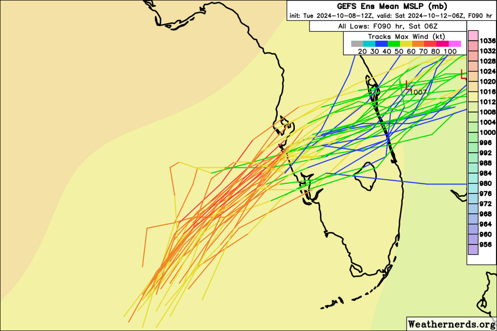
GEFS tracks
-
I think that’s a pretty good call. AMI, Longboat and Siesta were devastated by Helene and this will takeout a lot of what’s left. I’m thinking landfall is a bit further south between Bradenton Beach and Siesta Key. Tho will be watching HAFS-B intently, it’s been persistent with TB landfall.