Chicago Storm
-
Posts
19,240 -
Joined
-
Last visited
Content Type
Profiles
Blogs
Forums
American Weather
Media Demo
Store
Gallery
Everything posted by Chicago Storm
-
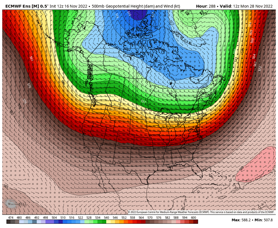
December isn’t going to be wall to wall mild. Anyone with that idea might as well give up on it now. .
-

Winter 2022/23 Lake Effect Snow Thread
Chicago Storm replied to Chicago Storm's topic in Lakes/Ohio Valley
Get into contact with Brett Adair of Live Storms Media on Facebook, or I believe his number is on their website as well. He could set you up quickly temporarily. Everyone else is making $ off of video like that right now, so why not you too. . -
Winter 2022/23 Lake Effect Snow Thread
Chicago Storm replied to Chicago Storm's topic in Lakes/Ohio Valley
nice opportunity to makes some $, so hopefully not. . -
Winter 2022/23 Lake Effect Snow Thread
Chicago Storm replied to Chicago Storm's topic in Lakes/Ohio Valley
. -
Winter 2022/23 Lake Effect Snow Thread
Chicago Storm replied to Chicago Storm's topic in Lakes/Ohio Valley
Some of the videos from the heart of the band are about as good as it gets. . -
Snow showers/squalls in the area much of the afternoon/evening today, but much of it missed ORD and home. .
-
Winter 2022/23 Lake Effect Snow Thread
Chicago Storm replied to Chicago Storm's topic in Lakes/Ohio Valley
6.0" in the last 2 hours at BUF. KBUF 180254Z 00000KT 1/4SM +SN FZFG VV003 M01/M01 A2996 RMK AO2 TSB04E23 SLP153 TS DSIPTD SNINCR 3/6 P0000 60002 T10111011 58008 RVRNO $ -
Winter 2022/23 Lake Effect Snow Thread
Chicago Storm replied to Chicago Storm's topic in Lakes/Ohio Valley
And it begins... KBUF 180154Z 26003KT 1/2SM SN FZFG VV004 M01/M02 A2997 RMK AO2 LTG DSNT SW AND W SLP157 SNINCR 3/3 P0002 T10111017 RVRNO $ -
Winter 2022/23 Lake Effect Snow Thread
Chicago Storm replied to Chicago Storm's topic in Lakes/Ohio Valley
The goods are approaching the Buffalo area. A lot of convective snow right now over Lake Erie, with a lot of lightning.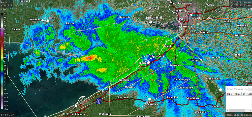
-
Created a LES thread for the season...
-
So it isn't spread out between countless other threads.
-
Additional periods of -SN today, but it didn't amount to anything with temps in the mid 30's and poor rates. Final event total stands at 1.0" here at ORD.
-
Fall 2022 Medium/Long Range Discussion
Chicago Storm replied to Chicago Storm's topic in Lakes/Ohio Valley
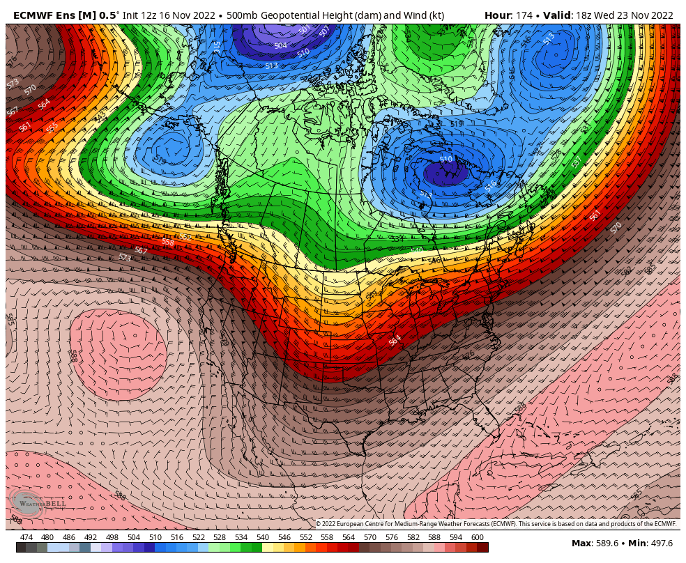
As alluded to in my previous post, the final 1/3rd of November looks interesting to watch regarding how things evolve as a whole. We will see the current -EPO and NAO/AO flux pattern that is bringing the more widespread snow chances and consistent cold break down. The MJO is still expected to move through phases 5-6-7 to finish out the month, which would suggest a return to mild conditions. However, continued SPV relocation in the vicinity of portions of Northern Canada, Greenland and the Canadian Arctic suggests it likely shouldn't be wall to wall mild. This sort of pattern for the final 1/3rd of the month should continue to remain fairly active across the region and CONUS, with the potential for up/down mild/cool temperatures. While it's not a great snow pattern for a good portion of the sub-forum, I would watch the potential for a thread the needle type system during this period. Outside of that, the northern portion of the sub-forum will be most favored for any other snow chances.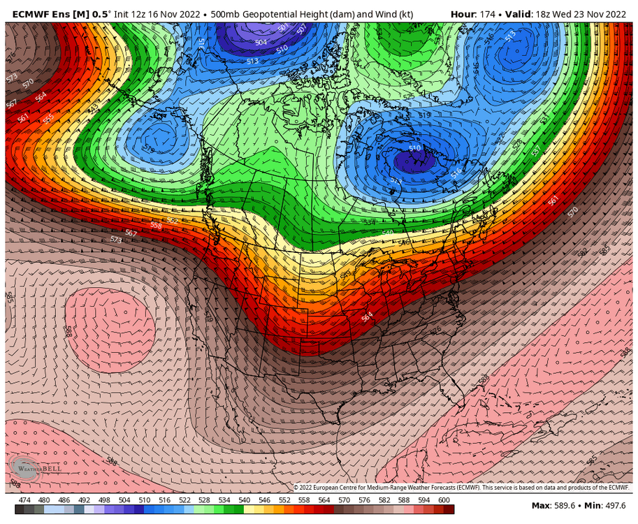
-
IDOT traffic cams showing accumulation on all surfaces. Looks like at least 1" on some of the cams.
-
Event and day total of 1.0" here at ORD, so far at least. Snow started early this morning and accumulated efficiently until a bit after sunrise. After that, snow continued through the morning and into the midday, but as 'white rain'. The early morning snowfall accumulation on the ground melted by early afternoon. Much of the afternoon featured -RA, before transitioning to -RA/SN this evening, and now finally back to -SN.
-
What is your favorite weather day of all-time?
Chicago Storm replied to Hoosier's topic in Lakes/Ohio Valley
Ah, that's a good one I missed. I'd say 9/12-15/2008, with the tropical remnants. Easily the worst flooding I had seen around home with that one. Kind of a situation where places flooded that you didn't think could flood, or at least couldn't to the extent that they did. -
i'm still trying to figure out when we have been cold and dry so far.
-
I don’t know, I’d say everything has gone about as I expected at least… Dusting to 2” area wide, locally higher. ORD is around 1” for the event. .
-
LES potential continues to trend downward on a lot of guidance (Not including the HRRR mirage that faded). .
-
What is your favorite weather day of all-time?
Chicago Storm replied to Hoosier's topic in Lakes/Ohio Valley
For myself, if I had to pick a single day it would be 6/20/2021. Chasing a QLCS 10 minutes from home at 11PM and being hit by an EF-3 tornado easily takes the cake, and will be hard to top. As for other events by weather type... ...Warm Season... Damaging Winds: 8/23/2007 derecho. This derecho raked across portions of the Midwest on this day. Walking home while the derecho hit, with tree and other debris flying around, was an experience for sure. Power was out for four to five days, with significant and widespread tree/property damage in the area. Hail: 6/26/2019. An isolated severe t'storm briefly perked up as it crossed the lake breeze, producing 2.25" hail and 50-60mph winds while home. This marked the biggest hail I have witnessed, while home or out chasing. Tornado: 6/20/2021. Chasing a QLCS about 10 minutes from home at 11PM and being hit by an EF-3 tornado is as good as it gets. Then, being in the damage path all night long, and out drone surveying damage the next day. An honorable mention goes to 10/4/2013, which was the day of the Wayne, NE EF-4 tornado. We ended up being hit by the outer edge of the ciculation, having windows blown out on our vehicle, while I was hanging out the window trying to hold my GoPro to the hood. Heat: 7/4-7/2012 heat wave. The hottest temperatures and longest duration of extreme heat I've experienced, with several days in a row of 100+ high temps. Being that the 4th of July is my favorite holiday, the overlap was perfect. ...Cold Season... Snow: GHD 1. It hit the marks for most snowfall in a single storm and 24hr period I've experienced, some of the top snowfall rates I've witnessed, and the most TSSN I've experienced in one storm. The wind, snow and accumulation combo easily puts it at the top of the list. Ice: I have yet to experience a significant ice storm, unfortunately. Cold: 1/30-31/2019. Although brief, this event featured the coldest temperatures and wind chills I can recall experiencing. Honorable mention would be 1/5-7/2019. The duration was much more significant versus severity, when compared to the 2019 event. -
Quality info here.
-
You're still out here by ORD?
-
They went 2-5" in the WWA, so they are pretty close to it. I guess it's time to pull up BUFKIT and check it out.
-
LOT AFD for @Hoosier... "IN FACT, LAKE TEMPERATURES OF +10 TO +11C AND 850MB TEMPERATURES OF -6 TO -7C AS WELL AS INVERSION HEIGHTS PUSHING 11,000-12,000 FEET WILL GENERATE AS MUCH AS 250-350 J/KG OF LAKE-INDUCED CAPE FROM LATE TUESDAY AFTERNOON THROUGH EARLY WEDNESDAY MORNING, LEADING TO CONCERN THAT LAKE ENHANCEMENT TO SNOW MAY "OVERACHIEVE" IN SPITE OF MARGINAL SURFACE TEMPERATURES. INTERESTINGLY, THE 12Z HREF SHOWS SPLOTCHY 20-30% PROBABILITIES OF SNOW RATES >1"/HR BETWEEN 2-3 PM TUESDAY AND 3-4 AM WEDNESDAY ACROSS THE NORTHERN CHICAGO SUBURBS. PERHAPS MORE CONCERNING IS THE 12Z HREF 24-HOUR LOCAL PROBABILITY-MATCHED MEAN QPF OF 0.75-1.00" ACROSS LAKE, COOK, AND NORTHEASTERN DUPAGE COUNTIES. WHEN APPLYING A STANDARD 10:1 SNOW RATIO, IT'S EASY TO SEE HOW SNOW TOTALS MAY GET OUT OF HAND. HOWEVER, WITHOUT A PERSISTENT BAND HITTING THE SAME AREA FOR HOURS AND HOURS, IT MAY BE TOUGH TO TRULY REALIZE THE SNOWFALL AMOUNTS ADVERTISED BY INDIVIDUAL HIGH RESOLUTION CAMS THAT INFORM THE HREF. FOR NOW, WE WILL CAUTIOUSLY ADVERTISE AN ADDITIONAL 2-3 INCHES OF SNOW ON TOP OF WHAT FALLS IN THE MORNING KEEPING IN MIND OUR FORECAST MAY BE WAY TOO LOW."
-
In the LOT CWA (Even the MKX CWA)? Yea, I'd agree.