-
Posts
19,128 -
Joined
-
Last visited
Content Type
Profiles
Blogs
Forums
American Weather
Media Demo
Store
Gallery
Everything posted by Chicago Storm
-
This most definitely isn't a bowling ball situation. Some seem to have forgotten what exactly one of those look like, but that's not surprising given it's been quite a while since we've actually seen one.
-
Re: RFD snowfall totals, the snow measuring out of there is not the best...So use with caution.
-
if you haven't already, try the same with pork chops.
-
Top-down saturation, something often seen during the cold season.
-
if he’s deleted, all of the threads he started are also deleted. so that’s a no. .
-

Winter 2022/23 Medium/Long Range Discussion
Chicago Storm replied to Chicago Storm's topic in Lakes/Ohio Valley
-

Winter 2022/23 Medium/Long Range Discussion
Chicago Storm replied to Chicago Storm's topic in Lakes/Ohio Valley
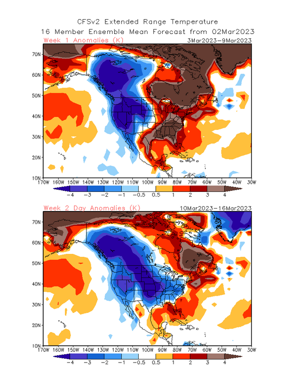
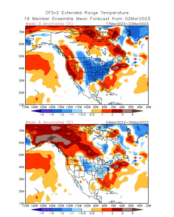
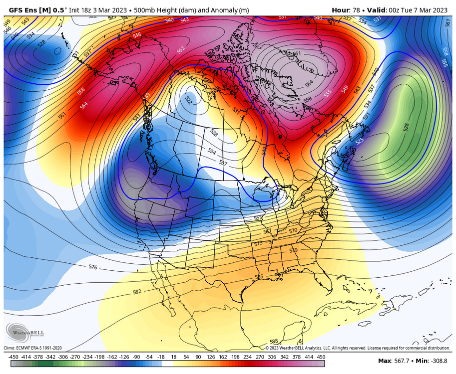
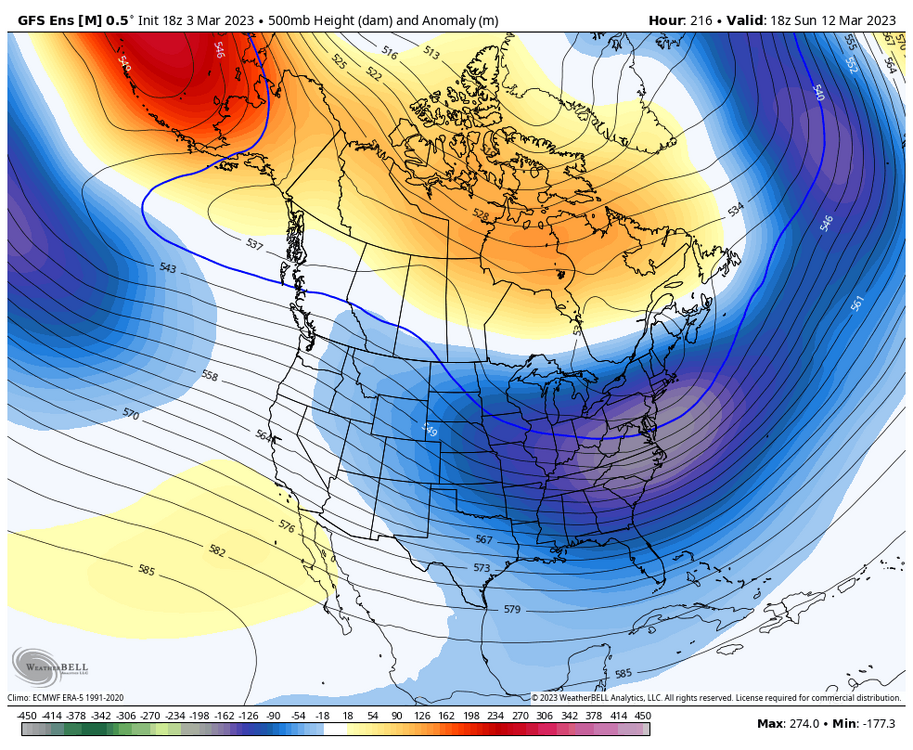
Time for a long awaited update. I previously had thought that I had not mentioned anything regarding the final 1/3rd of February, but apparently I did and had forgotten. In any case, obviously we did see the weather pattern from the middle 1/3rd of February continue through the final 1/3rd of February as well. As we are transitioning into March, we are finally seeing some effects of the SPV disruption that has been ongoing since mid-January. We have see a large/significant ridge develop around Europe as we have transitioned from late Feb into early March. This ridge is in the process of retrograding to Greenland, and eventually will back well into Canada, making for a solid -NAO through the early portion of mid-month. At the same time, we are about to see a fairly significant GOA/AK/Aleutian ridge develop (-EPO/-WPO), along with significant ridging in the Arctic (-AO), all of which will continue into the start of mid-month as well. The-NAO/-AO/-EPO combination will push much the sub-forum into a cooler/colder pattern than we have seen, with the coolest/coldest regime as a whole in comparison to average than we have seen since the late January or the pre-Christmas periods. However, one thing to point out is while it will end up cool/cold compared to average for this upcoming point in March, things to not look favorable at this time for significant/severe cold. This is due to Canada being void of any real significantly cold air leading into this period, likely due in part to the very long process of the SPV being disrupted for nearly a month and a half now, instead of the usually more significant SSW events we have seen in the past. Another thing to note is that we are also going to be transitioning from the lengthy -PNA/West Coast trough period we have been in, to a more near neutral/+ PNA. This will lead troughs/disturbances will be originating from the Pac NW/SW Canada, instead of rolling into California/the heart of the West Coast like we have been seeing for a while now. With that said, the addition of some cooler/colder temperatures, along with an average pattern in regards to activity, could mean some increased wintry precip chances that include more areas outside of the heavy hit MN/WI/MI corridor (Quality still TBD). While the evolution of the pattern on the large scale (teleconnections) already started to occur days ago and will continue through the early portion of the middle 1/3rd of March, the effects for us as a whole in the sub-forum will be delayed. We will start seeing more of the effects of this transition at the end of this opening 1/3rd of March, likely continuing through much of the middle 1/3rd of March, even while the pattern on the large scale will likely already have changed once again by then. Some parting words... This upcoming pattern will decently resemble what you would expect to see with the MJO progression from late February through mid-March (Phase 7-8-1[?] progression). Most recently, for much of the final 1/3rd of February, the MJO has been stalled in low amplitude phase 7. To begin March, and continuing through the next few days, the MJO while transition through high amplitude phase 7. This supports the idea of a delayed transition for effects in our sub-forum from the overall pattern shift. As we head later into this beginning 1/3rd of March and into the middle 1/3rd of March, there is high support for a transition into high amplitude phase 8 and potentially phase 1. This supports the aforementioned relaxation of the PNA, with a mild west/cold east regime. However, on the flip side, phase 8 usually has high correlation of being mild even into the Central US. That may be hindered this go around, due to the significant blocking up north. -

Winter 2022/23 Medium/Long Range Discussion
Chicago Storm replied to Chicago Storm's topic in Lakes/Ohio Valley
coming later. -
I'd image we see widespread 40-60mph wind gusts up into SE. Michigan as well.
-
Apparently everyone is behind the 8 ball on this one.
-
I had been going with gusts up to 60MPH being likely (Didn't want to go all in on the hi-res' higher end depictions alone). But yea, a lot of downstate IL NWS offices were more conservative and only suggested gusts up to 50MPH for the most part, which was quite surprising. With it happening in a widespread/significant fashion in real-time now, any that haven't jumped onboard yet...it's a lost cause.
-
A lot of TSSN (Or mix) from Eastern Illinois, up through Northern Indiana, and into Southern Michigan now.
-
Widespread 60-75MPH post-frontal wind gusts across much of S. IN/KY/TN as well.
-
.
-
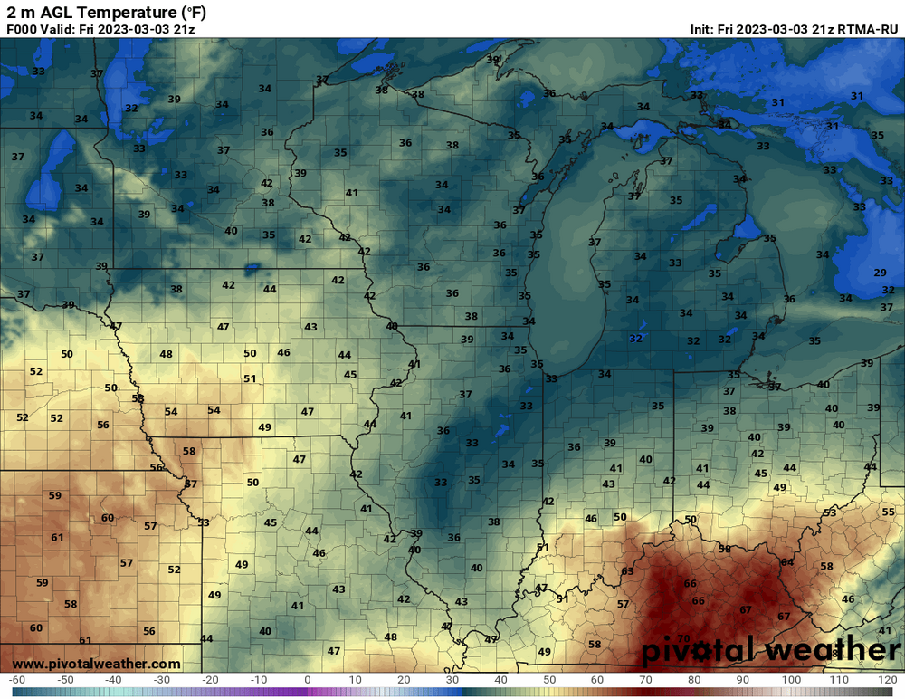
To show just how thread the needle/dynamic cooling dependent this setup is, it's in the 40's and 50's across Iowa and Missouri currently.
-
Crazy amount of TSSN in Central/East-Central Illinois.
-
Peak wind gusts across downstate IL... 72MPH MTO 69MPH CMI 67MPH DEC
-
There’s already widespread TSSN in Central and East-Central Illinois. .
-
Seeing some very high wind gusts just north of the peaking SLP. 66MPH at DEC and 63MPH at SET.
-
18z NAM will be SE, so there’s that. .
-
ya’ll are overusing the “lock of the week” meme. .
-
.
-
.
-
-


