Chicago Storm
-
Posts
18,587 -
Joined
-
Last visited
Content Type
Profiles
Blogs
Forums
American Weather
Media Demo
Store
Gallery
Everything posted by Chicago Storm
-
That's a questionable statement.
-

Winter 2022/23 Medium/Long Range Discussion
Chicago Storm replied to Chicago Storm's topic in Lakes/Ohio Valley
ricky lol'd at your thought that we have had a period of cad at any point so far. -
break out the gold bond and speedo.
-
Winter 2022/23 Medium/Long Range Discussion
Chicago Storm replied to Chicago Storm's topic in Lakes/Ohio Valley
Should add an image comparison of the pattern, from what it looked like previously (Top) to what it is expected to look like now (Bottom).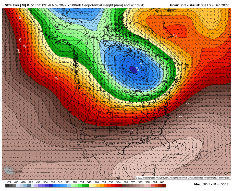
-
Winter 2022/23 Medium/Long Range Discussion
Chicago Storm replied to Chicago Storm's topic in Lakes/Ohio Valley
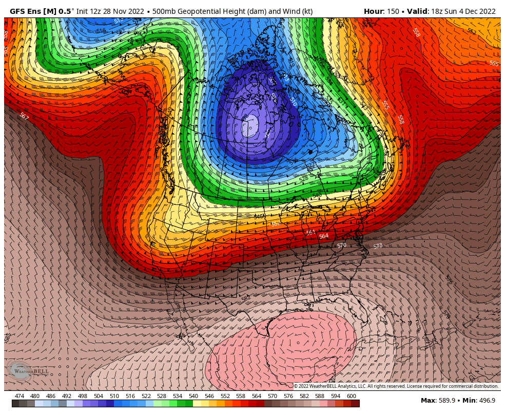
Portions of this first 1/3rd of the month are going as planned, and other portions are not (Bolded parts of the above quoted previous post are what will not be working out). As has been mentioned in other threads, a big fail point for the upcoming times is going to be medium/long range guidance failing horribly with the handling of things, especially the PV lobe in Canada. This is the first time medium/long range informaton has performed this badly since this past spring. The MJO movement, which has been a big signal for the pattern for far this season, has also not been as helpful in this case. Instead of the Canadian PV lobe parking on the south Hudson coast beneath the NAO block, we are seeing it instead make a brief appearance there, before quickly returning back north to the Arctic. What this means for late in this opening 1/3rd of the month and continuing into the middle 1/3rd of the month, is instead of a pattern featuring more consisently/widespread colder temps and a WNW/NW flow pattern that would likely not be as active or conducive to big storms... We end up with more a mild/cool temp pattern, and a pattern that is more active and supportive of bigger storm systems. Will have more thought on the middle 1/3rd of the month in its entirety soon.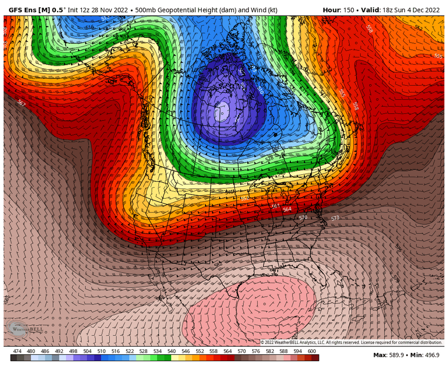

-
Winter 2022/23 Medium/Long Range Discussion
Chicago Storm replied to Chicago Storm's topic in Lakes/Ohio Valley
There was nothing of note for most prior to Christmas last year. There were two threads created (One in early Dec & one in Nov), but both events faded well in advance. Outside of that, not much happened either, other than up north near Duluth/UP-land. Going back two winters ago, to the start of winter 2020/2021... We also only had two thread worthy events prior to Christmas, which did end up producing for areas of MN/WI/MI. So we are already ahead of where we were pretty much the last two winters. So far this season we have had that surprise event about a month ago across MO/IL/IN/KY, and then the lighter event further north up around here a few weeks ago. Minnesota/N WI/N MI have obviously had several events too. Then add in the upcoming Thur/Friday event for somewhere. -
Winter 2022/23 Medium/Long Range Discussion
Chicago Storm replied to Chicago Storm's topic in Lakes/Ohio Valley
there was a fall banter thread, but not a winter one yet. so i went ahead and created one. -
i guess.
-
Winter 2022/23 Short/Medium Range Discussion
Chicago Storm replied to Chicago Storm's topic in Lakes/Ohio Valley
cromartie providing a lot of bump worthy material for down the road. -
Josh already answered the first portion, but as for the second portion... It has to do with the wave dampening/shearing out as it encounters blocking/confluence off to the NE/E.
-
Winter 2022/23 Medium/Long Range Discussion
Chicago Storm replied to Chicago Storm's topic in Lakes/Ohio Valley
Still doesn't look warm, but more-so a continued mild/cool back and forth. -
gonna need to apply more after the thur/fri snow event washes it away.
-
Winter 2022/23 Short/Medium Range Discussion
Chicago Storm replied to Chicago Storm's topic in Lakes/Ohio Valley
someone gets it. . -
somehow i missed this earlier, but not so hot looking. really surprised you didn't go miss north/rainer.
-
The GFS has actually done fairly well in recent times. However, with the recent upgrade that's in limbo now.
-
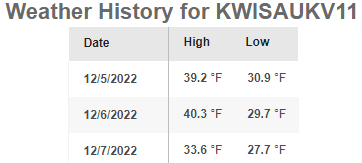
Re: Lake... Whether this event ends up in WI or IL, lake water temps are down in the low 40°'s now. A good 10° lower than was in place with the event from a few weeks ago.
-
Winter 2022/23 Short/Medium Range Discussion
Chicago Storm replied to Chicago Storm's topic in Lakes/Ohio Valley
High ENS support for this potential as well. -
Winter 2022/23 Medium/Long Range Discussion
Chicago Storm replied to Chicago Storm's topic in Lakes/Ohio Valley
The PNA is only part of it though. The whole handling of the PV lobe in Canada has done a 180 over the past week, which is also a main driver of the pattern. Instead of a colder and not as active (For bigger storm systems) WNW/NW flow pattern with the PV lobe stuck beneath the NAO block (Sort of rex block-like), we get a quickly retreating PV lobe back up towards the Arctic and a more cool/mild and more active pattern (For bigger storm systems). -
Winter 2022/23 Short/Medium Range Discussion
Chicago Storm replied to Chicago Storm's topic in Lakes/Ohio Valley
Yes it did. Saw a few people of importance elsewhere on social mention that the new version rated much worse than the previous version, in many aspects. . -
keep moving the goal posts. .
-
looks like shorts weather. .
-
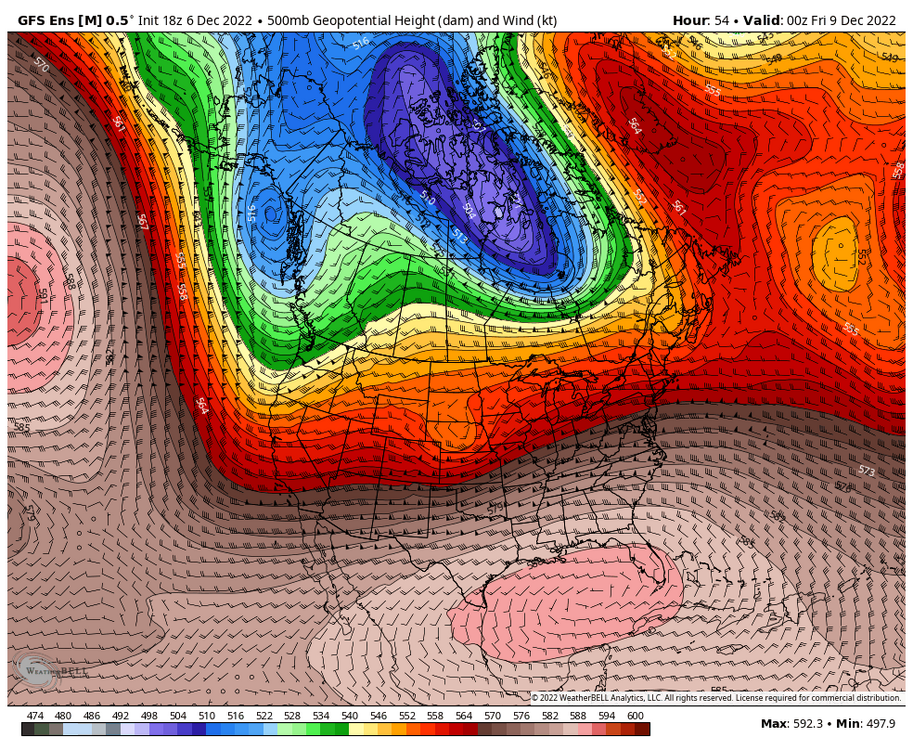
Part of a trough currently along the West Coast will translate east across the CONUS mid to late week. Should have the opportunity for a corridor of snow on the northern end of the system. Track and strength still tbd, dependent on shallow ridging ahead of wave and blocking north, in the wake of the departing Canadian PV lobe. .
-
Winter 2022/23 Short/Medium Range Discussion
Chicago Storm replied to Chicago Storm's topic in Lakes/Ohio Valley
First potential to watch will be late this upcoming week. A piece of the trough currently along the West Coast moves east across the CONUS, with the PV lobe in Canada departing back north. How quickly things evolve will greatly dictate track/strength of this potential. . -
Winter 2022/23 Medium/Long Range Discussion
Chicago Storm replied to Chicago Storm's topic in Lakes/Ohio Valley
It's a f***** up situation/pattern, to say the least. -
it used to mean lengthy periods of cold/dry. this season it apparently means a day or two of cold with no precip. .