Chicago Storm
-
Posts
18,586 -
Joined
-
Last visited
Content Type
Profiles
Blogs
Forums
American Weather
Media Demo
Store
Gallery
Everything posted by Chicago Storm
-

2/14-2/15 Potential Major Winter Storm
Chicago Storm replied to A-L-E-K's topic in Lakes/Ohio Valley
yep. i get that there 'needs' to be a cop-out or fail-point. however, it isn't convective issues, it very clearly was a trend towards an even more janky H5 evolution...which carries elsewhere. -
2/14-2/15 Potential Major Winter Storm
Chicago Storm replied to A-L-E-K's topic in Lakes/Ohio Valley
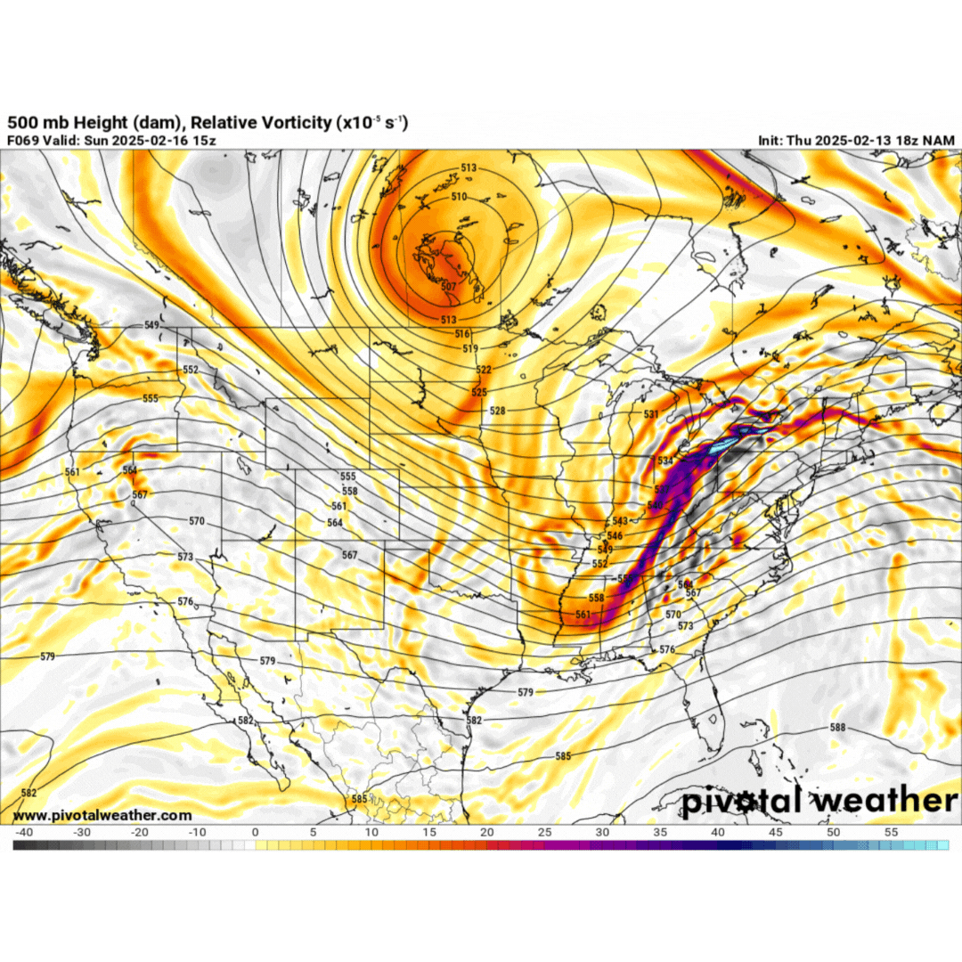
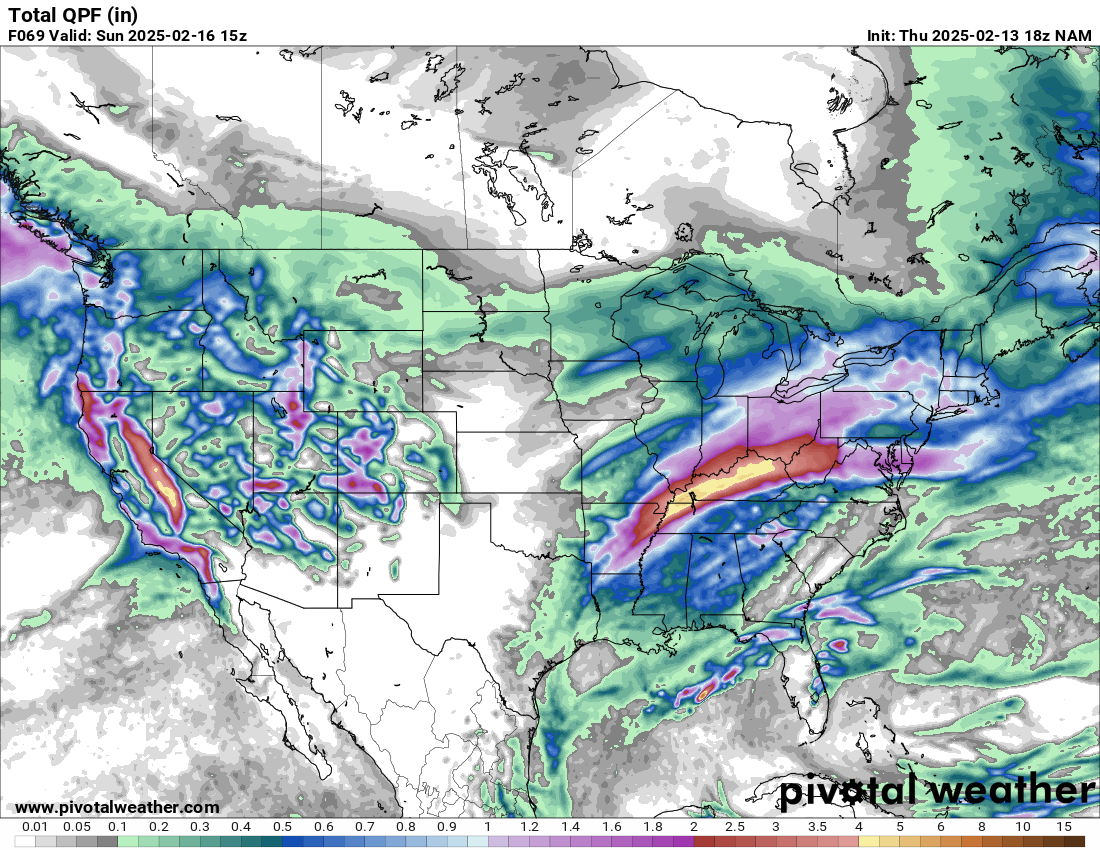
convection most definitely did not block moisture transport, as that heavy convection was modeled for days, even on guidance showing a heavier hit for MI. again, the difference came aloft, with an even jankier H5 look...which is also why the surface low kept trending east. let's take a look at the NAM, which was one of the last to let go of a snowier solution... pretty clear cut look on why things trended southeast and weaker. obviously if you trend H5 jankier, the associated surface low in turn ends up weaker/southeast, and moisture transport/850 low shunted east. also, note on the second image of the heavy convection modeled days ago.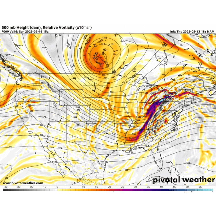

-
2/14-2/15 Potential Major Winter Storm
Chicago Storm replied to A-L-E-K's topic in Lakes/Ohio Valley
but, it’s actually not the reason. look at the H5 changes over the past few days and you have your answer. -
2/14-2/15 Potential Major Winter Storm
Chicago Storm replied to A-L-E-K's topic in Lakes/Ohio Valley
and you say i’m the asshole… -
2/14-2/15 Potential Major Winter Storm
Chicago Storm replied to A-L-E-K's topic in Lakes/Ohio Valley
WAA burst of snow this evening was as advertised. Peaked with a period of SN at ORD, with a final snowfall total of 1.8”. The seasonal snowfall total is now 14.8”. -
2/14-2/15 Potential Major Winter Storm
Chicago Storm replied to A-L-E-K's topic in Lakes/Ohio Valley
They have been issued int he past for the same. Classic inconsistencies in the NWS. -
2/14-2/15 Potential Major Winter Storm
Chicago Storm replied to A-L-E-K's topic in Lakes/Ohio Valley
The internally don't follow their usual routine is part of the issue. Any other time, a WWA would have been issued. -
2/14-2/15 Potential Major Winter Storm
Chicago Storm replied to A-L-E-K's topic in Lakes/Ohio Valley
Easily. -
2/14-2/15 Potential Major Winter Storm
Chicago Storm replied to A-L-E-K's topic in Lakes/Ohio Valley
That WAA wing of snow is going to be a brief, but nice period of 'pound town'. -
2/14-2/15 Potential Major Winter Storm
Chicago Storm replied to A-L-E-K's topic in Lakes/Ohio Valley
Oh, I'm aware. I just don't expect something out of my climo that isn't possible. -
2/14-2/15 Potential Major Winter Storm
Chicago Storm replied to A-L-E-K's topic in Lakes/Ohio Valley
We're all dog hunters at heart. Josh and the deep winter-ites are good with the nickel and dimers, but for most here, they want quality events. Personally, I'd prefer summer year-round, but do have a soft spot for chasing dogs in the winter. -
2/14-2/15 Potential Major Winter Storm
Chicago Storm replied to A-L-E-K's topic in Lakes/Ohio Valley
From your area (Roughly) up into MI-crew territory (And the Ontario folks) definitely are fully in the game still. -
2/14-2/15 Potential Major Winter Storm
Chicago Storm replied to A-L-E-K's topic in Lakes/Ohio Valley
Not a single 6z EPS member was 'amped' for outside of MI. The number of 'amped' GEFS members are becoming less as of 12z. If you get my jive on the overall look of things... -
2/14-2/15 Potential Major Winter Storm
Chicago Storm replied to A-L-E-K's topic in Lakes/Ohio Valley
This. -
2/14-2/15 Potential Major Winter Storm
Chicago Storm replied to A-L-E-K's topic in Lakes/Ohio Valley
This is one of the most overused statements in the winter, and is not the case in this instance. -
2/14-2/15 Potential Major Winter Storm
Chicago Storm replied to A-L-E-K's topic in Lakes/Ohio Valley
That has to do with the evolution aloft, in which how things are currently depicted are not favorable for such. -
2/14-2/15 Potential Major Winter Storm
Chicago Storm replied to A-L-E-K's topic in Lakes/Ohio Valley
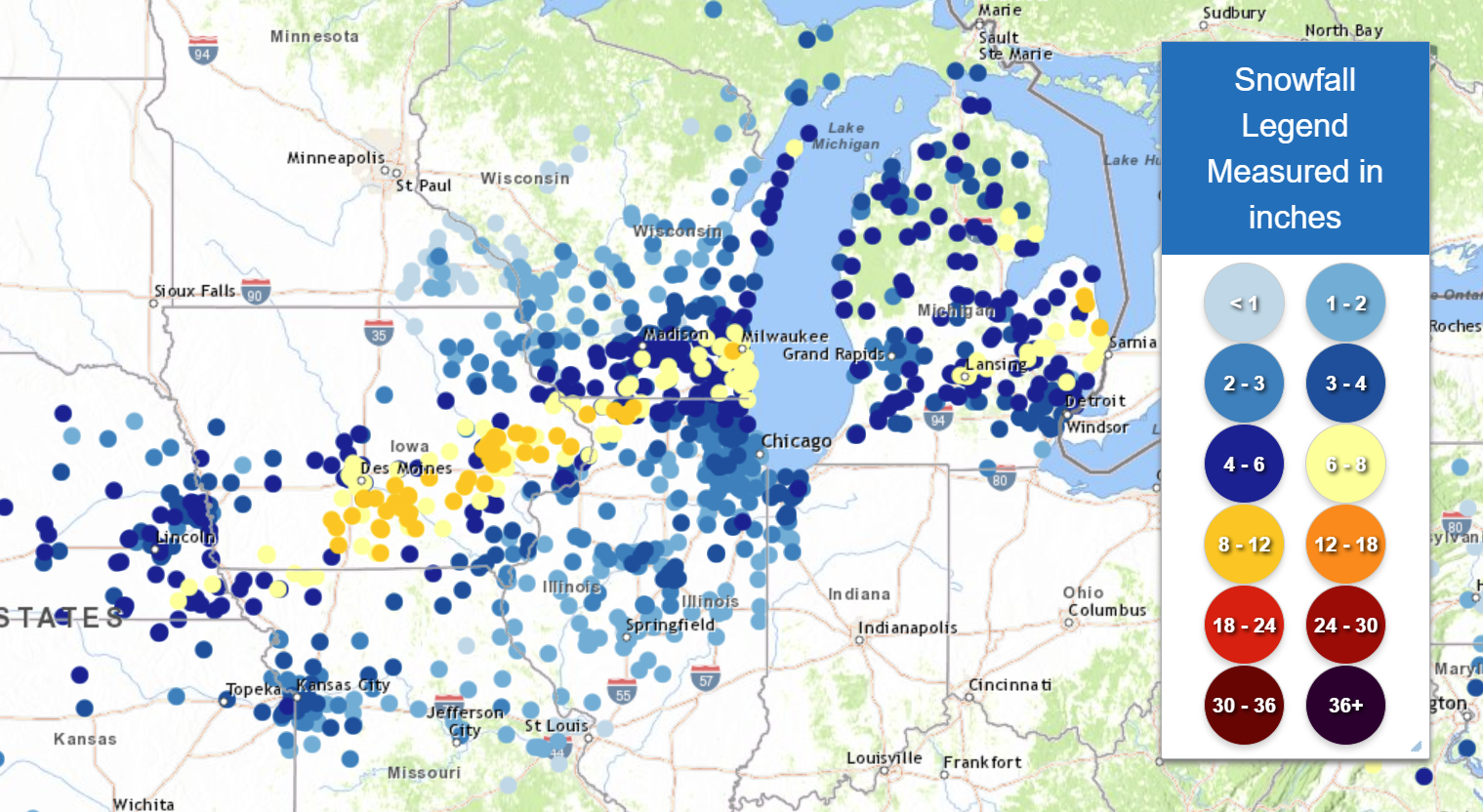
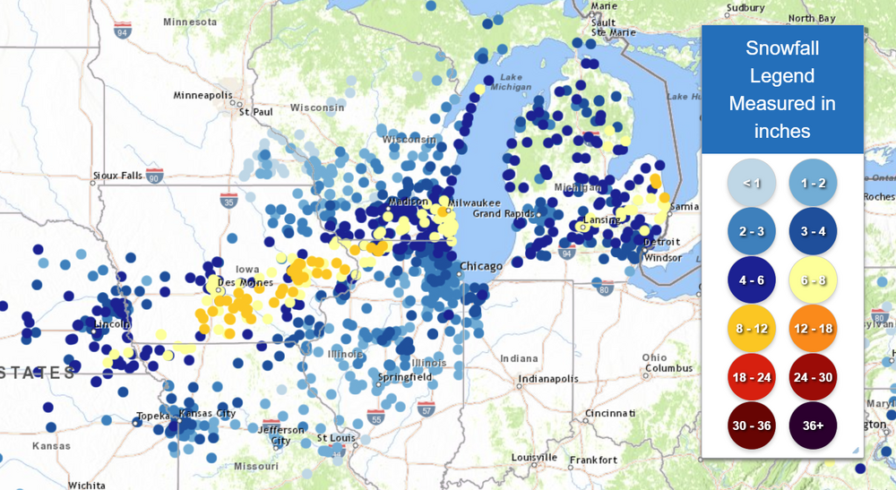
With this trending evolution, we're probably looking at a Des Moines-Dubuque-Madison-Sheboygan-N/L Michigan northern max, for the heart of a potential snowfall axis. The bigger concern would probably be an added trend to this new evolution, which would result in SE shifts or a slower evolution until late (See the 0z UKMET). -
2/14-2/15 Potential Major Winter Storm
Chicago Storm replied to A-L-E-K's topic in Lakes/Ohio Valley
GEM stepin’ too. -
2/14-2/15 Potential Major Winter Storm
Chicago Storm replied to A-L-E-K's topic in Lakes/Ohio Valley
alek on the pbp. you know there's some jonesing. -
2/14-2/15 Potential Major Winter Storm
Chicago Storm replied to A-L-E-K's topic in Lakes/Ohio Valley
Not yet... -
2/14-2/15 Potential Major Winter Storm
Chicago Storm replied to A-L-E-K's topic in Lakes/Ohio Valley
That would be correct. -
2/14-2/15 Potential Major Winter Storm
Chicago Storm replied to A-L-E-K's topic in Lakes/Ohio Valley
that TPV lobe though... -
In the end, this one was a medium dawg...
-
2/14-2/15 Potential Major Winter Storm
Chicago Storm replied to A-L-E-K's topic in Lakes/Ohio Valley
Normally, that would be a look for a hit here or just SE of here. But with things strung out, that given it freedom to roam a bit more. -
Final even snowfall total of 2.9" at ORD. The seasonal snowfall total is up to 13.0".